Register | Login
Attackpoint - performance and training tools for orienteering athletes

Training Log Archive: Nadim

In the 31 days ending Aug 31, 2019:

activity # timemileskm+m
  Orienteering11 18:14:29 49.42(22:09) 79.54(13:46) 417915 /16c93%
  Running16 9:22:41 57.57(9:46) 92.65(6:04) 1819
  Bicycling21 5:53:05 86.4(4:05) 139.04(2:32) 610
  Hiking3 37:07 1.81(20:30) 2.91(12:44) 396
  Total38 34:07:22 195.2(10:29) 314.15(6:31) 700515 /16c93%
averages - sleep:7.6 weight:191.8lbs

«»
5:49
0:00
» now
ThFrSaSuMoTuWeThFrSaSuMoTuWeThFrSaSuMoTuWeThFrSaSuMoTuWeThFrSa

Saturday Aug 31, 2019 #

12 PM

Bicycling (Commute) 4:49 [3] 1.02 mi (4:43 / mi) +10m 4:35 / mi
slept:8.0 weight:191lbs

From Northfield Rd., to Rugby Ave. and Del Ray Ave. I had slept in and after some work around the house I went to lunch.

Bicycling (Commute) 4:51 [3] 1.03 mi (4:42 / mi) +11m 4:33 / mi

From Del Ray Ave., to Northfield Rd., I was somewhat tired and lacking energy after lunch.
5 PM

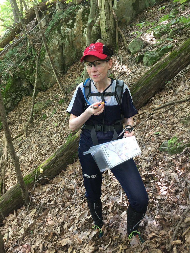
Orienteering (Field Checking) 1:46:58 [1] 2.8 mi (38:12 / mi) +87m 34:50 / mi

Great Falls Park, MD. After assembling new shelving and cleaning up the basement, I finally got myself out. I was probably avoiding it due to it feeling warm but really it was only 84 F. when I started. It felt hotter in the sun and it felt more humid than we were spoiled with in the last week. I did field checking to update the map, mostly around control locations for QOC's October event here that I'm setting courses for. The woods were still feeling overgrown; later I felt like they were fighting back to say don't map me.

Running (Trail) 12:08 [3] 1.1 mi (11:02 / mi) +76m 9:05 / mi

Great Falls Park, MD. As it was getting too dark under the trees to do any more field checking, I ran trails and a little bit on the road back to my car. Just about all of this was uphill. While I was driving away, the display change on my GPS in the car told me it was officially sunset.

Friday Aug 30, 2019 #

7 AM

Bicycling (Commute) 5:47 [3] 1.41 mi (4:06 / mi) +10m 4:01 / mi
slept:6.0 weight:191lbs

From Northfield Rd., to the Bethesda Metro Station.
6 PM

Running (Street & Trail) 53:47 [3] 5.92 mi (9:05 / mi) +126m 8:31 / mi

From the Bethesda Metro Station, Wisconsin Ave. to Cedar Ln., to the Elmhirst Trail., to the Rock Creek Trail, to Kensington Pkwy. to Connecticut Ave., to East-West Hwy., to the Bethesda Metro Station. After a long day at work, it was still warmer than it had been earlier in the week--probably in the mid 80s F. and a little more humid than earlier in the week. I felt I was moving okay. Starting out, I was thinking this loop would be 7 miles but it came-up to be much shorter. I was satisfied that I'd run enough, not to add-on. I moved up hills competently but still on the slowish side of things. My legs were a little sore from cycling yesterday. I weighed out at 190.5 lbs.

Bicycling 6:24 [3] 1.41 mi (4:32 / mi) +18m 4:22 / mi

From the Bethesda Metro Station to Northfield Rd. I was tired and slow starting out but I picked up the pace for the last 1/3 of the way. The breeze from riding felt so nice. It helped evaporate the sweat from the run and cool me off.

Thursday Aug 29, 2019 #

7 AM

Bicycling (Commute) 38:25 intensity: (28:25 @3) + (10:00 @4) 12.2 mi (3:09 / mi) +20m 3:08 / mi
slept:5.0 weight:192.5lbs

From Northfield Rd., Bethesda, MD. to 13th & C St. SW, Washington, D.C.

Samantha and Max had a mock school day--a dry run for when they start for real next Monday. Max was late, and Samantha's bus was late.

It still felt cool, probably in the 60s F as I rode in. I think one guy passed me on the flat stretches but I was moving pretty well for not having ridden much lately. I felt like I had a little more endurance from running or just being in better shape overall. There was a slight tailwind.
6 PM

Bicycling (Commute) 45:05 intensity: (38:05 @3) + (7:00 @4) 12.0 mi (3:45 / mi) +113m 3:39 / mi

From 13th & C St. SW, Washington, D.C. to Northfield Rd., Bethesda, MD. Traffic was light getting to Georgetown. I rode into a slight headwind but was able to ride faster into it than other times this summer. I did keep my cadence up. After Georgetown, I pulled for a guy across the flats but he pulled ahead just as I got to the climb past Fletcher's Boathouse. I kept him within 100m for about 2 miles but lost him eventually. On other guy went past me too. I still stronger spinning away but overall, I wasn't going that fast.

Wednesday Aug 28, 2019 #

6 PM

Running 41:17 [3] 4.63 mi (8:55 / mi) +57m 8:35 / mi

Washington, D.C. From 12th & Independence Ave., SW, down The Mall, past the Washington Monument past Constitution Gardens and the Lincoln Memorial, to Ohio Dr. to the Rock Creek Trail, to Calvert St., to the Woodley Park/Zoo Metro Station. It had rained earlier. Most of the way was dry but some of it was damp. The air was humid too but the temperature was in the low 70s F. All day I had been feeling low on energy. I was not feeling good starting out but after the stop to cross 17th Ave. NW, I got better. There were some cyclists, a man and his college age daughter(?) who were stopped at the same traffic light I was at. We passed each other back and forth a few times. The woman would pickup the pace when I got close but eventually I worked harder than she wanted to, and I got ahead for good, like in the old days when I could run hard and often go faster than casual cyclists.

Tuesday Aug 27, 2019 #

8 AM

Bicycling (Commute) 5:35 [3] 1.41 mi (3:58 / mi) +11m 3:52 / mi
weight:191.5lbs

From Northfield Rd., to the Bethesda Metro Station. I hit the traffic intersections well.
6 PM

Running (Street & Trail) 26:22 intensity: (9:00 @3) + (17:22 @4) 3.05 mi (8:39 / mi) +110m 7:46 / mi

From the Bethesda Metro Station, Woodmont Ave. to Wisconsin Ave., to Norwood Park, to the Little Falls Trail, to Falls Rd., to Glenbrook Rd., to Edgemoor Ln. into to the Bethesda Metro Station. I felt like and easier day would be appropriate so I didn't set out running very quickly. I did stop for a bathroom break and felt better after that. I picked up the pace, feeling stronger and running a quicker cadence without stretching my stride. I climbed a little better but I was fading toward the end.

Bicycling (Commute) 6:04 [3] 1.41 mi (4:18 / mi) +14m 4:10 / mi

From the Bethesda Metro Station to Northfield Rd. There was a little bit of traffic. I was pretty sweaty again but the ride helped dry me off.

Monday Aug 26, 2019 #

7 AM

Bicycling (Commute) 5:54 [3] 1.41 mi (4:11 / mi) +10m 4:06 / mi
slept:5.5 weight:194.5lbs

From Northfield Rd., to the Bethesda Metro Station. It felt almost cold this morning. I think the temperature was right around 60 F. I'd eaten a late dinner the night before.
6 PM

Running (Street & Trail Commute) 1:16:18 [3] 7.95 mi (9:36 / mi) +145m 9:05 / mi

From 12th & Independence Ave., SW, Washington, D.C. Independence Ave. to the Reflecting Pool, to the Lincoln Memorial, to the Rock Creek Trail, to along the Georgetown Waterfront, to the Capital Crescent Trail (CCT), to Canal Rd., NW, to Foxhall Rd., to 44th St. NW, to the Glover Archbold Trail, up to the Tenleytown Metro Station via Van Ness St. and Wisconsin Ave., then to the Friendship Heights Metro Station at the DC/MD border (Western Ave. & Wisconsin Ave.). I felt a little warm starting out. It was probably around 79 F but warmer and more humid than on last Friday when I ran after work. My legs were also tired. I eased into the run but did increase the pace without feeling like I was trying much. There were some faster runners around including a younger woman who left both me and another guy behind. I got into a rhythm by the time I was leaving Georgetown. Since the trailhead for the Glover Archbold Trail was still blocked due to an old and dangerous railroad trestle at the start of it, I'd found a way around that didn't involve me picking a way through dense thorns like last time. On the run, I felt okay but not quite as strong as last Friday. My left knee has been aching on slopes and I tried to run better. My stride on my right leg is better and feeling more natural now. I was pretty sweaty by the end and fortunately I had only one stop to go on the metro train.

Bicycling (Commute) 5:58 [3] 1.41 mi (4:14 / mi) +27m 4:00 / mi

From the Bethesda Metro Station to Northfield Rd. I had a little bit of tailwind. I weighed out at 191 lbs. again.

Sunday Aug 25, 2019 #

6 PM

Orienteering (Field Checking) 1:33:30 [1] 2.53 mi (36:57 / mi) +59m 34:28 / mi
slept:8.0 weight:191lbs

After a big lunch at my mother's house to see a visiting cousin, I finally got out to Great Falls Park, MD to do some map updating. Mostly, I worked around various control sites but I did cover some other areas. The map of Great Falls, MD is very good. Dave Linthicum was spot on accurate with what was on the map and his hand drawn or modified (?) contours were very good too. I went to update vegetation changes mostly. However as I looked more closely at some areas, I did find some missing features. Perhaps they were under Dave's mapping threshold before, or that he avoided some features where they were already dense nearby like at various gold mining scars. I located some new rock, depressions and ditches that are in addition to the vegetation. Most of the green symbol-ed vegetation has expanded but in some places, removing green makes sense now. At home, though we're unlikely to get permission for a club event, I did add some LiDAR to the northermost areas of the Ford Gold Mine. I could see how Dave emphasized reentrants by exaggerating them, when compared to the LiDAR contours.

Saturday Aug 24, 2019 #

3 PM

Orienteering (Foot) 1:35 [3] 0.15 mi (10:34 / mi)
slept:8.5 weight:191lbs

Summer Short Series: Squirrel Kill at Arundel High School, Gambrill, MD. This was my first practice exercise on continuity. Ted had setup several controls in very close proximity. The idea was to practice moving into and out of a control at the correct angles without stopping or swerving to the right bearing.

Before this, we did a different exercise (3 times) in which we were to turn over a map, quickly find the start, and move to the first control. I misunderstood this the first time, somehow getting confused and thinking I was running to the start triangle from #1? I did much better each time.
4 PM

Orienteering (Foot) 1:26 [3] 0.13 mi (11:02 / mi) +3m 10:12 / mi
slept:8.5 weight:191lbs

Summer Short Series: Squirrel Kill at Arundel High School, Gambrill, MD. This was my second practice exercise on continuity. Ted had setup several controls in very close proximity. The idea was to practice moving into and out of a control at the correct angles without stopping or swerving to the right bearing. Two other runners were starting at the same time on a different course, that used the same controls.

Orienteering (Foot) 1:20 [3] 0.15 mi (8:54 / mi) +3m 8:26 / mi

Summer Short Series: Squirrel Kill at Arundel High School, Gambrill, MD. This was my third practice exercise on continuity. Ted had setup several controls in very close proximity. The idea was to practice moving into and out of a control at the correct angles without stopping or swerving to the right bearing. The first 2 runs got me familiar with the controls. On this run, my run to #1 was long enough that I'd memorized the next 2. I was therefore able to move in and out very quickly.

Orienteering 31:49 [3] 2.15 mi (14:48 / mi) +108m 12:48 / mi

Summer Short Series: Squirrel Kill at Arundel High School, Gambrill, MD. This was a mass start memory score-o. We needed to go to a control or several controls that we'd memorized from reading the map, but leaving the map at the start. On each control, was basically a single character symbol--some examples were: @, #, !, *, &, ?, etc... When we returned, on a separate piece of paper, we were to write down the symbol next to the control number. We could go out and return as much as we wanted as long as we stayed within the time limit (35 minutes). I set out memorizing a route and the clue descriptions of the control. I repeated the clues to myself as I ran and when I read the symbol I'd start repeating the symbol instead of the control description. For instance I'd memorize: root stock, root stock, depression, trail bend, and when I got to the first control, I'd change my mantra in my head to @, root stock, depression, trail bend. At the next it'd become @, *, depression, trail bend. In all, I went on 4 loops doing this. It might have been more efficient to do more controls and fewer loops, but I was concerned about forgetting how to navigate to a control or the symbol. Ted had what amounted to decoy controls out too, though really they were controls meant for a later sprint. I navigated pretty well to the controls. On the first, I had detoured to return a tennis ball to some players who'd warned me about it falling close to me. One time I got on the wrong trail before correcting. Another time, I chose an off trail route but made the mistake of thinking I had to cross a double reentrant, rather than stay on a bearing I'd memorized. I thought I was doing okay on this training exercise. I decided not to go out with about 4 minutes left, but at that point I hadn't realized I'd missed going to an easy and nearby control next to a ball field. Joe Barrett got all of the controls. I missed 5 or 6. After the event, Max, who went to almost all the controls, was able to tell me the symbol of each control he visited (about 20 altogether) just from looking at the map. Max had come back a few minutes after the end of the score-o so he didn't get a full score.

Orienteering (Foot) 22:44 [3] 1.89 mi (12:02 / mi) +70m 10:47 / mi

Summer Short Series: Squirrel Kill at Arundel High School, Gambrill, MD. In this sprint exercise, we were to focus on leg memory, while doing a regular course. One was to memorize a leg and try not to look at the map again until nearing the control. I would look just before I got there to know which direction to leave the control from, and to memorize the next leg. I thought I was doing okay on this. For at least 2 legs I went off trail in the forest rather than go around on trails. There were 3 legs in which I needed to look at the map along the way. Often this was due to stopping too soon or a feature being small. One leg that got a lot of people required remembering that a fence blocked access to a control, and needed to be gone around. On this run, I slowed down the last third of the way.

Orienteering 30:29 [3] 2.97 mi (10:16 / mi) +25m 10:00 / mi

Summer Short Series: Squirrel Kill on the Cancun map (an industrial park south of Baltimore Washington International airport). It was apparently named Cancun since there was a restaurant with the same name nearby. This was supposed to be a standard urban sprint in which we put together the other lessons emphasized in earlier training. It was to be our last bit of training to get ready for the US Nationals.

I started badly, perhaps still messed-up from the first start exercise. When I flipped the map over, I saw the start triangle and control #1. I'd also seen others go out before me in 2 directions. I wasn't sure if there was route choice involved or we'd gotten different courses. The map itself had only one N/S line on it. I got about 50m away, then thinking I needed to run to the start triangle, I turned around. Ted stopped me before I made a bigger error and everyone had a laugh as he explained the N/S line printing and that we all were on the same course. I got moving eventually but had lost time. For the rest of the course, I don't think I lost much more. I took the high route through the dark green to #2. That got me to the control just as far ahead of Mark who'd gone the long way around. I once found myself on the wrong side of a hedge but was able to cut through quickly enough. I missed a leg going on a small trail to get across a strip of trees, and around a pond. No one except Boris caught me from behind. I wasn't moving that fast at the end.

Friday Aug 23, 2019 #

8 AM

Bicycling (Commute) 5:39 [3] 1.41 mi (4:00 / mi) +11m 3:55 / mi
slept:6.0 weight:191.5lbs

From Northfield Rd., to the Bethesda Metro Station. I felt better, having been rested. However walking around, my left big toe and tendons leading from it is still (since Day 4 at the Scottish 6 Days) often painful when walking. I don't feel that as much on bicycle or running--my running shoes have enough cushion to mitigate it, and bicycling stresses it less.
6 PM

Running 1:08:39 intensity: (53:39 @3) + (15:00 @4) 7.6 mi (9:02 / mi) +214m 8:18 / mi

From 12th and Independence Ave., 15th St. SW, then to Ohio Dr., and the 14th Street Bridge. Using the Mt. Vernon Trail, I got to Key Bridge. Next I took the towpath to the Rock Creek Trail, to the Lincoln Memorial and along the Reflecting Pool. From 17th St., I finished up Independence Ave., to 12th St. SW. It was 69 F when I started and the rains had basically stopped. I felt okay starting out and paced myself. It felt too late in the evening to do the run I did in July that was similar but took me onto Roosevelt Island. I slowed a little but felt competent with my pace and strength. I really wasn't moving that fast and when another runner passed me by so fast that at first I mistook him for a cyclist, that kind of burst my bubble. I wasn't sure which direction to go after the towpath but deciding to go back to my office meant that I was assured to get a bathroom stop. One more runner went past me pretty well; he was carrying a backpack, but I picked up my pace from there and he only moved ahead slowly. Leaving the Lincoln Memorial, a runner was ahead of me and I found myself focusing on him and gaining. I passed him then kept up the effort. It felt like I had some strength in my gait like in years past, though again I wasn't really moving that fast. Finishing-up I passed a younger woman who was running parallel across the street from me. I thought I was kicking it in a bit, but was only managing to pull ahead of her slowly. All in all, this was a good run for me and I hope for many more. It's part of the reward of running through the heat of the summer to feel good when it's cooler.

Bicycling (Commute) 5:57 [3] 1.41 mi (4:13 / mi) +14m 4:06 / mi

From the Bethesda Metro Station to Northfield Rd. After running I'd changed my shirt back at my office and then stood waiting for a train, and stood on the train since I was sweaty. That was 2 hours of standing since starting my run. My knees were aching and stiff. It took a while to loosen up.

Thursday Aug 22, 2019 #

Note
weight:193lbs (rest day)

I must admit to laziness this day. Maybe it'll help my knee and toe.

Wednesday Aug 21, 2019 #

Note

Flying back from KS and having dinner once I returned home didn't leave much time for running.

Tuesday Aug 20, 2019 #

8 PM

Running (Street & Trail) 20:34 [3] 2.19 mi (9:24 / mi) +73m 8:31 / mi

Overland Park, KS. I'd worked a little late, and then went out to get a haircut. By the time I was ready to run, it was nearing sunset. I hurriedly drove around trying to remember were some trails I'd run previously were, and then I happened to find one from the Congregation Beth Torah parking lot that I hadn't run before. Once again it was hot and humid so I didn't push too hard. I tried to follow the sometimes disjointed trail and a small stream. The trail ended so rather than turn around, I improvised a loop, not being sure whether or not I'd connect properly. The sun had probably set while I was running and that was a cause for brief concern. However it all worked out okay. After finishing I walked around trying to dry off in a nice but warm breeze. I found some take home Chinese food and relaxed the rest of the evening.

Monday Aug 19, 2019 #

6 PM

Orienteering 37:28 [3] 3.27 mi (11:27 / mi) +195m 9:40 / mi
slept:5.0 weight:190.5lbs

Kansas City, KS. Johnson Community College. After work, I was able to meet Mike and Mary for some orienteering training--3rd day of it in a row! Mary gave me a 1:5,000 sprint map of a course they'd used previously. This community college is rather big. Mary told me they have 20,000 students! I'd actually been to this community college previously on 11/20/2008 for night-o, and a vetting of Mary's course for the Kansas State Champs weekend. The course we ran this day was different. I didn't recognize much of it at first. There were even new buildings added since the printing of the map we used. In fact, there was still construction going on in places where we ran.

The course was fun. We'd parked cars and started near the middle of a 3.4K course. I started out to do the far ends of it in large fields but as I got to the first control area, I realized I had left my eyeglasses. I ended up using a cheap pair that's not for athletic use and as I sweat (it was in the 90s F), they sometimes would slide down my nose. As I looped back from the fields (adding on distance to the 3.4K of the printed course), I started to tire. I happened to hit new unmapped fence obstructions too, where there was construction going on so I did some stopping and sometimes walking to figure out how to get around. I was mostly accurate but sometimes I'd miss something. The worst was leaving #7 at 90 degrees off, then catching myself 40-50m later.

Afterward we had a nice chance to catch-up with dinner nearby. We discussed mostly orienteering stuff--what events we'd be going to, club growth and other fun things. I don't get a chance as often as I used to, to see Mike and Mary in KS. My office travels less for work with there now being better teleconferencing tools, and when I do travel, we're often sharing vehicles. This time I was out alone to provide orientation to a new employee who started this day.

Sunday Aug 18, 2019 #

5 PM

Orienteering 2:18:05 [3] 5.86 mi (23:34 / mi) +985m 15:29 / mi
slept:8.5 weight:193lbs

Great Falls, MD. I was going to go to the park earlier in the day to check control sites, but I'd set the course using the new Condes 10, and my temporary license expired--QOC had purchased the new club license but I didn't get the code until midday. In the park, I hit most of the control sites. I went to 29 of 42 controls. I didn't go to most of the Beginner course controls which are exposed. I did check some new locations with the hope that the park service will allow them. I did need to adjust 2 controls. It is summertime still, but overall I found expansion of the invasive stilt grasses, and groves of beech tree saplings. There were a few areas that had opened up since mapped last, but they were rare. The forest was getting dark for the last 9 controls that I got to. On the early controls, I was feeling pretty good, without any discernible slowing down from the rogaine yesterday. I felt stronger, probably since I wasn't carrying 3 liters to drink. I ran between just about all of the controls except where the grasses were too deep or the hills too steep. I did start tiring on the climb toward the end. Even after drinking a liter of water on the way home, I weighed out at 190.

Saturday Aug 17, 2019 #

8 AM

Orienteering (Foot) 5:49:10 [3] 12.3 mi (28:23 / mi) +1582m 20:17 / mi

Summer Short Series: Michael Dickey setup a pretty nice 6 hour rogaine by making a map of Sugarloaf Mountain, at the SE end of Frederick County, MD; just over the line from Montgomery County. He must have put in a lot of time setting up the map--one of the joys of being retired. The contours were good, based on LiDAR; 5m interval. Many trails big and small were shown. He added additional useful terrain features such as cliffs, boulders, clearings and more. The scale was 1:15,000 and printed on two sides of 11"x17" paper.

We started at the Sugarloaf Mountain West View Parking Lot which is nealy on top of the mountain. Though I thought about it several times, I hadn't been there in decades. Peggy and I "ran" together. We spent most of the time walking but we did run where it was good enough to. QOC had evaluated this areas sometime before I joined the club, and had thought it to be too green. Many parts were just fine, even though we're in the midst of summer. Some areas were a little too steep, rocky, or had low vegetation (stilt grass, ferns, blueberries, mile-a-minute vine) including deadfall. We had the added difficulty of it being very humid. There was early fog while driving-in. The temperatures at the 8:30 start were a little above 70 F, and the expected high was to be 92 F.

Michael accurately set a lot of nice controls with appropriate point values. We took our controls in this order: 52 (2), 47 (2), 43 (1), 44 (4), 40 (3), 38 (4), 33 (2), 31 (3), 34 (2), 32 (3), 36 (3), 42 (2), 39 (1), 37 (3), 41 (3), 48 (1), 50 (2), 49 (3). Our point total without any bonus was thus 43. We probably got a point or so for turning in a Heineken beer bottle too. With the map on two side of a paper, Peggy and missed some better opportunities for points. At 47, we could have picked up 42, 36, and 35 for 9 points, instead of the 3 we got with 45 and 43.

IMG_7734

IMG_7732_Adj

We actually lost a lot of time on #44, a 4 point control. On our initial pass of that we used the trails, left from a bend, set different bearings and crossed the cliffs wide enough apart that neither of us was sure which cliff we'd passed. Though we'd found a charcoal terrace that we presumed was the southern on in the area, we never saw the boulder and were just a little higher than the control. We turned back up the ridge, saw Tom Nolan going the other way, and went 200m the wrong way and below before turning back. I actually got tangled up in some small branches, fell and injured my right knee on a protruding rock. That added to the pain I'm still feeling in my left big toe metatarsal. When we finally found the control, it was a little more obscured than other controls due to there being greener vegetation around it. We'd hunted 40 minutes which was a real setback. Dasa Merkova had come in nearly behind us and had barely missed before too, but we gave her enough of clue leaving that she probably found it quickly after.

At #31 there were many mapped and unmapped larger boulders. I got suckered into going too low. I should have known better from the change in steepness of the contours. We lost about 4-5 minutes there and when leaving we saw Addie. She was probably able to find it pretty quickly after that.

Later at #34, there was a great cliff overlook that we stopped to take pictures from. We didn't see the control immediately so after drinking we had second thoughts about it being on a cliff below us--that cliff was far enough below and so rock as to be a time suck and a bit dangerous. We climbed back but went to a different spur before coming back to the one we'd initially went to. This time we found it quickly. We'd probably lost 17 minutes and we gave the control away to a young man who'd gone solo and came in just at the right time.

IMG_7738_Adj

IMG_7736_Adj

We got back on track for a while after that. We were happy to have beaten the young guy we'd seen at #34 by getting to #32 before him. We hit our next controls accurately though the climb to #42 was wearing both Peggy and I down. What we missed due to the map being on both sides of the paper, was another shot at #35, a four point control.

For the rest of the route we spiked everything. We were just slow. When we were going down a trail pass by a group going up, we admitted to them that we were doing our old people shuffle (right knee hurt going downhill; left toe hurt on rocky ground). As time remaining was getting short, we decided at #50 to again deviate from our plan by getting #49 for 3 points instead of #54 for 2. #49 was on charcoal terrace on a somewhat vague hillside and away from the finish. Peggy started getting concerned about wasting time and losing points because we'd be late, but just in the nick of time, I popped over the last rise to spike it. Without Michael's good mapping and LiDAR, that could have been a disaster. We hurried back from there. Though we had a chance to get #54 again from a trail bend, Peggy was too tired to consider dropping down any more. We continued on up and finished with 10 minutes to spare.

This was another great Summer Short Series event for us. The SSS training exercises this year have been really good and of high quality. It's nice to see the many returning and new contributors who put these on!

Friday Aug 16, 2019 #

7 AM

Bicycling 5:54 [3] 1.41 mi (4:11 / mi) +11m 4:05 / mi

Thursday Aug 15, 2019 #

7 AM

Bicycling (Commute) 6:16 [3] 1.41 mi (4:27 / mi) +10m 4:21 / mi
weight:193lbs

From Northfield Rd., to the Bethesda Metro Station.
6 PM

Running (Street & Trail) 41:07 [3] 4.55 mi (9:02 / mi) +162m 8:08 / mi

Washington, D.C. From 12th & Independence Ave., SW, down The Mall along Independence Ave. and the Reflecting Pool to the Lincoln Memorial, to Ohio Dr. to the Rock Creek Trail, to Calvert St., to the Woodley Park/Zoo Metro Station. It was fairly warm and humid outside. I seemed to get a good start with a quicker first mile. Though this wasn't a fast run, it was faster than I'd run it in a long time. Once again I couldn't stop sweating afterward. Though I wrung out my shirt and shorts as much as I could and waited a while before getting on the trail after the run, I still ended up with a sizeable puddle under me.

Bicycling (Commute) 5:40 [3] 1.41 mi (4:01 / mi) +62m 3:32 / mi

From the Bethesda Metro Station to Northfield Rd. My calves were cramping as I rode so I slowed down.

Wednesday Aug 14, 2019 #

Note
slept:6.75 weight:190.5lbs

I dropped Max off at school for his first Cross Country practice. He was still a little nervous and asked for advice. He later cycled back home.

I worked late and then made a big dinner for Max and I. After eating it was too late and I was too full. I suffice to live this day vicariously. Max said his Cross Country team had about 75 people. I thought that was huge but then I remember that my own high school team grew to around 45-55 boys and girls. For his first team workout the freshman he ran with opted for an easy 4 mile group run.

Tuesday Aug 13, 2019 #

7 AM

Bicycling (Commute) 5:49 [3] 1.41 mi (4:08 / mi) +9m 4:03 / mi

From Northfield Rd., to the Bethesda Metro Station.
9 PM

Bicycling (Commute) 5:47 [3] 1.41 mi (4:06 / mi) +12m 4:00 / mi

From the Bethesda Metro Station to Northfield Rd.

Running (Street & Trail) 20:51 intensity: (10:00 @2) + (10:51 @3) 2.2 mi (9:29 / mi) +52m 8:50 / mi
weight:191.5lbs

I'd been having trouble with my iPhone. My Windows PC won't recognize it and it's been that way for a while. I decided to go to the Apple Store after work and they recommended I replace it. Since I didn't have a good backup at home on my PC, I needed to backup wirelessly. The Genius in the store told me it'd be best if I did the backup in the store, and that it'd be quick. It started to look okay with a 15 minute wait but eventually that grew and grew to a 40 minute wait. It estimated a 38 minute wait by the time the store was 15 minutes from closing at 9pm so I headed home. Needless to say, the backup failed; since the data can be large, it only happens over Wi-Fi. With pictures, music and some other files the storage used on my phone was over 100GB. I got the backup started at home again and by the time I was going to bed, it still showed several hours of backup time remaining.

Max was probably a little nervous about the next day, his first day of Cross Country practice. He planned to run this evening so he and I did it together. He likes the quiet streets at night and this standard loop of mine was fine for that. We talked about what he might expect to see tomorrow and how running is really something to be adapted to, and gauged over a longer time. I hoped that he'd just find some buddies to run with and to enjoy it.

By the time my Apple phone backup finished the next day, it was only 1.3 GB, since the pictures backup separately and other things in the cloud already don't get backed up again at all. I even had backups of most of pictures on my desktop computer but at least I have everything from the last few months backed up now.

Monday Aug 12, 2019 #

8 AM

Running (Street & Trail) 50:06 [3] 5.62 mi (8:55 / mi) +129m 8:19 / mi
slept:7.5 weight:192lbs

From Cedar Ln., the Rock Creek Trail to Ken-Gar Park, to Plyers Mill Rd., to Connecticut Ave. to Howard Ave./Kensington Pkwy., to the Rock Creek Trail, to Cedar Ln. I had an appointment scheduled for 10am. Since it didn't make sense for me to go to work and leave as soon as I got there, I used the time to run. I think it was 71 F when I started. It felt nice in the shade. Gradually there was less of that. If my splits are accurate it looks like I slowed more when there wasn't shade than when I was climbing. I felt like I was slowing going gradually downhill in the sun, and later in the shade I was able to pick up the pace again. I definitely felt warmer as I went but when I got finished my car still reported 71 F which is odd. I worked on my stride, mostly my right leg. When I weighed-out, even though I'd already drank 2 glasses of water, I was 188.5--lowest in a long while.
12 PM

Bicycling (Commute) 6:40 [3] 1.41 mi (4:44 / mi) +10m 4:38 / mi

From Northfield Rd., to the Bethesda Metro Station. I was feeling rather tired and I didn't want to push to keep from getting sweaty in my work clothes.
6 PM

Bicycling (Commute) 5:54 [3] 1.41 mi (4:11 / mi) +13m 4:04 / mi

From the Bethesda Metro Station to Northfield Rd. I was already a little sweaty from walking around Bethesda so when I got on my bicycle, I felt cooler. I picked-up the pace as I went.

Sunday Aug 11, 2019 #

5 PM

Bicycling (Trail) 1:25:00 [3] 14.8 mi (5:45 / mi)
slept:7.5 weight:192lbs

Waldorf, MD. After dropping Samantha of to a weeklong summer camp, Peggy and I started cycling from Theodore Green Blvd. at the eastern end of the Indian Head Rail Trail, to Bumpy Oak Rd., and back. The trail was well graded but we seemed to be going downhill or flat the whole way out. We were probably riding into the wind (gentle) so that helped coming back. This end of the trail was not quite as scenic as the part Peggy and I rode in June. It was however, just as quiet. We overlapped sections of the trail a little but we've now ridden the whole of the trail. There were a lot of young deer jumping onto and off of the trail. They could be seen from far away. The many benches along the way seemed to have been dedicated by various donors. They had quotes routed into the recycled plastic boards and sometimes the quotes were interesting. I had left my watch at home so I'll have to rely on Peggy's measurement of time.

Saturday Aug 10, 2019 #

4 PM

Hiking warm up/down (Trail) 12:07 [1] 0.51 mi (23:45 / mi) +31m 20:00 / mi
slept:8.0 weight:192lbs

Great Fall Park, MD. From the Angler's Inn parking lot, Greg and Kathleen Lennon led a group out to the start area for the Summer Short Series training.

Orienteering (Foot) 55:11 [3] 2.84 mi (19:26 / mi) +331m 14:16 / mi

Great Falls Park, MD. Summer Short Series (SSS). Greg and Kathleen setup a map contact training exercise. It was based on a training idea from Thierry Gueorgiou. We navigated to controls which on a map that had no indications of north or south. All trails were removed along with any feature that's normally oriented north south. To make it more challenging, our maps were cut in the shape of a circle, and of course, we ran without compasses. I've done much training and map updating in the park so I probably had some advantage but there were plenty of times when I just wasn't sure what part of the park I was in. I kept my focus on what was around me and what would be coming up. When I needed to orient the map north, I'd do it on a gully, ditch, or reentrant. Since we had walked in, I didn't realize that I'd left my glasses at the parking lot until it was too late. Since the map was printed at 1:7,500 scale, it didn't make a big difference. I found the exercise to be great. It's generally great to be training in Great Falls, MD anyway since the map is so good and the contours are often intricate, but the exercise really forced good concentration and for me to see things like I was seeing them for the first time again.

I started well, taking a gully to the left away from the route Peggy and Joe Barrett used. Just before getting to #1, I saw Joe coming into the control from my left to my right. I lost sight of Joe before I got on the way to #2. I was hesitant and feeling like I needed my eyeglasses there but it turned out that I was right on target--I spotted the control (a red cup on a string that also had a streamer) in the green just in front of me. I felt lucky to be getting out of there quickly and with no one seeing me. I was right on target to #3 too; I made course corrections along the way using small knolls. For #4, the leg lines in and out of the control covered up a contour so I wasn't reading a reentrant that I crossed. I tried to make it fit by thinking I was at the next reenrant I had to go down into. When I hit that reentrant, I got a bit off track to the right. I corrected by swinging over 2 reentrants. I started #5 well. Along the way, Joe Barrett passed me--he apparently never found #2 and lost time. After crossing a ridge, I started to go down the right spur, and had Joe on my right on a different spur. I ran too high and it took me a while to figure out what gullies I was seeing. I came back as Joe had been running out of #5. I got too low this time and eventually climbed enough to see it. As I was going to #6, I came across Mark Thompson. He needed help relocating and afterward, he stayed with me as we got the last control. From there, I had him take us to the first control again, for practice. I helped a little but he was starting to pickup reading the right features and matching them up on the map. Mark led most of the way back to the start from there but we continued to verbalize the navigation to each other. This was a fun exercise!

Running warm up/down (Trail) 5:42 [2] 0.46 mi (12:24 / mi) +6m 11:53 / mi

From the finish of the SSS training to the Angler's Inn parking lot.

Friday Aug 9, 2019 #

8 AM

Bicycling (Commute) 40:25 [3] 12.2 mi (3:19 / mi) +63m 3:16 / mi
weight:193lbs

From Northfield Rd., Bethesda, MD. to 13th & C St. SW, Washington, D.C. It started off feeling cool wherever there was shade. It was still humid so if felt to heat up along the way. I rode steadily. It's possible I had a slight tailwind but didn't feel it until on Ohio Dr. along the river. I felt weak and tired by the time I was finishing up.
6 PM

Bicycling (Commute) 45:12 [3] 12.0 mi (3:46 / mi) +152m 3:37 / mi

From 13th & C St. SW, Washington, D.C. to Northfield Rd., Bethesda, MD. Traffic was light but there were headwinds getting to Georgetown. Starting out, I was sore in my quads but more so in my right quad. I passed some people in Georgetown and pulled for one the next 2 miles on the flats before I dropped him. I started feeling better and that was good as I started climbing. I kept a good cadence.

Thursday Aug 8, 2019 #

Note
weight:190.5lbs

I had no time to workout since I had an office dinner after work.

Wednesday Aug 7, 2019 #

9 PM

Running (Street & Trail) 33:33 [3] 3.77 mi (8:54 / mi) +100m 8:13 / mi
slept:7.0 weight:190.5lbs

From Northfield Rd., Custer Rd. to Wilson Ln. to Glenbrook Rd., to the Capital Crescent Trail, to Bethesda Ave. at Woodmont Ave., to Old Georgetown Rd. to the Huntington Pkwy., to Custer Rd., to Northfield Rd. I had an errand to do. I set out to run into Bethesda for it but I felt good enough to do this whole loop. The weather felt cool at first however the humidity was around 88% from earlier rain. I worked on improving my stride, especially on my right leg.

Tuesday Aug 6, 2019 #

6 PM

Running (Trail) 38:40 [3] 4.41 mi (8:46 / mi) +59m 8:25 / mi
weight:192.5lbs

College Park, MD. From Cherry Hill Rd., the paved Paint Branch Trail to a bridge over the Paint Branch next to the University of Maryland, then back. I felt pretty good at first though I kept the pace modest for over the first quarter mile. I quickened my cadence and worked on my stride on this fairly flat trail. Coming back, I felt the very modest uphill grade and slowed. I got finished before heavy rains came. On the way out, I'd been looking at how the areas where there was tornado damage over a decade back, had changed. I weighted out at 189.5 lbs.

Saturday Aug 3, 2019 #

9 AM

Running (Trail) 30:41 [3] 1.75 mi (17:32 / mi) +190m 13:07 / mi

Near the town of Grandtully, east of Aberfeldy, Scotland. I went up and down a hill for bathrooms and got a little late. I ended up jogging a lot of the way uphill to the start, except where too steep, for Day 6 of the Scottish 6 Days.

Orienteering (Foot) 40:18 [4] 3.8 km (10:37 / km) +87m 9:31 / km

Scottish 6 Days: Day 6: on the Grandtully map, near the town of Grandtully. This was straightforward orienteering in grassy woods with some clearings. I had a 10:24am start time—the earliest all week. We there were some elephant trails but still it took navigation skills. The early part of the course climbed and I could hardly run. Going downhill I was much better. I missed on number 5 but only lost about a minute. I was too high and relocated on a boulder. Going to number 15 I missed the first crossing point over the fence. I wasn’t sure if I’d passed the first or second crossing point so I ran back uphill a little. I felt good running in and with this the last day, I sprinted hard to successfully beat a teenager. I fumbled the punch a little.

This was a fun week. It was sad to be saying goodbye to everyone and to be leaving this interesting land. I bought more o-gear to make up for it. Later we drove to Greenock.

Friday Aug 2, 2019 #

12 PM

Running 21:00 [2] 1.17 mi (17:57 / mi) +176m 12:14 / mi

Orienteering 1:49:25 [3] 5.3 mi (20:39 / mi) +314m 17:26 / mi

Thursday Aug 1, 2019 #

10 AM

Hiking (Trail) 10:00 [1] 0.6 mi (16:40 / mi) +19m 15:11 / mi

Near the town of Forgandenny, near the town of Bridge of Earn and Perth, Scottland. From the car park to the Arena for the Scottish 6 Days.

Running (Trail) 21:56 [2] 1.2 mi (18:17 / mi) +146m 13:16 / mi

Near the town of Forgandenny, near the town of Bridge of Earn and Perth, Scottland. From the Arena for the Scottish 6 Days to the start. This jog and walk to the start was just under half the climb of my whole course. Many people paused on the switchbacks of the last climb up the grassy slope. I jogged the flats and downhills with Max.

Orienteering (Foot) 1:15:01 [3] 7.6 km (9:52 / km) +330m 8:07 / km
spiked:15/16c

Scottish 6 Days: Day 4: on the Culteuchar and Dron map near the town of Forgandenny, near the town of Bridge of Earn and Perth, Scottland. Somewhere between legs 2 and I stubbed my left toe and strained or bruised it. The tufts of grass we’ hard to run on.

S-1 - Like others I didn’t go down to the Start Triangle and up from there. I jogged the climb initially, then walked. I wanted to go south around the green to avoid climb. The crossing point for the barbed wire fence was only on the direct route. As I tried to cross going south, I kept getting stuck on the barbs. Eventually I gave up and used the crossing point but I’d lost a couple of minutes. I climbed and went around the mapped green. I passed the west side of the fenced enclosure then ran along it on the south side. Going down, I was having a hard time matching up the contours. I angled down to the control but I was sure it was mine until I could read it.

1-2 - I ran the trail to the south to minimize transit of the marshy areas. The control was visible from far away.

2-3 - I contoured the left side of the hill, climbing just enough.

3-4 - I went fairly straight, crossing the reentrant and then going into the woods. I kept climbing in there on an elephant trail to the first cliff and then the control.

4-5 - straight.

5-6 - I contoured into the reentrant and then across the small hilltop passing some others. I spiked the control going over the mapped cliff.

6-7 - I went fairly straight to spike it. I gave it away for others.

7-8 - I used the trails at first and avoided the hilltop by running the right side of it. After passing the reentrant I drifted right. I stopped before the fenc, realizing from the bends that I was too low. I came up two bends in the fence before crossing and spiking the control.

8-9 - I followed the elephant tracks down the steep reentrant and partway up the other side. Taking the angled trail, I got to the green. Instead of cutting left, I climbed to the fence, then turned left. It was hard going up. I also stopped in the bush and relieved myself. It was easy from the end of the fence.

9-10 - I went out straight and minimized a descent that I’d have to climb out of. I ran the ridge and my bearing. Others weee going my way. I used a fence on the left for a handrail and went around the green on the right side at the end.

10-11 - down to the vehicle track, past the houses, then to the bend. I’d been running hard earlier and wasn’t thinking well. The mapping around the houses confused me. I cut right through the forest to the field and to the trail at the bottom of it. I left the trail above the control and spiked it.

https://flic.kr/p/2gMPQq1
2 PM

Hiking (Trail) 15:00 [1] 0.7 mi (21:25 / mi) +347m 8:26 / mi

From the event arena to the Car Park area where the food and gear vendors were. I was pretty tired after the run.

« Earlier | Later »