Training Log Archive: NadimIn the 7 days ending Aug 14, 2021:
| |||||||||||||||||||||||||||||||||||||||||||||||||||||||||||||||||||||||||||||||
| « | » |
| » now | ||||||||||
| Su | Mo | Tu | We | Th | Fr | Sa | |||||||
Saturday Aug 14, 2021 #
Bicycling (Road) 55:51 [3] 15.47 mi (3:37 / mi) +229m 3:27 / mi
slept:6.1 weight:195.4lbs (injured)
Wednesday Aug 11, 2021 #
Hiking (Street & Trail) 1:15:00 [3] 1.7 mi (44:07 / mi)
(injured)

Tuesday Aug 10, 2021 #
Hiking (Street & Trail) 16:42 [1] 0.58 mi (28:48 / mi) +16m 26:33 / mi
(injured)
Hiking (Street and Trail) 3:30:00 [1] 3.5 mi (1:00:00 / mi)
slept:4.0 (injured)

Hiking (Street & Trail) 2:00:00 [3] 1.0 mi (2:00:02 / mi) +60m 1:41:10 / mi
(injured)
Monday Aug 9, 2021 #
Orienteering (Foot) 45:45 [4] *** 2.84 mi (16:06 / mi) +41m 15:25 / mi
spiked:6/9c (injured)
I had chased an RMOC team on my first leg, pulled up short and a little low. I went back to some boulders to relocate, then hit the control well. On my second leg, I spiked it but I just felt slow going up a rather gradual hill. It was advertised as a 5m contour map but intermediate 2.5m contours were show everywhere across the map, making it seem much steeper. Though dashed, it wasn't easy to see that when on the run. On my short 3rd leg, I dropped into the correct stream reentrant (dry) but didn't get out of it quickly enough; I had to come back a short way to a dot knoll. My 4th leg was the worst. I chose to go straight--the road route seemed too far out of the way but in retrospect it wasn't a bad option. I started well crossing the first and second trails where I expected to. I went awry when I interpreted a bit of pine trees as a mapped green area. I adjusted my route based on it like I had in the Long event the day before, and then things didn't make sense. I never should have thought I was at the green area since I hadn't yet crossed the 3rd trail. I walked a bit and wandered a little. Going on to the trail and stream I recovered from what could have been a bigger error, but I easily lost 4-5 minutes. I took the road to #5 and got to the boulder without losing time, but I did check a boulder or 2 just before getting there. The rest was just about running speed. The 6th control was kind of a spectator control just outside the event stadium and the next 2 were at trail intersections. Neither Jon nor Vido had runs that they were proud about either, but we somehow managed to make smaller errors than our competitors.

Sunday Aug 8, 2021 #
Hiking (Street & Trail) 25:21 [1] 1.34 mi (18:55 / mi) +50m 16:58 / mi
(injured)
Hiking (Street & Trail) 5:22 [3] 0.26 mi (20:40 / mi) +28m 15:33 / mi
(injured)
Orienteering (Foot) 1:20:41 [4] 5.7 km (14:09 / km) +165m 12:22 / km
(injured)
S-1 - Starting out, I did okay getting up the big hill and veering left to where the running/walking was easier (to some mapped rocky ground at the crest of a change in contour). I adjusted my bearing from there and spiked it.
1-2 - For this long leg, my plan was to use the contours more than the mapped rides. I stayed in the reentrant, then along the hillside to my left, at the edge of trees and field. I was hard to figure out what was what in the greener areas and areas mapped as marsh. However, I felt that I was right of the line as I crossed the marsh and began climbing. Contours were supporting that, but there wasn't a lot to go on. I adjusted left, no seeing any boulders. I didn't try to locate the mapped trail just north of the control. Greg Alswede passed me but I kept my route. Figuring from the change in slope angle, that I'd gone far enough, I cut left some more. Not seeing anything for a while, I figured it best to suck it up and relocate. My GPS track shows that I was probably 10m from the control when I decided to relocate. I chose the change in contour west of the control. Practice doing field checking gave me good confidence so I turned around and attacked. I was successful and happy about that! I'd probably lost about 3 minutes.
2-3 - I tried to run straight but the vegetation pushed me right. I adjusted and spiked the control!
3-4 - I hadn't considered using the road since it seemed to far away, and I had to climb anyway. I again used contours more than any of the mapped rides. Getting to the south (right) side of the hilltop, I located a cliff and thought it was the mapped blob. I came to the north of the control, dropped down, went north from below, then climbed back up. Next I went hunting slopes further south. I probably came thought the mapped green but it was low vegetation (Manzenita or Juniper?). I couldn't see any cliffs. The rock that the control was on was small compared to other mapped rock I'd seen. I thought it was placed incorrectly. Later people who'd come from the road and below told me that the mapped cliffs were visible and that the control was placed correctly. My GPS track shows I'd lost 4:30 minutes.
4-5 - I contoured out of #4 to get across the reentrant. I thought this would have put me significantly to the left (west) of the control. Walking up the steep slope but not quite to the top, I even thought I might have been rounding the NW side of the hilltop. After crossing the trail, I cut to the right and descended. I saw nothing below me but the weather station, and that wasn't mapped. The contours there told me I needed to go left some more. After committing to doing that, I saw the stony ground. It seemed I had to go a long way. I estimate that I lost 2-3 minutes.
5-6 - I ran straight. Though I knew I was going a little to the right to reduce climb, the contour wasn't making a lot of sense as I got to the saddle climbing for what seemed like a long time. From there I tried to set a bearing but ended up a little high. Recognizing the change in contour, I dropped toward and around the green to hit the control well. If I lost any time it was about 10-15 seconds.
6-7 - I went straight. At the road crossing, my exact position was inconclusive. At the hilltop, I found myself on the right side, when I should have been on the left. It seemed odd since I felt I was following the bearing well, with not a lot of obstacles to pull me off. I adjusted to the left and that turned out to be wrong (had I gone on my bearing I would have spiked the control, and it makes me think there was some distortion in the LiDAR here, since it was a flattish knoll). There weren't any catching features nearby. Another runner was to my right but I think my presence pulled him off his line, to mine. I tried to use the slope and tree line to determine how far to go. I did a big loop, walking much of the time. Finally climbing back, a woman asked me if I was hunting for the same control. I said I was. Shortly afterward, I spotted it. My GPS track shows that I lost 5:45 minutes.
7-8 - I took off after this but drifted left. The woman who was behind me at #7 had gotten to the control a bit ahead of me.
8-9 - I was being careful with setting my bearing. This was a short leg and I didn't catch the woman who'd gotten to #8 ahead of me.
9-10 - I didn't use the road initially. The woman who was ahead of me did. I got the the road just behind her, then sprinted ahead to punch #10 first.
10-F - I pushed the last half of this and felt pretty good after coming down the hill from #7.
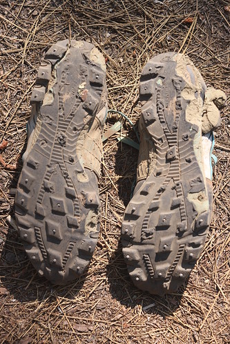
As I count it, I lost 14-15 minutes. I had trouble inside the circle and outside of it. I didn't expect to place 2nd in my age group but others had worse problems. Still others hadn't competed. I would have liked to do this over, using some different routes. My GPS track indicates 7.065 Km and 465m climb! I'd come downhill on some descents, especially near the end, that my foot was hurting. My Integrator shoes, both of them, had actually broken apart at the heal. I'd never seen this happen before. I had to throw them away :(