Register | Login
Attackpoint - performance and training tools for orienteering athletes

Training Log Archive: Nadim

In the 7 days ending Mar 20, 2021:

activity # timemileskm+m
  Orienteering2 7:42:14 9.36(49:23) 15.06(30:41) 177
  Running7 6:26:00 38.58(10:00) 62.09(6:13) 593
  Calisthenics1 1:00
  Total10 14:09:14 47.94 77.15 770
averages - sleep:6.7 weight:189.2lbs

«»
5:30
0:00
» now
SuMoTuWeThFrSa

Saturday Mar 20, 2021 #

11 AM

Running (Trail) 1:00:17 [3] 5.54 mi (10:53 / mi) +79m 10:25 / mi
slept:7.75 weight:189lbs

Lake Needwood Regional Park, MD. Starting at Needwood Rd., up Upper Rock Creek Trail (a dirt trail going up towards the Agricultural History Farm Park) to Muncaster Rd. (not Muncaster Mill Rd., which I crossed), and back. I didn't feel that strong but not too bad either. I did this after dropping Max of at a gym to workout with a friend and after getting my auto emissions test. The trail doesn't climb a lot overall but it does undulate many short ups and downs over the more gradual grades. I felt most of them. Though I'd gotten more sleep, my sleep was interrupted in the middle. Though it wasn't what awoke me, my knee hurt more in bed than it did on this run (which was none). It was sunny and in the upper 40s or lower 50s F. I ran in shorts and a t-shirt. I think I only saw about 4 of 5 people over the route. 3 were runner going down when I was going up. In contrast, as I stretched after finishing, I saw a steady stream of people taking the route around the lake and enjoying the good day.
2 PM

Orienteering (Field Checking) 4:30:24 [1] 5.6 mi (48:17 / mi) +93m 45:55 / mi

Hoyles Mill Conservation Park. I started from the Hoyles Mill Trailhead parking lot on White Ground Rd. Today was better than last time in that I was able to make better sense of the vegetation and match-up point features on the base map. Building on, and updating the vegetation mapping from my last outing, I found ways through the green areas of the north, to nicer stuff more typical of what I'd seen further south. Unfortunately somehow my GPS setup had gotten reset, perhaps due to an update. It changed track recording to Auto mode--That's much less detail than recording every second of a track. It gives results with less detail than my watch GPS shows. There were nice scattered and prominent rocky features in corridors of open forest. Where there was medium green vegetation, I found places that poked holes through it and which could be mapped as light green. I spent a little while in a big high field where it looks like natural hay grows. I got a bit of an viewpoint across the forest and to the suburbs.
The High Field

Friday Mar 19, 2021 #

7 PM

Running (Street & Trail) 47:30 [3] 5.0 mi (9:30 / mi) +67m 9:07 / mi
slept:6.5 weight:188lbs

Arlington, VA. Starting at Bluemont Junction Park at Wilson Blvd., north on the W&OD Trail to the Custis Trail (on the north side of I-66), to N. Glebe Rd., to Fairfax Dr., to the Bluemont Junction Trail, to George Mason Dr., to the Lubber Run Trail, to Arlington Blvd., to N. Granada St. to N., Greenbriar St., to the W&OD Trail to Bluemont Junction Park. Though today is Friday, I ran the same run that I had done on Monday. It was in the low 40s F and I felt significantly better. Fluidity improved at about 2 miles out as I started doing more downhill running than uphill running. I felt I was moving better throughout, except maybe for the last mile when I was more tired from running harder earlier. I'd had to stop at a traffic light in Ballston and apparently I hit the Start/Stop button twice when restarting it. Noticing just before I entered Lubber Run, I was able to restart it but my overall time is estimated. I was glad to find an open and clean restroom in Lubber Run too.

Thursday Mar 18, 2021 #

6 PM

Running (Street & Trail) 45:26 intensity: (34:00 @3) + (11:26 @4) 5.05 mi (9:00 / mi) +32m 8:49 / mi
slept:6.0 weight:188.6lbs

From the intersection of Elmhirst Ln. and Elmhirst Dr., to Elmhirst Pkwy. to the Elmhirst Trail, to Cedar Ln., to Rock Creek Trail, to the bridge over Rock Creek. that's just past the beltway (I-495) underpass, and back. It had been raining all day so it was wet and about 50 F when I started. I felt bloated and not so smooth for the first +1 mile (unsettled stomach). When doing a variation of this route my 2nd mile always seems to inexplicably be slower; there are minor hills but it still ends up further downward. I wore shorts and a sweat top but even that much started feeling warm. I took it off on the way back after the rain had started again. That seemed to energize me with my 3rd mile being faster than the second, even though it has a net climb. Still feeling a little better, I pushed more on the way back. I felt my left knee but not a lot.

Wednesday Mar 17, 2021 #

6 PM

Running (Street & Trail) 52:20 [3] 5.0 mi (10:28 / mi) +96m 9:53 / mi
slept:6.5 weight:189.3lbs

Cabin John Regional Park, MD. From the Tennis Center parking lot, I took mostly the Cabin John Trail northward to the campground loop north of Tuckerman Rd.; then after the loop I returned on similar trails. Having run a similar loop 10 days back. I felt slower and heavier today. By avoiding some wet spots last time, the distance should have close to 1/10th of a mile shorter this time. However my time today was slower and my watch measured the distance to be 1/20th longer. I didn't have to work as hard on the way back. Trail conditions were nice and dry overall. I ran here to give my left knee some softer ground and it did feel better during and afterward.

Tuesday Mar 16, 2021 #

6 PM

Running (Street & Trail) 45:27 [3] 4.73 mi (9:37 / mi) +71m 9:11 / mi
slept:5.8 weight:190.1lbs

From Northfield Rd., Custer Rd. to Wilson Ln. to Glenbrook Rd., to Bradley Blvd., to Kennedy Dr., to Dorset Ave., to the Little Falls Trail, to Hillandale Rd., to Bradley Blvd., to Arlington Rd., to Wilson Ln., to Custer Rd., to Northfield Rd. It was in the mid 40s F with a cool breeze. I pretty much knew starting out that I'd be slow on this run. A late dinner and apparent water retention have my weight up a little but it was also cumulative training catching up with me and and a need for more sleep and rest. My left knee was also not feeling so good. In the first mile, I pushed much too hard for the speed I was going. I put less effort into it afterward and felt better except in the last 3/4 of a mile.
7 PM

Calisthenics (General) 1:00 [3]

30 sit-ups.

Monday Mar 15, 2021 #

7 PM

Running (Street & Trail) 48:13 [3] 5.0 mi (9:39 / mi) +62m 9:17 / mi
slept:6.25 weight:189.9lbs

Arlington, VA. Starting at Bluemont Junction Park at Wilson Blvd., north on the W&OD Trail to the Custis Trail (on the north side of I-66), to N. Glebe Rd., to Fairfax Dr., to the Bluemont Junction Trail, to George Mason Dr., to the Lubber Run Trail, to Arlington Blvd., to N. Granada St. to N., Greenbriar St., to the W&OD Trail to Bluemont Junction Park. It appears that I last ran these trails and streets on 4/7/2006. Being in the area made it convenient this evening, and I like Arlington too. I've been coming here for a long time. It was a regular hangout for me in the 90s and 80s. I rode the W&OD trail from my parents home near Fort Hunt, to Harper's Ferry back when they were still constructing the trail in Arlington, and when it was all dirt in Fairfax County--that was about 1984. Running the the dark, most of it still made sense, though I did have to look around more carefully--some little things had changed while others were essentially the same. I was stiff starting out and generally climbing out of the Four Mile Run valley. Once to Ballston (another hangout), it was mostly downhill to the W&OD Trail, with some exceptions. I'd carried a headlamp in my hand but never used it. I thought I might need it in Lubber Run Park, but unexpectedly, there were a few lamps lighting most of the way. They helped me see the sudden short steep hills there. I felt like I was picking up the pace on the gradual railroad grade climbe of the W&OD Trail as I was finishing-up, but it looks like I was down--that was due to being cautious on the steep winding descent to the W&OD Trail in the dark.

Sunday Mar 14, 2021 #

11 AM

Running (Street & Trail) 1:26:47 [3] 8.26 mi (10:30 / mi) +186m 9:49 / mi
slept:8.0 weight:189.4lbs

Black Hills Regional Park; Boyds, MD. Starting from the Little Seneca Boat Launch, on Clarksburg Rd., I went north across the bridge over the lake where there used to be Ten Mile Creek many years ago (there's a wide shoulder on the bridge and further north for a little while). The lake is one of the larger drinking water reservoirs in the area. I got on the extension of the Hoyles Mill Trail on the north side of the bridge, returned to Clarksburg Rd., and continued north. I took the Cool Spring Run Trail to the northernmost end of the lake and soon after I got on the Ten Mile Creek Trail. The Ten Mile Creek Trail took me all the way back to where I'd started. I had printed and taken a country trail map with me, and I read it along the way. It was mostly accurate and I was glad to have it. When I'd finished, my watch had registered 1,200 ft. of climb, but that seems to have gotten adjusted down to half of that. The trails seem mostly well graded but designed for mountain biking with many small ups and downs. For a little while in the middle of the run, the ball of my right foot was feeling like the callus on it was hurting it. My left knee ached a little toward the end.

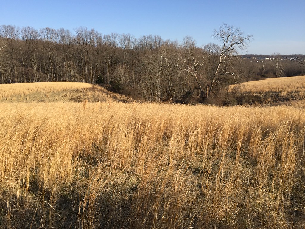
The Ten Mile Creek Trail goes up and down fingers of the lake and it's larger reentrants. There's a mix of thick, and open forest along the trail, but the park land is mostly too narrow to be effective for orienteering usage.
From the north end of Clarksburg Rd. to the south end of it, a distance of 6.45 miles, there was only about 3 steps on pavement. That was crossing Ganley Rd. where it dead ends. I'd explored some of the west side of Black Hills Regional Park before, but that exploration was about 21 years ago. I was mountain biking with a GPS at the time, and doing it for a running guide book that I was making. There were some big fields then, but now those areas appeared to be tree covered (probably the thick forests that I saw). The route made a really fun run for me, and I had a great day to do it on--sunny and in the 50s F. There are a lot of good views to be seen with the trail often high over the water, and there being no leaves to block one from seeing far away. The ground at the shoreline tends to be steep. The water looked deep too, with a pleasant green color. The trail tends to get close to the water at the mouths of the lake fingers.
With the long shape, the lake seemed similar to some Scottish Lochs. Initially there were few people to see, but as I got closer to the southern end, more people were to be found hiking and cycling.

Doing the loop as I did it is probably not common. I guess that most probably go out and back on Ten Mile Creek Trail from where I started/ended. Where the trail emerges north of the lake bridge, the upper parts of Clarksburg Rd. incur a steadily climb, but the road also narrows there with no shoulders. People drive fast on it.
3 PM

Orienteering (Field Checking) 3:11:50 [1] 3.76 mi (51:01 / mi) +84m 47:43 / mi

Hoyles Mill Conservation Park. After my satisfying run, I got some lunch from a general store at Boyds. It was under new management and I was suprised to see that the proprietors were southeast asian like me. I field checking started from the Hoyles Mill Trailhead parking lot on White Ground Rd. I mostly went along the Hoyles Mill Trail and along the northern forest edge of the park. I knew this area to be green, but since it's a part of the map I'd started, it needed to be done. This is also a good time of year to get out into these areas too, since it'll be harder to make sense of it later on. I did find a few interesting things, but not a lot of features. Most of what I found was manmade. That and more thorns were to be expected for former farmland. However, I did find some pleasantly open land too. There were some interesting ditches and intermittent streams, along with areas of disturbed ground and dot knolls. The vegetation seemed particularly tricky to map.

« Earlier | Later »