Training Log Archive: NadimIn the 7 days ending Jul 1, 2017:
| |||||||||||||||||||||||||||||||||||||||||||||||||||||||||||||||||||||||||||||||||||||||||||||||||||||||||
| « | » |
| » now | ||||||||||||
| Su | Mo | Tu | We | Th | Fr | Sa | |||||||||
Saturday Jul 1, 2017 #
Other (Horse Riding) 2:40:00 [1] 7.0 mi (22:51 / mi) +110m 21:48 / mi
(sick)
After finishing, the retired military couple who'd helped Samantha, needed help themselves. Their motorcycle had broke down so we gave one a ride to a station.


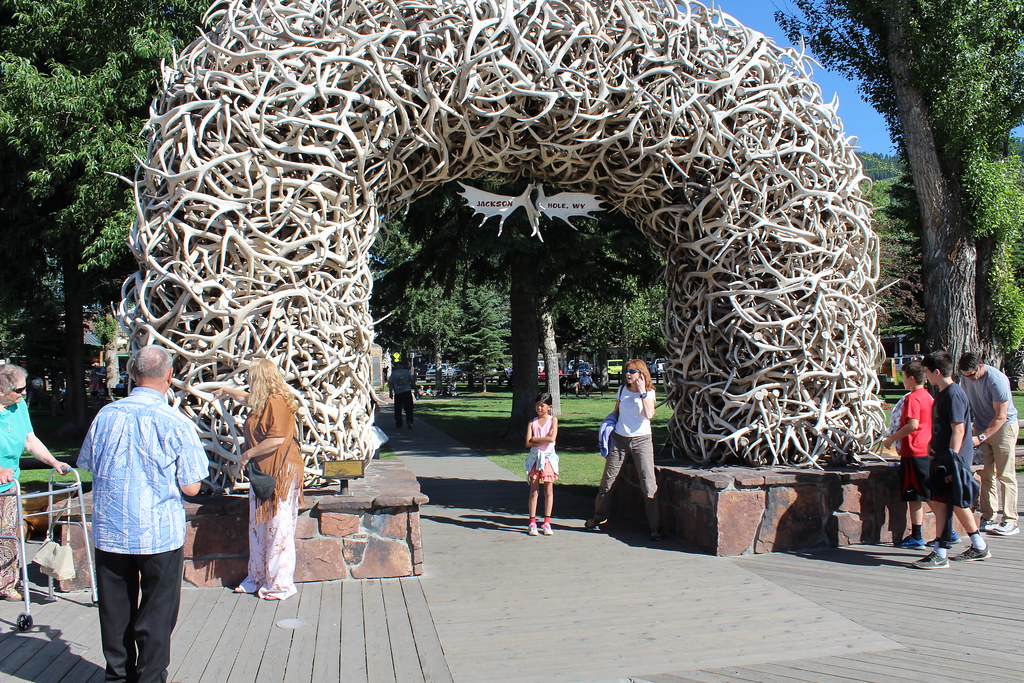
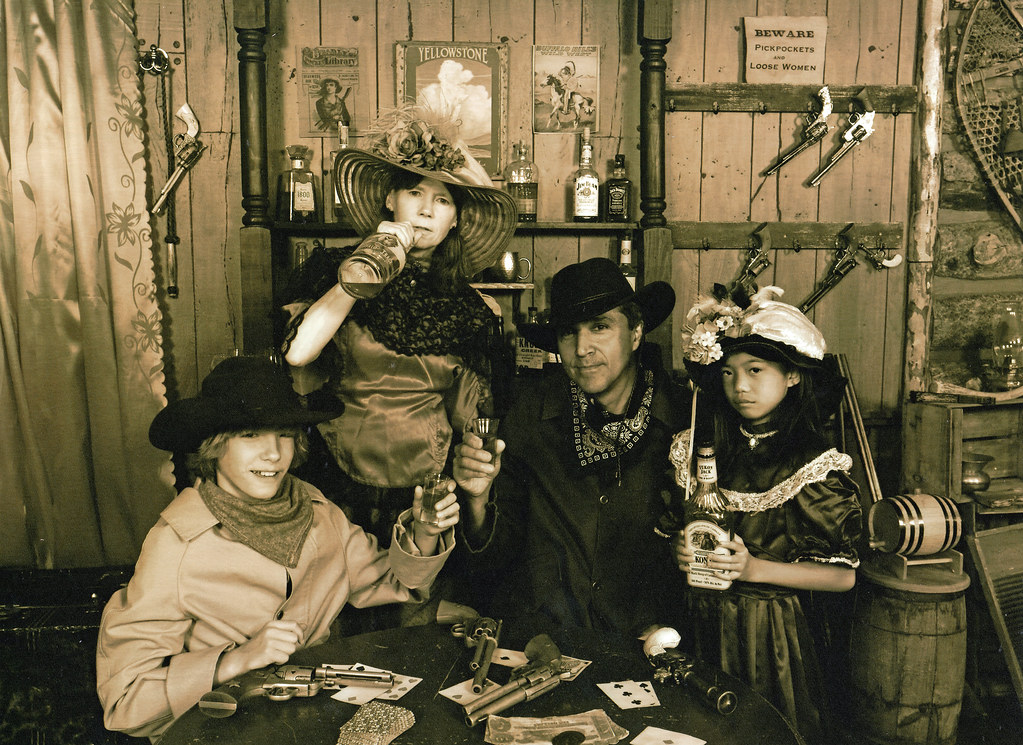
Eventually, with another stop at Colter Bay to clean-up, we left the Hole and went into Jackson. We were in-time to get a feel for things and see the mock gun fight. It came with a history lesson and Max, whom I'd tipped off earlier about it, remarked that it was not so lame as he'd thought it'd be. What I thought the highlight of the day was, came immediately after the gun fight. We saw the same troupe of actors who put on the gunfight, become our servers at the Jackson Hole Playhouse. After dinner, the actors did what's probably more natural to them, they put on a good production of The Unsinkable Molly Brown. I enjoyed it giving Samantha another good strong woman figure to think about but the play was just pretty funny and good all around. Peggy and I agreed that the best part was a slow motion mob fight scene which had a dutchess head butting a Coloradan socialite. It was all done in fine costume with live music.


We had to drive all the way back to Colter Bay to our cabin afterward. In the dark, speeds were slow for potential wildlife crossings. We saw none and there weren't many cars out either. I thought I might be shaking my cold sometimes, but it kept coming back.
Friday Jun 30, 2017 #
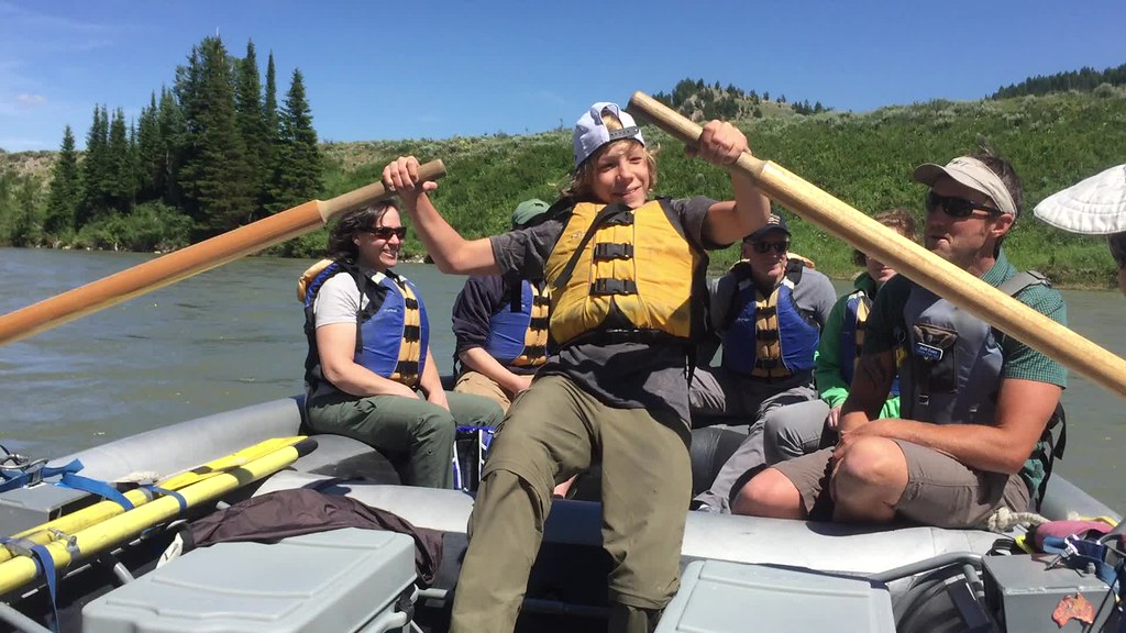
Other (Rafting) 1:20:14 [0] 10.0 mi (8:01 / mi)
(sick)
Eventually we checked-in to a comfortable, yet 100 year old cabin in Colter Bay, and had lunch in Moose, WY, before our raft trip.
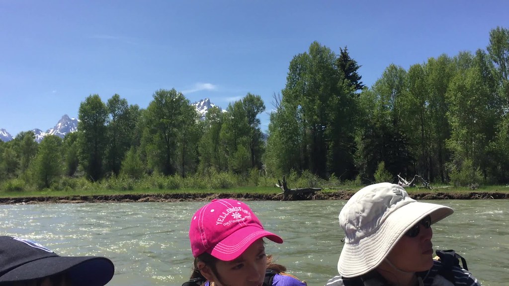
The raft trip was purely about sitting and enjoying the sights. The raft was guided so we did not take one stroke. We just enjoyed the majestic views of the Tetons and things around the river. The guide pointed out a couple of eagles and beaver works. In 2000 when I did this I saw more wildlife. Samantha was nervous and it came out as she had difficulty stopping her chatter, but eventually she calmed down. The river was flowing high but not as high as it had been. It was braided. At one point the guide asked Max for his decision on which flow to take. Max didn't understand the question well, being surprised that a guide would appear to value his opinion; Max hesitated and finally picked one. At this point it was a bit late. The guide tried to move us over but wasn't able to. Then he got worried and told all of us to get low on the raft. We headed straight into rootstock lodged on a sandbar. We bounced but the guide thought we might have caused some damage from how hard we hit. It was the liveliest point of the trip so it was okay with us--no one got hurt, except for the guide's pride.

Afterward we explored an old ferry store in Moose and Max learned more about the value of money. He bought a tin Coca Cola sign and regretted the expenditure that wiped out the rest of his vacation allowance, when he saw it for less in Jackson, WY a few days later. We had an early evening dinner but erred when ordering a pizza that ended up having hot wings sauce on it. Max and I did some laundry even later--he was enjoying a chance to use Peggy's iPhone to play games that we hadn't let him do for several days in Yellowstone.
My sneezing and runny nose kept going throughout the day but didn't slow me much. .
Thursday Jun 29, 2017 #
Hiking (Trail) 40:53 [1] 1.18 mi (34:39 / mi) +39m 31:25 / mi
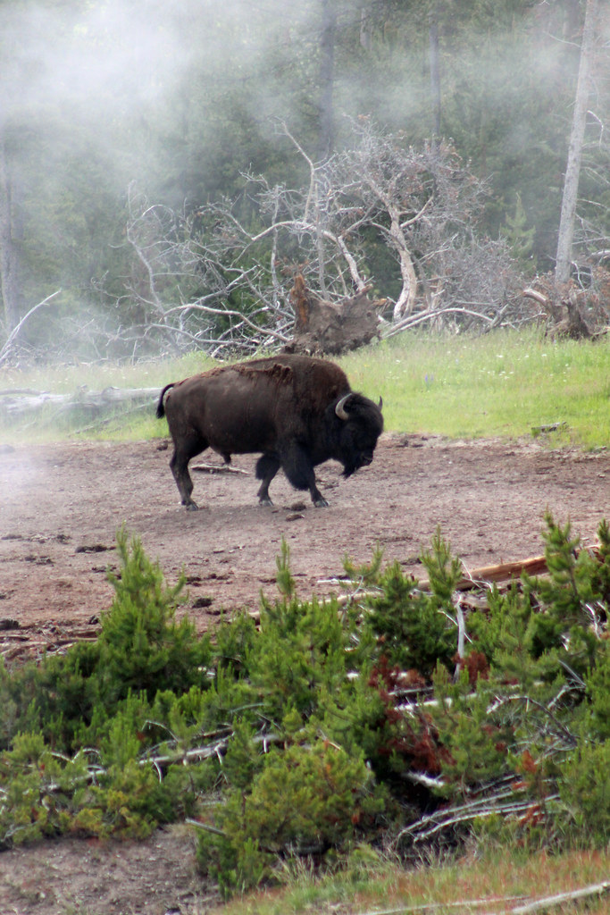
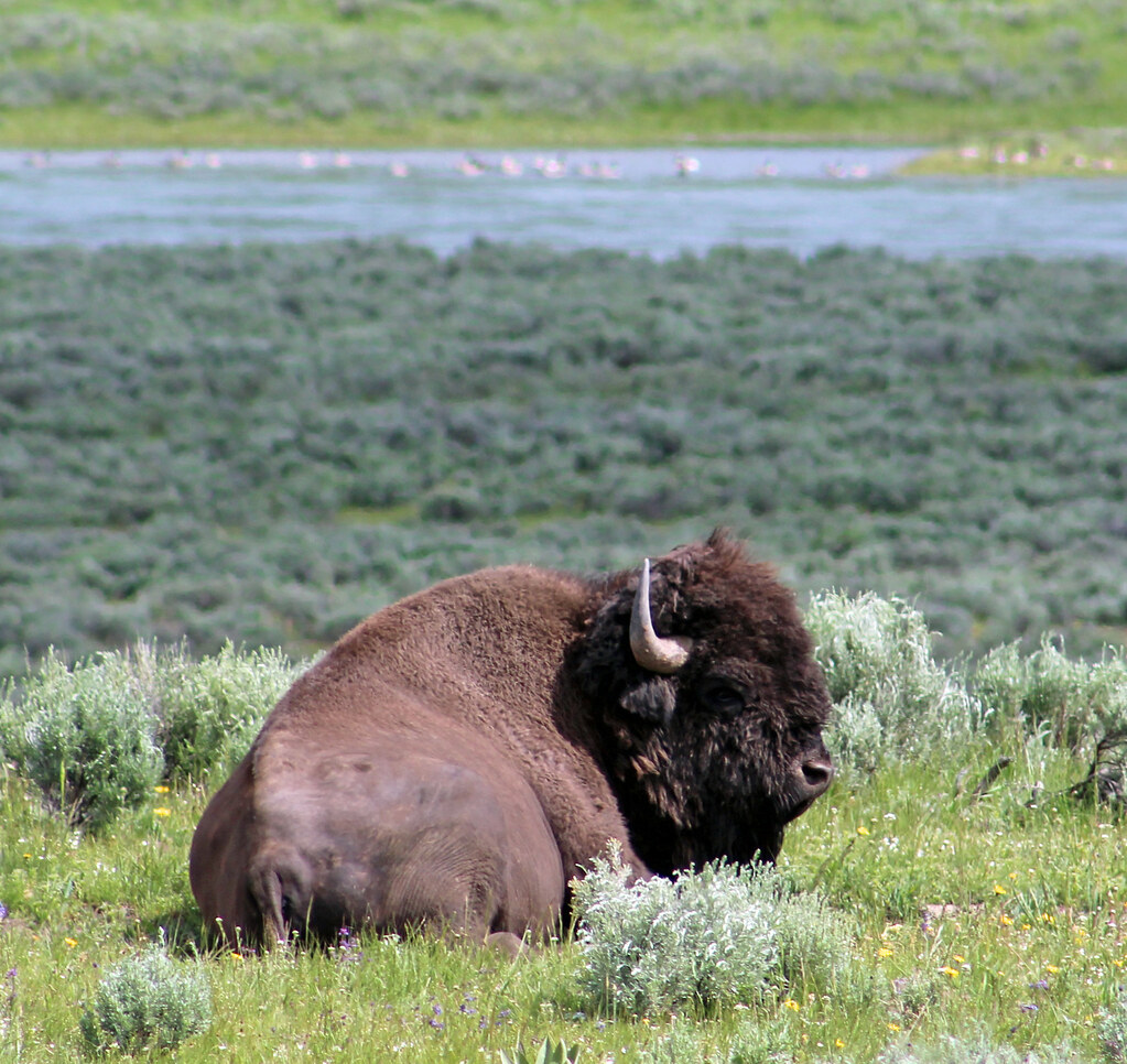
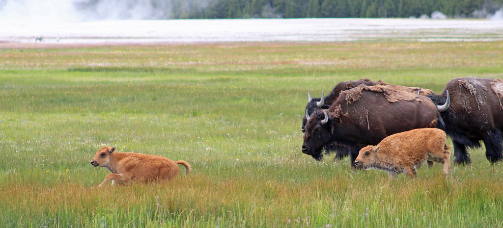
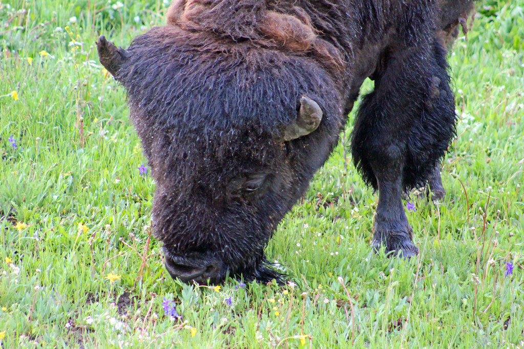
On the way down, we saw a bison.
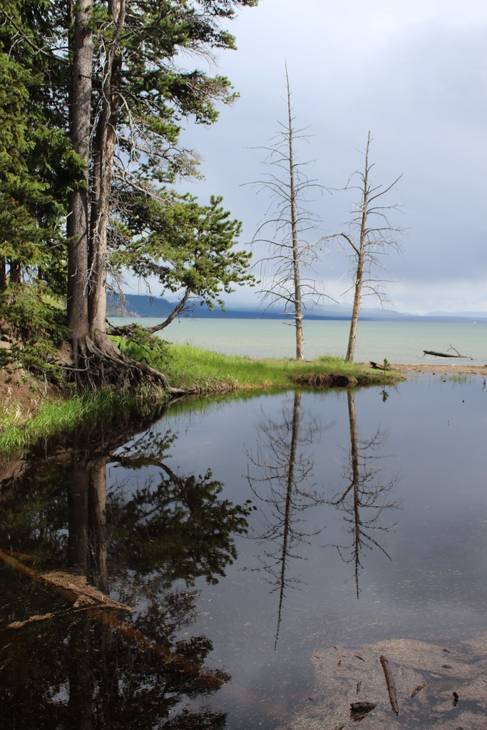
After the hike, we went to the Lake Lodge area where I'd stayed several nights in 2000. It's funny how little of it I could remember. This was followed by a drive to the Fishing Bridge, the visitor center there, and a store in which we waited out some rain.
Hiking (Trail) 1:20:55 [1] 2.76 mi (29:19 / mi) +73m 27:05 / mi
(sick)
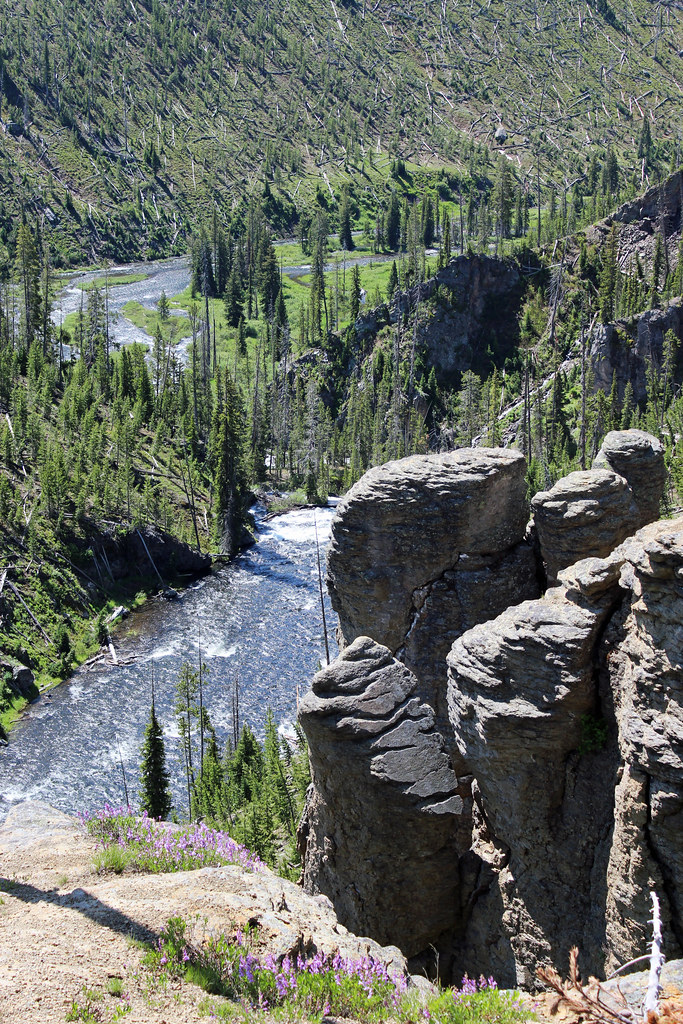
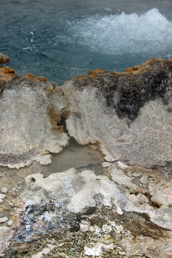
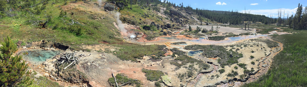
We drove a little way out on the east access road and got going on this nice flat little hike. At first the trail across a large flat field was muddy. I stayed to the side. Stepping on the trail as Max was initially doing, was pulling off a layer of dirt which stuck to the shoes. The rain was looking like it'd hold off. We caught-up to and passed a big guided group at the large pond and headed into the woods along the lake shore, not fully certain that we were on the right trail. However soon enough we got to Storm Point, a beautiful and open rocky knoll overlooking the large Yellowstone Lake. The hiking trail continued along the shore for a little more, then cut across the forest (lush, but with lots of deadfall from an earlier fire), then back across the field. Rains came again pretty soon after we finished.


On the way to Grant Village, we stopped on the road again and saw another bear--no cub this time, but it was pretty close to the cars in front of us.
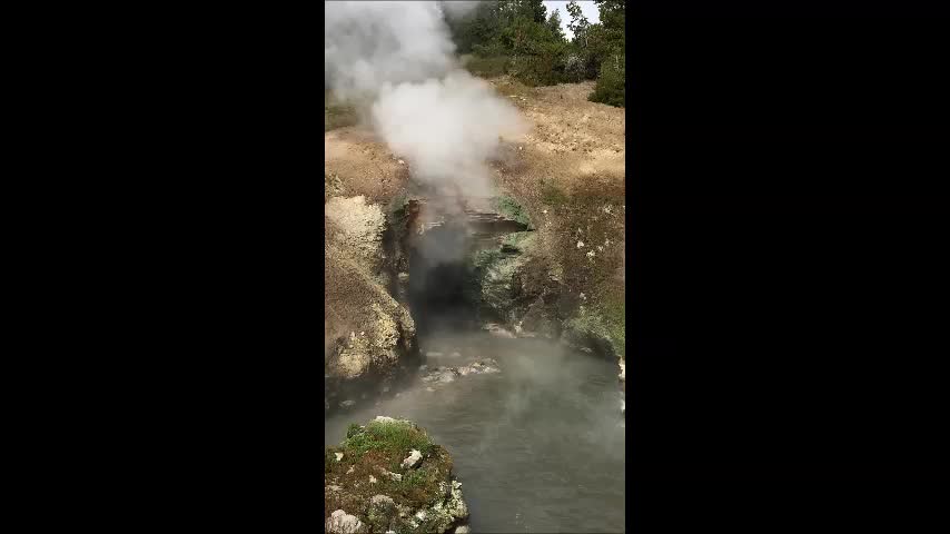
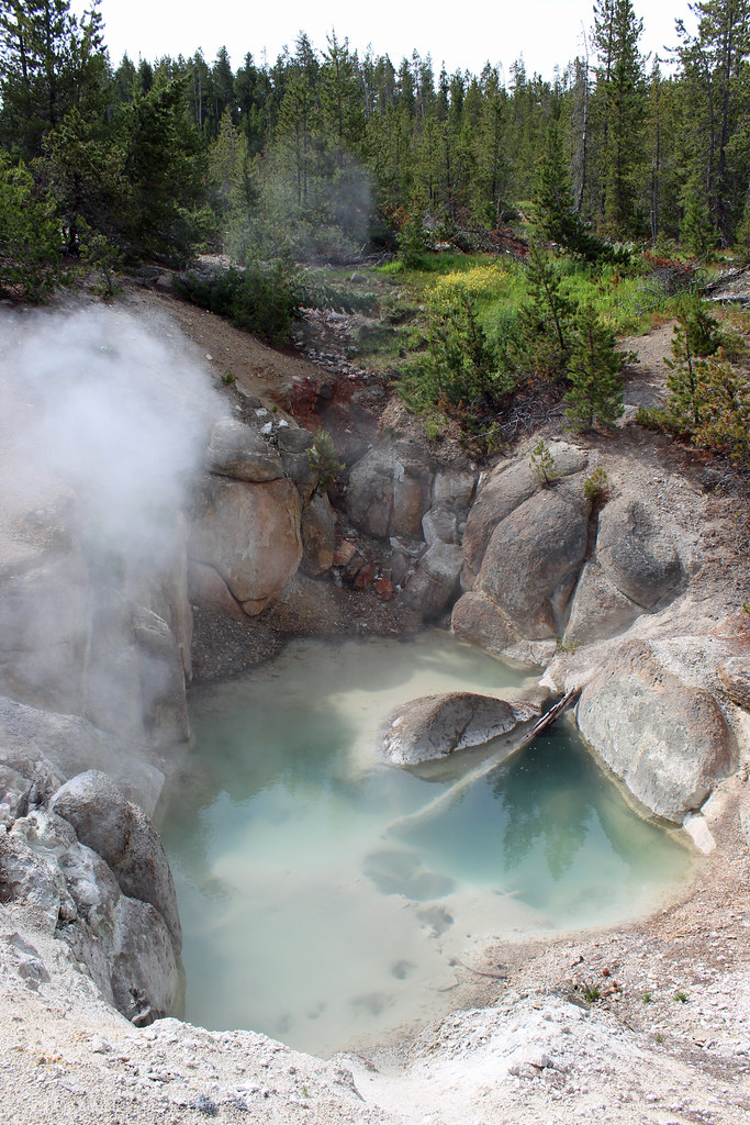
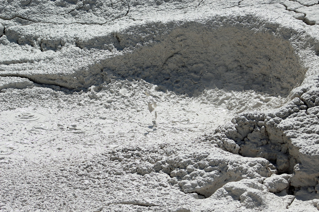
At Grant Village we checked-in for the night and ate dinner in the Lake House overlooking Yellowstone Lake again. A geyser in the West Thumb must have went off, because I noticed what seemed like a fog filling that area suddenly.

By the end of the day, it was clear that the sore throat I'd been feeling was becoming a summer cold.
Wednesday Jun 28, 2017 #
Hiking (Trail) 1:44:05 [1] 2.56 mi (40:39 / mi) +55m 38:07 / mi
Hiking (Trail) 35:03 [1] 0.74 mi (47:22 / mi) +10m 45:27 / mi
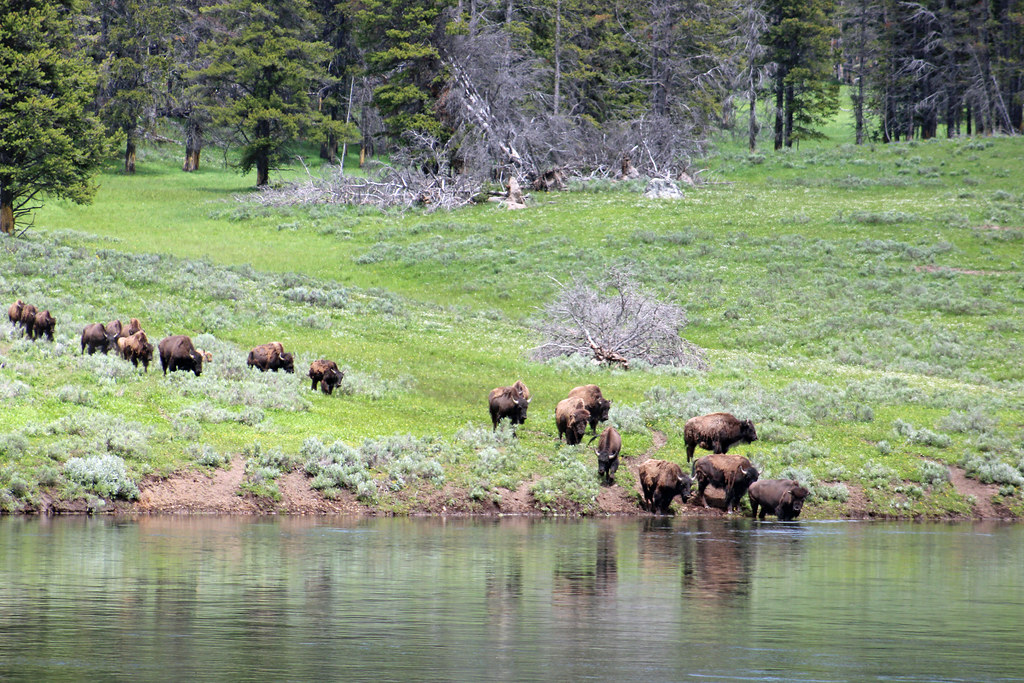
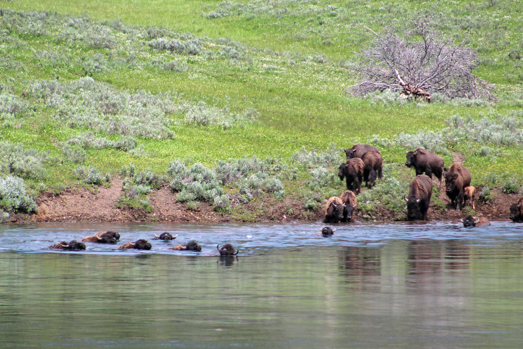
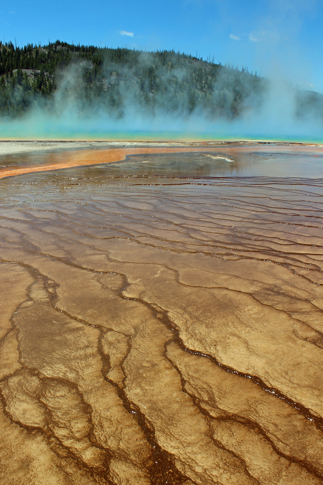
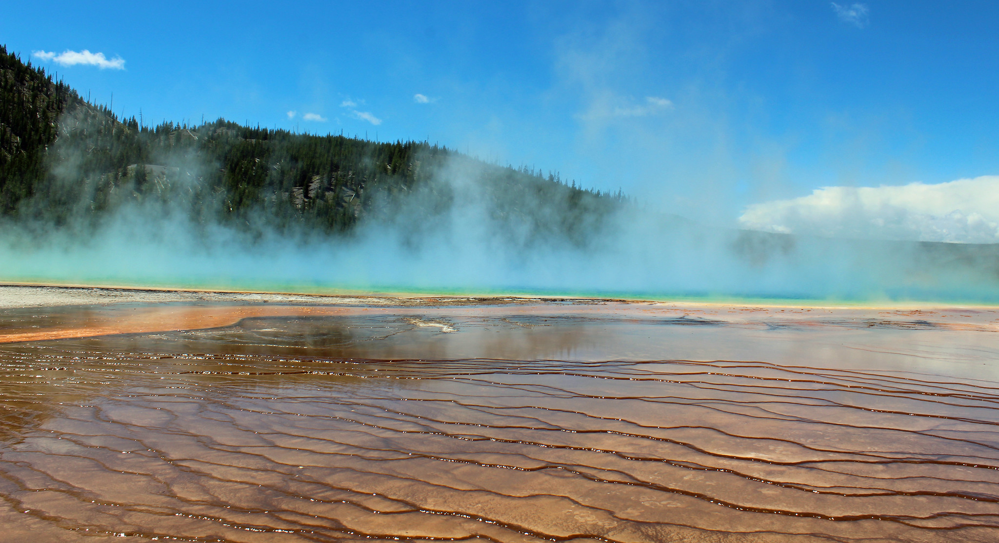
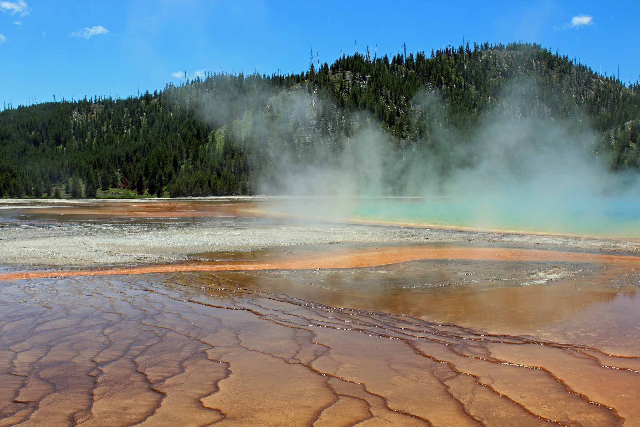
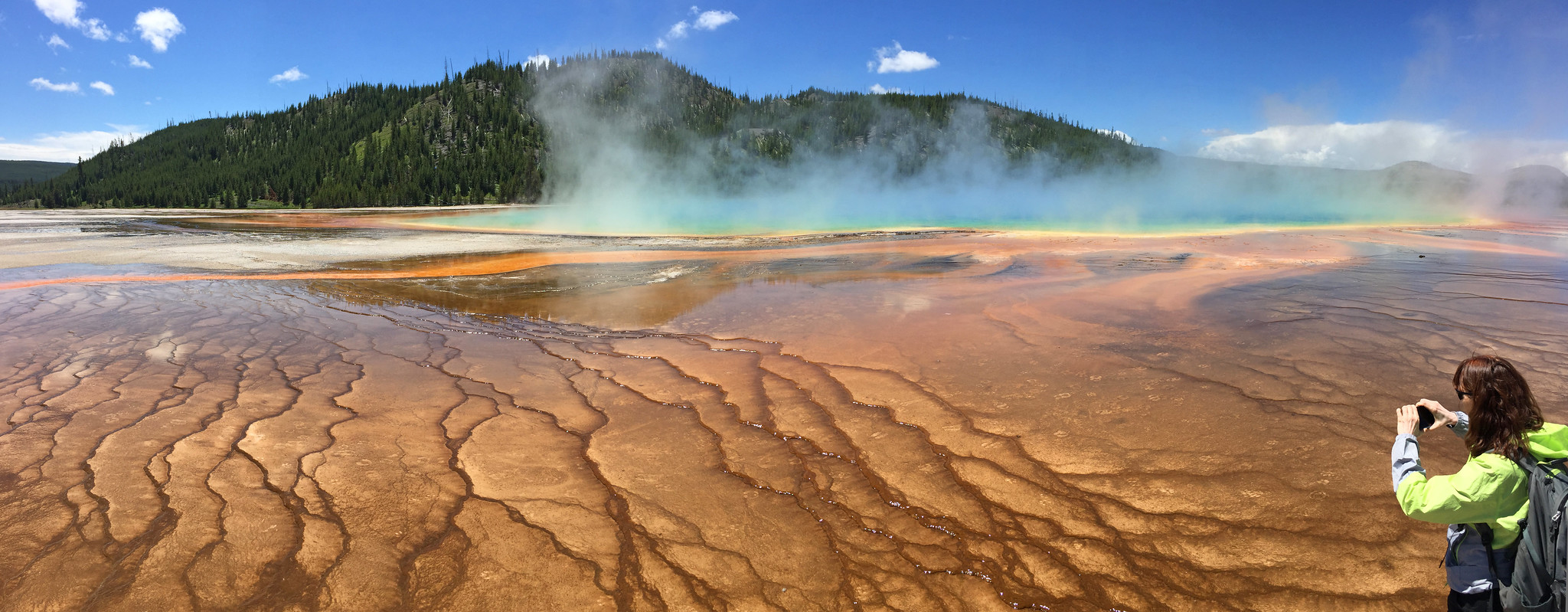
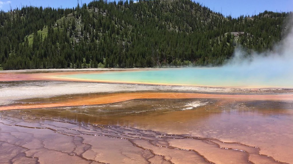
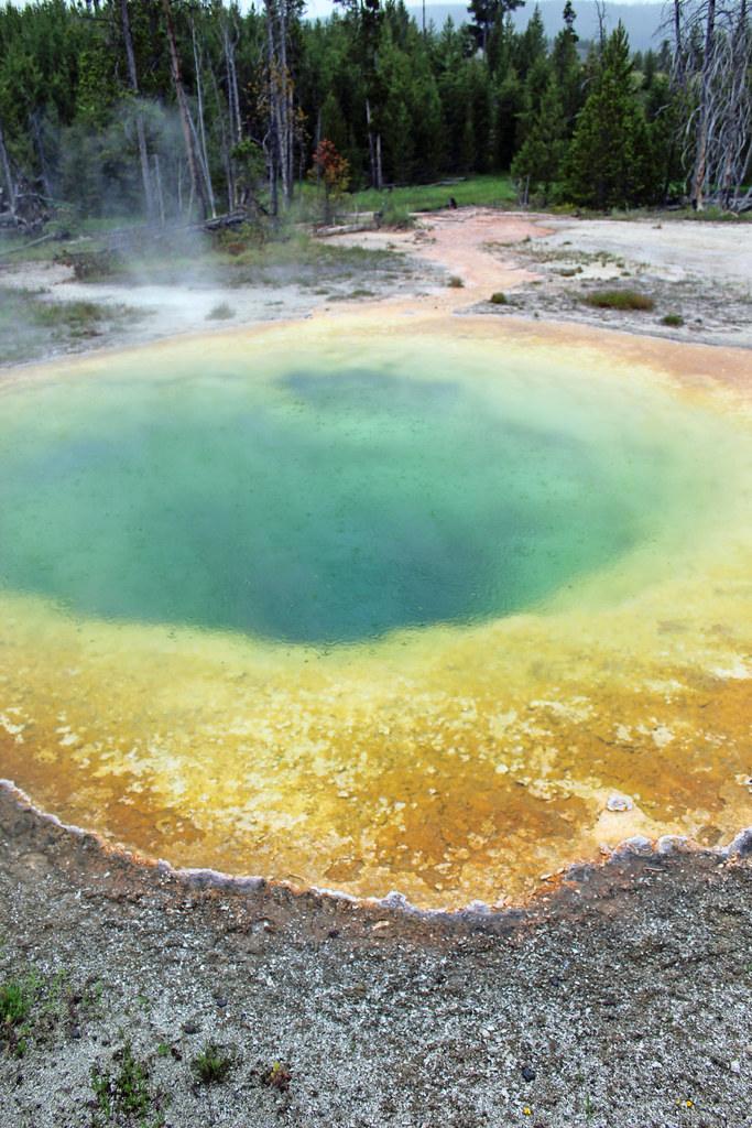
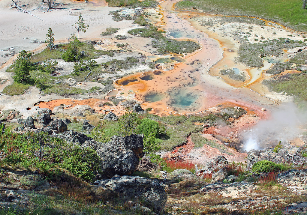
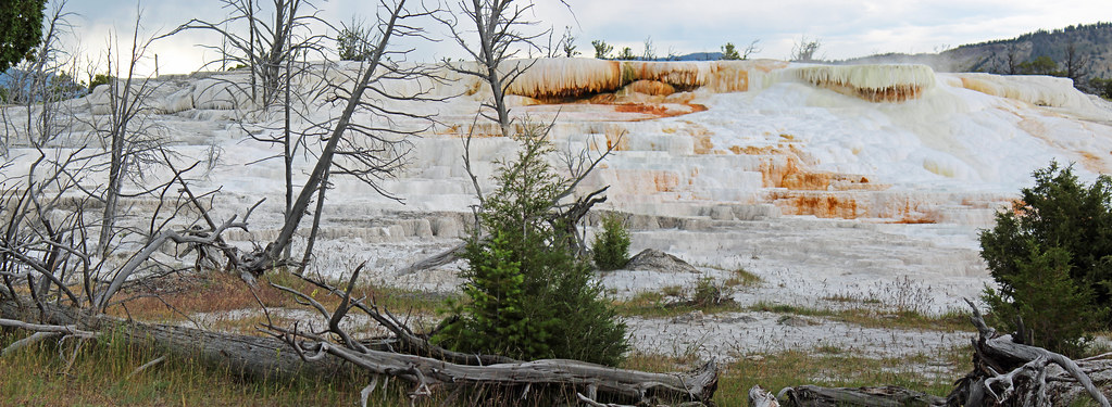
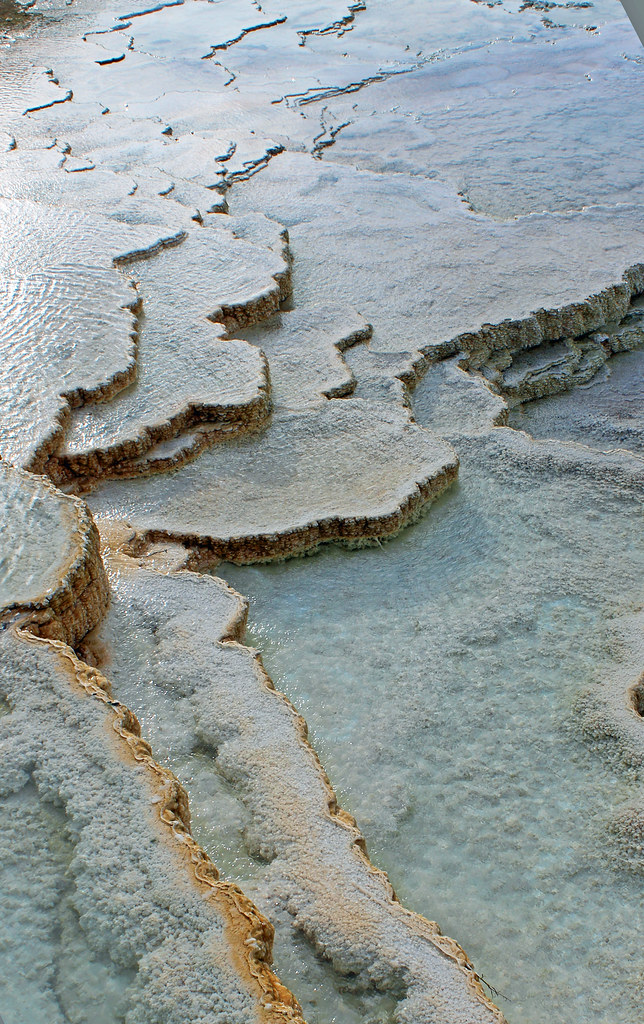
I loved seeing Grand Prismatic Spring when I was here in 2000. I must have spent 2 hours on the hill overlooking the spring then, and I got a great picture of a herd of bison crossing the hot waters. The view from this hill is really necessary to seen the sun-like multi-colored rays emanating from the circle. On this trip, yet another disappointment was the closing of the trail that lets one get to that hill--they were doing a bridge repair and walking-in from the other direction would have required a walk of a few miles one-way.
Settling for the boardwalk with a lot of other people, we did get a feel for the place. Approaching the spring there were some good rays. Standing on a bench I got a panorama shot I liked with Peggy in it. It was windy and we'd seen one hat that had been blown off a tourist and was sticking out like a sore. Peggy had cautioned Max about his hat but sure enough, his blew off to where we couldn't reach it too :(. I want to come back here one day. I know enough to not expect the same experiences when returning to places, but I can sure hope for something approaching my 2000 trip.

Hiking 25:33 1.1 mi (23:14 / mi) +20m 21:59 / mi
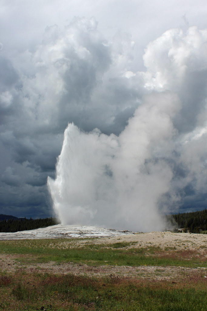
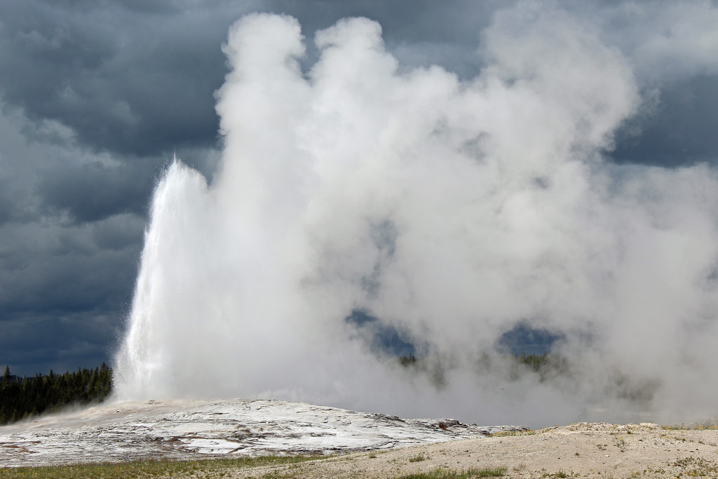
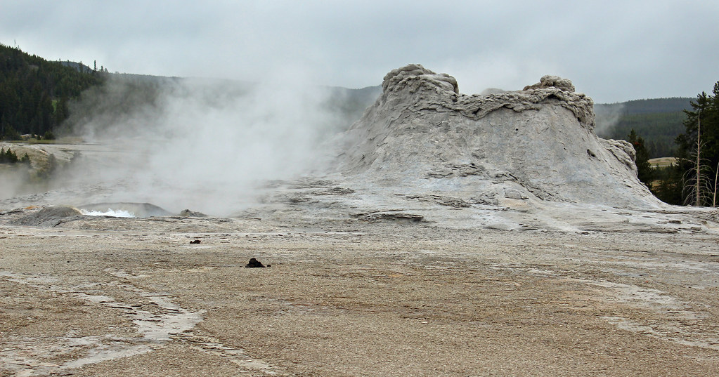
After Old Faithful was finished till it's next interval, we quickly went off to see what we could of the Upper Geyser Basin. It was a bit of a walk just getting there, with the usual delays with Samantha not cooperating on hiking. It got colder and we put on jackets. We rushed past what are usually some fairly interesting pools. Unfortunately with the dark sky, we didn't get a sense of the depths or the colors. We would have gone on but it became obvious that the rain would hit us. We finished a loop and even took to running part of the way back. A few drops hit us but we escaped most of it to get indoors and shop. I got a t-shirt and a photo book souvenir.
Hiking (Trail) 1:00:47 3.75 mi (16:13 / mi) +18m 15:58 / mi
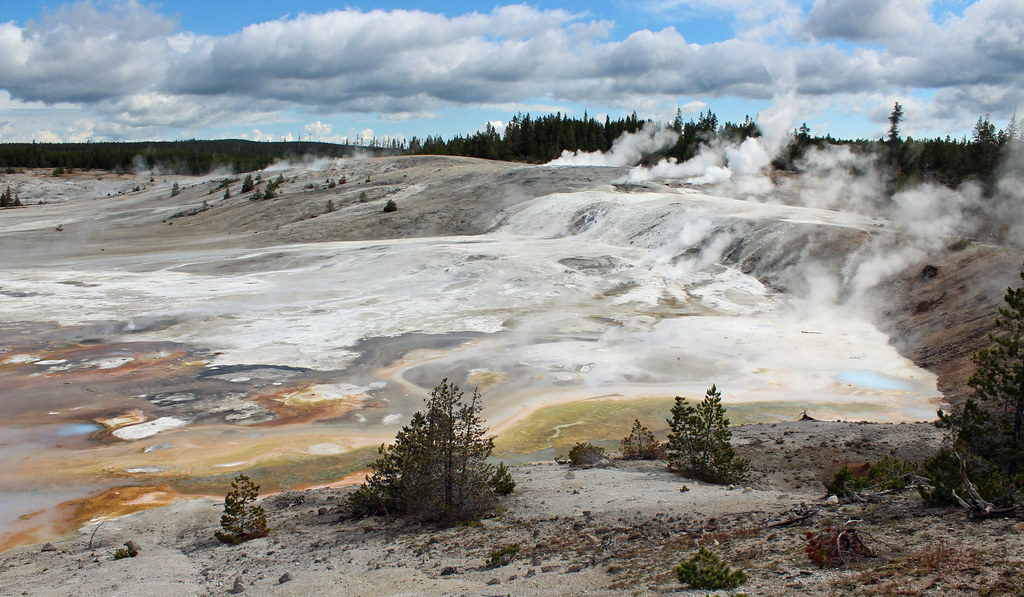
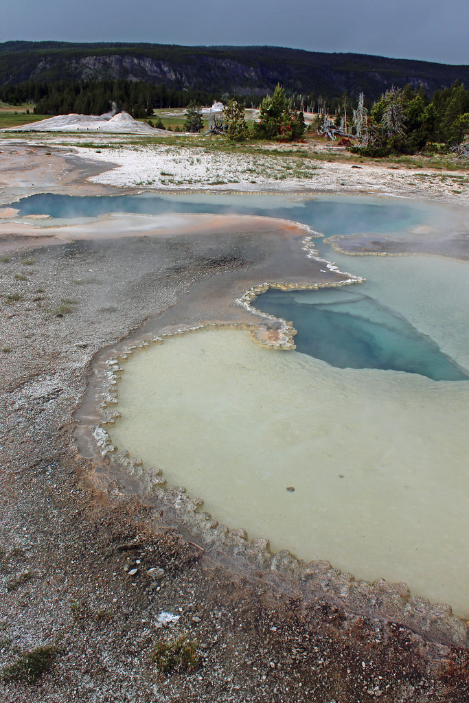
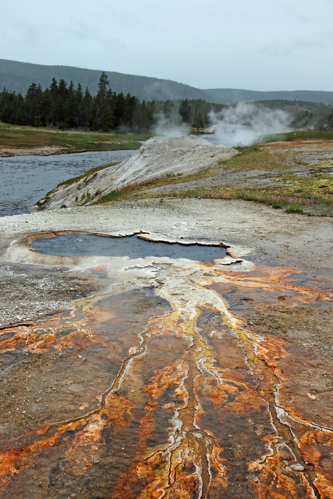
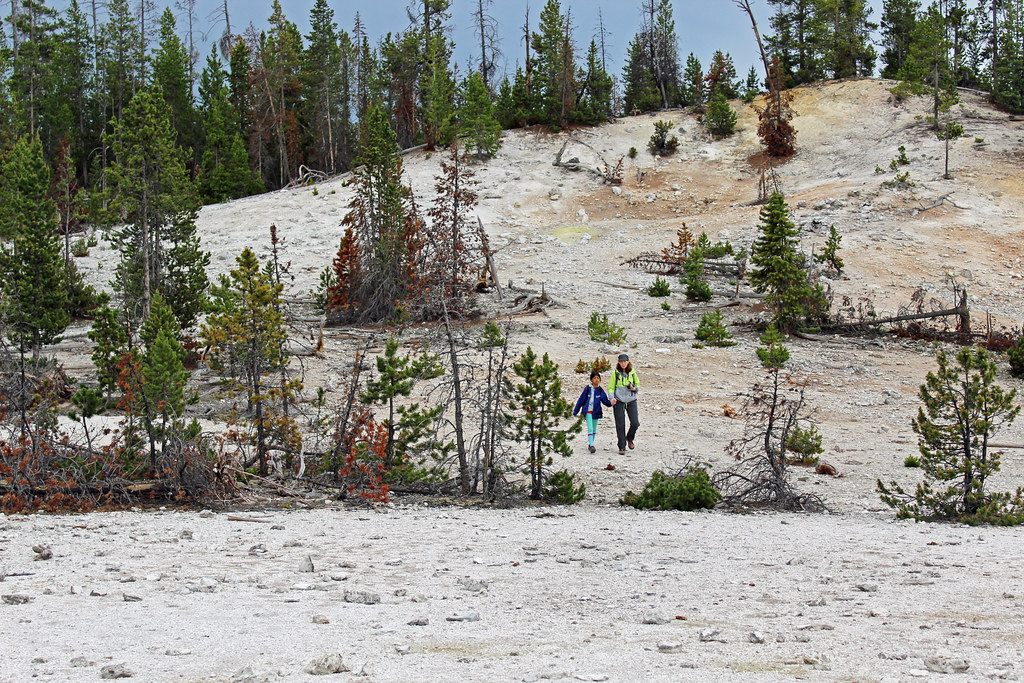
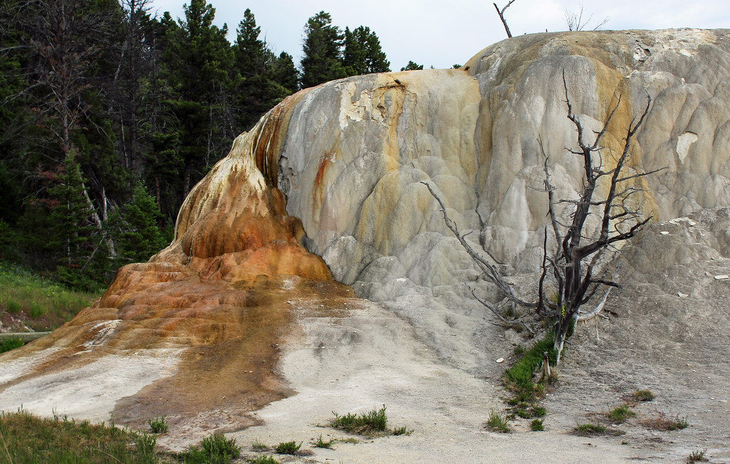
It turned out that the rains didn't go away. It rained harder and slowed again several times. By the time I got to a placard with a map, I estimated I'd only have about a mile one way walk to get to the end (going along the Firehole River) so I thought to suck-up the poor weather and hope for some interesting shots that can only be gotten in inclement weather. Like my Mammoth Springs hike, I moved into the sport of running photography, going from feature to feature. That kept me warm but I didn't get to see a single geyser spout; I never stood still long enough. The map turned out to be misleading too. It was about 2 miles to the end where the Morning Glory spring was. I pushed on to it and did a small side loop too. I had most of the places to myself but a few other hardy souls were out too. At the time of this writing, I'm still not sure how my photography turned out, but it turned out to feel disappointing again. It had taken me 15 years to travel out here again and it could be another before I return.
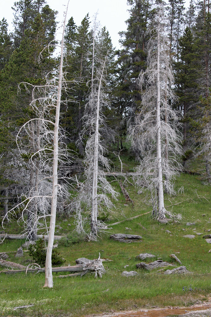
We drove on some side roads as we headed back to Canyon Village but only saw limited wildlife. Being on roads untraveled before did however surprise me. There were just a lot more geothermal features in the park than I'd remembered or knew. Evenings come late in Yellowstone at this time of year. Back in Canyon Village with more rain, a faint hope to go out the Lamar Valley in hope of seeing wild wolves just wasn't feasible. It was cold and rainy.
Tuesday Jun 27, 2017 #
Hiking (Trail) 2:23:36 [1] 4.28 mi (33:33 / mi) +218m 28:58 / mi
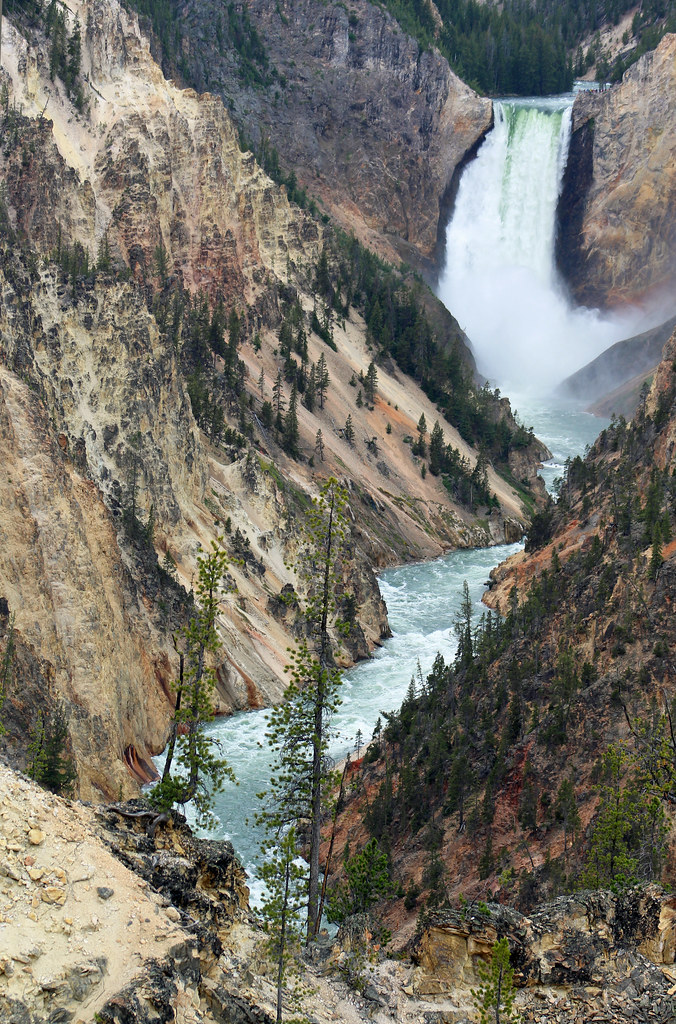
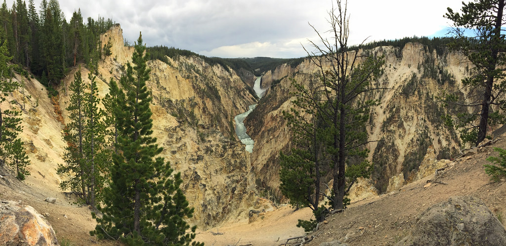
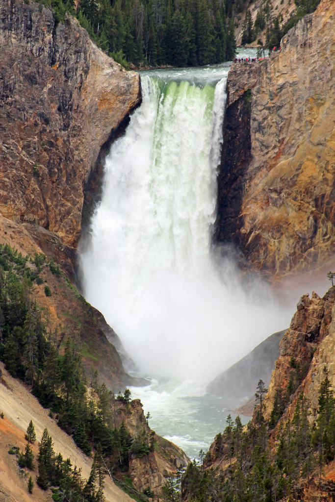

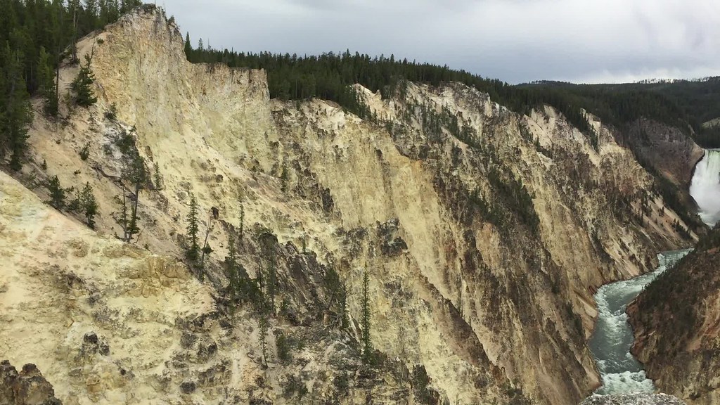
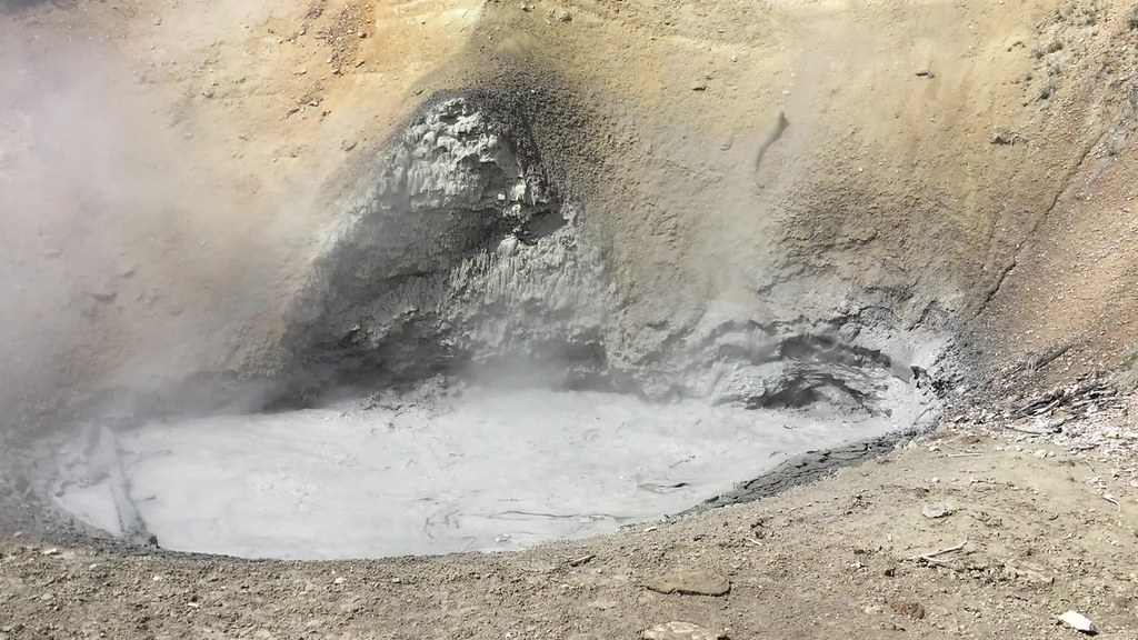
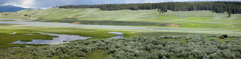
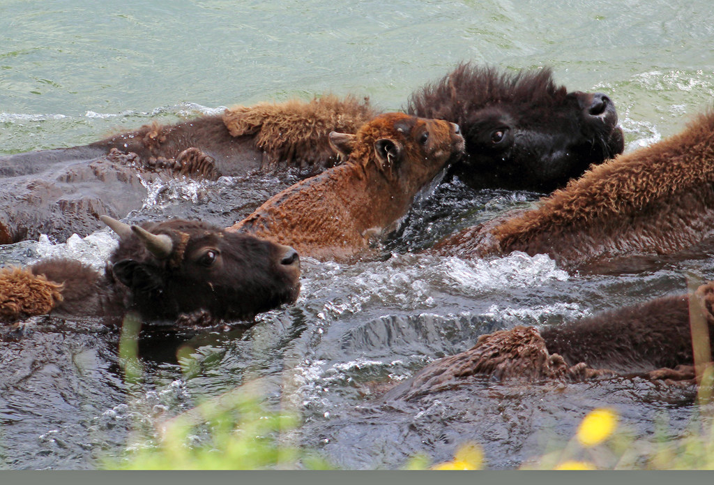
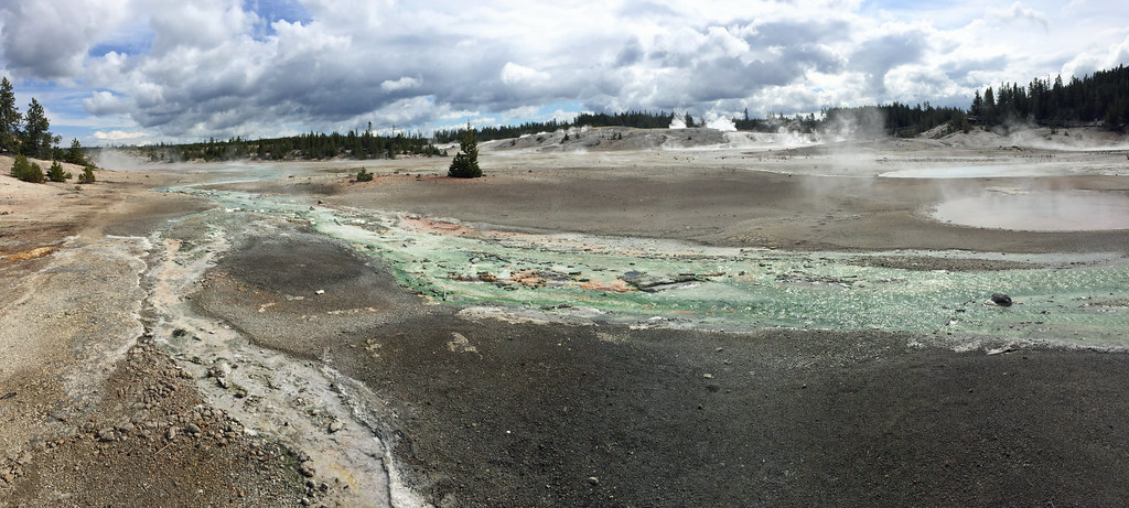
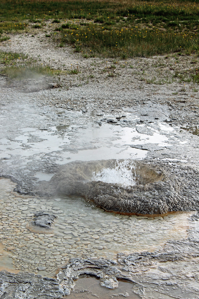
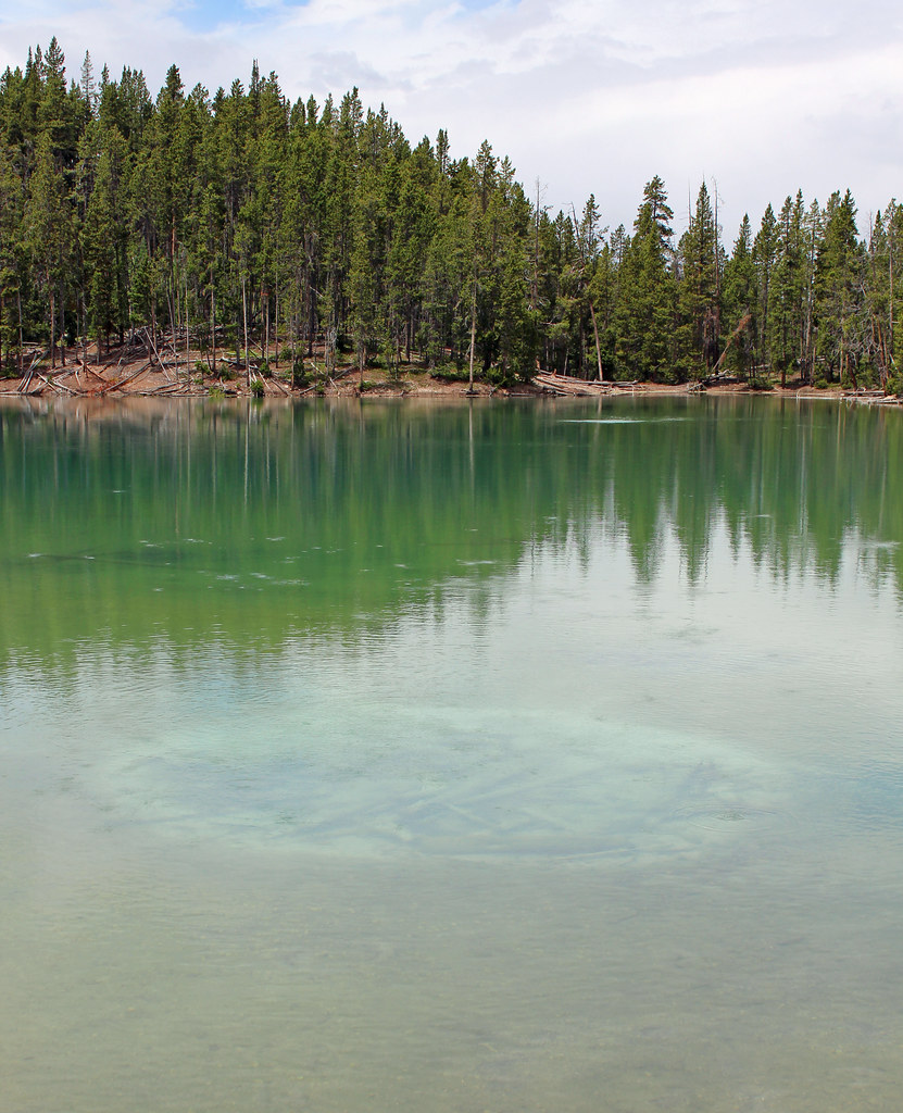
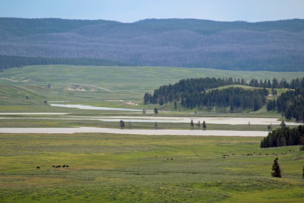
After great view, Peggy and I discovered an opportunity to do a loop hike right from where we were. It went further along downstream on the south rim for a way. Of course it was gorgeous. There were some pretty steep up and down hills but Samantha didn't have us stop too many times. We headed away from the canyon through thick forest toward Lilly Pond and another small pond. Surprisingly we came upon active geothermal features and got good close looks at them (still keeping a safe distance from ground that could collapse). The trail lead across a starkly contrasting small flat white valley that looked like everything had been blasted away--the trees had probably just died naturally as the underground activity heated up. It had more thermal and muddy ponds, some of which bubbled. Eventually we got to Clear Lake which starkly contrasted again. It was clear and apparently safe looking but looking into the water, I could see where the ground had been disturbed from past bubbling. It reminded me of some African lakes I'd heard about which became supersaturated with lethal gases and eventually killed whole villages. Past Clear Lake there was a junction we went out and back on. It bought us a view of the wide open valley for the flooded Yellowstone River (heavy snows in the region were making for high water from Idaho to WY). We could make out some bison herds far off. Finishing up we went through interesting terrain with scattered open areas, depressions and intricate reentrants. I would have taken the trail toward Uncle Tom's (staircase) Trail but the way to it, and the South Rim Trail, had been closed for infrastructure work. It was disappointing because the rim walk looked interesting (I'd been down/up Uncle Tom's Trail in 2000 and enjoyed that but even if it were open, I was unlikely to get the family to make that 500ft vertical effort). We had to settle on walking along the busy road for a mile but it went quickly. This still turned out to be a wonderful hike and all the better since we hadn't planned on doing it.


After a late lunch, rains came and it got colder. By the evening, even with my light rain jacket, I was feeling cold walking in the village between buildings where we shopped and ate more.
Monday Jun 26, 2017 #
Hiking (Trail) 53:57 [1] 1.25 mi (43:09 / mi) +31m 40:04 / mi
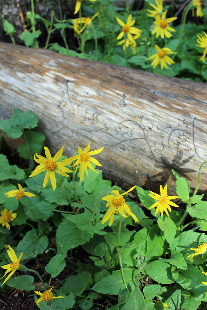
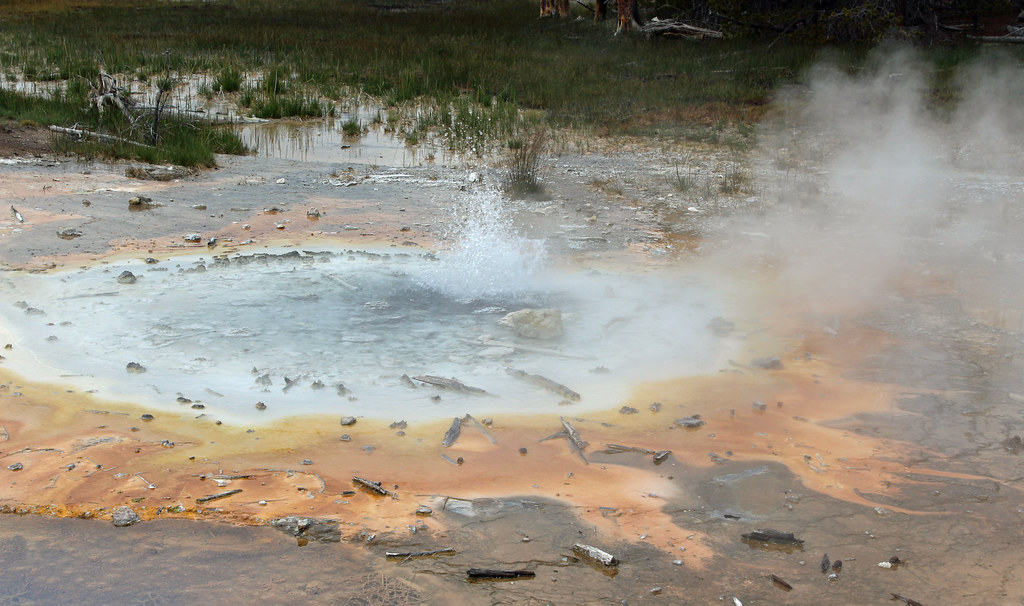
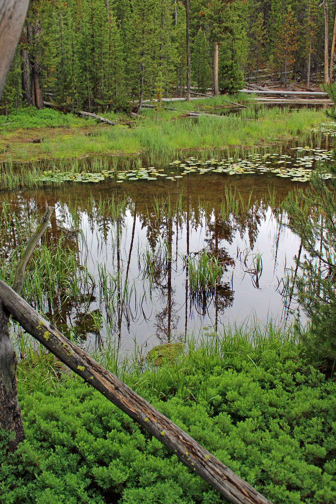
we got to the Artist Paint Pots. Samantha was reluctant to do much but Peggy got her going. This was a good outing. I pointed out the Lodgepole pines and the telephone poles too. The sun let us see into the pools which were nicely active.
Driving north after this, we hit construction traffic that delayed us about 45 minutes. It seemed such a waste; they had one-way traffic on a couple miles of roadway, which was being repaved and protected from falling rocks.
Hiking (Trail) 51:23 [2] 2.19 mi (23:28 / mi) +122m 20:00 / mi
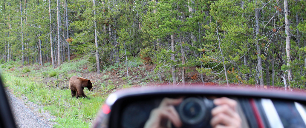
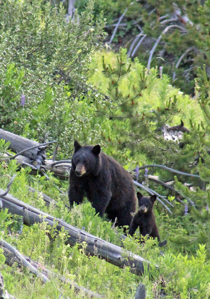
It was getting late when we were done and we were hungry. We headed to dinner at Tower Junction. Along the way we stopped where a crowd was pulled over and saw a mother bear with her cub. They were making their way up a reentrant, to cross the road. They almost turned back since there were so many people where they were going, but they persevered and we got a good look!
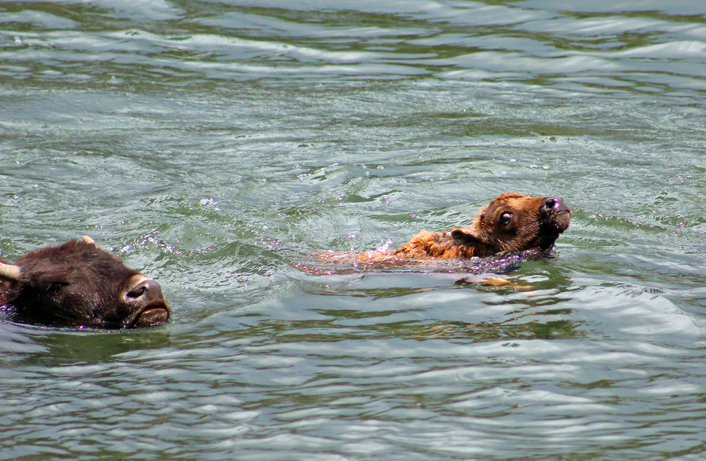
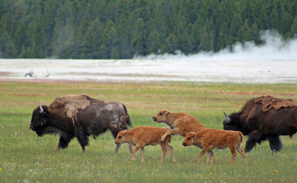
We ended up not eating at Tower Junction and seeing some bison as we drove on to the Canyon Village.
Sunday Jun 25, 2017 #
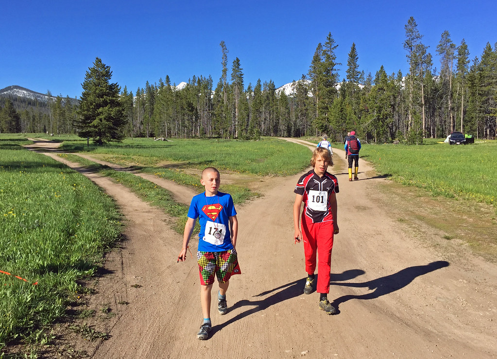
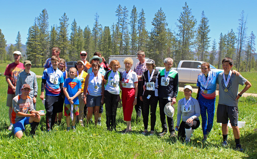
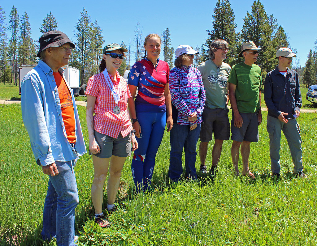
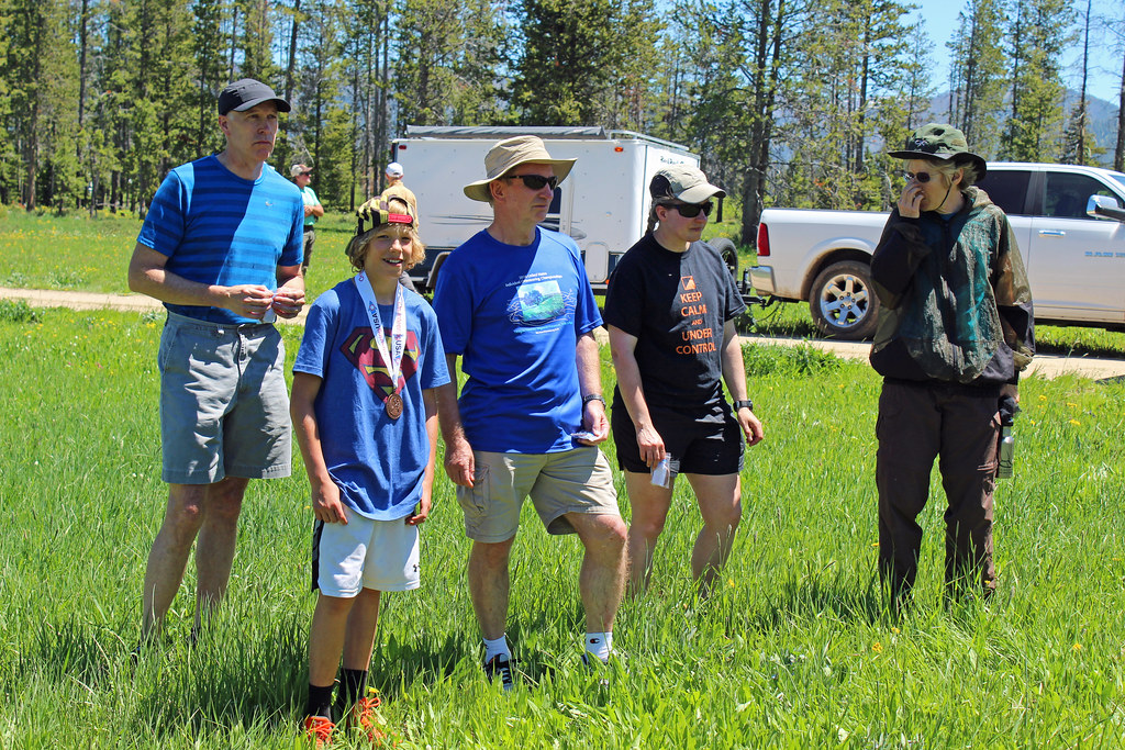
Running warm up/down (Street & Trail) 12:29 [2] 1.11 mi (11:15 / mi) +60m 9:38 / mi
slept:6.5
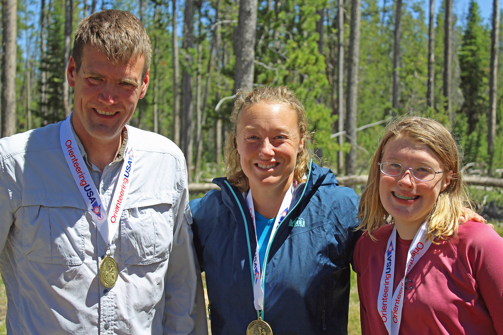
Orienteering race (Foot) 42:40 [4] **** 4.34 km (9:49 / km) +80m 9:00 / km
13c
Hiking (Street & Trail) 21:28 [1] 1.04 mi (20:38 / mi)
Hiking (Trail) 52:19 [1] 1.2 mi (43:36 / mi) +11m 42:24 / mi