Register | Login
Attackpoint - performance and training tools for orienteering athletes

Training Log Archive: Nadim

In the 30 days ending Apr 30, 2020:

activity # timemileskm+m
  Orienteering4 19:01:58 27.16(42:02) 43.72(26:07) 328
  Hiking9 6:49:30 22.53(18:11) 36.26(11:18) 482
  Bicycling6 2:11:54 31.69(4:10) 51.0(2:35) 367
  Running3 59:57 6.35(9:26) 10.22(5:52) 102
  Total22 29:03:19 87.73(19:52) 141.19(12:21) 1279
averages - sleep:6.2 weight:199.2lbs

«»
6:31
0:00
» now
WeThFrSaSuMoTuWeThFrSaSuMoTuWeThFrSaSuMoTuWeThFrSaSuMoTuWeTh

Tuesday Apr 28, 2020 #

12 PM

Bicycling (Commute) 6:38 [2] 1.21 mi (5:29 / mi) +10m 5:20 / mi
slept:6.0 weight:199.5lbs (injured)

From Northfield Rd., I went to Greentree Rd. where there's a food truck, to pickup an order for Max and me.

Monday Apr 27, 2020 #

7 PM

Hiking (Street & Trail) 43:17 [2] 2.29 mi (18:54 / mi) +54m 17:36 / mi
slept:6.0 weight:199lbs (injured)

From Northfield Rd., Peggy and I went up Moorland Rd. to Overhill Rd.. to Maple Ridge Rd., to the Bethesda Trolley Trail, to Old Georgetown Rd., to Greentree Rd., to Grant St., to Northfield Rd. This was a hilly route for the area but that doesn't matter much when one is just walking. For a change, it was nice weather with clear skies.

Sunday Apr 26, 2020 #

3 PM

Orienteering (Field Checking) 3:18:52 [3] 5.63 mi (35:19 / mi) +113m 33:14 / mi
weight:200lbs (injured)

Germantown Soccerplex and Hoyles Mill Conservation Park, MD. I'd waited for the rain to stop and then some more to make sure that I had a window since more rain was forecast. It was grey but not bad outside. On a bit of a whim, I decided to detour my walk out to where I planned to start field checking. I turned over to the end of a golf driving range (closed) and picked-up some scattered open forest that I didn't expect to find anything in. I just knew there were some grassy rides there. I followed one, mapping along the way, and found a way into a patch of forest. The first bit was just a small scattered open area with some deadfall in it--not too nice. Past that it opened up to super-open forest with some deadfall and a few rootstocks. This was classic QOC ridge and valley terrain--not too difficult, especially with it being so open. It will be great for intermediate runners. It had an empty feel to it, like no one ever goes in this very pleasant forest. I spooked out a rare wild turkey. Usually when I find them they're in flocks. This one was by itself and instead of flying off, it ran downward across a slope at probably 12 mph, and disappeared. I also got to a small but very green island of forest amidst the scattered open trees, at the end of a ridge. There was a depression in the thick forest; probably an old house foundation. I spooked an old crow out by accident. The first part of the scattered trees itself was great--classic cross country racing terrain, but the scattered trees around the old house foundation were thicker with thorns. Eventually, I got to one more island of forest that had more rootstocks.

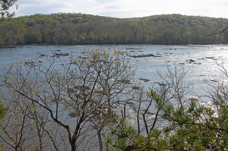
Finally, I made my way to the other side of the powerlines and into a technical area with several small knolls. It couldn't be any more different from where I was. The knolls had some rocky patches and some good boulders. It finally started raining, and so I headed back without thinking about it, only I headed the wrong way. I got rather confused even though I knew the power lines were nearby. My base map had meridians but no north or south on it so when I wasn't seeing what I'd expected to, I figured I was lost. I remembered the orientation of north on the map and then came across the nicest cliff I'd seen in the park yet. It's all fun exploration.

I jogged about a mile back across the grass between the power lines. The running was okay but slow--I had a backpack, a jacket, other stuff and wet shoes.

Saturday Apr 25, 2020 #

12 PM

Orienteering (Field Checking) 6:30:00 [1] 9.0 mi (43:20 / mi) +34m 42:50 / mi
weight:201.5lbs

Germantown Soccerplex and Hoyles Mill Conservation Park, MD. I looked forward to getting back here all week. It fun exploring new places. The forests here have a lot to find. I spent hours trying to capture the boundary between white forest and light green. As I tracked my way, I kept finding more boulders, stony ground and small cliffs. Nearly all seemed to me to require technical navigation. I had trouble depicting things in the right places as I made map notes. The contours were nearly flat and clumps of barberry bushes made ground visibility limited. It was easy enough to move about but not in straight lines. I'll be relying on the relative angles of things, my waypoints and tracks a lot as I draft and match it up to the terrain on the map. I actually saw 2 other people going about off trail today--they were near a stream. I saw a lot of wildlife. It started with a fox who sat on a log about 30m away watching me but not phased enough to scatter. It was like he was saying this was his territory. I may have seen him again a few hours later, or another one. It's not unusual to see deer and often they are in herds. I only saw one but it wasn't very worried about me neither. I almost stepped on a snake that only slithered into a bush as I was trying to get closer for a picture. Later a hawk screeched at me from above a few times. It was nice to be out there.

Snake in the Bush

Friday Apr 24, 2020 #

7 PM

Hiking (Street & Trail) 46:33 [1] 2.5 mi (18:37 / mi) +24m 18:05 / mi
weight:202.5lbs (injured)

Wednesday Apr 22, 2020 #

8 PM

Hiking (Street & Trail) 53:26 [3] 2.82 mi (18:57 / mi) +51m 17:57 / mi
slept:5.5 weight:201.5lbs (injured)

Tuesday Apr 21, 2020 #

6 PM

Hiking (Street & Trail) 53:37 [1] 3.09 mi (17:21 / mi) +50m 16:32 / mi
slept:5.5 weight:200lbs (injured)

Sunday Apr 19, 2020 #

12 PM

Orienteering 4:02:55 [3] 5.72 mi (42:27 / mi) +76m 40:46 / mi

Orienteering (Field Checking) 2:28:30 [3] 3.0 mi (49:30 / mi) +28m 48:08 / mi
slept:5.25 weight:201lbs (injured)

Germantown Soccerplex and Hoyles Mill Conservation Park, MD. I continued field checking the parks. It was in the 50s F starting out and sunny. The sun went away after a couple of hours but it remained nice out. I continued to find nice terrain. My watch had stopped unknownst to me for a long time, so I restarted it. I missed tracking 1.75 hours of the whole outing. As has happened previously, I got cramps in my hamstring in the evening from getting dehydrated. I was going to carry some water but I'd forgotten and I didn't want to haul a backpack around the whole time. As it was, my jacket was tied around my waist the whole time.

Saturday Apr 18, 2020 #

4 PM

Orienteering (Field Checking) 2:41:41 [1] 3.81 mi (42:26 / mi) +78m 39:55 / mi
slept:7.5 weight:199.5lbs (injured)

Germantown Soccerplex and Hoyles Mill Conservation Park, MD. After a month of preparing the basemap, I have finally started on some field checking. If it's safe enough to hold it, I aim to have a summer training event here in the soccerplex. The soccerplex includes 24 soccer fields, 4 baseball fieldsd, an indoor pool, tennis and basketball courts, a golf driving range, and various playgrounds. The adjacent park is a much, much larger wooded area with few trails and interesting looking contours. I knew the forest to not be very open. On my outing, I founds some bad woods at the edges of the large fields, but progressively better and more terrain. The areas I'd map white are not blazing fast, but sufficiently open to run. There were smaller bushes in them but better yet, I found an extensive boulder field. I took most of the time trying to map that. I finished up with more trail work and checking in the socceplex. In the soccerplex, I had used good imagery and LiDAR to pick out the vegetation. I found that some of that had changed. Trees that had been standing in some places were removed. People were walking about on the trails a lot but were staying socially distant.

Friday Apr 17, 2020 #

6 PM

Hiking (Street & Trail) 34:17 [3] 2.3 mi (14:54 / mi) +52m 13:55 / mi
(injured)

From Northfield Rd., to Jefferson St., to Garfield St., to Sonoma Rd., to Oneida La., through trails in Ayrlawn Park, to Lindale Dr., to to Bradmore Dr., to Roosevelt St, to Irvington Ave., to Huntington Pkwy., to Northfield Rd. After work was over, I did a fast walk before watching a movie with Samantha. Walking fast like this hurts my ankles and shins. I guess I'm not used to it. The lower leg work is good and I have a hard time imagining walking faster, even though I'd race walked a mile in 9 minutes before and maybe faster. Seeing the trails in Ayrlawn Park was nice again. I'd not been there in years. Even though it's a very small area, it's got quite a network. I'd also forgot that it had so many boulders.

Thursday Apr 16, 2020 #

9 PM

Hiking (Street & Trail) 32:52 [3] 2.18 mi (15:05 / mi) +32m 14:25 / mi
weight:201lbs (injured)

From Northfield Rd., to Moorland Ln. to Overhill Rd., to Hampden Ln. to Wilson Ln., to Maiden Rd., to Kirby Rd., to Granada Dr., to Wilson Ln., to Aberdeen Rd./Aberdeen Pl., to Huntington Pkwy., to Charlcote Rd., to Northfield Rd. I walked this quickly. Unfortunately, I needed a bathroom for over the last half of the way. This was in the dark so I was getting a little disoriented on the roads that I hadn't been down before. It all worked out okay.

Tuesday Apr 14, 2020 #

12 PM

Bicycling (Commute) 7:39 [3] 2.0 mi (3:49 / mi) +27m 3:40 / mi
(injured)

I went to Norfolk Ave. to get lunch and then rushed back to eat and get back to work. I was there in about 3:45 minutes! There was a tailwind but going back was about the same, going uphill and into the breeze.

Monday Apr 13, 2020 #

7 PM

Hiking (Street & Trail) 38:09 [3] 2.1 mi (18:10 / mi) +34m 17:17 / mi
slept:6.75 weight:197.5lbs (injured)

From Northfield Rd., to Jefferson St., to Roosevelt St., to Garfield St., to McKinley St., to Hempstead Ave. to Greentree Rd., to Ewing Dr., to Lavin Ln., to Rayburn Rd., to McKinley St., to Garfield St., to Roosevelt St., to Jefferson St., to Northfield Rd. After dinner, Peggy, and I went for a walk, Samantha was going to walk with us but since she got an early start, we didn't connect with her again until we were home.

Sunday Apr 12, 2020 #

5 PM

Bicycling (Road) 58:44 [3] 15.35 mi (3:50 / mi) +174m 3:42 / mi
slept:7.5 weight:196lbs (injured)

From Northfield Rd., Custer Rd. to Maple Ridge Rd. to the Bethesda Trolley Trail to Jones Bridge Rd., to Beach Dr. to Blagden Rd., to Ridge Rd., to Military Rd., to 27th St., NW/Utah Dr., NW, to Western Ave., to Summerfield Rd., to Oxford St., to Brookeville Rd., to Bradley Blvd., to Wisconsin Ave., to Woodmont Ave., to Bethesda Ave., to Exeter Rd., to Battery Ln. to Custer Rd., to Northfield Rd., I kept thinking it was about to rain today. The rain never came here so finally, after a late in the day check, I just went out. It was nice, in the 60s F. I didn't feel very strong but I kept a good, comfortable pace. There were a lot of other cyclists and runners out (especially in Rock Creek Park), but not so many cars.

Saturday Apr 11, 2020 #

4 PM

Hiking (Trail) 1:14:36 [1] 3.1 mi (24:04 / mi) +137m 21:10 / mi
slept:7.5 weight:198.5lbs (injured)

Blockhouse Point Conservation Park, MD. Peggy, Max, Samantha, and I went along River Rd., then west to the southern set of cliffs. The views were pretty good--bright sunshine, trees with leaves just starting to emerge, and temperatures at around 60 F. We took a copy of the orienteering map I'd made of the park. I'd stopped my watch at one of the pauses and forgot to restart it right away. As we headed back, we agreed to go a slightly different route, ending with a walk up the less interesting the pipeline ride, as an add-on. However, because of that, we got to see more of the park overall. I could tell that the woods were opening-up from how I'd mapped them. The mountain laurel has been thinning. Some rootstocks I'd mapped were gone. I also found some minor bends to the trail that I'd fix. In some places, the trails appeared to have been rerouted but overall, the map held up pretty well. It was a nice hike and we picked up groceries and dinner on the way home.

IMG_6920_Adj

IMG_6917_AdjCrop

Friday Apr 10, 2020 #

5 PM

Hiking (Street & Trail) 32:43 [2] 2.15 mi (15:13 / mi) +47m 14:15 / mi
weight:200.5lbs (injured)

After working, I went for a fast walk. From Northfield Rd. to Moorland Ln. to McKinley St., to Old Georgetown Rd., to the Bethesda Trolley Trail (along NIH), to Battery Ln. to Park Ln. to Custer Rd., to Northfield Rd. It was as brisk out as was my walk. The temperatures were in the 40s F and it was windy. My hands were getting cold. However it was nice to be walking around in the sun. I had jumped from as step at home the previous day and again hurt my left ankle. I wouldn't have been any good trying to run today but I felt like I was getting exercise with this walk.

Monday Apr 6, 2020 #

5 PM

Bicycling (Street & Trail) 43:21 [3] 9.85 mi (4:24 / mi) +113m 4:15 / mi
slept:3.5 weight:197.5lbs (injured)

From Northfield Rd., Moorland Ln. to Glenwood Rd., to Old Georgetown Rd., to the Bethesda Trolley Trail, to Grosvenor Ln., to Beach Dr., to the Rock Creek Trail, to Susanna Ln. to Jones Bridge Rd., to the Bethesda Trolley Trail, to Maple Ridge Rd., to Park Ln. to Custer Rd., to Northfield Rd., I finished work at a good time and so Max and I went for an easy ride. It was sunny and around 68 F. There were plenty of others out riding, running and walking.

Sunday Apr 5, 2020 #

7 PM

Running (Field Checking) 20:37 intensity: (10:00 @2) + (10:37 @3) 2.1 mi (9:49 / mi) +37m 9:19 / mi
slept:7.0 weight:197.5lbs (injured)

From Northfield Rd., to Jefferson St., to Glenwood Rd., to Garfield St., to Roosevelt St., to Ewing Dr., to Greentree Dr., to Garfield St., to Jefferson St., to Northfield Rd. Just a house or 2 down the road, I was already feeling pain in my calf. The run became another exercise in pain management. I slowed and kept a restricted gait. It seemed that the downhill running was worse for pain than going uphill. That's seemingly different since there's more stress and bending involved in going uphill. After the run, I hurt more than I had started out; I should probably stick to cycling for a while. It sprinkled on me really lightly during this run and that was probably what Peggy's weather app was providing a 23 minute alert for.

Friday Apr 3, 2020 #

6 PM

Running (Street & Trail) 19:45 [3] 2.1 mi (9:24 / mi) +36m 8:56 / mi
slept:6.0 weight:196lbs (injured)

From Northfield Rd., to Charlcotte Rd., to Hampden Ln., to Wilson Ln., to Honeywell Ln., to Cornish Rd., to Glenbrook Rd., to Wilson Ln. to Custer Rd., to Northfield Rd. I was kind of tired through most of this. In the last half mile, I felt my left calf again, so I slowed down. It was fairly nice outside but breezy.

Thursday Apr 2, 2020 #

12 PM

Bicycling (Commute) 7:17 [3] 1.28 mi (5:41 / mi) +20m 5:26 / mi
weight:196.5lbs (injured)

From Northfield Rd., to Greentree and Old Georgetown Rd., then back. Max and I rode up to the food truck to pickup lunch for the family.
5 PM

Running (Street & Trail) 19:35 [3] 2.15 mi (9:07 / mi) +29m 8:44 / mi
(injured)

From Northfield Rd. I ran up to Custer Rd., to Wilson La., to Exeter Rd. to Glenbrook Rd. to the Bethesda Trolley Trail, to the NIH grounds, to Maple Ridge Rd. to Georgetown Pike, to Huntington Pkwy., to Custer Rd. to Northfield Rd.

Wednesday Apr 1, 2020 #

12 PM

Bicycling (Commute) 8:15 [3] 2.0 mi (4:07 / mi) +24m 3:59 / mi
(injured)

From Northfield Rd. to Norfolk Ave., then back. Max and I went to pickup lunch for the family.

« Earlier | Later »