Discussion: EOC report from the field
in: Orienteering; General
May 14, 2012 12:20 PM
#
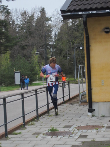
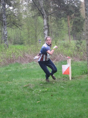
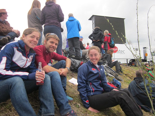
Today at the Middle preliminary, Samantha was so close, missed by 31 seconds. A couple of "if only" and she would have been in for sure.
Robbie MP on #3 and figured it out on the way to 4, had to go back and get the correct one, but that dampens your enthusiasm for the rest of the course.
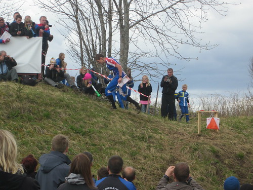
Ross got drawn off to a wrong control.
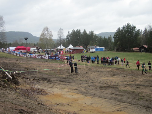
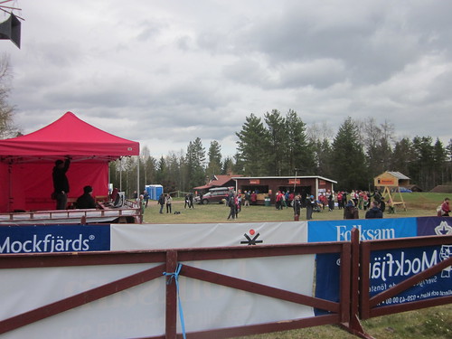
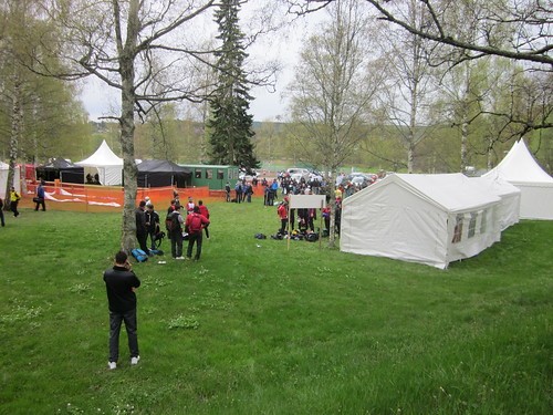
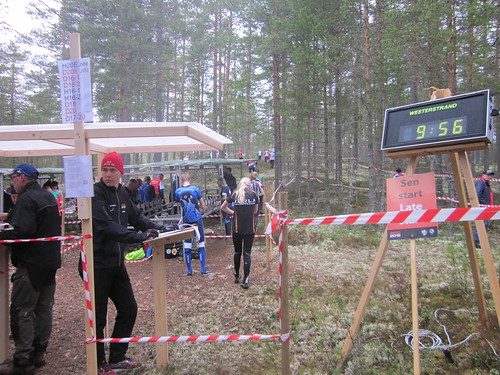
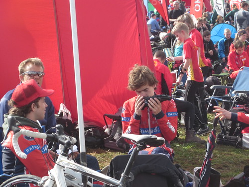
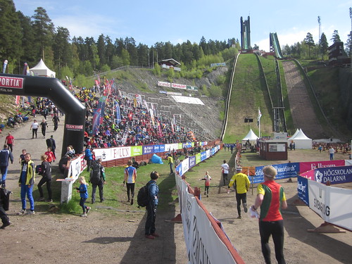
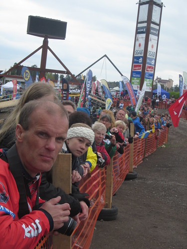
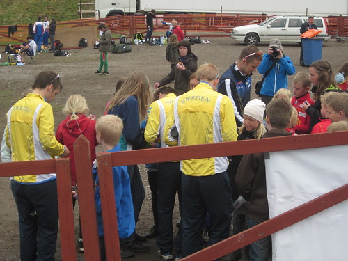
The arena, a damp and very windy day, (3 Porta-potties blew over)-
Swisscheese up the hill.
Connecting to Emit
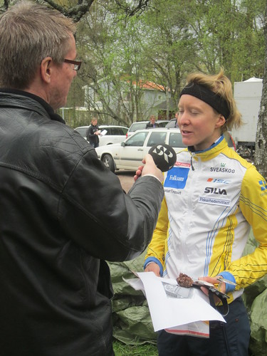
Interview with Helena
Robbie MP on #3 and figured it out on the way to 4, had to go back and get the correct one, but that dampens your enthusiasm for the rest of the course.
Ross got drawn off to a wrong control.
The arena, a damp and very windy day, (3 Porta-potties blew over)-
Swisscheese up the hill.
Connecting to Emit
Interview with Helena
May 14, 2012 5:17 PM
#
AliC:
Cool, thanks for report, good luck to Ross + Sam + Robbie for long qual!
May 14, 2012 5:42 PM
#
I hope (and imagine) the portapotties were unoccupied when they blew over. Looking forward to upcoming races!
May 14, 2012 8:02 PM
#
No, no one was in them! And they spent awhile afterwards fixing them so that they wouldn't fall over again.
May 15, 2012 3:00 PM
#
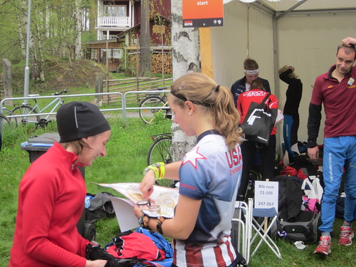
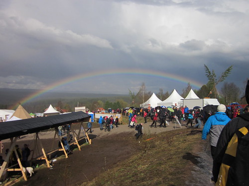
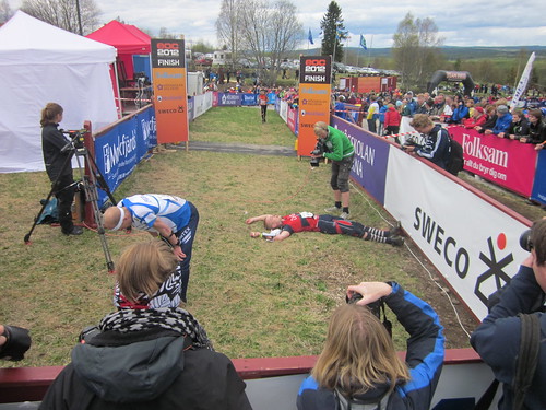
Today the Long Quali at the same arena, same last control and finish chute.
Weather is a bit warmer, a few sprinkles once, but overall a nicer day, cloudy, but no wind. Some runners liked today better, some not as much as yesterday.
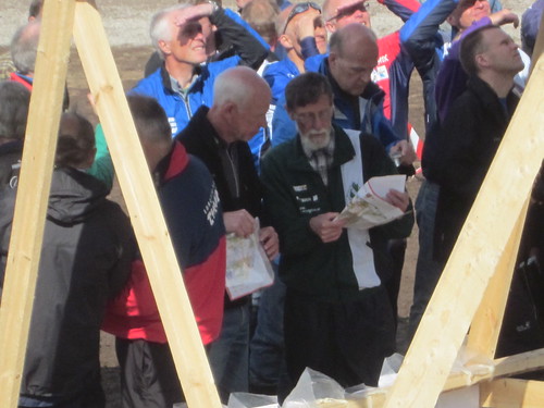
No European O meet would be complete without Per Forsberg. His knowlwdge and enthusiasm is infectious.
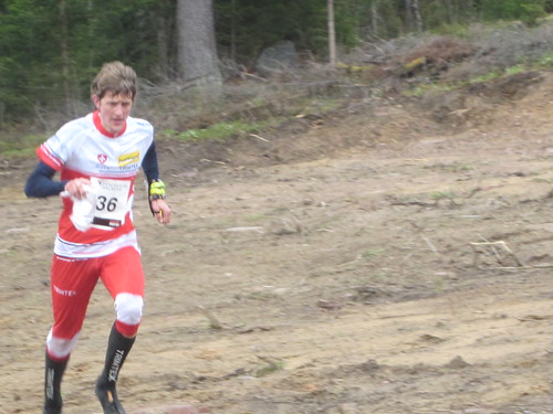
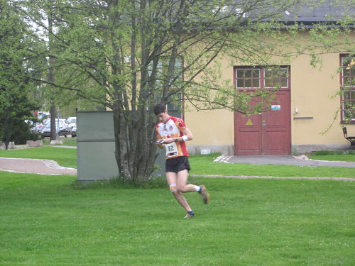
Ross had a good run today. Not really that hot, but certainly humid if you were running, damp if you were standing around.
Not Sam's best day. We went over the course.
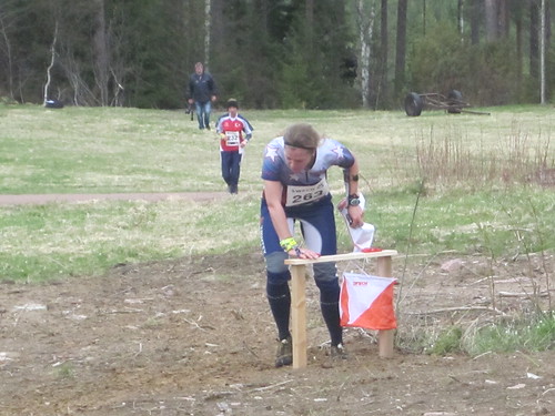
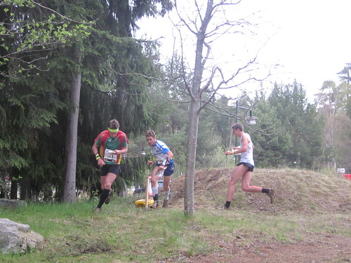
Ross going over his course. The women went over the big hill in the lower center, the guys avoided it.
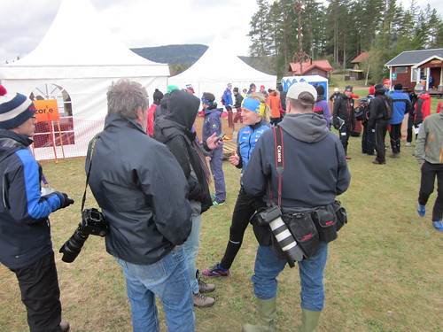
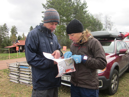
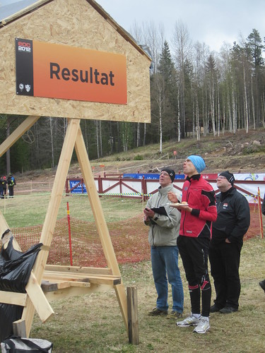
Our host, bubo, checking the results.
Tove and Simone were really impressive, but everyone seems to be pulling for Minna. She's a bit of an underdog because of injury and sickness the last few months.
Weather is a bit warmer, a few sprinkles once, but overall a nicer day, cloudy, but no wind. Some runners liked today better, some not as much as yesterday.
No European O meet would be complete without Per Forsberg. His knowlwdge and enthusiasm is infectious.
Ross had a good run today. Not really that hot, but certainly humid if you were running, damp if you were standing around.
Not Sam's best day. We went over the course.
Ross going over his course. The women went over the big hill in the lower center, the guys avoided it.
Our host, bubo, checking the results.
Tove and Simone were really impressive, but everyone seems to be pulling for Minna. She's a bit of an underdog because of injury and sickness the last few months.
May 15, 2012 11:08 PM
#
bubo:
Still waiting for some true Per Forsberg action...
There will be more to come at the finals - and that´s for sure.
There will be more to come at the finals - and that´s for sure.
May 16, 2012 12:32 AM
#
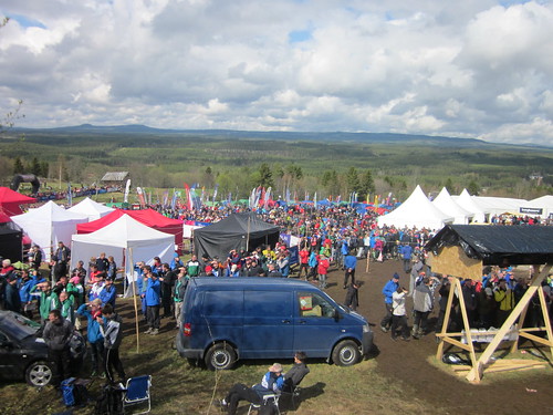
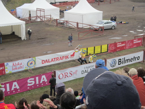
Maybe it's just in these pictures but are there any spectators or crowds at EOC or are they all going to show-up on the weekend? What's the turnout like so far?
May 16, 2012 12:53 AM
#
5000 people have registred for the spec races so it should be a few more than what is seen on the pics above...
Most Swedes will have Thursday and Friday off.
Most Swedes will have Thursday and Friday off.
May 16, 2012 2:21 AM
#
lack of spectators in the world's biggest O nation really does make the case for getting rid of qualification races eh!
May 16, 2012 6:43 AM
#
The connection is the IOF's Leibnitz Convention which is in the IOF Rules. Having a special day to eliminate 34 Women and 73 Men (Middle Distance) doesn't seem to be bringing in the punters.
LEIBNITZ
"It is of decisive importance to raise the profile of the sport to further the spread of
orienteering to more people and new areas, and to get orienteering into the Olympic Games.
The main vehicles to achieve this are:
• to organise attractive and exciting orienteering events which are of high quality for competitors, officials, media, spectators, sponsors, and external partners
• to make IOF events attractive for TV and Internet
We shall aim to:
• increase the visibility of our sport by organising our events closer to where people are
• make our event centres more attractive by giving increased attention to the design and quality of installations
• improve the event centre atmosphere, and the excitement, by having both start and finish at the centre
• increase television and other media coverage by ensuring that our events provide more and better opportunities for producing thrilling sports programmes
• improve media service by better catering for the needs of media representatives (in terms of communication facilities, access to runners at start/finish and in the forest, continuous intermediate time information, food and beverages, etc.)
• pay more attention to promoting our sponsors and external partners in connection with our IOF events
May 16, 2012 8:24 AM
#
Having the qualifiers on a schoolday and workday outside of holiday season is for sure a good way to reduce the pressure on the arena. Then organize them far away from any population center with no public races and bring in some bad weather and not even the retired punters will come. From the pictures, spectator turnout is about what I expected.
May 16, 2012 8:49 AM
#
One good thing about Q races is they allow more runners from 'smaller' O nations to take part.But why bother trying to bring in the punters for Q races? Why waste resources on making them spectator friendly - just organise them low key with no arena production and save all that time and expense for better coverage of the finals. That way you can choose good terrain irrespective of arena considerations and so make sure that those who don't make the final still get a good O experience.
Tennis tournaments have qualification tournaments but they don't get any media attention.
Tennis tournaments have qualification tournaments but they don't get any media attention.
May 16, 2012 8:51 AM
#
Back to EOC, just watched Sam finish the sprint Q on the livestream. She looked good!
May 16, 2012 12:30 PM
#
bubo:
Spectators for the quali races have been very few - as noted above - what you see in the pictures is correct. There are very few that don´t have any "official" connections and that would be regarded as "true spectators". Most of the people that can be seen here are either meet officials, team leaders, runners and family or club members of the runners.
The masses will show up on Thursday for the long weekend. Arena production is decent but not perfect so far. Some mess-ups with start lists, results and non-working computers the most serious glitches.
I don´t know if it has been mentioned elsewhere on AP (there is a note on the EOC page) but one of the more serious threats to the races was a traffic accident that stopped some of the teams from getting to the start/quarantine in time for the long quali. Only one russian woman had to get a new start time though, all the others made it.
May 16, 2012 12:32 PM
#
bubo:
...and of course - Sam made it through to the A final!!!
12th place in her heat (2:30 behind Simone).
12th place in her heat (2:30 behind Simone).
May 16, 2012 5:03 PM
#
Oh yeeaaah, Sam! Even got a plug on the main EOC page:
The European Championship is also the first part of the World Cup so we will not see only European runners in the A-final, but also Samantha Saeger from the USA.
The European Championship is also the first part of the World Cup so we will not see only European runners in the A-final, but also Samantha Saeger from the USA.
May 16, 2012 6:24 PM
#
bubo:
c.hill >> Correction - Rosalind H also made the A-final, so one more Irish runner to cheer for on Saturday ;)
Dave H and Niamh also ran in the qualis but didn´t get through...
Dave H and Niamh also ran in the qualis but didn´t get through...
May 16, 2012 7:08 PM
#
I like this photo by Anders Öberg of Per pulling double duty as MC and paperweight:

"Everybody put yer hands up - WOO WOOOOOO!!!"
"Everybody put yer hands up - WOO WOOOOOO!!!"
May 16, 2012 7:09 PM
#
17th is the cut for these Qualis.
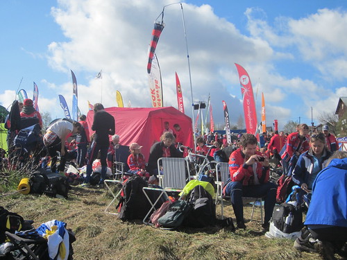
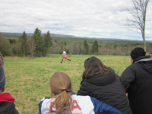
Judy and I have commented that the spectators look quite older, so retired and have the time. We are an unusual pair, and certainly the only from USA.
Judy and I have commented that the spectators look quite older, so retired and have the time. We are an unusual pair, and certainly the only from USA.
May 16, 2012 7:11 PM
#
Yeah, that photo is definitely from Monday, they were holding the tent down from the incredible winds.
May 16, 2012 8:22 PM
#
Wednesday, Sprint Qualifier in Falun, about an hour south of Mora.
Venue is an old army base, converted to an office park.
Men's race was first. Radio control was this dirt mound.
Robbie through the barracks area.
Heading for the penultimate control
The contourtion of using Emit.
Going over the course with Niamh
Interview with...(famous Swede whose name I have forgotten and probaly cannot pronounce)
A younger spectator
Crowds and rain expected tomorrow.......
May 17, 2012 5:39 AM
#
What's the weather going to be like from Fri-Sunday. I'm packing lots of warm clothes. Can't be far off, right?
May 17, 2012 8:41 AM
#
bubo:
Right now it's raining at the EOC arena. Ross finished his B-final as the first runner back a while ago and was interviewed by Per F's sidekick. He was pleased with his race - the best so far this week.
May 17, 2012 10:34 AM
#
... the contortion of using Emit? But getting an SI stick into a small hole in a hurry is also tricky. Wonder why the hole couldn't have a tapered funnel.
May 17, 2012 12:20 PM
#
Guerogiou tweeted that he has shin infammation and is going back to France to investigate.
May 17, 2012 2:36 PM
#
Great pictures and information about the races, Jeff. Way to go Sam! good luck in the Sprint final! Good luck to Sam and Ross! Judy and Jeff have a great time!
May 17, 2012 2:51 PM
#
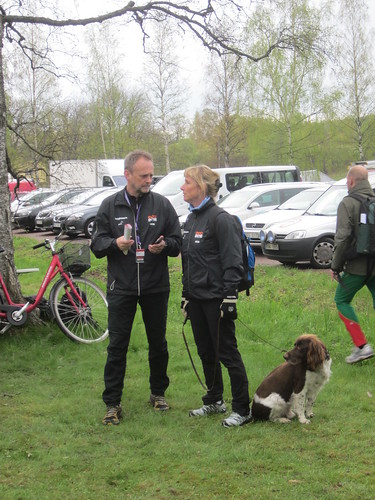
The interview is with Lena Eliasson. With several weeks of practice, you could almost certainly pronounce her name fluently and, as a bonus, learn how to make delicious Swedish rye bread too. At least you could if you had a good coach.
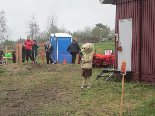
The younger spectator is actually a springer spaniel. They like to run and hunt birds, but sometimes they are happy to sit around and spectate instead.
The younger spectator is actually a springer spaniel. They like to run and hunt birds, but sometimes they are happy to sit around and spectate instead.
May 17, 2012 7:08 PM
#
The weather has had both rain and sun every day, today the rain was heaviest so far. As far as I can tell, weather prediction around here is a 50/50 proposition.
It is fairly warm though, always in the upper 50'sF.
So, today the people have shown up, I'd say about 5000 of them.
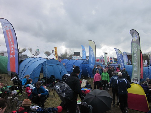
It was a bit tight down in the tent area, add a bit of rain and it gets better.
Nope, not a mass start, just a small part of the steady stream of people "walking" the 2.5Km. to the starts (1,2&3).
Start area #2. This start also had a juniors JWOC qualifing race. Step in at your start time, they check you off, and 3 minutes late you're out the other side, up the hill to the start triangle.
This person was luring kids to child care......
Mark up hill to the penultimate control.
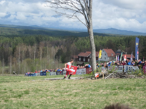
This control was so close to the spectators that many runners found it difficult to make themselves run up so close ot the fencing. The spectator area was NOT shown on the maps. (nor the camera).
Notice the lovely sunny skies............
Some OK Linne folks in front of the jumbtron.
The most competitive class in the EOC tour event.
As the women's race wound down, the skies opened up again, but in the end it was quite lovely.
It is fairly warm though, always in the upper 50'sF.
So, today the people have shown up, I'd say about 5000 of them.
It was a bit tight down in the tent area, add a bit of rain and it gets better.
Nope, not a mass start, just a small part of the steady stream of people "walking" the 2.5Km. to the starts (1,2&3).
Start area #2. This start also had a juniors JWOC qualifing race. Step in at your start time, they check you off, and 3 minutes late you're out the other side, up the hill to the start triangle.
This person was luring kids to child care......
Mark up hill to the penultimate control.
This control was so close to the spectators that many runners found it difficult to make themselves run up so close ot the fencing. The spectator area was NOT shown on the maps. (nor the camera).
Notice the lovely sunny skies............
Some OK Linne folks in front of the jumbtron.
The most competitive class in the EOC tour event.
As the women's race wound down, the skies opened up again, but in the end it was quite lovely.
May 17, 2012 9:16 PM
#
Is it me or the map really looks like its in 3D? Was this how runners saw it as well?
May 17, 2012 9:18 PM
#
Great photos!
Lots of route choice for a middle distance. Great route choice analysis from today's race on WorldofO.
http://o-training.net/blog/2012/05/17/eoc-middle-f...
Norwegian gold and bronze on the 17th of May in Sweden. Interesting! ;-)
BTW 26 years ago today the 2nd ever orienteering World Cup was hosted here in Hamilton. The Norwegians partied hard at the banquet that night on their National Day.
May 17, 2012 9:24 PM
#
The 3D map would make orienteering so much easier! I think there are options from the EOC page to view the map with and without 3D shading.
May 18, 2012 12:31 AM
#
bl:
Who/what determines Sport-i-dent vs Emit in such a competition? I've encountered emit only once, finding it quite unsatisfactory with the "contortion" req'd - and either beep or flash was absent - can't recall which.
May 18, 2012 8:26 AM
#
@z-man: Runners had traditional maps, the shading was added to help people watching the broadcast understand what is up and down easier.
@bl: Emit had a strong hold in the district dalarna a while. Why they are using it now i dont know maybe they got a better deal/better solution for the timing. Also interesting is that the spectator races are using Sport-Ident.
@bl: Emit had a strong hold in the district dalarna a while. Why they are using it now i dont know maybe they got a better deal/better solution for the timing. Also interesting is that the spectator races are using Sport-Ident.
May 18, 2012 9:46 AM
#
Maps seem to break almost every possible ISOM rule there is. It can't be by accident, it must be made on purpose, it so obvious and arrogant, not even trying to be somewhat close to the standard. Are mappers trying to make some kind of statement, or is this a protest to influence something, like IOF mapping committee?
I wonder how the quality control can have failed so badly. Are those people joined the protest? Poor athletes, I'd say EOC is not the place for such protests, it already may have had big influence on middle final.
I wonder how the quality control can have failed so badly. Are those people joined the protest? Poor athletes, I'd say EOC is not the place for such protests, it already may have had big influence on middle final.
May 18, 2012 1:01 PM
#
Tove's through the spectator control on the long final in the lead! Go Tove!
May 18, 2012 1:07 PM
#
At WOC in Denmark a few years back I believe specator races used Emit but the
WOC used SI.
@Jagge--what are the deviations in the mapping you've noted at EOCs?
WOC used SI.
@Jagge--what are the deviations in the mapping you've noted at EOCs?
May 18, 2012 1:21 PM
#
None of the symbols supposed to be rotated to north aren't rotated (exactly) to north (all point symbols, all texts, marshes, undergrowth...). North lines aren't parallel with paper edges. Excessive use of form lines. Stacked form lines everywhere (big no-no, ISOM says clearly only one form line level is allowed between full contours, IOF mapping comitee has been talking about excessive form line use recent years but these arrogant mappers do the exact opposite). etc. Easy to get most those things right, but it's not done. On purpose I suppose, must be a statement, what else?
The non-standard mapping and using such locations as controls had major impact on middle final (like Minna's decisive mistake, reading wrong some non ISOM form lines)
The non-standard mapping and using such locations as controls had major impact on middle final (like Minna's decisive mistake, reading wrong some non ISOM form lines)
May 18, 2012 2:44 PM
#
coti:
I agree with Jagge. Rules must be respected, whether we like it or not.
But why they came here?
The lack of constructive dialogue between mappers and controllers could be one reason.
Also at the same time, inflexibility and lack of dialogue can lead to radical positions.
But why they came here?
The lack of constructive dialogue between mappers and controllers could be one reason.
Also at the same time, inflexibility and lack of dialogue can lead to radical positions.
May 18, 2012 7:03 PM
#
@J-man are you perhaps thinking of WOC 99 where Elite were on EMIT and spectator races SI?
May 18, 2012 7:18 PM
#
No, j-man's right. WOC 2006 definitely had spectators using Emit (my first Emit experience :) And the WOC races used SI because I remember coming across a stand with no flag but it did have the number I was looking for and an SI box.
May 18, 2012 7:25 PM
#
Nick:
thanks Jagge for pointing those out. i guess i just had a quick look at map & terrain etc., but did not noticed those . too bad, way too bad- that for suuuuuure !
May 18, 2012 8:47 PM
#
Not too much different happenning today, same arena, a much longer race. No rain today, and a bit warmer.
The day starts in the OK Linne area with Boris checking start times.
Time for us tourers to get ready. Ahh, nothing like the smell of new shoes......
It is uphill to the last control for 250meters, but they ran all of it.
and then you get to collapse, it makes for great screen shots.
Linne favorite, Annika Billstrum, on the other hand gave an interview at the finish line.

Mark cheered on by his biggest fan..
The day starts in the OK Linne area with Boris checking start times.
Time for us tourers to get ready. Ahh, nothing like the smell of new shoes......
It is uphill to the last control for 250meters, but they ran all of it.
and then you get to collapse, it makes for great screen shots.
Linne favorite, Annika Billstrum, on the other hand gave an interview at the finish line.
Mark cheered on by his biggest fan..
May 19, 2012 6:21 AM
#
Jagge I'm with you on excessive use of formlines, around here the defence is "they're all doing it!!!" But you surely overstate things by saying "broke every rule in the book". My thought on seeing the maps was "nice clear mapping".
May 19, 2012 9:13 PM
#
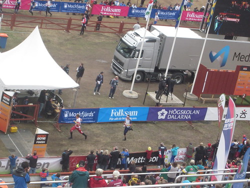
Sprint final day at the ski arena in Falun.
Today i learned all about the popularity of orienteering in Sweden.
Here is the arena, this was the finish for all races, EOC and EOCtour.
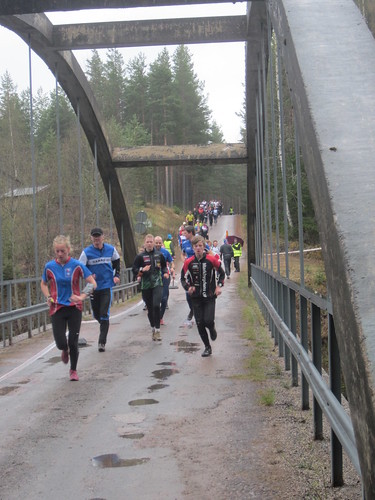
The runners came over a bridge into the arena, forking off to the right for the map exchange, or straight to the finish after the final loop.
The stadium was packed, and the crowds cheered wildly whenever a new best time came into the stadium. Per was wipping the crowd up, and they needed no more prodding when a Swede came by. But nothing could match the explosion of cheering when the Swedish runner came into the stadium with a few seconds lead over leader.
And you want to recruit kids into the sport? Look at the attention these are giving to the winner as he is being interviewed.
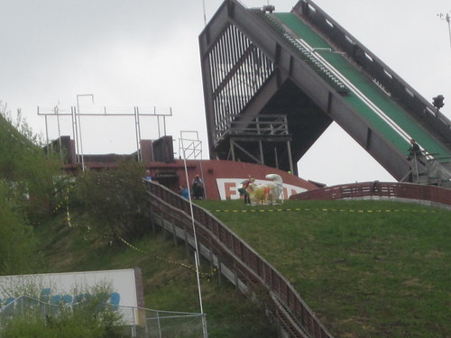
The map exchange was on staircase, halfway up was the new map.
Many of the men ran right by the maps! For the women's race the map tender moved onto the staircase and made sure no one missed the map box.
An amazing and exciting day. A revelation for me to realize just what an incrdible nationalistic sport this is over here.
Today i learned all about the popularity of orienteering in Sweden.
Here is the arena, this was the finish for all races, EOC and EOCtour.
The runners came over a bridge into the arena, forking off to the right for the map exchange, or straight to the finish after the final loop.
The stadium was packed, and the crowds cheered wildly whenever a new best time came into the stadium. Per was wipping the crowd up, and they needed no more prodding when a Swede came by. But nothing could match the explosion of cheering when the Swedish runner came into the stadium with a few seconds lead over leader.
And you want to recruit kids into the sport? Look at the attention these are giving to the winner as he is being interviewed.
The map exchange was on staircase, halfway up was the new map.
Many of the men ran right by the maps! For the women's race the map tender moved onto the staircase and made sure no one missed the map box.
An amazing and exciting day. A revelation for me to realize just what an incrdible nationalistic sport this is over here.
May 19, 2012 9:19 PM
#
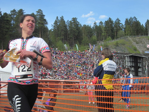
Your picture of the female runner #122 is Iliana Shandurkova. She and her husband were members of QOC for a few years. It was nice to see her have such a good race today.
May 19, 2012 9:29 PM
#
bubo:
Oh - and the picture of runner #118 is actually an American runner... Can´t remember her name right now ;) (but I do know where I have my car keys).
May 20, 2012 8:10 PM
#
Relay day, and if I thought the crowds were wild yesterday, it really could not compare to today when the men's relay finished. Fortunately the Swedes did not win........;-). They might have wrecked the stadium and Per would have had a heart attack.
As the crowd followed the final leg on the GPS, it became obvious that the race was going to be won in a sprint from the last control. Everyone rushed to the fencing to await their arrival.
The younger Swiss Team won in a sprint, really well run by them.
Unfortunately their fortune was the #1 Team's misfortune. Daniel Hubmann really tore his Achilles coming off the bridge, I think we could actually here it break from where we were on the hill. It was painful and sad to see him limp the last 150 meters to the exchange zone.
I was surprised to see Simone go out 2nd for the Swiss women's team. Perhaps their strategy was to get a good lead and then Judith Wyder could be careful and slow and bring home a gold. Simone certainly did her part, although a 30 second error near the end cost her some of her big lead. It may have put to much pressure on Wyder though, she just missed the correct dot knoll on #4, and lost the lead.
The spectator control was the Falun Ram, atop the jumping hill.
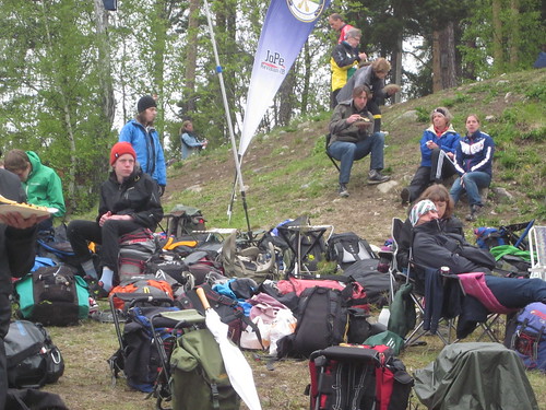
Although exciting, there is still some down time during the relays to talk, rest and eat.
It is still somewhat hard for me to comprehend the popularity of the athletes with the kids of Sweden, but then again, I am from the US....
The Swedish women ran a great race and were happy with their bronze.
That's it from the EOC's, I had a great time.
As the crowd followed the final leg on the GPS, it became obvious that the race was going to be won in a sprint from the last control. Everyone rushed to the fencing to await their arrival.
The younger Swiss Team won in a sprint, really well run by them.
Unfortunately their fortune was the #1 Team's misfortune. Daniel Hubmann really tore his Achilles coming off the bridge, I think we could actually here it break from where we were on the hill. It was painful and sad to see him limp the last 150 meters to the exchange zone.
I was surprised to see Simone go out 2nd for the Swiss women's team. Perhaps their strategy was to get a good lead and then Judith Wyder could be careful and slow and bring home a gold. Simone certainly did her part, although a 30 second error near the end cost her some of her big lead. It may have put to much pressure on Wyder though, she just missed the correct dot knoll on #4, and lost the lead.
The spectator control was the Falun Ram, atop the jumping hill.
Although exciting, there is still some down time during the relays to talk, rest and eat.
It is still somewhat hard for me to comprehend the popularity of the athletes with the kids of Sweden, but then again, I am from the US....
The Swedish women ran a great race and were happy with their bronze.
That's it from the EOC's, I had a great time.
May 20, 2012 8:41 PM
#
Simone sprained her ankle in the morning during a footing. That's the reason she ran the shorter second leg.
May 20, 2012 9:55 PM
#
Shorter? The legs were almost identical with a difference of less than 100 meters.
May 21, 2012 6:25 AM
#
Maybe colors they used to print the map are correct, but some comments I have read indicates colors weren't right either.
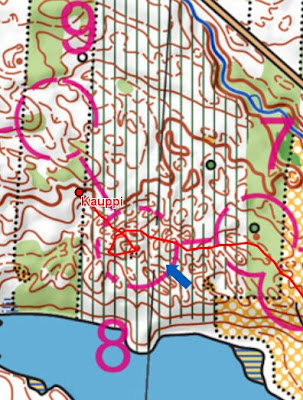
Here is how women's middle, the decisive part and with Minna's decisive mistake. She was slightly ahead of Simone before this mistake.
https://lh6.googleusercontent.com/-EHKAyJf1D70/T7i...
As you can see, there is two levels of form lines (not allowed by ISOM) immediately before control, inside ring. In ISOM maps two form lines side by side always(!) means you are kind of on top or on bottom of something. Minna may have thought she was running along that (non-existent) ridge and attack dot knoll from there, and failed. In addition, look at the undergrowth symbol and compare it with north lines. Those are supposed to be parallel in ISOM maps, so you should be able to use green undergrowth stripes as north lines - one of the very basic skills (just like using marsh symbols to see west-east direction without seeking for north lines). Anyway, in this maps those are not parallel. And as you can see, Minna ran too much right, about exactly as much as one gets off by using undergrowth symbol as north lines! So she may have done it "just right" but still missed.
Maybe either of those really happened, but in any case the decisive moments happened on non-standard mapping and non standard mapping played major part here and being used to the non standard mapping was the essential skill. That surely isn't quite as it should be in major championship race. In most countries such mapping is strictly forbidden and such maps
does not exist and athletes aren't used to run with those. And they should not need either, that's what standards are for.
Note, we are not talking about just "mapping styles". ISOM is a frame and different mapping styles should stay inside this frame and atheletes should learn to adapt those styles, but they should not need to learn non standard mapping like this. They should be able to count on some things and north lines and symbol rotations are one of those.
So, as I can see, EOC mapping was a big fat failure. I can't remember any major championship event with equally bad or worse mapping. This may be the rock bottom ever.
What made it worse the course setter did not even try to avoid these badly mapped parts with multiple form line levels. So, if mappers were not up to the task the course setter wasn't either. Maybe too much focus was paid on TV and hill shading and such secondary aspects, and they forgot to do the the actual job - making decent maps based on standards and plan fair courses. And in addition, IOF control must have failed miserably, isn't there some quality control and event advisors who are supposed to say this will not do, there must be some respect to the standards. I somehow can't see they did not know what they were doing, so maybe this is their silent protest and they are making a statement - "we know international O community has worked for years to standardize maps, but we dont give a rat's ass and no one else should either".
Would be nice to hear from mappers, event advisor and course planner explaining what on earth was their thinking behind building non-standard mapping traps like these for athletes. Shame on you, who ever were involved!
May 21, 2012 7:25 AM
#
Jagge, I repeat that the statement of breaking "almost every possible ISOM rule there is" is OTT. You have identified excessive and stacked formlines, and the symbols not oriented to mag north. You have postulated that this is some sort of statement or protest.
These certainly break sound principles but it hasn't happened overnight. The last orienteering I did in Sweden (Salen which is not far from Falun) the north lines weren't parallel to the page sides. Not just subtly as here, but clearly different. Questions do need to be asked, but they should be accurate questions. To test your conspiracy theory, are there any other mapping rules that Sweden has broken (at EOC or elsewhere?)
These certainly break sound principles but it hasn't happened overnight. The last orienteering I did in Sweden (Salen which is not far from Falun) the north lines weren't parallel to the page sides. Not just subtly as here, but clearly different. Questions do need to be asked, but they should be accurate questions. To test your conspiracy theory, are there any other mapping rules that Sweden has broken (at EOC or elsewhere?)
May 21, 2012 8:13 AM
#
gruver>> I don't think you can compare to local swedish competitions that falls under swedish rules.
Swedish maps (for national competitions) should accoring to swedish rules be aligned to the Swedish National Grid which means that north lines will NOT be aligned with page sides (but tilted about 3 degrees in stockholm and slightly more in Mora)
Apperantly the organizers have missed (or gotten approved) to use this alignment also at EOC?
May 21, 2012 8:53 AM
#
bubo:
...or maybe the EOC map controllers don´t know (or care enought about) the rules? There should have been signals about this well in advance if it was considered important.
gruver>> If your race in Sälen was at O-ringen in 2008 - well, that´s also an international competition that should follow IOF standards (but not a championship with a supposedly stricter ruling).
gruver>> If your race in Sälen was at O-ringen in 2008 - well, that´s also an international competition that should follow IOF standards (but not a championship with a supposedly stricter ruling).
May 21, 2012 12:52 PM
#
gruver>> They violated ISOM rules enough, hard to believe it was not accident. Especially violating form line rules make is obvious, the very rule IOF mapping commission has been specially pinpointing last years! They must have done it on purpose.
And what is the alternative then? They can't read, so they didn't know what ISOM says? Or they can't see, so they either are too blind to see the standard or can't see what they were drawing? Or they did not know how to count - well, to two, and the concept of two form lines is beyond their brain capacity. I don't think that's the case either, they did it on purpose, maybe the message from the leading O nation is ISOM is dead, no one should follow it anyhow and all work with ISOM 201x should be stopped?
And what is the alternative then? They can't read, so they didn't know what ISOM says? Or they can't see, so they either are too blind to see the standard or can't see what they were drawing? Or they did not know how to count - well, to two, and the concept of two form lines is beyond their brain capacity. I don't think that's the case either, they did it on purpose, maybe the message from the leading O nation is ISOM is dead, no one should follow it anyhow and all work with ISOM 201x should be stopped?
May 21, 2012 12:53 PM
#
Somewhat shocking the veg isn't aligned with north lines, but that should have led Minna to miss left, not right :)
May 21, 2012 12:57 PM
#
ndobbs> if you look at the weg and see you need to go straight west, and then you look at the needle and run west, will you end up left or right? Haw about base plate? Or aligning map with thumb compass with the veg lines? Think again...
May 21, 2012 1:38 PM
#
If you set the goal to go due north, you'd follow the veg lines on the map and north lines according to the compass, so you would end up to the right (in the terrain) of where you want to go (on the map). Replace north with any other direction.
May 21, 2012 2:15 PM
#
Oops!
Anyhow, she ran straight towards the control for half the route, and the subsequent deviation was way bigger than the discrepancy between north and vegnorth.
Anyhow, she ran straight towards the control for half the route, and the subsequent deviation was way bigger than the discrepancy between north and vegnorth.
May 21, 2012 2:21 PM
#
Jagge
your point about the north lines is certainly valid - but I hardly think it has anything to do with arrogance or protests - it was just a mistake - quite a bad one for sure but still just a mistake. (Actually if that stuff about Swedish rules requiring maps be aligned differently is true then that is probably the source of that particular mistake).
But when it comes to 'stacked' form lines - sure ISOM says it is forbidden - but in practice it is very commonly done - just have a look back through maps from WOC's in Scandinavia over the last 20 years - you will not find many that don't break that rule. Including the maps from 2010 in Norway - where the current IOF mapping committee chairman, Håvard Tveite, was mapping controller. So was he making a statement or a protest? Would you label WOC2010 mapping as a 'big fat failure'?
As a mapper my interpretation of the formline rule is that I try to avoid 'stacked formlines' wherever possible - but occasionally, when the only alternative would be to leave off essential detail which would make the mapping inconsistent, I do it. I think this is very reasonable and that many experienced and respected mappers also do much the same.
The EOC long and middle course setter was Eva Jurenikova - currently one of the best orienteers in the world. I think if anyone is likely to know how the world's best runners feel about mapping standards she would. Maybe the fact that she didn't seem worried by a few 'stacked formlines' is an indication of the general attitude of elite runners.
I thought the EOC maps looked good. Sure there were a few stacked formlines, and maybe they could have avoided some of them, but overwhelmingly the map seemed clear and readable. The only thing I would have liked was a few more slope lines - important to show which is up and down in terrain with so many depressions.
May 21, 2012 2:57 PM
#
you have a PhD in maths don't you Neil? Obviously geometry is not your speciality.
May 21, 2012 3:12 PM
#
It's worse than that. I spend a lot of time conformally mapping squares onto annuli and rotating them, but that doesn't mean I can't get a sign wrong embarrassingly often.
May 21, 2012 4:21 PM
#
IMHO, while intuitively satisfactory, ISOM 407 (and 409) are visual disasters. Can't we do better?
Also, since we are talking about mapping... I find it frustrating that we do not center the circle where the bag is located relative to the "point" features. As any good geometrist can attest, these things are not points whatsoever, and less so as we move away from 1:15, yet we continue with this charade.
Can someone please refer me to where this circle-centering protocol is defined? I'd like to excise it.
May 21, 2012 5:57 PM
#
coti:
Jagge, I do not think it's any protest ... maybe just a few mappers errors, combined with inattention controllers ... If I can refresh you, I saw more errors to mappers famous ... This is evidence that too much relaxation is also dangerous as tolerance 0.
I imagine that the commission maps are high pressure if you believe in a plot, sabotage, or protest.
Maps Commission should continue their work to revise the regulations ISOM, with or without consulting others. (Ideally with)
There are still ambiguities in ISOM rules.
I trust and hope that all will be solved soon.
May 21, 2012 7:24 PM
#
@Jagge: Hillshading map and stuff for TV was made after maps & courses were finished, and not initiated by mapmaker, so no connection there.
May 22, 2012 12:44 AM
#
robplow, thank you for some sane and realistic comments about the form lines.
and I agree with your slope tag comment.
I see two related pet peeves on these maps (mostly the qualifying map?) that I believe also detract marginally from the up/down impression.
One is half knolls (or depressions). These don't exist in theory or reality. I think simple, complete top and bottom contours are vital to clarifying the topo picture.
The other issue is formlines which are truncated while still running at right angles to neighboring contours. Continuing these form lines as little as half a dash, with a curve, would show how they blend in and clarify the picture. This is a particularly Swedish "tradition", and I understand how this practice originated in the generally flat but rumpled landscape, but I think this is a sloppy habit.
Having gotten that off my chest, I think the maps look very good from across the ocean, and are generally fine examples, as they should be.
May 22, 2012 5:23 AM
#
robplow, no. Take a look at WOC 2010 maps again, there is no stacked form lines there. Maybe it is possible to find one or two, but more likely there is none. I just checked and could not fine any.
Note, ISOM tells smaller or flatter knolls should be shown with form lines. Their interpretation was flatter knolls above from line can be drawn with form lines too, so there is form line & form line knoll combinations, but there is no two regular form lines anywhere. One can argue is that correct, but you kind of need to do it like that or draw flat knolls with full contour - kind of against ISOM too. Tveite's interpretation was that one, it was consistent, so you can't blame him. Same at WOC2011. Some see it more strict, just take a look at NOC maps from Salo or EOC maps from Estonia, hard time finding even those combinations.
Two or more form lines is always violation and error. Errors are getting more common is not excuse for having them in championship maps. Relay forking errors have become common too (Jukola 2011, JWOC, FinnSpring 2012), why not accepting those too?
Jurenikova may be elite runner, but maybe she has lived too long surrounded by bad mapping and see the bigger picture any more. Elite runners living and training with ISOM maps may see it differently, think of what Novikov said about the map after his very successful long final.
If it isn't intended to be statement, and it is as you say they think maps were fine and they even got them approved by IOF, it's even more scary. If Swedes got all their violations and national oddities accepted, why should other organizers get any of their own national oddities approved too? Doesn't that mean ISOM is dead?
May 22, 2012 7:24 AM
#
Sure there are (not just knolls) on the WOC 2010 long final map - you just haven't looked hard enough.
I am not 'blaming', or on any way criticising Mr Tveite, just pointing out that even maps he controlled have some examples of this. The occasional 'lapse' is nothing to get overexcited about
Their interpretation was flatter knolls above from line can be drawn with form lines too, so there is form line & form line knoll combinations The rule as stated in ISOM for symbol 103 (formline) clearly forbids even this I would have thought. But the rule for 110 knoll (which you are quoting) seems to suggest otherwise. Complicated isn't it? Not so easy to know exactly what is isn't allowed and opinions differ. But I am glad to hear you think bending the rules in certain cases is OK. That is exactly the sort of pragmatic attitude I am advocating.
I am not aware of what Novikov said - is it available somewhere?
Doesn't that mean ISOM is dead? No, the occasional minor bending of the rules in the interests of showing the terrain in the best possible way is not going to kill ISOM. ISOM also says "The map must contain the features which are obvious on the ground to a competitor at speed. It must show every feature which could influence map reading or route choice". Sometimes it is just not possible to satisfy that requirement unless you use a second formline. So either way (if you just leave off significant features or use an extra formline) you are you are going against ISOM.
There have always been (and always will be) differences in style between mappers and even different national styles. This is not something to get too upset about - on the contrary I think it is part of the fun and challenge of the sport - adapting to different maps. That is why there are model events. So long as the differences are minor, ISOM is in no danger. If people start drawing green contours and showing vegetation in shades of pink - then there might be a problem.
I had a look at those Salo maps - they look good too - but why no index contours - a clear breach of ISOM!
A final comment about the EOC maps - I wasn't there so I cannot comment on how well the maps represented the terrain. I can only comment on the drawing - and that seemed mostly OK to me (north lines aside).
May 22, 2012 7:46 AM
#
Jagge>>
1) Read Bulletin 3 for the EOC (section "Map details"). It tells about the 3 degrees map rotation relative to the north. So, without taking stand whether it should be allowed to use a such map or not, I am confident that all runners who have good team leaders (which I take for granted that Minna has) must have been told about this beforehand.
2) Neither do I like the multiple form lines between each contour. However I think it is far-fetched to look for conspiracies and believing that the evil Swedes do this in order to make an announcement to the rest of the orienteering world.
I think it's just an effect of bad work being conducted. It is actually quite facinating how much bad work that appears at high levels in oh so many places in the world!
My opinion is that the most blame must be given to the controllers, both the international and the national ones. Mapmakers are human beings who naturally sometimes may make mistakes and who may even follow bad practice. Controllers are there to correct them!
May 22, 2012 11:40 AM
#
I have been told SOFT recently discontinued funding/a post related to maps and mapping. It would have been maybe acceptable as a protest. If not, then it just lack of competence. Interesting if they they picked mappers who don't know how to rotate a map or count to two, to map maps for international championships, and controllers didn't check maps at all and didn't even bother to check public teaser clips posted to web months ahead, those were full of violations too. Don't tell me mappers and controllers were all Swedes and old friends?
robplow, no-one buys that from line excuse. With two form lines we are talking about mapping about 1 meter (1.5 meter at max) bumps. Contour interval is 5 meters, are you seriously thinking ISOM writers had one meter bumps in mind when they wrote that sentence? Last time I checked a one meter bump didn't look to me like a genuine "obvious feature" that absolutely must be mapped in 5m interval maps. And for sure it didn't effect route choices, even I could hop that one meter up and down easily with my bad knee. If your terrain is so flat one meter bump is the prominent land form, you should be mapping with 2.5 m interval in the first place. No, there is no excuses for double form lines. EOC mappers with three form lines are mapping about 80 cm bumps.
robplow, no-one buys that from line excuse. With two form lines we are talking about mapping about 1 meter (1.5 meter at max) bumps. Contour interval is 5 meters, are you seriously thinking ISOM writers had one meter bumps in mind when they wrote that sentence? Last time I checked a one meter bump didn't look to me like a genuine "obvious feature" that absolutely must be mapped in 5m interval maps. And for sure it didn't effect route choices, even I could hop that one meter up and down easily with my bad knee. If your terrain is so flat one meter bump is the prominent land form, you should be mapping with 2.5 m interval in the first place. No, there is no excuses for double form lines. EOC mappers with three form lines are mapping about 80 cm bumps.
May 22, 2012 12:36 PM
#
coti:
It is a pity that Jagge message is diluted with anger and disappointment that are expressed:
If If I should summarize in one phrase posts Jagge, I would say:
"If they, as a leading nation, disregard the rules, then who respect them ?"
When you are the great nation of orientation, expectations are high, as well as disappointment when expectations are not fulfilled.
I think it's just beginner mistakes, and no protest or something.
Eriol, I think you know mappers or organizers.: Could you ask for an opinion? Please ...
May 22, 2012 12:48 PM
#
Not sure about your maths Jagge - but even if it is accurate it would apply equally to the case of the formline knolls that you say are acceptable. I don't tend to think in m when I am mapping - I think in terms of 'does that catch my eye enough to warrant mapping'.
I think my point is lots of very experienced and respected mappers (and the silent majority of runners) do 'buy that line'. There are lots of small bumps that are significant enough to map - and most of them are - when they happen to fall on or near a 5m contour and even most of those between contours are covered by formlines, the problem is when there are lots of bumps that are all worth mapping. it seems wrong to me to leave some off just because they happen to be in the wrong place in the wrong place.
If what you are saying was really true then to be consistent mappers would also have to leave off a lot of small bumps in the regulation 5m contours.
You haven't answered my question about the index contours on the Salo maps.
May 22, 2012 12:54 PM
#
Even on the most complex maps there can be flatter areas where a 1m-1.5m height difference could be shown with a form line. I noticed there are several places on the maps where a form line is shown, and another one 30m further along the slope. This is ok, and the features shown need not be the same height. Stacking, ie multiple form lines above one another on the slope must only be confusing to runners. My practice has always been - at least in steeper areas - to show only one form line where it is needed, and possibly to move one or both of the contours (above or below the form line) slightly if it is needed. It should be acceptable for either of these contours to vary by up to 1m to show, or help to show, distinctive features.
May 22, 2012 1:08 PM
#
How arrogant of those Canadians to use narrow ice when the World Junior Hockey Champs are in Canada when the international rules call for a wider ice surface. It affects the performance of Swedish and Finnish players. Yeah OK sure the Canadians invented the sport and have the most experience hosting games and making ice, and developing hockey players etc. and sure they have the most arenas in the World but it is unfair for that country that has that much experience and knowledge to ignore the rules and use a different size of ice. It is a conspiracy. Take for example in 2002 when the World Juniors were in Canada. They used a smaller sized rink. The year before in Czech the proper IIHF rules were followed but in Canada in 2002 they weren't. Oh wait a minute the organizers mentioned that different rules would be used in pre competition bulletins and manager meetings? Oh, Finland won the gold in 2002? Sorry I take that back. Hyvä Suomi. ;-)
Seriously though why always so much chatter about the technical aspect of the sport and so little about the 'athletics' aspect of the sport? A couple of questions...
How is Simone so dominant in all disciplines? Does anybody know how much she trains compared to the other top women? When was the last time Sweden had such a dominant junior (Tove A) racing at the senior level? Jorgen back in the late 70's? What is the status of Hubmann? Any chance for him to race WOC on home soil?
May 22, 2012 1:31 PM
#
Simmo of course that is what any good mapper tries to do but if you move adjacent 5m contours 1.25m (25% of the contour interval) up and down (as ISOM allows) to catch small features - you now have a 7.5m gap - what if two features of similar size to one you have moved the main contours to catch happen to be in that gap?
I am not advocating rampant use of form lines. I agree that probably they were over used on EOC maps (but I am reluctant to make assertions like that unless I actually go into the terrain myself and can make a better suggestion) but even so in most cases they did not cause me any confusion. All I am saying is in some (rare) cases it is the lesser of two evils.
And now that I read that the north lines being 3 degrees out was not a just a mistake (but was flagged in the bulletin) I also think that is pretty bad and the IOF event advisor should have noticed it and demanded it be corrected - it only takes a few minutes in OCAD (well, you might have to also spend some time adjusting the layout.) But I still doubt it was any sort of protest. And lets not be too tough - event advisors are volunteers - 'big fat failure' is a little uncalled for.
May 22, 2012 1:34 PM
#
all interesting questions Hammer - start another thread and I will gladly read that as well as this one.
May 22, 2012 1:59 PM
#
robplow you are right of course, and mappers have to be very careful when moving adjacent contours to preserve as close to 5m height difference as possible. Agree also that people need to view the terrain before criticising a mapper's interpretation.
May 22, 2012 3:18 PM
#
coti:
A single form line between two normal is more than enough to represent any land. Using two or more intermediate curve is a solution for lazy or careless.
May 22, 2012 3:39 PM
#
Seriously though why always so much chatter about the technical aspect of the sport and so little about the 'athletics' aspect of the sport? A couple of questions...
How is Simone so dominant in all disciplines? Does anybody know how much she trains compared to the other top women? When was the last time Sweden had such a dominant junior (Tove A) racing at the senior level? Jorgen back in the late 70's? What is the status of Hubmann? Any chance for him to race WOC on home soil?
Valentin Novikov is 38 years young!
May 22, 2012 4:04 PM
#
What is the status of Hubmann? Any chance for him to race WOC on home soil?
http://translate.google.com/translate?u=http%3A%2F...
http://translate.google.com/translate?u=http%3A%2F...
May 22, 2012 4:04 PM
#
Jagge, it is a bit hard to understanf your tirade of ange. If it would have been directed solely towards the relay map I would have had a little more understanding, but when running there, I found the maps used in Skattungbyn to be clear, readable and very well representing the terrain. The downside was print quality.
The rotation were apparently OK's by IOF before the event and the stacked form line more or less only appears as an exception in heavily undulating area. Your math is invalid, as there may well be non mapped "negative" height differences, so you may well have 2 x 3m forms showing between two contours. In theory much more than that.
Iff you are comparing the to for instance the NOC maps in Salo, the usage of form lines are in total more restrictive in Skattungbyn. In Salo the excessive usage of form lines is aggrevated by the lack of index contours, making height differences difficult to estimate.
To shout conspiracy and proclaim scandal is uncalled for.
May 22, 2012 4:19 PM
#
Hubmann is out. A ruptured Achilles.
Simone is a beast. Even if Simone doesn't train as hard any more, she has the "fear factor". Do any of the top women think they can beat her? If no one believes, no one will. She has being untouchable and every race she wins, that dominating attitude just gets cemented more and more. People believe less and less.
Kinda like last year, the Kenyans on the road were untouchable and there was talk of a 1, 2, 3 in London. This year, they didn't win much. The fear factor has being diluted and they are back on human terms.
Simone... she's in a different league, at least when it comes to the mental side of things.
From a technical point of view, she didn't stop at controls, most of the other women in the relay stop and had a wee looksy at whats coming up. Maybe ~2sec dropped... Those seconds add up.
May 22, 2012 4:41 PM
#
I have an man crush on Novikov.
As for Simone--I always thought her comparative advantage was physical rather than technical or mental, but I only watch from afar.
As for Simone--I always thought her comparative advantage was physical rather than technical or mental, but I only watch from afar.
May 22, 2012 5:09 PM
#
Watching the middle distance coverage it was clear that Simone moved a lot smoother than the rest of the women. No hesitations leading into the checkpoints and no pause when leaving. Saving seconds throughout the race.
May 22, 2012 5:13 PM
#
Since WOC 09, she has not won 6 of her 34 WRE races....
2nd in EOC Sprint 2010
5th in NOT Sprint 2010
4th Middle Q WOC 2010
2nd Middle F WOC 2010
5th Swiss Middle 2011
2nd POM 2012
In the same period, she has ONE race sub 1,300 points run
2nd in EOC Sprint 2010
5th in NOT Sprint 2010
4th Middle Q WOC 2010
2nd Middle F WOC 2010
5th Swiss Middle 2011
2nd POM 2012
In the same period, she has ONE race sub 1,300 points run
May 22, 2012 6:09 PM
#
Well said coti. I could not agree more.
You haven't answered my question about the index contours on the Salo maps
Count climb among those two lines. Typical reason for these complex cliff heavy terrains is messed up contours like that. While mapping you mess up full and form lines and if you afterward try turning a contour to index one it may go into a cliff and comes out as form line, and then ends. Unlucky disappearing index contour :) With luck that does not happen, but there will be from 3..6 full contours between index ones or spiral index contour making two loop around a hill. And you can't just like that turn contour to form lines or the other way, the elevation between them would not be correct, and in worst case you would end up having two form lines side by side aka stacked form line, and that's the worst possible result, any decent mapper does and sacrifices everything to avoid that. So, my guess it at Salo they planned to ad index one too late, they found out there is some contour messes and fixing them would have needed complete re-mapping of some areas and there was no time for it. So they decided to take the blame for "forgetting" to use index ones.
Personally I'd see it would have been better to add them best possible way even if there is not always right amount of contours in between. That would bring it closer to ISOM, more easily visible errors isn't smaller issue. That might even make summing up climb more correct. But I would have taken away half of those form lines too. And not using those awful micro dot knolls. But they honestly tried to make it closer to ISOM than the typical maps here, it a bit more generalized - cliffs are bigger (not cliff with size of small stone) and so. So even if the result was pretty poor they at least managed to avoid stacked form lines (the very minimum here), and they did not just try arrogantly show up with an entirely regular Finish standard over detailed mess with imaginary/under sized bare rock grey (only some...). So, at least they tried.
You haven't answered my question about the index contours on the Salo maps
 |
Count climb among those two lines. Typical reason for these complex cliff heavy terrains is messed up contours like that. While mapping you mess up full and form lines and if you afterward try turning a contour to index one it may go into a cliff and comes out as form line, and then ends. Unlucky disappearing index contour :) With luck that does not happen, but there will be from 3..6 full contours between index ones or spiral index contour making two loop around a hill. And you can't just like that turn contour to form lines or the other way, the elevation between them would not be correct, and in worst case you would end up having two form lines side by side aka stacked form line, and that's the worst possible result, any decent mapper does and sacrifices everything to avoid that. So, my guess it at Salo they planned to ad index one too late, they found out there is some contour messes and fixing them would have needed complete re-mapping of some areas and there was no time for it. So they decided to take the blame for "forgetting" to use index ones.
Personally I'd see it would have been better to add them best possible way even if there is not always right amount of contours in between. That would bring it closer to ISOM, more easily visible errors isn't smaller issue. That might even make summing up climb more correct. But I would have taken away half of those form lines too. And not using those awful micro dot knolls. But they honestly tried to make it closer to ISOM than the typical maps here, it a bit more generalized - cliffs are bigger (not cliff with size of small stone) and so. So even if the result was pretty poor they at least managed to avoid stacked form lines (the very minimum here), and they did not just try arrogantly show up with an entirely regular Finish standard over detailed mess with imaginary/under sized bare rock grey (only some...). So, at least they tried.
May 22, 2012 9:59 PM
#
Hello,
both stacked form lines and the non-aligned north lines have been discussed on several occasions during our meetings (EOC course setters & cartographers). Kalle Östgren, one of the persons responsible for the EOC maps has written a comment on alternativet/orienterare.nu:
Kalle Östgren
2012-05-21 18:09 | #49
Svar till inlägg av Zerbembasqwibo, 2012-05-21 15:19:
"Jag representerar OK Kåre och är beställare av kartorna till EM-tävlingarna i Falun.
Kartorna är godkända utav SOFT utsedda kartkontrollanterna Tord Hederskog (sprint) och Roger Åsberg (stafett). Det har även funnits national controlers kopplade till IOF (Göran Andersson Sprint och Lennart Smedenmark Stafett) med bland annat som uppgift att kontrollera kartorna. De har godkänt kartorna.
I höstas beslutade vi att behålla kartorna orienterade i rikets nät, och inte i norr-syd, eftersom kartorna då i princip var helt klara och det ansågs som ett för stort jobb att vrida kartan och behöva gå igenom alla detaljer igen. IOF godkände detta.
Nordlinjerna är vridna ca 3 grader.
I Bulletin 3 för EM står det att nordlinjerna inte kommer vara parallella med kartkanten.
Alla träningskartor för EM har haft lutande nordlinjer, så löparna bör inte ha blivit överraskade.
Vi valde Kartsam som leverantör av kartorna eftersom de har tryckt kartor till bland annat 5-dagars. Vi lät deras Tjeckiska tryckeri göra ett provtryck, och bland annat en del färger justerades efter det provtrycket. Kontrollanterna (åtminstone några av dem) har sett provtrycken. "
I asked one of the cartographers to come to the first officials' meeting and be ready to explain the north lines. The only question asked about the maps there was whether the model event map was relevant to the competition maps.
Long distance final
I tried to avoid placing controls in the most detailed parts of the map. For example control number one has been moved 4-5 times before the final version was decided.
Middle distance final
The area around the control no 8 has been one of the main issues in our discussions (what symbol to use to show the bad runnability and at the same time keep the map readable and the mapping style consistent on the whole map). The cartographer checked the area once again after the winter and did some adjustments.
After some hesitations I made a decision to use this area for one control, to increase the overall technical difficulty of the course (it was the most detailed area I had available). I concluded that the readability was good enough. My intention was definitely not to trap the runners. The control was not hidden, it was visible from about 20-30m as long as you arrived from the right direction.
I checked all "my" control points (170 in total) at least 4 times. I made a lot of effort to avoid any places where I considered the map not to be 100% clear.
May 24, 2012 5:25 AM
#
Thank you Eva.
Orienteering is racing with compass and standard map. To be good at it you need years of practice and lots of it becomes automated. Since the introduction of thumb compass one of the first skills kids learn is using undergrowth symbol and marsh to check map orientation. If you have done that without thinking of it since you were kid, you can't just forget it overnight or after a model run. Honestly I don't think that 3 degree changes anything as it is, but knowing the added error exist makes you not trust your compass. Same with form lines. It is fundamentally different to read ISOM form lines with just only one level compared to non-standard multiple level form line mapping. One can learn to see whats up and down and flip/invert it in your head if it doesn't match, without having to take second look at map, no need to see or search slope lines. Some are good at this, some are not. Reading non-standard multiple line form line mapping is something else, and the normal skill can not be used. Even if athletes are able to forget their skills and do things differently, they are not able to use their skill, so they loose their edge. That not right or fair, athletes should not need to race in a sport quite something different than the international orienteering, their should not need to forget their skills and try doing something else.
About the infamous control 8. If mapped as ISOM - north lines and objects nicely rotated and no extra form lines - there might be some tiny land form not mapped, but those would fall in the generalization category, and that's what athletes are supposed cope with and supposed to be challenged with. Leg still equally technical - no terrain changes. Anyone complaining there was a tiny bump missing you could ask reading ISOM. So all rules and guidelines would have been backing you up. Now you have nothing. There is only nonstandard land form mapping with several form line levels, wrong rotated undergrowth stripes and non-standard north lines. The only acceptable symbol is the dot knoll. You are testing non standard skills only and leg end up being decisive leg of a major championship course, and no rule or guideline is backing you up. Doesn't look good to me, and surely not the brightest moment of O history.
Of course no map is perfect and there is should always be room for compromises. But the goal of those compromises should be ensuring fairness and try fulfilling the spirit of ISOM. I checked WOC2010 maps again, and I could not easily find any double form lines near controls. There was some in far edges of the map where no course went. To me it just shows Mr Tveite was reasonable and wasn't trying to proof anything. And course setters knew what they were doing.
May 24, 2012 6:37 AM
#
Maybe I'm just not elite enough, but I've been using a thumb compass since I was about 10 (25 years ago) and I'd never even contemplated orientating a map off an undergrowth symbol (not that it's common on Western Australian maps). Surely the north lines are a) close enough together and b) the most consistent thing on any orienteering map by which to orientate yourself?
May 24, 2012 12:44 PM
#
jagge--with all due respect, Minna is a great athlete, but this horse has been pretty thoroughly beaten.
I really hestitate to even pose this question, so I'm asking for it... since leg 8 was the decisive leg and a permanent "black eye" for international orienteering, what did it actually decide? I guess it is obvious to everyone else that it affected the relative placings of all the medalists, but from where I sit, I am missing this. How do people come to this conclusion? What is the chatter out there? Is the IOF radio silent?
I really hestitate to even pose this question, so I'm asking for it... since leg 8 was the decisive leg and a permanent "black eye" for international orienteering, what did it actually decide? I guess it is obvious to everyone else that it affected the relative placings of all the medalists, but from where I sit, I am missing this. How do people come to this conclusion? What is the chatter out there? Is the IOF radio silent?
May 24, 2012 7:05 PM
#
coti:
j-man with all due respect .... well, really think all this blah, blah, blah, because x or y is not won? Personally I think the stakes are more important. Sweden is a nation's leadership orientation, so normally it should lead by example: if it does not follow the rules, what to ask from nations as Barbados or Romania by examples?? .
But the worst is not this: It gives the impression that there are two ways to be treated, countries practicing this sport. One allowed for those with a past, and one for emerging countries. And this is not fair. Everyone knows that this sport was introduced by the Nordic countries. With all due respect to them, this sport no longer belongs, but of all who practice it.
Sweden was the country that contributed the most to spread the sport. so I think and still is normal to set an example.
Once again: The rules apply to all. Being one who prescribed it, does not mean not to comply.
This discussion thread is closed.