Discussion: 2007 Canadian Championships
in: Orienteering; General
Jan 25, 2007 2:25 AM
#
AZ:
Greetings everyone and welcome to the first promotional posting for the 2007 Canadian Champs. I’m sure you will enjoy this one as much as all the ones that will follow between now and July ;-)
There is a lot to recommend this year’s Canadian Champs:
• nobody has orienteered in Saskatchewan before this (well, almost nobody)
• this is wicked terrain, with great contour detail and large variety in the vegetation
• coming to Saskatoon is a great way to support the brand new Saskatchewan Orienteering Association
• the area is historically intriguing, our map is just a rifle-shot away from Duck Lake, Batoche, and other important sites from Louis Riel’s northwest rebellion that helped define just what Canada should become
For map samples, terrain photos, event schedule, historical links, registration, and other stuff surf over to http://www.coc2007.ca
Adrian Zissos,
Member of the course planning team
Jan 25, 2007 3:05 AM
#
Looks good. Had to go to the "registration" page to find prices though. How long are the "early bird" rates good & how much do they increase?
Jan 25, 2007 3:33 AM
#
AZ:
I will pass these questions to the organizers and the web will be updated shortly. Thanks for pointing this one out.
Jan 25, 2007 4:45 AM
#
rm:
As a course setter, I'll mention that running a test course there last fall was the most fun orienteering I did all year (and last year was a good year). Very sweet terrain.
Jan 25, 2007 9:42 AM
#
bubo:
nobody has orienteered in Saskatchewan before this (well, almost nobody)
It certainly took a long time to get this far...
I spent a couple of weeks in Saskatchewan (Regina) in 1982 making maps for COF, but I never heard anything about the maps ever getting used.
Had it not been for our already planned European O trip this would have been fun. Maps and terrain look great!
Jan 25, 2007 1:47 PM
#
feet:
This is the North American event I'm most excited about for 2007. Thanks for getting the website up in good time.
While we are asking about additions... Since Saskatchewan is expensive to fly to, it would be great to be able to book in advance if fares drop and it's cheap (I'm tracking flight prices with a Firefox extension from FareCompare, highly recommended). But to do that you need to know how early to arrive. So... if you're just coming for the COCs, when would you arrive (is there a model event?), and when's the earliest you could be comfortable leaving out of Saskatoon airport? Guidance would be much appreciated.
While we are asking about additions... Since Saskatchewan is expensive to fly to, it would be great to be able to book in advance if fares drop and it's cheap (I'm tracking flight prices with a Firefox extension from FareCompare, highly recommended). But to do that you need to know how early to arrive. So... if you're just coming for the COCs, when would you arrive (is there a model event?), and when's the earliest you could be comfortable leaving out of Saskatoon airport? Guidance would be much appreciated.
Jan 25, 2007 3:44 PM
#
AZ:
1. The Ebs Trail map is about 1 hour from the Saskatoon airport
2. There will be a model event on the days of the Middle and Long events in a small 400X400m area adjacent to the parking. There is another area we might try to open on July 26 or 27 depending on if we can figure out the parking.
Thanks for questions. We'll add this information to the website.
2. There will be a model event on the days of the Middle and Long events in a small 400X400m area adjacent to the parking. There is another area we might try to open on July 26 or 27 depending on if we can figure out the parking.
Thanks for questions. We'll add this information to the website.
Jan 25, 2007 3:54 PM
#
A few more comments/suggestions...
I hope that Saas Peepre Junior Camp will also open to US Juniors... The site only mentions Canadian Juniors. A US Junior Trip is currently being planned to include both the Canadians & the USOF Convention in Colorado. John Fredrickson has some details on TheWaterstop.org. It would be great to have lots of activity for the juniors in the several days between the night O' and the other events.
I'm also hoping to see more details about the COF Conference... I'd like to know more about the activities/programs that will be available in those 4 days.
Oh, and on the registration page, what's this business about "must have" a club affiliation? USOF has a couple hundred "at large" members who aren't affiliated with any club. Likewise, this might discourage cross-over registration from adventure racers, raiders, etc who might not have any O' club affiliation. Maybe there's a good reason for this (insurance?), but I've always been of the opinion that you want registration for O' events to be as simple and non-threatening as possible... it is complicated enough as it is. This is no biggie, but it just caught my eye "now why did they say that?"
Will there be a group camping area, or a campground that is suggested as the "official" camping area... hopefully some place with a few trees and room to spread out a little (I'm not a big fan of the tightly packed 5m square spaces that you see at some events).
Jan 25, 2007 4:37 PM
#
AZ:
1. The Sass Peepre camp is open to all Juniors. We'll tidy up the wording.
2. The Conference agenda hasn't been set yet, but I think it finally has an organizer ;-)
3. I'm not sure about the club requirement - probably insurance. I'll pass that on.
4. I believe the organizers are looking for an 'official' camp site and will create an "accommodations" page shortly.
Thanks for the comments & questions - it helps.
Jan 26, 2007 2:34 AM
#
bmay:
Adrian wrote:
"• nobody has orienteered in Saskatchewan before this (well, almost nobody)"
So, has any one orienteered in all 10 provinces? And in all 3 territories?
I'm missing PEI, SK, NWT and Nunavut.
"• nobody has orienteered in Saskatchewan before this (well, almost nobody)"
So, has any one orienteered in all 10 provinces? And in all 3 territories?
I'm missing PEI, SK, NWT and Nunavut.
Jan 26, 2007 2:51 AM
#
With 8 prov and 1 terr, you've got me. I'm at 5 and 1. Let me know when there's a meet in Nunavut or NWT!
Jan 26, 2007 2:59 AM
#
I'm missing the above plus YT and NL, so I'm 7 and 0, which is pretty good for an American, but I bet PG has more than I do.
Jan 26, 2007 5:34 AM
#
I think you may have o'd in more provinces than I have states. I guess I had better get south a little more often!
Is there anyone who has o'd in every state?
Is there anyone who has o'd in every state?
Jan 26, 2007 5:55 AM
#
One would probably have to stretch the definition of "orienteering" to claim that.
Jan 26, 2007 6:01 AM
#
bubo:
I orienteered in 9 Canadian provinces back in the days when I travelled a lot (actually I guess I technically didn´t 'orienteer' in Saskatchewan, but I've made maps there). Missing Yukon, NWT, Newfoundland and I didn´t even know there existed a Nunavut...
Jan 26, 2007 7:12 AM
#
bubo:
o'd in more provinces than I have states
NY, Michigan, Illinois, Missouri, Kansas, Colorado, New Mexico, California (18 races, all in one trip) - well, that makes it a mere 8 states in the US, less than provinces in Canada... and most certainly a lot less than for example the well travelled PG.
NY, Michigan, Illinois, Missouri, Kansas, Colorado, New Mexico, California (18 races, all in one trip) - well, that makes it a mere 8 states in the US, less than provinces in Canada... and most certainly a lot less than for example the well travelled PG.
Jan 26, 2007 7:51 AM
#
Jan 26, 2007 11:15 AM
#
bubo:
I just found all the maps we made in Saskatchewan thirty years ago (!) - I don´t think they were ever used (at least I haven´t heard much since then).
I´ve posted links to the maps in my log.
I´ve posted links to the maps in my log.
Jan 26, 2007 12:11 PM
#
I've got 37 states, which I think is probably the most, but there are some people like PG who are close (but he has at least one that I don't).
Jan 26, 2007 1:13 PM
#
re: NWT
The shield terrain around Yellowknife, NWT looks amazing.
http://maps.google.com/maps?f=q&hl=en&q=yellowknif...
The shield terrain around Yellowknife, NWT looks amazing.
http://maps.google.com/maps?f=q&hl=en&q=yellowknif...
Jan 26, 2007 2:12 PM
#
35 states (31 American), 3 provinces, 1 Canadian territory, 24 countries (26 if counting the more aggressive TCC way), and 5 continents. Our Independent Panel of Judge is still trying to determine if Tenerife counts as Africa).
Jan 26, 2007 4:22 PM
#
I've got some catching up to do. 22 US states, a whopping 1 Canadian province, and a total of 5 countries.
Jan 26, 2007 5:51 PM
#
"Our Independent Panel of Judge is still trying to determine if Tenerife counts as Africa)"
Tenerife is officially part of the African continent, although some claim it is actually the last remaining peaks of the Atlantis continent.
Either way you win.
Tenerife is officially part of the African continent, although some claim it is actually the last remaining peaks of the Atlantis continent.
Either way you win.
Jan 26, 2007 6:07 PM
#
Nope, looks like that would be three.
You're right! Arkansas managed to slip by unnoticed. (I need to come visit you and get New Mexico. How soon do you slip off to Arizona?)
You're right! Arkansas managed to slip by unnoticed. (I need to come visit you and get New Mexico. How soon do you slip off to Arizona?)
Jan 26, 2007 6:18 PM
#
Well, I won't be here past March or (more likely) April, but I imagine that NM and its maps will still be here after I leave, for anyone wishing to tack on another state.
Jan 26, 2007 7:37 PM
#
bmay:
bubo wrote:
I orienteered in 9 Canadian provinces back in the days when I travelled a lot
So, you've orienteered in PEI? I've never known of an event there.
I orienteered in 9 Canadian provinces back in the days when I travelled a lot
So, you've orienteered in PEI? I've never known of an event there.
Jan 26, 2007 8:19 PM
#
bubo:
Yes, in 1977 at a place called Peakes. PG was there too - and he won while I was five minutes behind...
Jan 26, 2007 9:43 PM
#
Okay, so where was the pig? At the corner of the field 2/3 of the way to #1?
(You don't often see 7.5 km Blue courses with 7 controls these days!)
(You don't often see 7.5 km Blue courses with 7 controls these days!)
Jan 27, 2007 1:37 AM
#
I've got 36 states (but I'm counting DC ... and Hawaii, where I only ran on an o' map, didn't do a race ... so purists would say 34). But I *do* have a rare Iowa o' race. :-) Missed out on easily picking up Oregon.
Also 16 countries (17 if I can count Scotland separately) and 5 provinces. I think.
Also 16 countries (17 if I can count Scotland separately) and 5 provinces. I think.
Jan 27, 2007 3:02 AM
#
PG:
I think I have 37 states, 8 provinces, 14 countries. A couple of good ones (Tennessee, PEI) but lots of misses. The missing states are SC, MS, WV, IA, AR, OK, NE, SD, ND, MT, UT, NM, HI.
The dead pigs on PEI were on the SW corner of the field west of #3. I got to run by them twice, on the way to 3 and on the westerly route to 5. There were 4 of them I think, most definitely dead.
The map that bubo posted is a bit deceiving as there was no green. A lot of the "white" forest was not very friendly.
Jan 27, 2007 2:14 PM
#
Nick:
24 countries (25 if counted that I competed in DDR and West Germany before '89 ) ( 21/22 in Europe ), 6 provinces, and like 12 ( or so ) states . hopefully more to come (on each category, there is room for improvement !! )
Jan 27, 2007 4:54 PM
#
bubo:
Since this turned into a provinces/states/countries competition I´ll add the 'world record holder' - Peo Bengtsson who has orienteered in 85 countries (probably more, since this article was written some time ago)... It´s in Swedish, but I think you´ll understand the names of the continents and countries. There are a couple of others very close, but I think Peo is still at the top.
Jan 27, 2007 8:15 PM
#
I'm surprised I have more countries than PG. Even if I count Scotland & England as one.
Jan 27, 2007 8:37 PM
#
PG:
I guess I just don't get out much.... :-)
The ones I've got are FIN, NOR, SWE, DEN, GER, SWI, AUT, HUN, ITA, FRA, GBR, AUS, CAN, and USA. My favorites outside North America have been France (lots of variety and wonderful food/culture/ambiance), Switzerland (stunning settings), and Australia (strange/different in a very friendly way). I don't rank Scandinavia as high, except perhaps for the far north in Sweden and Norway. The rest, while interesting and difficult orienteering, is just not very memorable. None of that Wow factor.
There are lots of countries I'd like to go orienteering in, but it just hasn't happened. High on the list would be Ireland (with golf clubs along), some places in Eastern Europe, and maybe China, though I doubt the last one will ever happen.
Jan 28, 2007 12:18 AM
#
PG:
(You don't often see 7.5 km Blue courses with 7 controls these days!)
Here are my maps from the rest of the trip that included the pigs on PEI. Note that the blue courses for the Canadian Champs, 8 and 9 km, both had just 6 controls.
Here are my maps from the rest of the trip that included the pigs on PEI. Note that the blue courses for the Canadian Champs, 8 and 9 km, both had just 6 controls.
Jan 28, 2007 1:38 AM
#
But I *do* have a rare Iowa o' race. :-)
That's actually not very rare anymore, unless you want to be elitist about what constitutes "orienteering." There are lots of adventure races in Iowa. Some of them have pretty decent nav sections.
That's actually not very rare anymore, unless you want to be elitist about what constitutes "orienteering." There are lots of adventure races in Iowa. Some of them have pretty decent nav sections.
Jan 28, 2007 4:47 PM
#
I've orienteered in 7 provinces, 1 territory, 7 countries, and I'm not sure about states (although it's not very many). Not too bad for 14 years old. :) Does Newfoundland have any orienteering clubs?
Jan 29, 2007 12:00 AM
#
Jan 29, 2007 1:51 AM
#
Yes, I want to be elitist. ;-)
Hey, if I can count Hawaii, people can count Iowa ARs. My Iowa race, however, was an actual, stand-alone orienteering race on a real o' map. Spike was there.
Hey, if I can count Hawaii, people can count Iowa ARs. My Iowa race, however, was an actual, stand-alone orienteering race on a real o' map. Spike was there.
Jan 29, 2007 2:19 PM
#
I've got 36 states (but I'm counting DC ... and Hawaii, where I only ran on an o' map, didn't do a race ... so purists would say 34).
I'd grant you DC as at least a state with an asterisk, but the Hawaii claim is pretty dubious, especially with such a lame "O-map" as Kapiolani Park -- it doesn't even have contours!
I'd grant you DC as at least a state with an asterisk, but the Hawaii claim is pretty dubious, especially with such a lame "O-map" as Kapiolani Park -- it doesn't even have contours!
Jan 29, 2007 5:43 PM
#
or a 1000m interval ...
to each their own counting rules. I'm not sure I'm "elitist" to have these personal rules. I even have rules for if the map/course is in multiple states ...
to each their own counting rules. I'm not sure I'm "elitist" to have these personal rules. I even have rules for if the map/course is in multiple states ...
Jan 29, 2007 6:04 PM
#
It's not flat. In fact, it has a few contour features (small knolls or depressions or something) in selected areas, but the major part of the map is on a slope, and the contours aren't shown.
Jan 29, 2007 8:48 PM
#
The boys are off to a good start: Zach picked up 6 states and 1 province in his first year, and Nate has scored 9 states and 1 province in just 2 years. But I only see 1 new state (MI) and 1 new province (SK, probably without me, so Nate should move ahead of me) on this year's calendar.
Jan 30, 2007 12:10 AM
#
I even have rules for if the map/course is in multiple states
What would that be. I picked up both Iowa and Nebraska in a single adventure race (there were foot navigation sections in both states). My record for most states in a single race is 4, but that was in a cycling race.
What would that be. I picked up both Iowa and Nebraska in a single adventure race (there were foot navigation sections in both states). My record for most states in a single race is 4, but that was in a cycling race.
Jan 30, 2007 1:04 AM
#
Anyone have two countries in one O race? Closest I get is paddle-boating to Italy (not an O event...).
Jan 30, 2007 1:39 AM
#
Vytenis and I walked over to the German border at the 5th WRC, looked into Germany, but in the end opted to stay in Czech. Sort of like the Pennsylvania vs. MD route choice at the 2005 Long-O.
Jan 30, 2007 2:28 AM
#
JJ's description of the Hawaii o' map doesn't really match my memory ... so maybe I ran on a different one. Is there more than one o' map in Honolulu? Seems hard to believe.
Jan 30, 2007 2:32 AM
#
Multi-state maps I know of:
Townsend State Forest is mostly MA, but has a little bit of NH, and has had A-meet controls placed up there.
Fair Hill is mostly MD, but has a little bit of PA.
I believe there's a map that contains the common point of MD, PA, and DE.
George Washington Management Area in RI has a bit of CT depicted, and though there were no controls there, the finish chute at the 1989 Troll Cup (as well as the walk to the start at the 1987 US Champs) crossed the over the border and back.
There's a proper O-map in Williamstown, MA (Hopkins Forest?) that includes a bit of NY and a bit of VT, but I don't believe it has ever been used for a meet.
The Allegany State Park Rogaine map is mostly NY, but has some PA land on it. There's also some terrain that belongs to the Seneca Nation, which sort of makes it "international". I don't think any controls have ever been placed outside of the NY section, but it wouldn't surprise me in the least if at least one Rogaine team has strayed into the out-of-bounds Seneca area.
I seem to recall that there's a map in KS (Fort Leavenworth?) that was used years ago that must have shown something on the MO side of the river, because I remember somebody talking about using features in MO to navigate by.
Afton State Park in MN may or may not contain a sliver of blue ink that represents the WI side of the river, it's hard to tell. But there are no features that you could hang a flag on.
YMCA Camp Piomingo in KY shows the entire width of the Ohio River, but it looks like the border there runs along the far shore, so it's splitting hairs to say whether or not it shows any IN.
Two Rogaines that I've been to in AZ (Parker Canyon Lake and Empire Ranch) were located pretty close to the Mexican border, but neither reached it as far as I know. But you could see hills in Mexico from both events.
[Sorry we've trashed this thread out so badly, Adrian.]
Jan 30, 2007 2:39 AM
#
Is there more than one o' map in Honolulu?
I had assumed there was only one, but perhaps you're right. I was thinking of this one*, which is a map of this.
*Hmm, it's not where I thought it should be. I'll scan it as soon as I find it.
I had assumed there was only one, but perhaps you're right. I was thinking of this one*, which is a map of this.
*Hmm, it's not where I thought it should be. I'll scan it as soon as I find it.
Jan 30, 2007 2:40 AM
#
bmay:
My count at best guess ...
8 provinces and 1 territory
18 states
13 countries
8 provinces and 1 territory
18 states
13 countries
Jan 30, 2007 2:46 AM
#
bmay:
randy wrote:
(26 if counting the more aggressive TCC way),
I'm afraid I don't recognize PEI as its own country!
Or Alaska for that matter!
(26 if counting the more aggressive TCC way),
I'm afraid I don't recognize PEI as its own country!
Or Alaska for that matter!
Jan 30, 2007 5:17 AM
#
I have 19 O-countries (ones with seats in the United Nations), although Norway was spectating a WOC. I did not actually start in an O-event there.
Of resident Americans, I'd bet the largest number of O-countries is with either Pavlina or Sharon Crawford. Certainly Pavlina has the largest number of foot-O WOCs of anyone in the whole world (ever, I think... 11? and counting), and Sharon probably has the largest number of WOCs for combined foot-O plus ski-O (has to be 20++). Again, of anyone in the whole world.
Of resident Americans, I'd bet the largest number of O-countries is with either Pavlina or Sharon Crawford. Certainly Pavlina has the largest number of foot-O WOCs of anyone in the whole world (ever, I think... 11? and counting), and Sharon probably has the largest number of WOCs for combined foot-O plus ski-O (has to be 20++). Again, of anyone in the whole world.
Jan 30, 2007 7:45 AM
#
bubo:
Pavlina has the largest number of foot-O WOCs of anyone in the whole world
No, these are the all time leaders in WOC appearances (Number of WOC´s attended, not starts) according to this Link:
14 Eileen Loughman IRL
13 Shin Murakoshi JPN
11 Jörgen Mårtensson SWE
11 Vroni König SUI
10 Jozef Pollák CZE
10 Heidrun Finke FRG
10 Jean Cory-Wright GBR
10 Juliette Soulard FRA
10 Tania Robinson NZL
10 Geoff Peck GBR
10 Yvette Baker GBR
10 Sharon Crawford USA
9 Peggy Dickison USA
9 Ted de St Croix CAN
9 Pam James CAN
-------------------------------------
8 James Scarborough USA
8 Mikell Platt USA
7 Pavlina Brautigam USA
7 Eric Bone USA
7 Mike Smith CAN
7 Sandy Hott Johansen CAN
Jan 30, 2007 8:55 AM
#
Bubo,
I think this only counts Pavlina as Brautigam (and competing for the US). She ran, I think, 4 as Pavlina Genova for Bulgaria, though I bet there are people reading this who know for sure.
I think this only counts Pavlina as Brautigam (and competing for the US). She ran, I think, 4 as Pavlina Genova for Bulgaria, though I bet there are people reading this who know for sure.
Jan 30, 2007 9:59 AM
#
bubo:
Boris - OK, this moves Pavlina up to a split third with Jörgen Mårternsson and Vroni König with a total of 11 WOC's.
Jan 30, 2007 12:31 PM
#
I even have rules for if the map/course is in multiple states
What would that be.
I count 2 points for the location of start, 2 points for finish, and 1 point for each control, and only count it for the state with the most points. If it is a tie, the tiebreaker is where registration is. Its not easy being a geek.
I believe there's a map that contains the common point of MD, PA, and DE.
That is White Clay Creek. The only place I've ever run where 2 or more states have gotten points under the geek scheme above. The Maryland section is very small, in fact I believe it is all private property, tho people have hung bags on the Maryland side of the cairn marking the triple point.
This place is close enough to Fair Hill that a credible Tri State goat could be set. Skip one control in each state ...
I'm afraid I don't recognize PEI as its own country!
Or Alaska for that matter!
Yeah, the TTC list is a joke, but hardcore geeks in this space use it. The two extras on that list that I don't count are Tasmania and either Turkey in Europe/Turkey in Asia. I do count Scotland and Wales seperatly and would count Greenland and entities at a similar level. I think seat in the UN is a bit too restrictive, and use a rule of the thumb along the lines of -- does the place have a generally recognized national flag, even if it is not an absolutely soverign state. But, to each their own.
Jan 30, 2007 12:36 PM
#
Nick:
I am listed on that link as Ovidiu Duca 5 (ROM )and Nick Duca 5 ( CAN ).it's still me. actually the total is 10 with (6 -4 ROM vs CAN)
Jan 30, 2007 3:24 PM
#
One more multi state map - Governor Bebb in Ohio (OCIN). The west edge of the park is the Indiana state line, and the map shows a very little bit into Indiana. We've never placed a control on the Indiana side (although we did put one on a park boundary sign that sits approximately on the line), but I know of at least two orienteers who ran off the map into Indiana while competing.
Jan 30, 2007 4:28 PM
#
Oh, wait, I knew I was forgetting something really obvious. Great Falls is half in MD and half in VA, separated by a wide river. There doesn't seem to be a bridge (there is a dam, but I suspect that crossing it is not allowed). The Potomac is a river that has the border running along the shore, in this case the VA shore, so there are islands that are adjacent to the VA shore that are actually in MD, and I believe you can easily get to them. My recollection is that at an A-meet in the mid 80s there were supposed to be MD controls at a meet held on the VA side, but due to flooding the courses had to be rerouted. I don't know whether this has been done at other meets since.
Jan 30, 2007 4:49 PM
#
so I nearly got in VA too when I was there?!
I'm at 20 countries (I think, not including Scot/Wales/N.Ireland/England as separate entities),
this year I should pick up Ukraine, maybe Portugal, Russia too if I'm lucky :)
states: NY NJ CT PA MD is that all?
provinces: 1
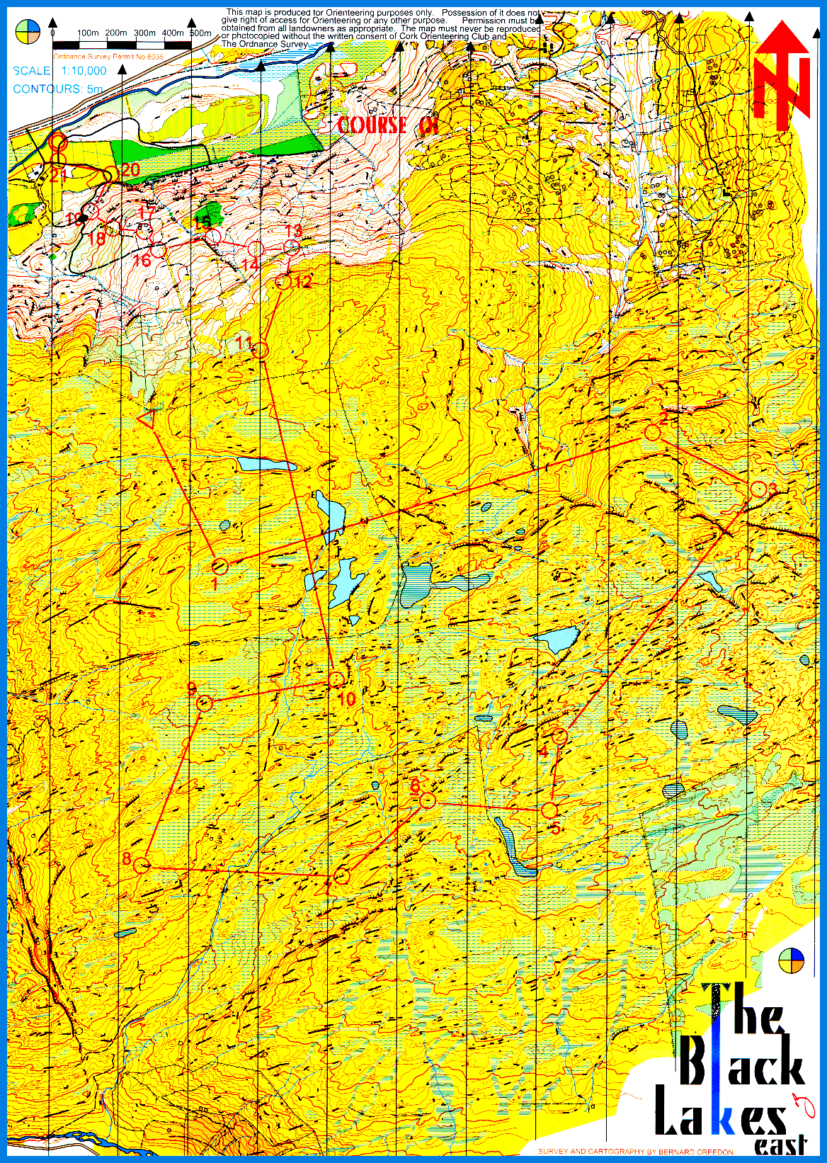
PG, the Shamrock oringen could be a good occasion to come to Ireland. The week before there should be a good few orienteers around interested in training in maps as nice as this!
I'm at 20 countries (I think, not including Scot/Wales/N.Ireland/England as separate entities),
this year I should pick up Ukraine, maybe Portugal, Russia too if I'm lucky :)
states: NY NJ CT PA MD is that all?
provinces: 1
PG, the Shamrock oringen could be a good occasion to come to Ireland. The week before there should be a good few orienteers around interested in training in maps as nice as this!
Jan 30, 2007 5:53 PM
#
Bash:
The Allegany State Park Rogaine map is mostly NY, but has some PA land on it. There's also some terrain that belongs to the Seneca Nation, which sort of makes it "international". I don't think any controls have ever been placed outside of the NY section, but it wouldn't surprise me in the least if at least one Rogaine team has strayed into the out-of-bounds Seneca area.
I talked to a team who got up near that part of the map in the 2006 North Am Rogaining Champs. Nothing was marked out of bounds, and they didn't believe they ever crossed the park boundary on the map. Regardless, they weren't exactly welcomed with open arms. One gentleman provided the helpful tip that firearms might be making an appearance shortly if they didn't leave the area immediately. So they prudently decided to skip the control they were looking for.
I talked to a team who got up near that part of the map in the 2006 North Am Rogaining Champs. Nothing was marked out of bounds, and they didn't believe they ever crossed the park boundary on the map. Regardless, they weren't exactly welcomed with open arms. One gentleman provided the helpful tip that firearms might be making an appearance shortly if they didn't leave the area immediately. So they prudently decided to skip the control they were looking for.
Jan 30, 2007 8:05 PM
#
In 1996 there was a bi-national race in Switzerland/France. Both French and Swiss were running with controls on both sides of the border (at least for the longer courses).
Jan 30, 2007 8:31 PM
#
Neil, I think OK Linne's training camp in the end of February will have some training sessions on that map. Wanna come? :)
Jan 31, 2007 6:58 AM
#
bubo:
Re: Bi-national races
Some years ago there was a relay called Grensekuriren that alternated between starting in Sweden and finishing in Norway or vice versa. The relay was run for the first time in 1967 and it was organized at least up 'til 1996 before the format changed, which means it is now run as a regular relay with start and finish in the same place.
Searching on the Internet I even found a post in Spikes blog ...
This discussion thread is closed.