Discussion: Top 10 favourite NSW or Aus maps/ areas
in: Orienteering; General
Jan 9, 2008 8:36 PM
#
i was looking through my map catlogue the other day and thought it might be interesting to find out/ discuss what peoples favourite NSW or Australian maps/ areas are. On the other side we could also look at a Bottom 10 maps/ areas
lets start with a few to get you started.]
Top 10 (not in any real order)
1. Gardiners Lookout
2. Mt Kooyoora
3. Khali's Rocks
4. Burngoogee
5. Honeysuckle Creek
6. Ngangaguringguring Hill
7. Miners Dispair
8. Inverary
9. Sunset mountain
10. Pomingalana
Bottom 5 for now (not in any real order)
1. Pinjarra Hills
2. Toota Maroota
3. Nail Cairn hill
4. Dragon Bones
5. Curlool Creek
Jan 9, 2008 9:01 PM
#
Cascades
Pittwater
Cantara
Kangaroo Crossing
In a masochistic way I sort of used to enjoy running at Pinjarra Hills... My bottom five would probably all be boring spur-gully maps (not Inverary or Sunset mountain although there is no way they would be in my top 10!) they would be boring ones I can't even remember the names of...
A nostalgic favourite is Kenine Hill, I just use to love racing around there as a youngster.
Jan 9, 2008 9:45 PM
#
can't believe I didn't say Badja, I think i just assumed it had to already be in mouse's top 10. A monkey drawing random circles could set a great course on that map.
Jan 9, 2008 10:33 PM
#
Favourite 10 Australian maps - (for technical challenge and enjoyment)
1. Kooyoora State Park
2. Wilpena Creek/Wilpena Spurs/Tripterra
3. Nerrina/White Swan
4. Cantara Dunes
5. Creswick Diggings/Petticoat Gully
6. The Cascades
7. Chewton/Wattle Gully/Spring Gully/Irishtown/Glenluce
8. Kangaroo Crossing
9. Pittwater Dunes
10. Big Badga
1. Kooyoora State Park
2. Wilpena Creek/Wilpena Spurs/Tripterra
3. Nerrina/White Swan
4. Cantara Dunes
5. Creswick Diggings/Petticoat Gully
6. The Cascades
7. Chewton/Wattle Gully/Spring Gully/Irishtown/Glenluce
8. Kangaroo Crossing
9. Pittwater Dunes
10. Big Badga
Jan 9, 2008 10:40 PM
#
keep em coming. There is some nice areas mentioned and i cant believe i didnt include them in my top 10 either..
i might do a list of the most favourite areas when there is a few more list from others.
i might do a list of the most favourite areas when there is a few more list from others.
Jan 10, 2008 12:02 AM
#
I cant believe you included Pomingalarna!! If you were going for local areas I would have picked Connorton
Jan 10, 2008 12:24 AM
#
I love Pomingalarna too! My favourite map is Campbell Park Offices :-)
Jan 10, 2008 12:55 AM
#
Milo:
Top ten Maps in Tassie (in no particaular order) I have enjoyed running and course planning on:
1. Livelys Bog
2. Windfalls Plains
3. Jasons Task
4. Littlechilds Creek
5. Stags Head North
6. Weeanoobryna
7. Verwood Forest
8. Cuckoo Hill
9. Mt Pearson
10. Four Springs - MTBO
I have not included Pittwater as I do no enjoy masochism or any maps on the mainland as I have not enjoyed any orienteering map there so far.
Jan 10, 2008 12:59 AM
#
does Campbell Park Offices bring back fun memories of being a NSW Junior Miss Jones?!
Jan 10, 2008 1:32 AM
#
Pomingalana is a sentimental favourite as it was the first area i orienteered on in 1978
Jan 10, 2008 1:37 AM
#
this hurts my head, too hard to choose, but i'll try. There is an advantage in going after you are reminded of some other maps.. also had to go out to 15.
No particular order:
1. Kooyoora State Park
2. Jason's Task
3. Nerrina/White Swan
4. Cantara Dunes
5. Creswick Diggings/Petticoat Gully
6. The Cascades
7. Chewton/Wattle Gully/Spring Gully/Irishtown/Glenluce
8. Kangaroo Crossing
9. Pittwater Dunes
10. Big Badga
11. Kahli's Rocks
12. Honeysuckle
13. Gumble
14. Big Bulga
15. Pinnacles (Lithgow sandstone?)
16. ANU (its bloody technical on a well designed course when running hard - there could be more sprint maps, but I've never seen, nor run on Uni Sydney)
Interesting:
ACT 3 (counted badja here)
NSW 4
QLD 1
SA 1
TAS 2
VIC 4
WA 0
Jan 10, 2008 1:47 AM
#
No particular order (although the ones at the top spring to mind first and so are probably best):
1. Pittwater Dunes
2. Cascades
3. Nerrina/White Swan
4. Big Badga
5. Kahli's Rocks
6. Cantara Dunes
7. Broken Hill maps
8. Stockton Dunes (cant believe a Newcastle map slipped in!)
9. Mitchell Park (best Metroleague map)
10. Real fast spur gully e.g Inverary or Blow Mine or Belford SF
I'm sure there are others that I need reminding of. Havent been to the Flinders but it looks real good.
I think my ultimate map would be scattered granite boulders in sand dunes in fast pine forest. Anyone know of such a place? (Apart from in Catching Features)
Bottom 5:
1. Burkes Creek (including flaming car wrecks)
2. Boxvale (familiarity breeds comtempt)
3. Culoul Creek
4. Marybourough maps in Qld.
5. Miners Despair
Jan 10, 2008 1:49 AM
#
Bomb:
Some great Qld maps -
cascades
brooklands/mt station
bettong (near bundaberg)
...and a few to come for the aus champs carnival!
and some shockers -
old hidden vale
clear mt
one mile creek
mt coottha
I think its really easy to think of heaps of local crap maps that would never get used for a major event... whats really special is when they save the thickest, steepest shite for an aus champs etc (or set the courses to make a good area seem awful - like the one in vic a few years ago)
my favorite map/race is aus is still probably the aus champs at wilpena - awesome terrain, great map and excellent courses.
Jan 10, 2008 3:21 AM
#
cascades
brooklands,
pittwater
pagodas
gumble creek (i reckon the best map eric andrews has ever made)
western plains zoo :)
creswick diggings is alright too
brooklands,
pittwater
pagodas
gumble creek (i reckon the best map eric andrews has ever made)
western plains zoo :)
creswick diggings is alright too
Jan 10, 2008 6:10 AM
#
It's on mine. For some of the maps we need a disclaimer on time - neither Littlechild Creek nor Stockton would be on my top-10 list now, but they would be contenders in the days when they were more runnable.
My favourites, in no particular order:
Kooyoora (especially the western half)
Kangaroo Crossing
NW corner of Creswick Diggings
Littlechild Creek/Livelys Bog (as it was in 1988)
Pittwater
Cantara (as it was in the mid-1990s)
Any of the Wilpena/Flinders areas
The eucalpyt section of Amiens (which is also the northern end of the Cascades)
Gumble
Sappa Bulga
The 2006 NSW Champs area near Sunset Mountain (whose name I have forgotten)
Badja
The eastern half of Mount Clear
Turallo Creek (a bit of a sentimental favourite, even though there's not a lot to distinguish it from some other gully-spur areas)
Stony Creek/Arachnicopia before it got burnt out
Including only those areas which have been used at championship/major event level, my least favourites would be:
Warrigul Rocks
Southern section of Old Hidden Vale (the day 3 area)
Darkin River
Pheasants Brush (a lottery depending on when you started - and how they ever got permission to use it I don't know)
The various Newnes maps
I was a bit young to experience some of the 'classic' Sydney sandstone areas in their full glory - Toota Maroota and Jerusalem Rocks were perfectly runnable on the bits they sent the M13s into.
Often, the course-setting is more important than the map itself - I've run some good courses on ordinary areas, and some very ordinary courses on decent areas.
Jan 10, 2008 6:33 AM
#
Blair - Jerusalem Rocks, renamed as Gaza Strip has been remapped and used for Metro's for the fast 4 years or so, it is a good area thanks to a bush fire
Biddy- You're right, Gumble is a perfect example of Eric mapping well when he likes the area!
Seldom Seen, one of my hated areas, is an example of how he drops off when he doesnt!
Glenn - 4. Marybourough maps in Qld. Sadly these areas are next two the Aust champs carnival this year.....gonna be a boring week.....
Jan 10, 2008 7:33 AM
#
Bomb:
The maryborough maps used for the Qld champs last year were the boring areas - they're saving the good stuff for the aus champs. james was surveying through there (for work, not mapping) and recons its pretty cool.
Jan 10, 2008 9:01 AM
#
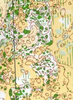
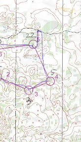
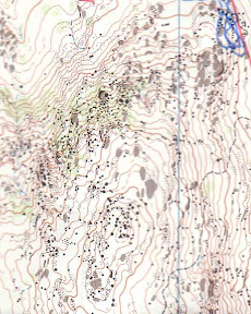
Pictures! Give us glimpses of these maps!
For us non-Australians, it is tough to see such abundance neatly listed...without a more tangible view of these areas. From a bit of searching, I cannot find any use of RouteGadget on Australian websites, which would give us interesting views of their maps.
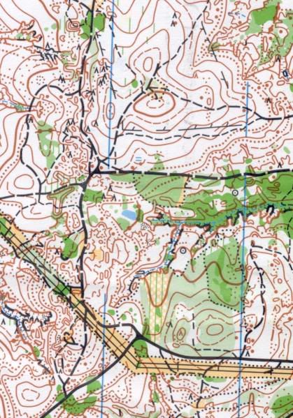
But I did find on the invitation page for last year's QLD Champs, a few photos and a map thumbnail.
The photos show wonderfully open "gum" forests, covering straight forward ridge-and-valley terrain. This is the Leyburn Diggings map in the Leyburn State Forest. How does this map compare with some of the top NSW maps?
For us non-Australians, it is tough to see such abundance neatly listed...without a more tangible view of these areas. From a bit of searching, I cannot find any use of RouteGadget on Australian websites, which would give us interesting views of their maps.
But I did find on the invitation page for last year's QLD Champs, a few photos and a map thumbnail.
The photos show wonderfully open "gum" forests, covering straight forward ridge-and-valley terrain. This is the Leyburn Diggings map in the Leyburn State Forest. How does this map compare with some of the top NSW maps?
Jan 10, 2008 9:12 AM
#
fell:
a few that haven't been listed that are my personal favourites:
Ngaralta Country
Bunjil Bunjil / Bunjil Spirit / Little Forest
Chinaman Flat
Barambogie North
the as yet unused melb uni map
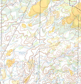
Some pics of previously mentioned maps:
Nerrina / Whiteswan
Ngaralta Country
Melbourne Uni.
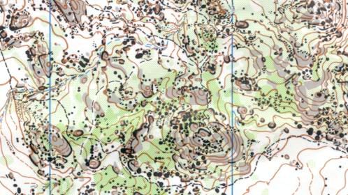
Kooyoora
Kahli's Rocks
Gumble
ganguddy
Creswick Diggings
Cantara
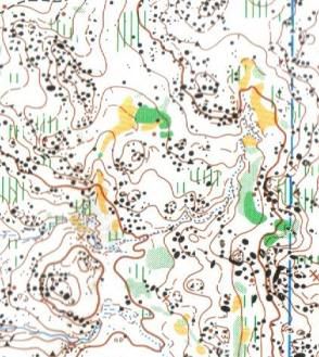
Badja
Ngaralta Country
Bunjil Bunjil / Bunjil Spirit / Little Forest
Chinaman Flat
Barambogie North
the as yet unused melb uni map
Some pics of previously mentioned maps:

Nerrina / Whiteswan


Ngaralta Country
Melbourne Uni.

Kooyoora


Kahli's Rocks
Gumble

ganguddy

Creswick Diggings

Cantara

Badja
Jan 10, 2008 9:56 AM
#
Two route gadgets I know of.
Bendigo Orienteers
http://www.bendigo-orienteers.com.au/gadget/cgi-bi...
South Australia
Perhaps a local can provide the link.
Bendigo Orienteers
http://www.bendigo-orienteers.com.au/gadget/cgi-bi...
South Australia
Perhaps a local can provide the link.
Jan 10, 2008 10:30 AM
#
Perhaps we need a book:
1001 maps you must run b4 you die.
Areas I have on the wish list like the kaarst terrain in Slovenia, Bohemias tower country, Vulcania in the Auvergne, that amazing badlands area near Los Angeles with a meet coming up. Surebridge. Given that standard, what maps from Australia would fit into such a book. I would imagine there would be a section for each different terrain type.
Granite: Cascades, Sappa Bulga, Kooyoora, Gumble. (Local bias... Mt Korong, but thats because only a quarter of it is mapped so far and I am the only orienteer who has seen the rest. It would be nice to think the 2009 Aus Champs area might also qualify)
Mining: Rowdy Flat, Jason's Task, Creswick Diggings-Petticoat Gully (ie all the mining and none of the spur gully), Nerrina.
Borderline Fryerstown
Dunes: Pittwater, maybe Cantara, depending on vegetation
Pagoda country: Ganguddy
Spur Gully: Interesting question. There is so much of it, so we take it for granted. But after you run on crap stuff, you appreciate the good bits. What makes it good is a high ratio of gully junctions to contours, fast running, limited visibility and a shortage of tracks. You never get all in one map.
Definites: Flinders Ranges (maps meet most criteria). Cyanide Dam is a great example of high junction-contour ratio.
Possibles: Blow Mine would be a stand in for a whole suite of similar maps. Inverary and Sunset Mountain are the trackless class. Local bias- Sedgwick
Tectonic: Dreeite when/if it is mapped.

Now, maps that have not been worth the trip.
Mount Robertson.
Old Hidden Vale
Honeysuckle Creek (sorry, but it doesn't turn me on)
Mt Terrible. At least a prize for advertising honesty
PS Fat Rat. I think your count has Victoria on 5.
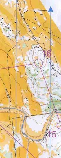
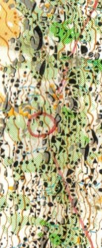
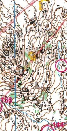
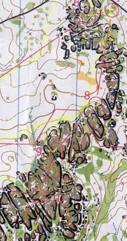
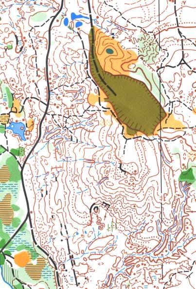
PPS Some images to add to those already submitted
Sunset Mtn
Flinders Ranges
Sappa Bulga
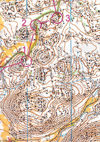
Jason's Task
Kangaroo Crossing
Chewton-Mineral Springs on RouteGadget
http://www.bendigo-orienteers.com.au/gadget/cgi-bi...
Kooyoora on Route Gadget
http://www.bendigo-orienteers.com.au/gadget/cgi-bi...
Korong on Route Gadget
http://www.bendigo-orienteers.com.au/gadget/cgi-bi...
Creswick Diggings on Route Gadget
http://www.bendigo-orienteers.com.au/gadget/cgi-bi...
Petticoat Diggings on Gadget
http://www.bendigo-orienteers.com.au/gadget/cgi-bi...
Monash Uni Sprint
http://www.bendigo-orienteers.com.au/gadget/cgi-bi...
1001 maps you must run b4 you die.
Areas I have on the wish list like the kaarst terrain in Slovenia, Bohemias tower country, Vulcania in the Auvergne, that amazing badlands area near Los Angeles with a meet coming up. Surebridge. Given that standard, what maps from Australia would fit into such a book. I would imagine there would be a section for each different terrain type.
Granite: Cascades, Sappa Bulga, Kooyoora, Gumble. (Local bias... Mt Korong, but thats because only a quarter of it is mapped so far and I am the only orienteer who has seen the rest. It would be nice to think the 2009 Aus Champs area might also qualify)
Mining: Rowdy Flat, Jason's Task, Creswick Diggings-Petticoat Gully (ie all the mining and none of the spur gully), Nerrina.
Borderline Fryerstown
Dunes: Pittwater, maybe Cantara, depending on vegetation
Pagoda country: Ganguddy
Spur Gully: Interesting question. There is so much of it, so we take it for granted. But after you run on crap stuff, you appreciate the good bits. What makes it good is a high ratio of gully junctions to contours, fast running, limited visibility and a shortage of tracks. You never get all in one map.
Definites: Flinders Ranges (maps meet most criteria). Cyanide Dam is a great example of high junction-contour ratio.
Possibles: Blow Mine would be a stand in for a whole suite of similar maps. Inverary and Sunset Mountain are the trackless class. Local bias- Sedgwick
Tectonic: Dreeite when/if it is mapped.
Now, maps that have not been worth the trip.
Mount Robertson.
Old Hidden Vale
Honeysuckle Creek (sorry, but it doesn't turn me on)
Mt Terrible. At least a prize for advertising honesty
PS Fat Rat. I think your count has Victoria on 5.
PPS Some images to add to those already submitted
Sunset Mtn
Flinders Ranges
Sappa Bulga
Jason's Task
Kangaroo Crossing
Chewton-Mineral Springs on RouteGadget
http://www.bendigo-orienteers.com.au/gadget/cgi-bi...
Kooyoora on Route Gadget
http://www.bendigo-orienteers.com.au/gadget/cgi-bi...
Korong on Route Gadget
http://www.bendigo-orienteers.com.au/gadget/cgi-bi...
Creswick Diggings on Route Gadget
http://www.bendigo-orienteers.com.au/gadget/cgi-bi...
Petticoat Diggings on Gadget
http://www.bendigo-orienteers.com.au/gadget/cgi-bi...
Monash Uni Sprint
http://www.bendigo-orienteers.com.au/gadget/cgi-bi...
Jan 10, 2008 11:06 AM
#
i might be a little biased here after being brought upon the stuff but i reckon the spur/gully terrain between bundaberg and childers in QLD is very hard to beat. maps like "isis", "promisedland" and to a lesser extent "bettong". shame they dont get used for bigger events
Jan 10, 2008 11:25 AM
#
What an interesting selection of maps! Thanks for posting the maps and photos. I have only orienteered in Australia at the Q'land Champs and WMG near Brisbane in 1994 so I can't pick a list of personal top ten except by names from your lists: Big Badja, Sappa Bulga, Ganguddy, Pomingalarna, Weeanoobryna, Chewton/Wattle Gully/Spring Gully/Irishtown/Glenluce (Is that one name or five?) and for a bit of normalcy, Cuckoo Hill
Sure makes me want to go back for the World Masters in 2009. See you there!
Sure makes me want to go back for the World Masters in 2009. See you there!
Jan 10, 2008 8:52 PM
#
Bomb:
gordhun - those maps you ran on then would rate pretty highly on the worst maps list - luckly we don't have access to a lot of those areas anymore!
Jan 10, 2008 9:20 PM
#
fell:
I've been thinking of my BOTTOM 5, but most of them have been biased by poor course setting or bad mapping.
Safely on the top of my list:
Goorooyaroo (this does fall into the local area category though)
another map that would be around the top:
Old Hidden Vale: I didn't think it was really a suitable area to hold a national carnival, but I think it had the potential for a good course on it.
I also heard that the area used for the 'Dubbo Dash' wasn't the most popular.
Neil; if we're talking about potential maps, I should mention:

Jan 10, 2008 9:26 PM
#
Milo:
"________" wrote "You won't get all that on one map." Come to the Sun Coast Classic in May and run on Mt Pearson. Not may tracks there, spur gully AND granite.
see link: http://www.tasorienteering.asn.au/downloads/sun_co...
see link: http://www.tasorienteering.asn.au/downloads/sun_co...
Jan 10, 2008 9:32 PM
#
I ran on it in the last Oz Champs. Its ok, but not nearly in my 1001 maps to run b4 you die list. The granite maps in my list above are all another step up in my world. But I will grant you the right to local bias if you will grant me the same. Hence Korong and Sedgwick got my gratuitious local mention. Its not that I am biased against tassie though. I am hoping to fly to Hobart in April just for the TOS event on Pittwater.
And for fell. I made it clear where my future classic maps are located. Where is that one?
And for fell. I made it clear where my future classic maps are located. Where is that one?
Jan 10, 2008 9:36 PM
#
Bomb:
we ran on old hidden vale in winter last year, and after a few years of no rain there was hardly any grass and it was actually really nice... not any more though. rain = grass
Jan 10, 2008 10:33 PM
#
I guess this is the private land bit? Bruce and I had a look at the northern section of the park a couple of years ago - great rock but very thick. You could just about get away with running an elite race on it with careful course-setting but there's no way the everyday punters would like it.
Jan 10, 2008 11:19 PM
#
These maps I recall as being enjoyable experiences, I'd probably come up with some others if I look back through my major carnival maps... eg. there are some NSW maps I've thoroughly enjoyed but can't remember their names.
Cantara Dunes (SA)
Creswick Diggings (Vic)
Pittwater (Tas)
Brooklands (Qld)
Stockton (NSW)
Flinders ranges maps (SA)
Malmalling (WA)
Kooyoora (Vic)
Big Badga (ACT)
Honeysuckle Creek (ACT)
The Cascades (Qld)
And my local Western Australian favourites...
Just like Candyman I have fond memories of running at Kenine Hill, an old map way south-east of Perth, farmland and granite. Ngangagurringuring was great when it was young, and I quite like the map from the recent WA Auschamps carnival, Hill Park Dale.
Jan 11, 2008 1:34 AM
#
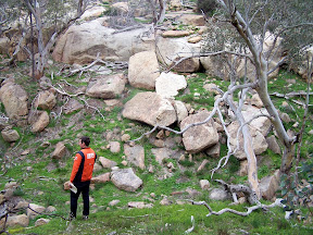
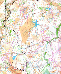
Blair, I suspect that the run that you and Bruce did may have focussed on the western side of the northern section (within the park)- and I can agree that that is extremely thick. On the eastern side (still within the park) you could be mistaken for thinking you were near Bendigo.
(The map below is a mock-up one that I use for training runs sometimes, and doesn't have granite or much vegetation marked on it. The private area is off to the west and north)

On my list of worst maps would have to be the three days for Easter in 2007 - unfortunately I've forgotten their names.
(The map below is a mock-up one that I use for training runs sometimes, and doesn't have granite or much vegetation marked on it. The private area is off to the west and north)
On my list of worst maps would have to be the three days for Easter in 2007 - unfortunately I've forgotten their names.
Jan 11, 2008 2:40 AM
#
fell:
the Easter maps were called Twigham and Worlds End
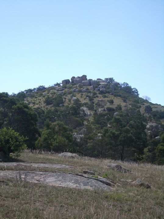
which I quite liked.
The photo I just posted is taken from the saddle in the top left (north west of James' map) facing north.
which I quite liked.
The photo I just posted is taken from the saddle in the top left (north west of James' map) facing north.
Jan 11, 2008 3:26 AM
#
I think my ultimate map would be scattered granite boulders in sand dunes in fast pine forest.
Unfortunately, I think granite boulders in sand dunes would require some unusual geological events. But I could be wrong.
Unfortunately, I think granite boulders in sand dunes would require some unusual geological events. But I could be wrong.
Jan 11, 2008 5:36 AM
#
At JWOC in Lithuania I noticed the occasional granite type boulder in amongsth the wonderful sand dunes. Carried there by ice. About 1 metre high at most and a density of 1 per kilometre square. Druskininkai Miskas. Now that is up there for my list of 1001 maps.
Jan 11, 2008 6:41 AM
#
Mouse, how bout starting to use http://www.maptalk.org for these kinds of discussion.
but while i'm wasting time waiting for Stingers training
1. Pagodas/Ganguddy- and if you are looking for the best ever control look at #10 on the map that Fell posted (not that i'm bias at all)
2. Kahlis Rocks
3. Baalbone Gap/Gardiners Lookout/Long Swamp
4. North Stockton Sanddunes
5. Golden Fleece/Jason's task
6. Pittwater Sandunes
7. Nerrina Whiteswan
8. Cascades
9. The Hutt
10. Further out the back
Was Old Hidden Vale that bad?
Glenn- I can't believe you don't like Miners Despair!!
Worse maps- any flat boring spur gully
Favourite map in the world- Trockner Steg (matterhorn glacier used for Swiss6days 2006)
Jan 11, 2008 9:49 PM
#
Because you come to this site to log training and you can't help but notice the discussion on the side bar. So its bound to get a response.
Jan 11, 2008 11:58 PM
#
"I think my ultimate map would be scattered granite boulders in sand dunes in fast pine forest.
Unfortunately, I think granite boulders in sand dunes would require some unusual geological events. But I could be wrong."
It can happen, its just highly unlikely. Sand dunes could be transported to overlie a normal granite area, not just on the coast but also in arid areas.
Unfortunately, I think granite boulders in sand dunes would require some unusual geological events. But I could be wrong."
It can happen, its just highly unlikely. Sand dunes could be transported to overlie a normal granite area, not just on the coast but also in arid areas.
Jan 12, 2008 12:23 AM
#
Well, that's the thing. I think you'd most often wind up with boulders in the dunes, which is not as interesting as boulders on the dunes.
Jan 12, 2008 1:29 AM
#
I've seen granite boulders and sand dunes near Bridport in Tasmania, although the bits I saw were in farmland and the dune formations were quite simple. Esperance would be another possibility. Whether any runnable forest exists in either location is an open question.
Jan 12, 2008 4:30 AM
#
ev:
i dont know if many people outside of victoria have seen it but i think one of the best maps in aus is the A2 1:20000 map of the whole southern side of bendigo. this map links diamond hill, kangaroo gully, one tree hill, wildflower drive, spring gully, the southern side of bendigo and all the bits in between. the masterpiece will be complete when we get permission to map spring gully reservoir.
other than that i think the best map in aus is pittwater and the worst is that bloody lantana jungle/rubbish dump that was used on the last day of the recent 5 days in newcastle.
other than that i think the best map in aus is pittwater and the worst is that bloody lantana jungle/rubbish dump that was used on the last day of the recent 5 days in newcastle.
Jan 12, 2008 8:45 AM
#
Summary:
Nothing better to do, so did some counting.
1 Cascades (10 mentions)
2 Pittwater (9)
=3 Cantara, Badja (7)
=5 Kooyoora, Creswick-Petticoat (6)
=7 Gumble, Nerrina, Wilpena area (5)
=10 Jason's Task, Kahli's Rocks (4)
=12 Brooklands, Ganguddy, Chewton complex, Stocktons Dunes, Honeysuckle Creek, Kangaroo Crossing (3)
The tail: 7 maps with two mentions including Sappa Bulga (?), Littlechild, Blow Mine Inverary. And 31 maps that received mention.
Maps that got divided reviews: Pittwater, Honeysuckle
Surprise: Sappa Bulga only scoring 2 mentions, less than Kahli's Rocks, Honeysuckle, Chewton. I don't think I really believe that.
Jan 12, 2008 12:29 PM
#
1 Kangaroo Crossing
2 Seldom Seen
3 Kahli's Rocks
4 Cascades
5 Big Badja
6 Kooyoora
7 Flinders Maps
8 Bob's Farm (I used to think that this was a magic forest 20 years before I even knew orienteering existed, would love to have seen a Stockton map)
9 Girrakool (the only Sydney sandstone map I've seen - I get homesick with all you Sydney boys riding Galston Gorge, West Head etc)
10 Something from WA but can't pick between Malmalling/Nganga/Peterdine/Hill Park Dale/Gunapin Ridge
PS I love that glenn likes Belford as I used to think this was a pretty special forest too!
Jan 12, 2008 6:57 PM
#
I ran in WOC in 85; and APOC 88; and pretty much enjoyed all the maps: Kooyoora, Slaty Creek, Big Rock, Sailor's Diggings, Mt. Alexander; Littlechild, Pittwater.
It's kind of interesting that Kooyoora is mentioned so often (after 22+ years!), just from the point of view of confirming that the WOC organizers knew what they were doing - i.e. 'picked a winner' of an area. I will be seriously looking at 2009.
It's kind of interesting that Kooyoora is mentioned so often (after 22+ years!), just from the point of view of confirming that the WOC organizers knew what they were doing - i.e. 'picked a winner' of an area. I will be seriously looking at 2009.
Jan 13, 2008 12:01 AM
#
The pagoda maps get a few mentions in the list. They are on for 2009 WMOC, as is the Chewton area for the associated Oz Champs tour. Also an area that was mapped in the 1970s and has not been used since. Its more fast granite country with similarities to Kangaroo Crossing.
Jan 13, 2008 3:06 AM
#
Sanddunes and granite eh? What about sanddunes and limestone pillars? Imagine if we could map the Pinnacles Desert a couple of hours north of Perth? I remember Karl Kullman making an orienteering t-shirt with a photo of them. Quite a unique area from what I understand.
http://www.discoverwest.com.au/western_australia/p...
http://www.safaris.net.au/info/pinnacle.htm
Cool eh?
http://www.discoverwest.com.au/western_australia/p...
http://www.safaris.net.au/info/pinnacle.htm
Cool eh?
Jan 13, 2008 8:14 PM
#
In answer to Robbie if it was on maptalk it would get lost amongst all the newcastle score event postings.
Jan 14, 2008 4:14 AM
#
:) nice one Candy.
surely only APers views are worth considering anyway...
surely only APers views are worth considering anyway...
Jan 21, 2008 7:27 PM
#
Nice to see a couple of maps I helped make get on the list. I'd agree with Blair, Littlechild Creek was great back in the 80's when you could run it hard. Up there over weekend taping for NL Middle in May. Gotta come down if you want to see what it's like in 08.
Fave areas in Aus I've run on in 30+ years of O. Geez i'm getting old!!! No particular order except no 1.
1. Kooyoora (simply the best)
2. Pittwater (how good is it to have that 20min from home)
3. Gardners Lookout
4. Kangaroo Crossing
5. Cascades
6. Nerrina/White Swan
7. Jasons Task (top half burnt out last week)
8. Creswick Diggings stuff
9. Chewton/Castlemaine
10. Littlechild (before it was partially logged)
Not ben to Cantara or Wilpena but have drooled over them.
fave places O/S - forest just south of Brussels (how damn gorgeous was that to hoon around), Czech sandstone around Jicin (just awesome), that white moss forest we went to in '97 in Norway for training (beautiful), Whitehorse - Chadburn Lake (remote O at it's best),
Sep 8, 2008 7:19 AM
#
Was wondering about how people decided their favourites.
Do you select terrain you go well in or just the opposite.
I often want to return to places I've done my worst at just to improve my technique but I reckon a lot of people avoid terrain they can't handle and would mark it down for that reason.
I'm lucky in so far as I have a terrible memory for maps (and their names) so unless I've been to a place several times it's almost like a new map to me.
Sep 8, 2008 7:25 AM
#
As for Fatrat and Candyman's obvious displeasure at us Novocastrian's utilising MAPTALK for our discussions - I thought that's the whole idea of the site.
I think other people and clubs should be emulating us rather than bagging us!
Talk about elitists!!!!!
(or perhaps I've missread the tone of your comments).
I think other people and clubs should be emulating us rather than bagging us!
Talk about elitists!!!!!
(or perhaps I've missread the tone of your comments).
Sep 8, 2008 4:48 PM
#
Do you have to be elite to be elitist? If so that's the first time somebody has accused me of that for a couple of years!
I would love for Maptalk to become a vibrant forum where National Orienteering issues were discussed including new and different race formats, ideas for attracting newcomers to the sport, best international orienteering experiences, what exciting new areas are being mapped and and being used for major Australian events etc etc. I don't particularly think that these sort of issues and topics are or would be particularly elitist.
Good on the Newcastle orienteers for making such good use of the forum and being so quick on the uptake but i am afraid that it has turned what was intended to be a National forum into a club notice board.
I think most people from outside of Newcastle who might stumble across the board would not find any topics or discussions that they would want to participate in or be particularly interested in reading.
Sep 9, 2008 2:25 AM
#
sarcasm is hard to portray in forums.
i will generally choose a map based on the technical challenge (more the better) but also the relative runnability of it (having had significant ankle injuries I don't enjoy terrain that is too rocky underfoot - it has to be pretty rocky, most granite maps i like; perhaps how thick the forest is, particularly the scratchiness of the flora transfers closest to how i choose best) and mapping standard, though normally this is not an issue as the most technical maps are mapped for major events which attracts the most care when mapping.
I hope Maptalk works, the problem is perhaps that the most likely people to express views are those on AP (elite or not bloody elite, give up the stupid bloody elite argument - what a counter productive argument that just pisses off elites more and makes them even less likely to contribute to the sport). So those that would use Maptalk the most already have an available forum which is more convenient (generally because they are self -obsessed enough to check their AP daily or even hourly)
Sep 10, 2008 7:54 AM
#
Looking back on my own assessments, I think that novelty is an element of my enjoyment. Hence I tend to devalue local spur-gully. I remember the 1998 Easter at Maldon when I was excited about Tarrengower. I was pretty new to the sport then and mostly ran on local maps. I was surprised when someone from NSW told me granite hills were a dime a dozen but the spur guly terrain of Blow Mine was what attracted him to the carnival. Lookng back on my spur gully running away from Bendigo since that time, little of it has enthused me. Maybe I didn't know how good I had it at home.
Sep 10, 2008 8:10 AM
#
Ecmo:
A mix of favourite/most significant etc. Most important is some 'wow' factor or they were unusual or groundbreaking:
In order...
Kooyoora - significance to Oz O, exciting terrain and mapping milestone
Kangaroo X - if you look at physical and mental challenge together, the Cypress Pine bits are the hardest terrain in Australia
Pagodas/Canguddy - biggest wow factor
Uloola - best Sydney sandstone (post fire) and great location
The Boyd - groundbreaking granite area and lots of fun
Pittwater - technically hardest map in Australia
Amiens/Cascades - After Kangaroo X, second hardest map in Aust and best map in queensland by miles
Cantara - big wow factor and very different
Broken Hill maps - even further out in the desert than wilpena or burra. How could you possibly orienteer there? amazing
Sailors diggings - 1 great area to represent all the great gold mining maps around the golden triangle (Chewton, Wattle Gully etc)
Worst - so many to choose from
Toota Maroota - any area where M21E can't break 10min kms is too slow
East Pt - Darwin
Cumberland state forest
Token sprint maps - St Helens, Cooma Park
NSW Central Coast flat local bush (most of the ones from the 80s are now housing estates thank goodness)
Sep 11, 2008 9:47 PM
#
Candyman/Fatrat.
"sarcasm is hard to portray in forums."...agreed!!!!
Sorry, looks like I did misread your tone.
Often I think "attackpoint" is aptly named as many discussions include attacking or discouraging remarks amongst it's forum entries and I'm afraid I was quickly on the defensive. Perhaps some of these are sledging and perhaps if people read some of my entries directed at my contemporaries they would get the impression I was seriously bagging them or they me.
As I said Maptalk was a blank canvas and we at Newcastle have replaced our initial forum site (that I was in a losing race trying to delete spam every day) with this facility.
As per the use of elitist, it was used under the context of what as I said wrongly looked to be an attack on our grassroots efforts and the fact that it appeared to suggest that our opinions were not worthy and as such the term was used to portray a state of mind rather than an "O" class so no, you don't need to be an elite to be elitists.
As you stated above this appears not to be the intent so let's not get into another slanging match on this forum.
See you sometime in the bush (probably this weekend Fatcat)
Sep 12, 2008 11:06 AM
#
no problem with that, I think if you looked at what we wrote on each others logs you would see that light-hearted sledging and banter is common-place. It is one of the things that I really like about attackpoint that you don't have to (or even shouldn't) take discussions too seriously. I can certainly see however how somebody could see many of the comments as being 'attacks' but they certainly aren't meant as such.
Going back to your original post I chose my favourites as the most technically (and physically) challenging areas, certainly when i was younger I tended to prefer open, easy running, good visibility areas (as noted in my nostalgic favourite) and still enjoy running in this type of terrain now but it just doesn't compare to a real technical challenge.
Going back to your original post I chose my favourites as the most technically (and physically) challenging areas, certainly when i was younger I tended to prefer open, easy running, good visibility areas (as noted in my nostalgic favourite) and still enjoy running in this type of terrain now but it just doesn't compare to a real technical challenge.
Sep 12, 2008 9:49 PM
#
Agreee with all the above - Kooyoora etc. Would add Mt Franklin Gorge - the classic spur gully area.
One area I really hate - Honeysuckle, because I always do really badly and usually run off the map at least once per run.
And one I really really really really hate - Old Hidden Vale - steep, thick, boring as hell and hot. I'm still mad at QOA for foistering this on us for Easter. How could they? So many nice areas in Queensland and they gave us this crap. It was disgusting. I mean really really really terrible. I was embarrassed for my country that people from overseas came to run here. Lantana, tall grass, steep. Words cannot describe my loathing. And having Ipswich as the event centre didn't help. It made Molong look cultured. In fact the 'food' at the Molong RSL was a fine dining experience by comparison...
Sep 12, 2008 10:41 PM
#
Great to see that orange has map that other people enjoy. Khali's Rocks is a great map. Surprised to see Sapa Bulga not as highly mentioned. Really great map. Not many roads at all and lots of route choice options that organisers can utilise (because of its granite/open formant)
Really looking forward to running on some of these great maps that I've never seen before.
Really looking forward to running on some of these great maps that I've never seen before.
Sep 13, 2008 12:23 AM
#
dont worry liggo, we qld's were not impressed either...
( especially when you had first starts each day and had to create tracks in waist high grass in which other later competitors used to their advantage to win by a significant margin)
( especially when you had first starts each day and had to create tracks in waist high grass in which other later competitors used to their advantage to win by a significant margin)
Sep 14, 2008 12:11 PM
#
you're kidding arent you? I was gonna say its near there. Tough and very technical, an hour from sydney's centre. Yeah its a bit green but so bad you can run through it
Sep 15, 2008 4:30 AM
#
Sailor's Gully is a very poor selection to represent gold mining in the golden triangle. I wouldn't even call it mining terrain. Petticoat Gully and Creswick Diggings in one map minus the boring spur gully to the east would be the best mining map because of the complexity and size.
Jul 28, 2015 7:06 AM
#
Some seven years later, I feel moved to resuscitate this thread. With the benefit of eight years more getting lost, I have two new maps for my 1001 maps book.
Rowdy Flat- is there any more complex mining terrain than this in the country. We had to test map a portion before selecting it just to make sure it was mappable at the required scale.
http://doma.orienteering.asn.au/show_map.php?user=...
Yorkshire Hill - by far the best reef (as opposed to sluice) mining area in the country. Cut off from destruction by an impassable fence, it has historic charm by the bucket. Next event will be the next National Carnival in Bendigo. If you missed the last one it might be a long wait.
http://doma.orienteering.asn.au/show_map.php?user=...
Is there anything else of note that has become an orienteering map in the last 8 years?
Jul 28, 2015 7:16 AM
#
Funny, I don't remember it being called Yorkshire Hill. The 'impassable fence' rang a bell, then I looked at the map and thought "I remember running around a lake like that!"
Jul 28, 2015 7:19 AM
#
Flinders ranges, kangaroo crossing, petticoat gully, sappa bulga, badja, gumble creek, cascades, uq, port Lincoln negative terrain, that map from Aus schools champs last year in WA( that was fun)
Jul 28, 2015 7:30 AM
#
Peterdine (school's champs); we ran there just last week and it wasn't so much fun but we got the rocky bits.
I'll get to see some of the abovementioned maps in the next few months!
I'll get to see some of the abovementioned maps in the next few months!
Jul 28, 2015 7:50 AM
#
Peterdine seemed very different last October from how it was at Easter 1993 - not sure if that's due to the mapping or the grass.
Yorkshire Hill - I thought this map was going to be called "Inside The Fence" :)
Yorkshire Hill - I thought this map was going to be called "Inside The Fence" :)
Jul 28, 2015 8:01 AM
#
WA people may want to comment further, but my impression is that easterners got the wrong idea about how much grass is typical in WA semi-open farmland terrain in spring because 2006 was a severe drought year, and that the amount of grass in 2014 was more normal for spring?
Jul 28, 2015 8:22 AM
#
We were asked by the landowner not to draw attention to the map actually being "inside the fence". As far as they were concerned, the less publicity the better. If no-one knew where the map was, they wouldn't ask for access. Hence the next event on the map being some time well into the future. So for the controller of the event its a long wait to actually compete on the map.
Back on subject... I was wondering about Port Lincoln terrain.
Back on subject... I was wondering about Port Lincoln terrain.
Jul 28, 2015 10:51 AM
#
I have seen the maps from the most recent event. But the maps only tell you part f the story. Its the experience of running as well.
Jul 29, 2015 8:50 AM
#
Still very much a bush rookie, but earlier this month I had the displeasure to do the Mt Coot-tha map in Brisbane. Up-down-up-down, reduced to a walk. A short hard course of 3.3km had I reckon 300m of climb. Add in many features not mapped and it was a total waste of time.
Re some Sydney maps: (1) Garingal will next year unveil a new map at Galston, (2) WHO will also unveil a new bush map at Mulgoa, (3) Gaza Strip has not been used for about 6 years by IKO 0and needs remapping. (4) the new Simmos Beach map by SHOO is pretty good for Sydney bush
Re some Sydney maps: (1) Garingal will next year unveil a new map at Galston, (2) WHO will also unveil a new bush map at Mulgoa, (3) Gaza Strip has not been used for about 6 years by IKO 0and needs remapping. (4) the new Simmos Beach map by SHOO is pretty good for Sydney bush
Jul 29, 2015 9:11 AM
#
Simmo gets around. He's currently in Europe, probably having a cafe strip or muffin shop named after him.
This discussion thread is closed.