Discussion: ISOM box
in: Orienteering; General
Oct 30, 2019 9:44 AM
#
About the ISOM box on the map.
I personally liked to see info. which ISOM standard was used for the map. In the past all our maps had this information but it is not mandatory for the organizer to used it. I think it should be clear from the ISOM box (which standard) and how symbols set is represented on the map. Do athletes need to know if map was produced at scale 1:10000 and with 150% enlargement of ALL symbols or not?
I think a lot of mappers did something in between depend on the terrain with symbols between 100-150% to map at 1:10.
Slovenia case:
A) 1:10 (all symbols 150%) - ISOM standard; probably very little maps because we produce very, very little maps at 1:15
B) 1:10 (all symbols at 1:15, not enlarged) - Not allowed by ISOM; probably some maps
C) 1:10 (all symbols vary between 100-150%) - Not allowed by ISOM; probably most maps
D) Maps with no ISOM box, just scale: 1:10; new trend (not good)
Is there any good practice how to put these information on the map to inform athlete which ISOM standard (2017, 2017-2, etc), and how mapper used all symbols at defined scale 1:10? Is this information (map A, B, C) important enough or it is enough for athletes to see scale 1:10 and organizer can put all other info in the bulletin?
It would be nice to understand how other federations/countries deal with this for the national official events/maps.
Oct 30, 2019 12:38 PM
#
I have never seen a map in North America (as far as I know) with an ISOM box.
Oct 30, 2019 2:31 PM
#
Need to edit my question a little bit.
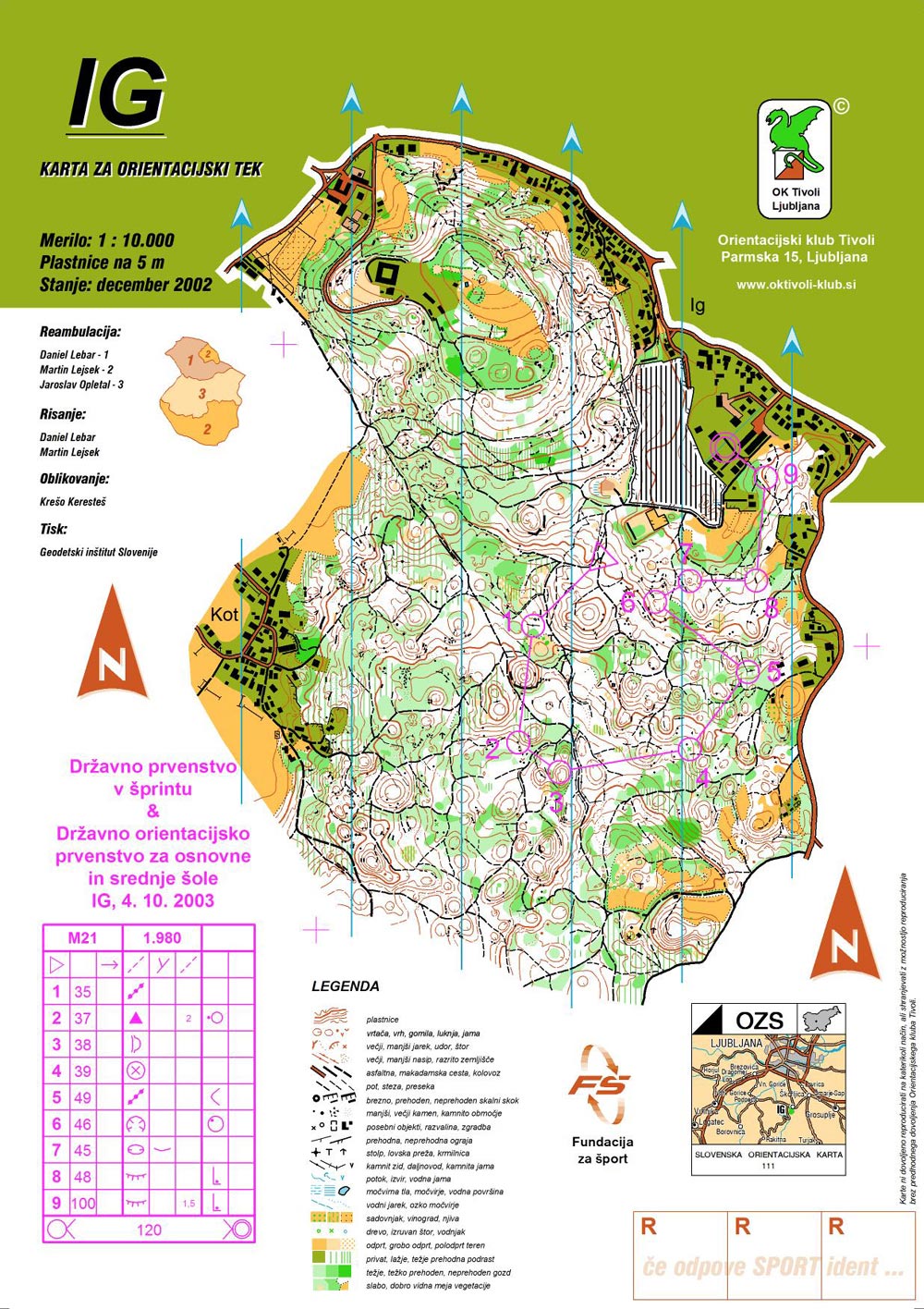
Map
http://www.oktrzin-klub.si/Piran2006/karte/2003.jp...
There is no ISOM box, normally is just a scale 1:10000, E=, year + mappers + design + print and official federation box (map number). There might be trust that official federation box is a sign that map is mapped by the ISOM standard.
1) To make better question. What data are necessary that map is registered by the federation map committe?
Oct 30, 2019 3:26 PM
#
At least in the USA, we haven't had a map committee in many years. I think we had one in the 1980s, but it disappeared some time after that (I remember the chairman stating that there was no need for the committee, but I forget when that was.) There is absolutely no federation control over mapping standards or quality here, and no map registration or catalog. All local clubs are on their own. (I'm not suggesting that this is how things should be, but it's how they are.)
Oct 30, 2019 10:01 PM
#
Since the ISOM and ISSprOM changes, it has been clear that competitors in non-international events will encounter a mixture of mapping specifications for many years. The ONZ Mapping Committee has been urging clubs to list the spec on the map. This advice has been largely ignored:-))
Oct 30, 2019 11:12 PM
#
The difference between ISOM specs is trivial compared to the difference in fieldwork skill/ style between mappers.
Oct 30, 2019 11:25 PM
#
Re Australia, pretty much what jjcote says. I now place the following information on my maps.
Specification used.
Scale at which terrain is mapped (ie symbol size)
How (or if) map was tested for compliance (OCAD or CheckOMap)
Date mapped (or updated)
Base map (lidar or no)
Sometimes I add a recommended print scale
I leave this on OCAD file. I expect it will be covered by layout items. As EricW implies, most orienteers aren't really interested in this detail. I suspect its of interest to the map custodians if they are considering a significant use for the map.
Nov 4, 2019 2:17 AM
#
bmay:
Around here, I presume that most forest maps are mapped following ISOM. Meaning, using specified symbol sizes at 1:15,000 and enlarged to 150% when printed at 1:10,000. I've never seen anything stating that a map has been produced differently.
If maps are to be produced that don't adhere to ISOM, then I as a competitor would be very interested in knowing what was actually done. For example, if a map were mapped at 1:10,000 without enlargement of symbol sizes, I would certainly be bringing a magnifier with me out on course.
If maps are to be produced that don't adhere to ISOM, then I as a competitor would be very interested in knowing what was actually done. For example, if a map were mapped at 1:10,000 without enlargement of symbol sizes, I would certainly be bringing a magnifier with me out on course.
Nov 4, 2019 2:21 AM
#
bmay:
Personally, I think that we need to relax our spec to allow a different approach to mapping detailed areas that aren't suitable for mapping at 1:15,000. At the Norwegian O-Festivalen this summer, we were in a very detailed area near Larvik. As an M45- I was given an enlarged ISOM map at 1:5,000, i.e., symbol sizes at 300%. It wasn't great (blowing it up to 300% still yielded symbol clutter on the map). I suspect it would have been much better to map the area at 1:10,000, then blow it up to 1:5000 (200% symbol enlargement) for the old categories.
Nov 4, 2019 6:47 AM
#
@bmay: The O-Festivalen middle is one of my "proof by existence" examples of terrain which really cries out for a larger scale but the same symbol sizes, i.e. use 1:15K symbols on a 1:10K map, then give the elites a 1:7500 enlargement and keep the same 1:5K for us older duffers.
The mapper, Helge Gisholt did an amazing job imho, but being allowed to reduce the symbol sizes a bit would have made the resulting map even more readable. He is a member of the Norwegian MC, I'll ask him or Larvik (the event organizer) for a copy of the ocad file so that I can print out various combinations of scale and symbol sizes. (I have a Xerox 2400 DPI C60 printer which is the latest version of the printer used by IOF MC's new CMYK printing reference sheets.)
The mapper, Helge Gisholt did an amazing job imho, but being allowed to reduce the symbol sizes a bit would have made the resulting map even more readable. He is a member of the Norwegian MC, I'll ask him or Larvik (the event organizer) for a copy of the ocad file so that I can print out various combinations of scale and symbol sizes. (I have a Xerox 2400 DPI C60 printer which is the latest version of the printer used by IOF MC's new CMYK printing reference sheets.)
Nov 5, 2019 5:41 PM
#
bmay:
It might be nice to see a copy of the Larvik map with reduced symbol sizes. I think it's important to note that mapping at a larger scale should primarily be used to improve legibility by increasing white space. Not as a license just to add more features, without improving legibility.
Nov 5, 2019 5:52 PM
#
bmay:
I've been contemplating how one would specify a non-ISOM map spec. It seems like one possibility would be to specify the map scale and symbol size separately. The symbol sizes could be specified relative to ISOM (at 1:15,000). For example ...
1) For normal orienteering terrain ... An ISOM-compliant map ...
"1:15000, 1.00"
"1:10000, 1.50"
"1:7500, 2.00"
2) For really detailed terrain ... A map created using ISOM sized symbols at 1:10,000 ...
"1:10000, 1.00"
"1:7500, 1.33"
"1:5000, 2.00"
3) For detailed terrain (but not crazy detailed) ...
"1:10000, 1.25"
"1:7500, 1.67"
"1:5000, 2.5"
The advantage of specifying symbol size is that it means something useful to me as an orienteer. I find it pretty hard to read a map at symbol size = 1.00 (i.e., ISOM 1:15000), definitely need a magnifier. Symbol size of 1.50 to 2.00 is pretty good. I don't see any reason to go beyond 2.00 as things get pretty weird at 3.00, for example.
Nov 6, 2019 8:23 AM
#
@bmay: I got a fresh copy of the Larvik map yesterday. I tried out various alternatives, I'll try to make a web page and post them.
I agree that we would need separate indicators for map scale and either absolute or relative symbol size, with relative my current favorite:
1:10 000, 0.67 x symbol size (or 1:15 000 symbol size?)
1:7 500, 0.75 x symbols (1:10 000 symbols)
Further enlargements would be shown as just the scale plus relative size:
1:7500, 0.67 x symbol size (or 1:15K symbols on 1:10K)
1:5000, 0.75 x symbol size (or 1:10K symbols on 1:7 500)
This way only the scale field would need to be updated and not the symbol adjustment.
Nov 6, 2019 8:34 PM
#
@bmay
Yes, that information is really missing on the map. I think this should be in the same category as contours. We would eventually come to the point to agree on standard that everyone can easily understand and I like your suggestion but i would split this info. into two separate information. How about this way.
Scale: 1:10.000, ISOM
E: 5m
S (symbol sizes): +50% (instead of 1.50)
Year:
and for maps not strictly using ISOM symbol sizes
Scale: 1:10.000
E: 5m
S: +30% or +0% (instead of 1.00)
Year:
Nov 6, 2019 8:51 PM
#
So when someone new to orieteeting asks what S: +0% mean you could just say: same symbol sizes that you can see on 1:15 map. No need to explain what is the base standard for symbol sizes and that number is a factor which means... etc.
Nov 7, 2019 12:48 AM
#
Right after that you can explain to them what a scale is and confuse them further.
Nov 7, 2019 11:42 AM
#
@tRicky: The scale could well be replaced with a distance bar, i.e. a measurement line indicating 10/50/100/200m. This way any enlargement is still OK.
Nov 7, 2019 7:12 PM
#
We put scale bars on our maps but I'm thinking for a newcomer, even understanding that concept can be a little daunting, let alone getting into intricacies like how big the symbol set is on a 1:15k versus 1:10k map and the reasons behind this! Start with the basics then when they decide to start drawing maps, then introduce confusing concepts.
I thought that having a 1:10k map was to make it easier to read (in addition to the mapping element) due to larger symbols. Having 1:15k symbols on a 1:10k map doesn't help with that.
I thought that having a 1:10k map was to make it easier to read (in addition to the mapping element) due to larger symbols. Having 1:15k symbols on a 1:10k map doesn't help with that.
Nov 8, 2019 12:32 AM
#
bmay:
@kofols ...
I like the idea of a %, but I would definitely not use the +50% notation. That gets confusing for really large blow-ups, e.g., +200% means printing 1:15000 at 1:5000, i.e., triple-size.
Instead, I would use the convention that is standard in web-browsers and document viewers, i.e., a Zoom factor in %. In Chrome, for example, a Zoom of 100% means no enlargment. A Zoom of 200% means double-size. A Zoom of 300% means triple-size. I think this is a convention that most people are likely to be familiar with.
As far as telling new-comers what the zoom factor means, they won't have ever seen a 1:15000 map, so relating it to that isn't much use. My interpretation of a symbol-size factor (relative to ISOM at 1:15000) would be ...
* 100% = for those athletes with great eyesight in perfect lighting condiions, requires magnifying glass for many orienteers.
* 150% = normal size for most orienteering maps
* 200% = good size for older and younger athletes, particularly for those on short easy courses.
Nov 8, 2019 5:05 AM
#
Worrying about newcomers is sort of irrelevant to this discussion - enlargement of symbols is not something they need to worry about. For beginners I always put a scale bar that shows the distance between north lines and a note next to the scale equating cm to m.
eg: 1:7500 (1cm = 75m)
This info about scale/symbol enlargement should certainly be part of the OCAD file (as a text box somewhere) and it can go on the printed map if you want but I don't see much need for it. That is the sort of info I want BEFORE the event - in the info. By the time I pick up the map it is too late - I want to concentrate on the course.
Nov 8, 2019 6:58 AM
#
@tRicky, bmay & robplow:
We have always showed enlargements simply by printing the scale, having a scale bar in addition would make it easier to verify that the printing process didn't mess up.
The problem with the symbol sizes which we are discussing now, is that we are contemplating reductions, not enlargement. I.e. Start with the 1:15K ISOM standard, enlarge it to 1:10K, but do not enlarge the symbols by the same factor. This means that the symbol size scaling probably needs a ratio, something like this (with the easiest way to create it in parentheses):
1:10 000, 2/3 symbols (15K symbols on 10K map)
1:10 000, 3/4 symbols (10K on 7.5K)
1:10 000, 4/5 symbols (12.5K on 10K)
1:10 000, 5/6 symbols (15K on 12.5K
This how we put more white space/less ink on a map, and this does make it easier to read for elite athletes, but we still have to enlarge everything beyond this point to make it usable for older runners: We keep the increased symbol separation but enlarge the map enough so as to make it readable for those with non-perfect vision. In order to make the symbols the same size as on a 1:7500 map today we would have to enlarge them to, in order, 1:5K, 1:5625, 1:6000, 1:6583. In reality we would probably chose either 1:5K or 1:7500?
I did print out the Larvik O-Festivalen Middle map in all (except the 5/6 scaling, but including the baseline) these variations, and with map scales of 1:5K, 1:7500 and 1:10K.
To me they all seemed easier to read than the baseline version but the difference was not as great as I had hoped.
Nov 12, 2019 10:54 AM
#
One thing which is important beside to have a readable map is to have correct map information. If map is drawn and printed by ISOM standard that should be clear.
Nov 12, 2019 11:21 AM
#
ISOM compliance isn't a binary state. How does one represent the degree of compliance?
Nov 12, 2019 12:57 PM
#
@TheInvisibleLog: Actually, compliance is indeed binary state. The only problem is that basically zero maps are 100% compliant.
Adding insult to injury, even if a map is in fact 100% compliant, it can still be effectively unreadable: You just need to add minimum-area/minimum-distance symbols all over the map, with zero white space between them since it is all yellow/gray/green.
Adding insult to injury, even if a map is in fact 100% compliant, it can still be effectively unreadable: You just need to add minimum-area/minimum-distance symbols all over the map, with zero white space between them since it is all yellow/gray/green.
Nov 12, 2019 3:12 PM
#
I am also extremely cynical about the value of noting "ISOM compliance."
This tells something about the drawing specs, some of which are important (min separations), but It tells nothing about the content of the map, feature selection, symbol selection, and local geometry which make a far greater impact on the quality/utility of the map.
This tells something about the drawing specs, some of which are important (min separations), but It tells nothing about the content of the map, feature selection, symbol selection, and local geometry which make a far greater impact on the quality/utility of the map.
Nov 12, 2019 4:19 PM
#
I question the practical usefulness of this suggestion of listing ISOM standard, compliance, etc. on the map. I don't however, question whether or not the information should be available - it should, just not (only) on the map - here's why.
Novice orienteers won't understand the information and so it isn't useful to them without a 15 minute explanation of ISOM, IOF, etc and what it means to them. All they need is a basic legend showing contours, trails, ponds, and other major features. This can be on the map if there's room, or on a separate sheet if not.
Meanwhile, I don't know any advanced orienteers that read the peripheral information on the map. I rarely read the scale and contour interval on the map let alone the definition of the special symbols, date the map was made and updated, etc. I would definitely not read an ISOM box if it was there. Rather, I flip the map over, find the first control and start triangle, and read the map as closely as possible and figure out such ISOM information as I go if I don't know it in advance from course / meet notes.
The difference between ISOM versions is small enough that any decently experienced orienteer can adapt on the fly. Differences in mapper experience and the resultant map quality will always be far greater than the differences due to ISOM versions and also theoretical compliance levels, as EricW has said.
Finally, as has been discussed many times, many many courses setters end up covering such information with control descriptions, at least at the local event level. I think an ISOM box would get covered up as often as not.
Instead of including this information on the map this is information that should be made available in meet notes, at registration, or at the start.
Nov 12, 2019 5:00 PM
#
I'm talking just about what is the core "must have" map information to declare map a product so there is connection between final product and standard. I agree about meet notes, etc but when you show a map to a colleague or using a map for exhibition this could be the best way to give your audience a felling that orienteering map is art produced by international standards. In each sport you have more than one (company = mapper) for production of sport equipment but international federations normally regulate this process so companies are able to get a certificate of a product. I'm just saying that it would be good to find a way to standardize what is product info. where/how to use it and what are KEY product=map information that should be written on the map and maybe we all stick to the rules we produce. We can have variations on HOW to describe a product and what to put on the map afterall, but these variations/flexibility should be part of the ISOM in the future.
Nov 12, 2019 6:20 PM
#
EricW
Yes, quality of the map is also/could be a map information but even harder to standardize. A novice mapper or experience mapper both use the same symbol set for a product. Quality of the map could only be standardize with a ranking method. I know our federation has a very simple method in the past that was used only for internal use. I don't know how Norway, Suisse, etc grade their maps but probably they do. It is just a total different debate.
Yes, quality of the map is also/could be a map information but even harder to standardize. A novice mapper or experience mapper both use the same symbol set for a product. Quality of the map could only be standardize with a ranking method. I know our federation has a very simple method in the past that was used only for internal use. I don't know how Norway, Suisse, etc grade their maps but probably they do. It is just a total different debate.
Nov 12, 2019 8:08 PM
#
Maps in Norway have to be certified by the county map examiner in order to qualify for "Tippemidler", i.e. public funds generated by lotteries. This can cover 1/3 of the map costs, with the remainder left for the club. Volunteer survey/drawing can of course cover those last 2/3, but we tend to use professional mappers for nearly all maps these days, simply because that's the best way to get consistent quality.
Nov 12, 2019 9:05 PM
#
One third of map costs covered by public funds... we can dream.
Nov 12, 2019 10:23 PM
#
@Terje
Yes, strictly speaking ISOM compliance is a binary state. But as you also say, there is unlikely to be any fully compliant map in existence other than for facile terrain - certainly not for terrain that would be used for any significant event. So I rephrase my initial question - how does one measure the extent of non-compliance? The question is not of value so much for competitors but for those who commission map projects. I have put some work into this question, but am not sure i came up with useful answers.
https://orienteering.asn.au/wp-content/uploads/201...
https://orienteering.asn.au/wp-content/uploads/201...
Nov 13, 2019 7:03 AM
#
@TheInvisibleLog
Great work on that powerpoint listing the significant problems related to verifying ISOM compliance. I have forwarded a link both to the Norwegian MC members and to my OCAD developer contacts.
(BTW, my last name has the Norwegian/Danish spelling, i.e. it ends in 'isen'.)
Last year I did digital checking of all major event maps in Norway: Using just the single 0.15 rule in OCAD gave me well over 6000 errors on one very good map, in interesting terrain. Hiding the the stony ground dots reduced this to ~4500 but the mapper/organizer still had a major task reducing this even when they concentrated on only the current course areas (this was a fairly big map base).
Nov 13, 2019 9:18 AM
#
@TheInvisibleLog
+1 Thanks for sharing your PDFs.
I hope our mappers will try to do the same test for our maps (complex karst terrain).
+1 Thanks for sharing your PDFs.
I hope our mappers will try to do the same test for our maps (complex karst terrain).
Nov 13, 2019 11:42 AM
#
@terje. Sorry bout the name. My brain remains stubbornly monolingual, despite trying to learn four other languages at various times in my younger years. No brain for it.
Nov 13, 2019 1:30 PM
#
@TheInvisibleLog
As promised I emailed OCAD and got a very quick reply : They are in fact implementing a much richer table of minimum distance thresholds:
> OCAD already uses different minimum distance thresholds for approx. 1
> year now.
> There is a user defined general threshold (default = 0.15 mm for maps
> 1:15'000).
> Apart from this OCAD uses constant minimum gaps:
> - 0.4 mm between impassable features
> - 0.05 mm between broken ground/stony ground dots
This discussion thread is closed.