Training Log Archive: joolsIn the 7 days ending Apr 15, 2018:
| ||||||||||||||||||||||||||||||||||||||||||||||||||||||||||||||||||
| « | » |
| » now | ||||||||||
| Mo | Tu | We | Th | Fr | Sa | Su | |||||||
Sunday Apr 15, 2018 #
orienteering 1:15:22 [4] 8.0 km (9:25 / km)
shoes: Salomons
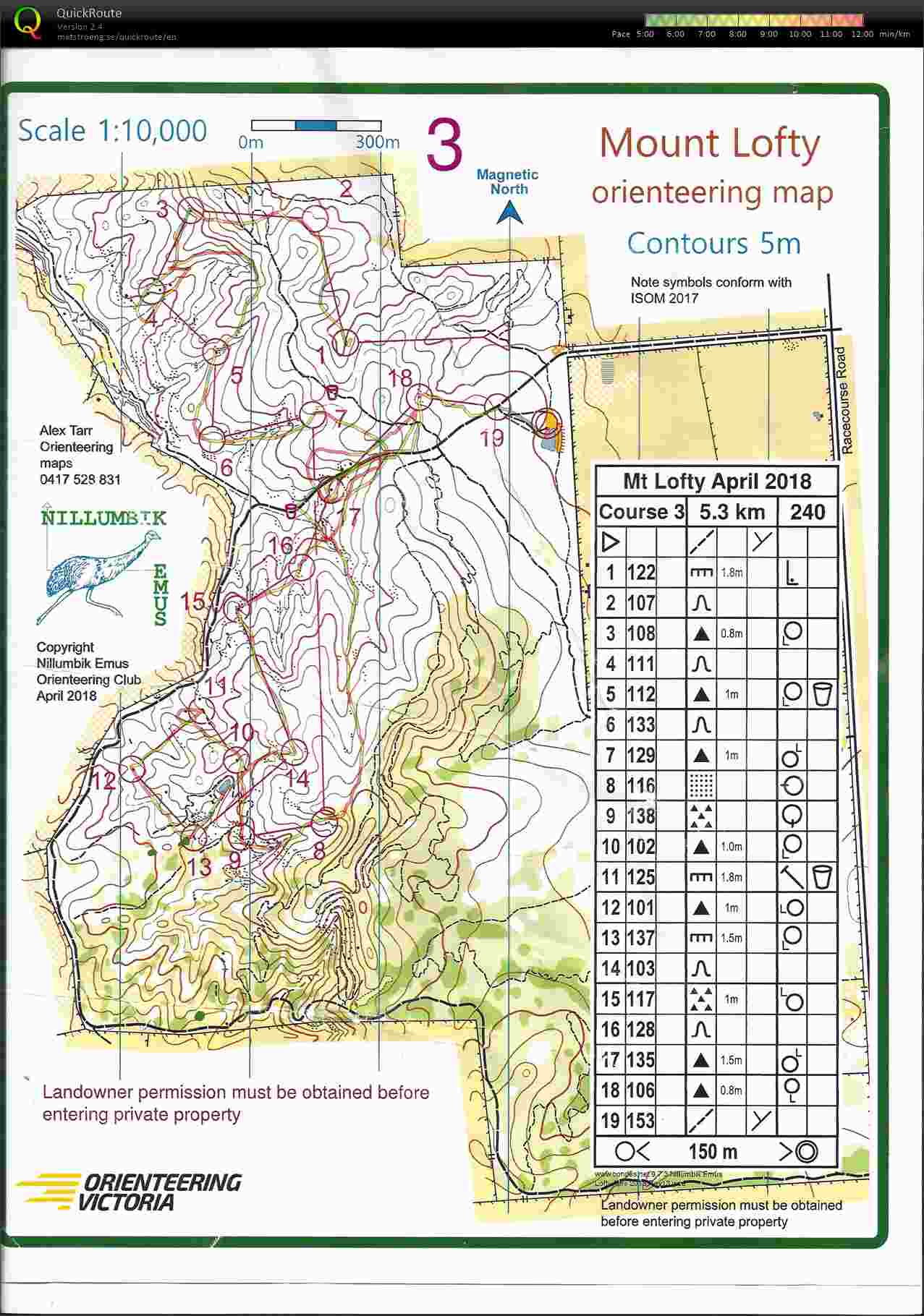
Orienteering was using a new map today in the forest near Redesdale. Similar terrain to the Kimbolton forest, with scattered rock features. My navigation performance was woeful. I was very confused on a couple of legs; found myself doing 180 degrees errors twice.
Saturday Apr 14, 2018 #
orienteering 57:28 [3] 5.76 km (9:59 / km)
shoes: Salomons
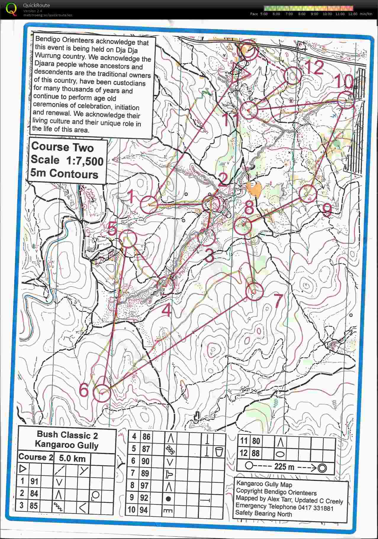
Local orienteering in the Kangaroo Gully area. It was pouring down just after we arrived and I doubted that I'd even start as we stood under the shelter holding it steady in the strong wind gusts. The rain did subside and I went out and ran my course. Not fast, but not many errors.
Step into Life group (Powerflex) 1:00:00 [2] 1.5 km (40:00 / km)
shoes: Brookes Glycerins
Powerflex stretch session by the lake, in the rain. Ilka came too, and the mood of the group lifted as the rain gradually got a bit heavier throughout the session until we all gave up our final relaxation session at the end when we were showered upon.
Thursday Apr 12, 2018 #
Step into Life group (Tone up) 1:00:00 [3]
Heavy weights session. Used 5kg and 6 kg weights...
Wednesday Apr 11, 2018 #
Step into Life group (Cardiomax) 1:00:00 [3] 5.0 km (12:00 / km)
shoes: Crimson brooks
Good session on a very warm evening at the oval. Lots of agility and endurance work... very sweaty.
Monday Apr 9, 2018 #
Bushwalk 6:30:00 [4] 19.0 km (20:32 / km) +800m 16:57 / km
From our campsite we headed out along Riggals spur, down to Lake Tali Karng. Did a bush bashing detour along the end of the spur to Echo Point in order to get a view of the lake below us. The view just showed that the lake was a long way down very steep slopes.
Back to the track and down...
The lake itself had a low water level and it appeared that there were no creeks running into it; both feed in creeks were dry. Despite this, the water was clear. It was a very isolated peaceful place; one which, if you had time, would be great to just soak up the atmosphere. Camping there these days is discouraged due to Aboriginal cultural preferences.
Next was the massive climb back up. We decided to climb up Gillio spur as it is the steeper one and our knees are getting old. So glad that we'd left our packs up top. The climb back to our packs took 1.5 hours, and we had lunch when we reached the packs. Then came another slogging climb up and over Spion Kopje, which had multiple 'false' summits, each of which was very rocky. I was exhausted already from the previous climb. Now we had packs on and were suffering from the old post lunch lethargy as well. From the top we had amazing views though, so the climb was rewarded. The walk back to the car took another couple of hours. Pretty tired! We drove down to find a car camping site along the Wellington River.