Training Log Archive: ndobbsIn the 30 days ending Sep 30, 2012:
| ||||||||||||||||||||||||||||||||||||||||||||||||||||||||||||||||||||||||||||||||||||||||||||
| « | » |
| » now | ||||||||||||||||||||||||||||||||||||||||||||||||||
| Sa | Su | Mo | Tu | We | Th | Fr | Sa | Su | Mo | Tu | We | Th | Fr | Sa | Su | Mo | Tu | We | Th | Fr | Sa | Su | Mo | Tu | We | Th | Fr | Sa | Su | ||||||||||||||||||||||||
Sunday Sep 30, 2012 #
trail run 2:00:00 [3] 16.0 km (7:30 / km) +400m 6:40 / km
This was the human equivalent of trying to drive across Nevada without enough gas.
The return was slow, walked the uphills. It was a sub-optimal choice of route anyway, should have run off-trail on rock and in the woods, for a shorter distance. Oh well. Pretty anyhow.
Swam in the beautiful Tenaya Lake afterwards.

And then attained my next major goal:

Will do some log-padding tomorrow (words, not training)!
Saturday Sep 29, 2012 #
Note
Checked out some Tufa on Mono Lake, interesting place. Time to go up Tioga Pass and see what all the fuss is about.
Tufa:

Route 120 towards Mono Lake is a lot of fun to drive? Why? Whee :)

trail run 1:32:00 [3]
Porcupine Flats to Indian Rock, mostly on trail, at sunset (before and after).
Yosemite is awesome in the un-American sense of the word.


Friday Sep 28, 2012 #
trail run 1:00:00 [3] 8.8 km (6:49 / km) +479m 5:22 / km

After leaving Bryce, drove to Cedar Creek, passing some cool lava flow stuff, then to Cedar City where I had some tasty Mormon food and filled up on petrol. Drove to the junction with 318/375, and followed 318 instead of 375... google maps was missing a wee junction. Did a big triangle, 100 miles extra.
After driving west down 6 until it hit 375, the road I was supposed to take to get to 6, I was pretty tired (it being midnight and all), so I stopped to rest. Before I could doze off, I heard someone calling at me. I opened the window, and a kiwi wearing but a towel asked me if I was the owner. I told him I was just resting... and asked, the owner of what?

Hot springs pool! Score.
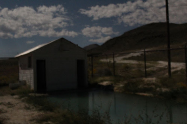
That revitalised me enough to drive the 47 miles left to Tonopah, where I filled the tank, and onwards to California where my second attempt to find a camping spot was rather successful.

Only problem was, it was 2 am and by 8 the tent was sweltering (after being freezing during the night).
Thursday Sep 27, 2012 #
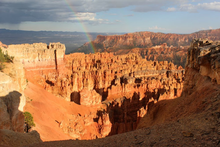
trail run 1:20:00 [3] 12.9 km (6:12 / km) +523m 5:09 / km
Fairyland Loop with a bit of the rim trail. ** Phenomenal **
First time running anything close to that long with a huge grin on my face the whole way. The most spectacular place I've been?
Left the camera in the car for that one.
After the run, I got food and drink, then took a couple of photos before the rain came. After the rain came rainbow, and stronger colours.
Then met a lad from Arkansas and walked the Queen's Bridge and Navajo (Wall St) loop.


Camped just outside BC, in Dixie Nat'l Forest. Soft pine needles, yay.
Wednesday Sep 26, 2012 #
trail run 30:00 [3]

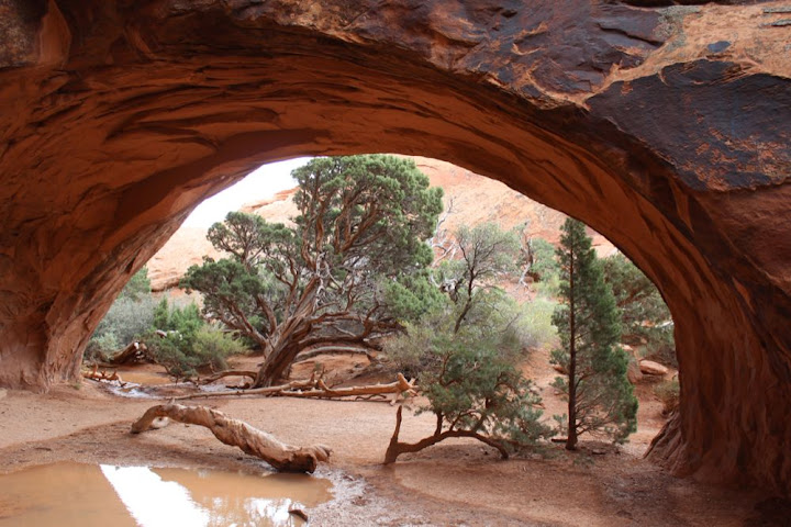
Drove from Arches across a large part of Utah, to within 70 miles of Bryce Canyon. Found a great camping spot off of 89, maybe Cottonwood Road?

Tuesday Sep 25, 2012 #
trail run 32:40 [3]
Colorado is pretty. But you have to be careful on the roads.
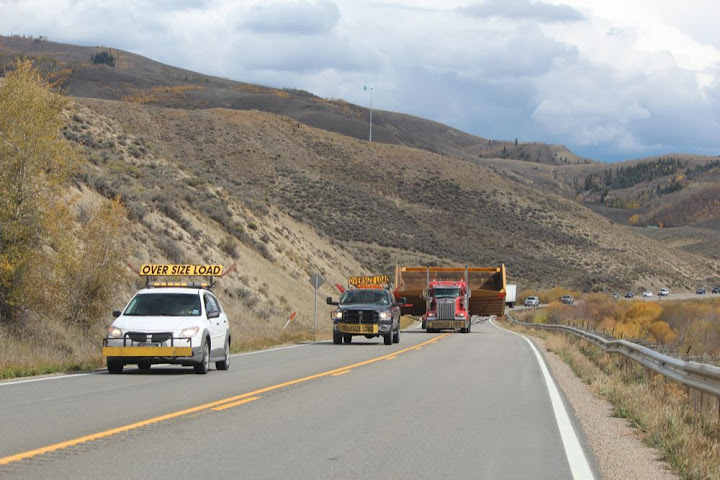
Crossed the continental divide! And said hi to the Colorado River, while it still exists -

Short trail run, partway up a hill (823m to the top, so wasn't going to be doing that today). Glenwood Springs is less pretty than some other bits, but still pretty.
Monday Sep 24, 2012 #
Note
I had legendary pizza last night. And my right knee is clicking a lot, I guess I should have been stretching quads and itbs more, must add them to the list.
orienteering 1:28:00 [3] *** 11.7 km (7:31 / km)
ahr:147 21c
A-meet course, very slow, painfully so at times. I guess yesterday and the altitude are getting to me. Right heel was irritated. I stopped at one point to stretch the hams and the calves, and that seemed to help a little.
Mostly fine up until right before 12, where there was a fabulous view from the rocky ridge. I didn't understand the map in the circle, presume I got the 'control'. Slow plodding after that, starting to suffer. Got a little confused coming towards 18, and at 19 I paused to take a gander at the steppin stone.
Zzz.
Sunday Sep 23, 2012 #
orienteering 40:00 [3] ***
8c
Only a couple of twinges from the left foot.
orienteering 1:35:00 [3] *** 12.2 km (7:47 / km)
19c
Course from Rocky Mountain Goat 2012, with swampfox shadowing me, sort of.
Cruising. A couple of swings to 1,2 and leaving 3 and 4, all to the left... pretty clean after that, only a bit of confusion in the circle at 12 (and at 17 where the circle wasn't centred). Wonderful terrain, reminded me of some Norte Alentajo Portugese stuff, lots of fun. I could imagine doing 5.5/km in this. Imagination is wonderful.
Saw a wee herd (8-10) of elk between 17 and 18, Yay!
Extended the left foot a couple of times, but wasn't running fast.
Saturday Sep 22, 2012 #
trail run 1:00:00 [3]
Arrived in Laramie, a month late.
Thursday Sep 20, 2012 #
Note
Saw the Mountain Heart band. Great occasionally, but didn't really pull it together.
Wednesday Sep 19, 2012 #
trail run 1:17:00 [3] 14.0 km (5:30 / km)
Some gps data here - http://www.attackpoint.org/viewlog.jsp/user_2942/p...
Fun. I have no idea where I'm headed tomorrow.
Tuesday Sep 18, 2012 #
orienteering 17:00 [3] ***
15c
Crossing the border was interesting. So you're coming to study in the US? No, that visa is expired, I'm coming as a tourist. How long? A month, maybe a little longer. And then you're returning to Ireland? No, I'm going to Finland. Why? Work. When do you start? November 19th. That's in two months, you said one month. Well, I might go to Brazil in the meantime. Why Brazil? My brother is moving there. Where are you staying in the US? I'll be travelling. Tonight, where are you staying tonight? With a friend in Toledo. What address? I don't know. How will you know where to go? I have a telephone number... ... ...
... funny thing is, they let me in, after a while.
I didn't quite have enough time to orienteer at Bishop Lake en (or off) route, sadly.
Cruised around Toledo in search of life that evening. It was a long struggle, but eventually we struck gold with a bar with live music and free root beer.
Sunday Sep 16, 2012 #
Note

Chopped a log too. Man can I swing an axe. I didn't shoot a duck, but I didn't try either, and I only lost one hook.
trail run 1:58 [5]
trail run 4:06 [3]
Legs were wobbly tired at the start, so started not too too hard... sped up at the end. Ugh.
Matched by Wil.
trail run 4:44 [3]
trail run 7:30 [3]
running 10:00 [3]
Saturday Sep 15, 2012 #
trail run 1:06:00 [3] 12.0 km (5:30 / km)
No satellites in this part of Canadia either.
Friday Sep 14, 2012 #
Note
Thursday Sep 13, 2012 #
Note
I guess it was the wet nighto that did it. After the nighto, that night I went to the car and found it beeping beeping beeping and saying battery low. It wouldn't turn off, or do anything, other than beep. Well, it would stop beeping while I held buttons down. So I left it to run out of energy. The next morning I charged it for a while and it worked for a while.
Hohum.
In other news, in Peekskill I used to listen to WNYC, the main local public radio station. After national news, there would be local news, people getting shot in front of Empire State Building, corruption investigations and whatnot. Vermont public radio, in its local news, had a story about a cemetery replacing lawnmowers with sheep and goats. Following the news, there was an hour on emergency plans, what to do if your town is cut off from the outside world for a week or two.
Note
running 3:41 [2]
orienteering 15:10 [3]
Anne planned a fun course, caught me out a couple of times, definitely rusty orienteering. Good stuff. Jeff probably ran a minute faster.
orienteering 5:12 [3]
Followed by a good lunch. Just had a cold shower, necessary after overheating in *canada*(?!), and feel much better now.
Heading westwards tomorrow.
orienteering 4:26 [3]
orienteering 2:50 [3]
orienteering 3:59 [3]
orienteering 5:40 [3]
orienteering 8:24 [3]

Tuesday Sep 11, 2012 #
forest run 1:05:00 [2]
Monday Sep 10, 2012 #
Note
And Carl and Mary-Jo are lovely, as is Ethan's bed.

More Shelburne pics.
Sunday Sep 9, 2012 #
orienteering 1:04:32 4.81 km (13:26 / km)
ahr:138 max:173
Ultra Long, except after 3 and a bit controls I bailed...
I did emerge uneaten despite wading through Shark Meadow for a brief eternity.
Garmin battery died, wandered in the complex area for a bit on the way home. I had hurt my left ankle a couple of times, and also fallen side-sloping...
Note
Saturday Sep 8, 2012 #
orienteering race 37:24 4.12 km (9:04 / km)
ahr:174 max:188
Not good, not awful. Well, if it were a big race I would call it awful, a couple of needleless mistakes. Maybe 2-3 minutes lost total.
Wonderful woods, of course.
orienteering 59:30 3.79 km (15:42 / km)
ahr:140 max:170
Worth doing once, a bit finicky though.
Note
Not logging the hour of canoe-o as exercise will perhaps make up for logging all the radioo.
orienteering race 1:27:09 8.94 km (9:45 / km)
ahr:136 max:206
1,3,2, uneventful, 4 I went offline, and cutting back I went through thick green swamp... figured I was miles behind. Plugged away, and came close to 4 in torrential downpour, attackpoint within 80m but managed not to climb as quickly as I ought, and went too far along... cut back and met the lead pack (except Giovanni, I guess) coming out... woo company!
5,6, uneventful... 7 looked epic, Giacomo and I took turns leading the first bit, I pushed on to the trail, then we all stopped a bit at the trail bend to do think about route choice... I went for contours, Ian went for the wall... mine was better to start with, following channels, but then I didn't do a good job contouring the second part and lost the lead, a bit behind for 9, leading again at 8 after the others hit the road too far to the right. I was considering the road/trail route to 10, but then saw a channel un-funnelling all the way to the road near the control, so took it. Got dragged a little right by a Giacomesque headlamp, and got stuck in thick veg/marsh when we met... he got to the road a bit ahead of me. Met at 10, he had more vim for the easy 11,12,finish.
Fun times, pity it wasn't harder though. (Although I was not thinking that en route to 4.)
Friday Sep 7, 2012 #
Note
Note
Wednesday Sep 5, 2012 #
trail run 30:00 [2]
Tuesday Sep 4, 2012 #
Note
Sunday Sep 2, 2012 #
trail run 33:00 [2]
Saturday Sep 1, 2012 #
Note
orienteering 1:41:46 6.89 km (14:46 / km)
ahr:141 max:173
Lots of veg, I can see why people complained, although I enjoyed it, even the nasty stuff that tore, scratched, bashed and bit me.
I found two streamers not at number 5. The map is a bit sketchy there, though, imho.
QR
The veg report:
Already a whole heap of green coming towards 1.
1 to 2 was fine
2 to 3 was nasty mountain laurel for an age, after which the blueberries were a breeze.
3 to 4 could be worse, friendly light green.
4 to 5 was rough for a while, despite trying to take a whiter route. The second half was light rocky blueberries, easy going, and then white.
5 to 6 to 7 to 8 nice.
to 9 was nice after the first 100m.
10... mostly nice, the way I went, but I got pushed a bit more off line than intended, didn't really know where I was for a bit.
10 to 11, started rough laurel, found a runnable line after that.
to 12, downhill in rocky ferns... oh the joy.
12 to path, more of the same
path the 13 to 14 to 15 to... much nicer.
4 was a crag, but seemed to be missing the hill.
Took quite a while to decide where 5 should be (I guessed correctly after collecting the second streamer - the flat area with the crag and knoll a little west were pretty obvious (relatively), and second streamer was (I think) between there and the mapped cliff. I wasn't a huge fan of the map there or further up the hill, where I went to relocate.
14 I switched off just coming into the control, and then forgot I was coming into the control, and there was no streamer, so I got confused... :)
At some point I need to learn to race again.
trail run 18:51 [3] 3.31 km (5:42 / km)
trail run 20:00 [3] 3.31 km (6:03 / km)