Training Log Archive: vmeyerIn the 1 days ending Feb 10, 2013:
| ||||||||||||||||||||||||||||||||||||||||
| « | » |
| » now | ||||
| Su |
Sunday Feb 10, 2013 #
Event: QOC Occoquan
10 AM
Orienteering race (Occowuan Red) 1:55:27 [3] *** 6.5 km (17:46 / km) +285233m 5 / km
shoes: Pink!! Ice Bugs
Garmin - 5.3 miles and 233 m climb
When I was driving into the park, I was reminded how beautiful the drive in after exiting the highway is. So scenic.
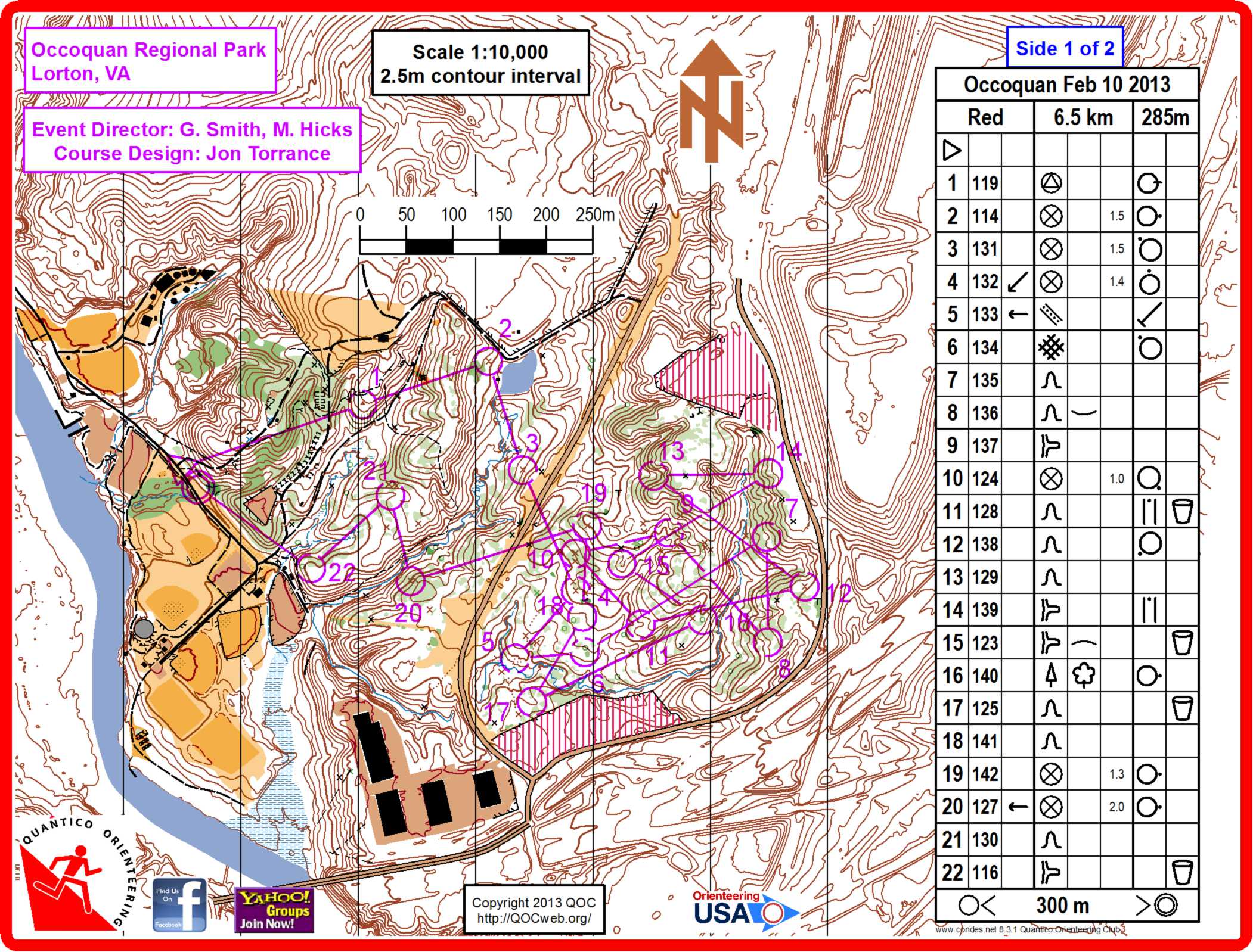
Went out early on Red on the updated map. There were 22 controls printed on a two sided map. Loved this because when I found a control, I just looked to see if it was any of mine and relocated from there. Of course, I found controls which weren't mine as well, but mostly they were somewhere on my course.
Start to 10 on one side, and 10-Finish on the other side.
Biggest error was navigating poorly out of 12, perhaps I was worn out from the 17th trip up and down the hill, but I let my concentration lapse, and was lost. Happily, I found 11, and then I navigated to 13 via 15.
Also lost time from 16 to 17 since the OOB area had this big ass building and retaining wall in it, and I was totally confused thinking it was the building on the other side of the road.
A beautiful day in the woods, and apart from some minor prickly stuff at the beginning, the woods were beautiful as well.
A second day in the Ice Bugs, and my feet held up pretty well. I need to adjust the ankle brace straps to be shorter but otherwise, my feet are better then they have been in a long time.
When I was driving into the park, I was reminded how beautiful the drive in after exiting the highway is. So scenic.
Went out early on Red on the updated map. There were 22 controls printed on a two sided map. Loved this because when I found a control, I just looked to see if it was any of mine and relocated from there. Of course, I found controls which weren't mine as well, but mostly they were somewhere on my course.
Start to 10 on one side, and 10-Finish on the other side.
Biggest error was navigating poorly out of 12, perhaps I was worn out from the 17th trip up and down the hill, but I let my concentration lapse, and was lost. Happily, I found 11, and then I navigated to 13 via 15.
Also lost time from 16 to 17 since the OOB area had this big ass building and retaining wall in it, and I was totally confused thinking it was the building on the other side of the road.
A beautiful day in the woods, and apart from some minor prickly stuff at the beginning, the woods were beautiful as well.
A second day in the Ice Bugs, and my feet held up pretty well. I need to adjust the ankle brace straps to be shorter but otherwise, my feet are better then they have been in a long time.