Training Log Archive: TheInvisibleLogIn the 7 days ending Sep 3, 2017:
| |||||||||||||||||||||||||||||||||||||||||||||||||||||
| « | » |
| » now | ||||||||||
| Mo | Tu | We | Th | Fr | Sa | Su | |||||||
Sunday Sep 3, 2017 #
Note
Jaded about events wins. Sleep in and blob around house rather than Glenluce. Off to Melbourne later for Fathers Day. Had my fill yesterday.
Saturday Sep 2, 2017 #
Walking warm up/down 20:00 [2] 1.95 km (10:15 / km) +70m 8:42 / km
shoes: Salamon Speed Cross 4 Black
Observation of the day. I think one can predict the names of the people who will collect controls on any given event. Its a cadre of about seven who will be doing it of they are at the event. It would be a good sign if the list was larger.
1 PM
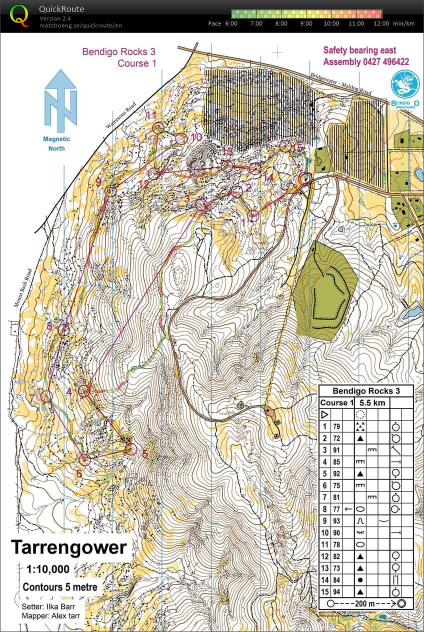
Real Orienteering race (Mt Tarrengower) 1:05:28 [3] **** 6.63 km (9:52 / km) +300m 8:03 / km
spiked:12/15c shoes: Salamon Speed Cross 4 Black
Bush event No. 43. Tarrengower.
Starting to feel a bit jaded about going to events, though when I get there, if the terrain is enjoyable I enjoy the event. Tarrengower is steep, but open with interesting granite. Enjoyed the courses Ilka set.
Three errors.
No: 2 Went towards the wrong cliff and slab, but corrected before reaching it. Lost maybe 30 seconds.
No. 5 went to the wrong boulder and had to reverse. Again maybe 30 seconds.
No 13. Didn't read the description and was lookingfor a control in a watercourse rather than on a boulder. Went right past control and didn't see it. Further down gully I reversed. Last a couple of minutes maybe.
Two more wobbles.
4 Possibly took the wrong way round the mountain. I ran along a track that was no longer there and was probably a little slow. Was also uncertain approaching the rock in the end of the long leg. I headed right to make certain I saw the cliff/rock feature, and it was where I thought it should be, so I was on the correct line after all and would have spiked it.
Tuesday Aug 29, 2017 #
10 AM
Walking 1:00:00 [1] 2.0 km (30:00 / km) +50m 26:40 / km
Another visit to what is clearly the bst unmapped orienteering terrain and arena in Victoria. Potentially the best orienteering terrain in Victoria. Black Range. So frustrating that the best has the most insurmountable obstacles.
Lets start with the biggest issue surrounding the 2019 Oceania Champs- parking. Its already prepared at Black Range.
The arena is already prepared with toilets, kitchen of sorts and spectating slopes.
Did you notice the granite surrounding the site in all directions?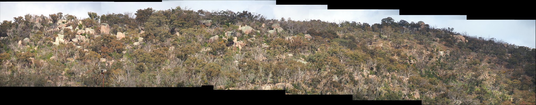
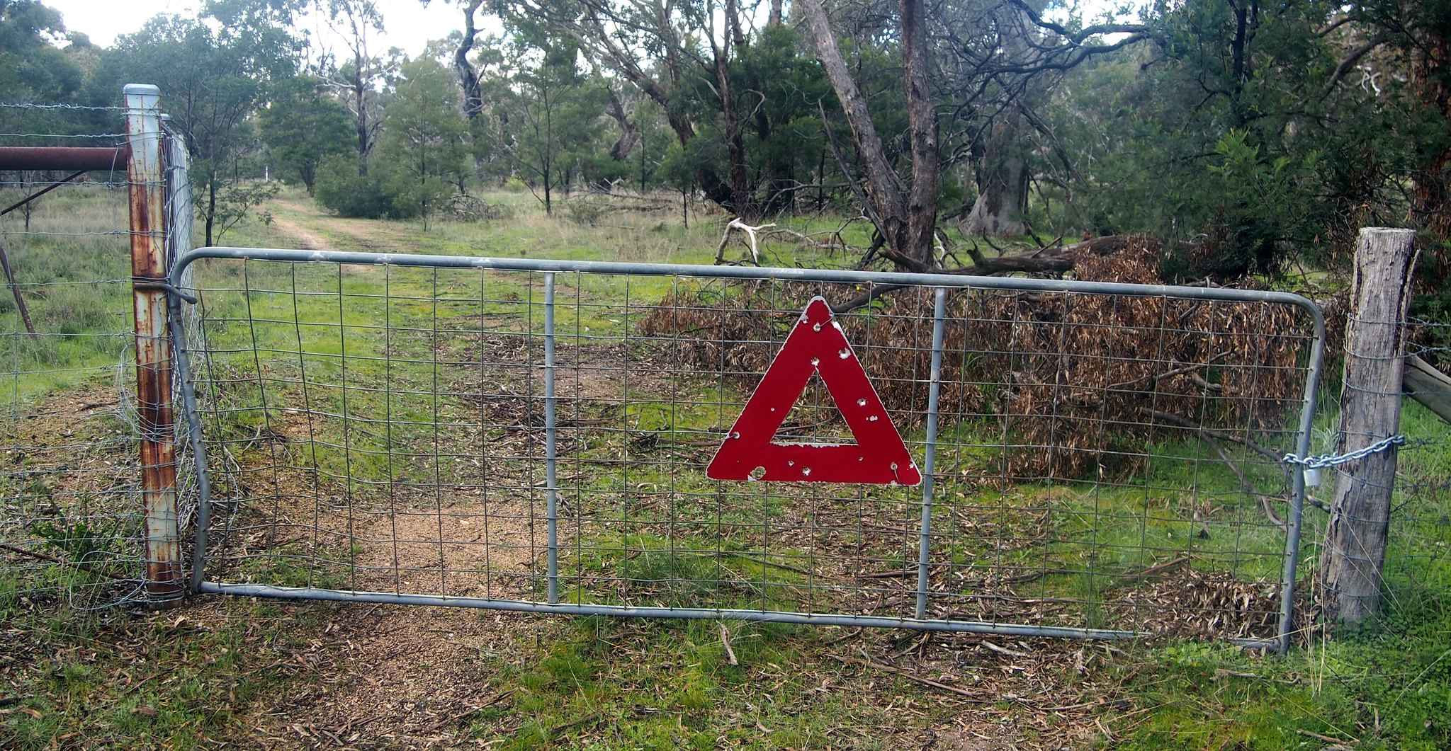
Someone even has put out the start triangle...
You can peruse the terrain through over 100 photos here: https://flic.kr/s/aHsm3JJm63
Lets start with the biggest issue surrounding the 2019 Oceania Champs- parking. Its already prepared at Black Range.
The arena is already prepared with toilets, kitchen of sorts and spectating slopes.
Did you notice the granite surrounding the site in all directions?
Someone even has put out the start triangle...
You can peruse the terrain through over 100 photos here: https://flic.kr/s/aHsm3JJm63
Monday Aug 28, 2017 #
Walking 3:00:00 [2] 8.0 km (22:30 / km) +300m 18:57 / km
Mt Rosea via the Devils Staircase on the way up and the normal track on the way down. It briefly snowed on us a couple of times. My hands were cold!!!
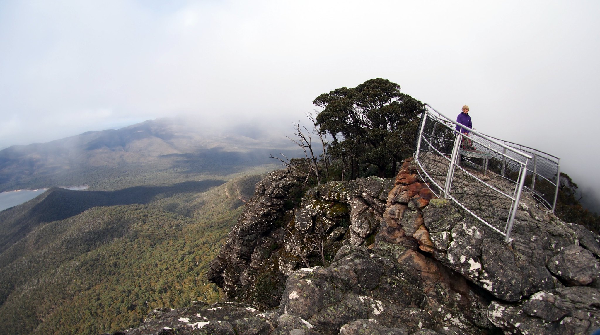
More photos here: https://flic.kr/s/aHsm7xt5xe
More photos here: https://flic.kr/s/aHsm7xt5xe