Training Log Archive: TheInvisibleLogIn the 7 days ending Apr 28, 2013:
| ||||||||||||||||||||||||||||||||||||||||||||||||||||||||||||||||||
| « | » |
| » now | ||||||||||
| Mo | Tu | We | Th | Fr | Sa | Su | |||||||
Sunday Apr 28, 2013 #
Note
(rest day)
Givingh the body a rest after the pack lugging.
Spent some time on the internet on the quest to shave every last gram off Jool's bushwalking gear. Aiming for 10kg for 2-3 day walks. That assumes I carry stove and tent.
Happy with-
MSR Whisperlite (no more Trangia and bulky meths).
Macpac Olympus tent.
Subsisting on cous cous (less fuel)
The super light (and expensive) water bag I purchased for this most recent trip.
Prolite or similar sleeping mat.
Looking for:
Merrell Avian mid light shoes. Can't get them in Bendigo.
Moderate temperature goose down high lofty bag. Not sure these get made any more. The assumption seems to be that if you are not aiming for sub zero conditions, you will accept micro-loft and other artificial fillers which are bulkier.
40 litre pack to force us to economise on space. (Currently 55 litres which is way too big and easy to fill with extra stuff). Have found a Dueter 38 litre. Maybe that will suffice.
Any suggestions welcome.
Saturday Apr 27, 2013 #
8 AM
Walking 4:00:00 [3] 12.0 km (20:00 / km) +200m 18:28 / km
Decided to take an easy day with a visit to the Nobs before walking out. We had no confidence that the rest of the planned circuit would not be overgrown.
Happy to be walking on a clear track!
The Nobs were well worth the detour.
Rest of the trip was a long downhill walk followed by a tour of the hound hunting zone called Jamison State Forest.
Happy to be walking on a clear track!
The Nobs were well worth the detour.
Rest of the trip was a long downhill walk followed by a tour of the hound hunting zone called Jamison State Forest.
Friday Apr 26, 2013 #
8 AM
Walking 8:00:00 [3] 8.0 km (1:00:00 / km) +900m 38:24 / km
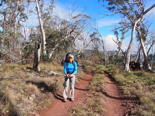
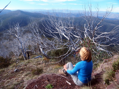
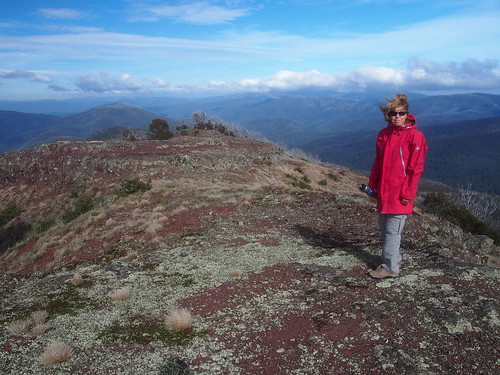
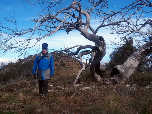
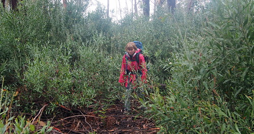
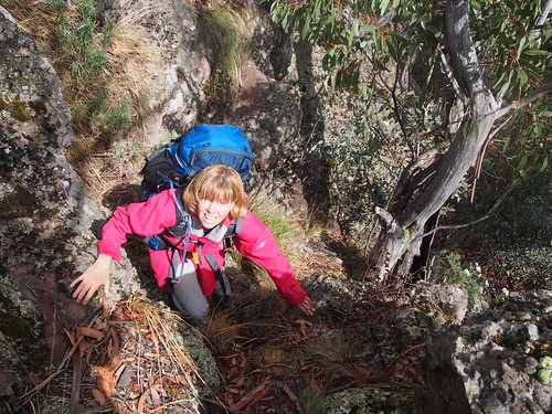
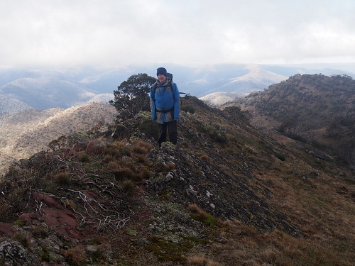
One big day. Mt McDonald from the Jamison River. It wasn't the climb that made it challenging, or not alone anyway. It was the the regrowth since the fires that had obliterated the track. What was described as a 2.5 to 3 hour trip before the fire became a five hour epic to the top. The good side of it was that the ascent was actually a test of navigation through scrub that blocked out the view. Once over 1400 metres the scenery emerged and its was impressive. But I think Julie was beyond appreciating by that stage. After a short time at the summit in cold winds, we traversed down the east ridge. Very scenic walk along a sharp ridge profile. But Julie found it a struggle after the climb.
This represents some of the more open country found on the ascent.
Further up it cleared as it became steeper.
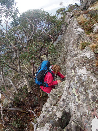
But scenery raised spirits at various points.
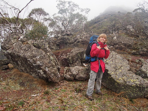
The top was windy and cool.
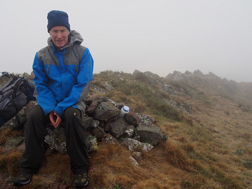
But there was still energy to send the summit picture to some friends at work.
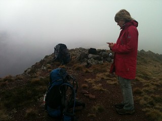
A hot cup of soup helped.
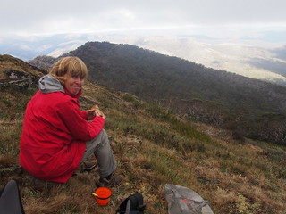
The ridge walk was impressive.
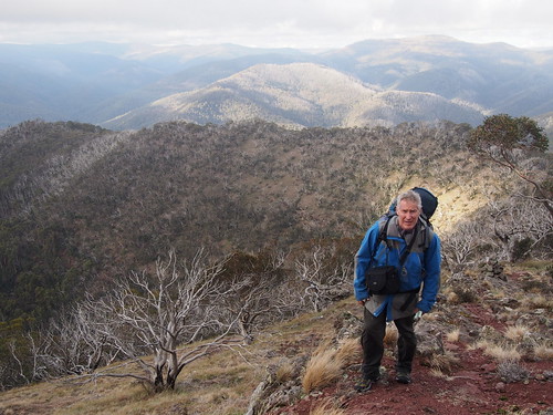
But the day was taking its toll.
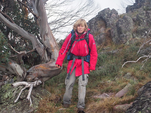
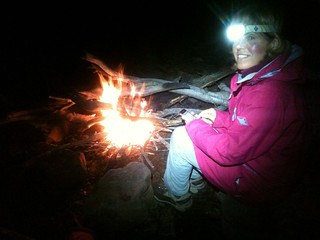
Happiest moments with a full stomach by a warm fire with no-one around.
This represents some of the more open country found on the ascent.
Further up it cleared as it became steeper.
But scenery raised spirits at various points.
The top was windy and cool.
But there was still energy to send the summit picture to some friends at work.
A hot cup of soup helped.
The ridge walk was impressive.
But the day was taking its toll.
Happiest moments with a full stomach by a warm fire with no-one around.
Thursday Apr 25, 2013 #
Note
Off for four days on the Alpine Walking Track.
Tuesday Apr 23, 2013 #
Note
On the OA website.
"The latter (MTBO map) has some 25 kilometres of purpose built single track which should figure prominently in route choice decisions."
This worries me.
"The latter (MTBO map) has some 25 kilometres of purpose built single track which should figure prominently in route choice decisions."
This worries me.
1 PM
MTB (Not O) 22:00 [2]
A lunch time run became a ride back from mechanic when the car developed a long weekend negating condition.
Monday Apr 22, 2013 #
5 PM
Running 36:00 [3] 5.8 km (6:12 / km) +55m 5:56 / km
shoes: Brookes 10
Along Bendigp Creek at a recovery pace, allowing even the female runners to pass me. Reached the goal, the quince tree, picked for tonights dinner (and a few more meals as well) and jogged back with a shopping bag of quinces and completed the Lamb, Quince and Honey Tagine. My best cooking effort in some time.