Training Log Archive: michalmyIn the 7 days ending Jul 15, 2017:
| ||||||||||||||||||||||||||||||||||||||||||||||||||||||||||||||||||||||||||||||||||||||||||||
| « | » |
| » now | ||||||||||
| Su | Mo | Tu | We | Th | Fr | Sa | |||||||
Saturday Jul 15, 2017 #
1 PM
Orienteering race (SL8 MD) 45:04 **** 4.38 km (10:18 / km) +193m 8:26 / km
ahr:159 max:177 spiked:5/12c rhr:103 slept:7.19 weight:65kg (sick) shoes: Nike Air Pegasus 30 (blue)
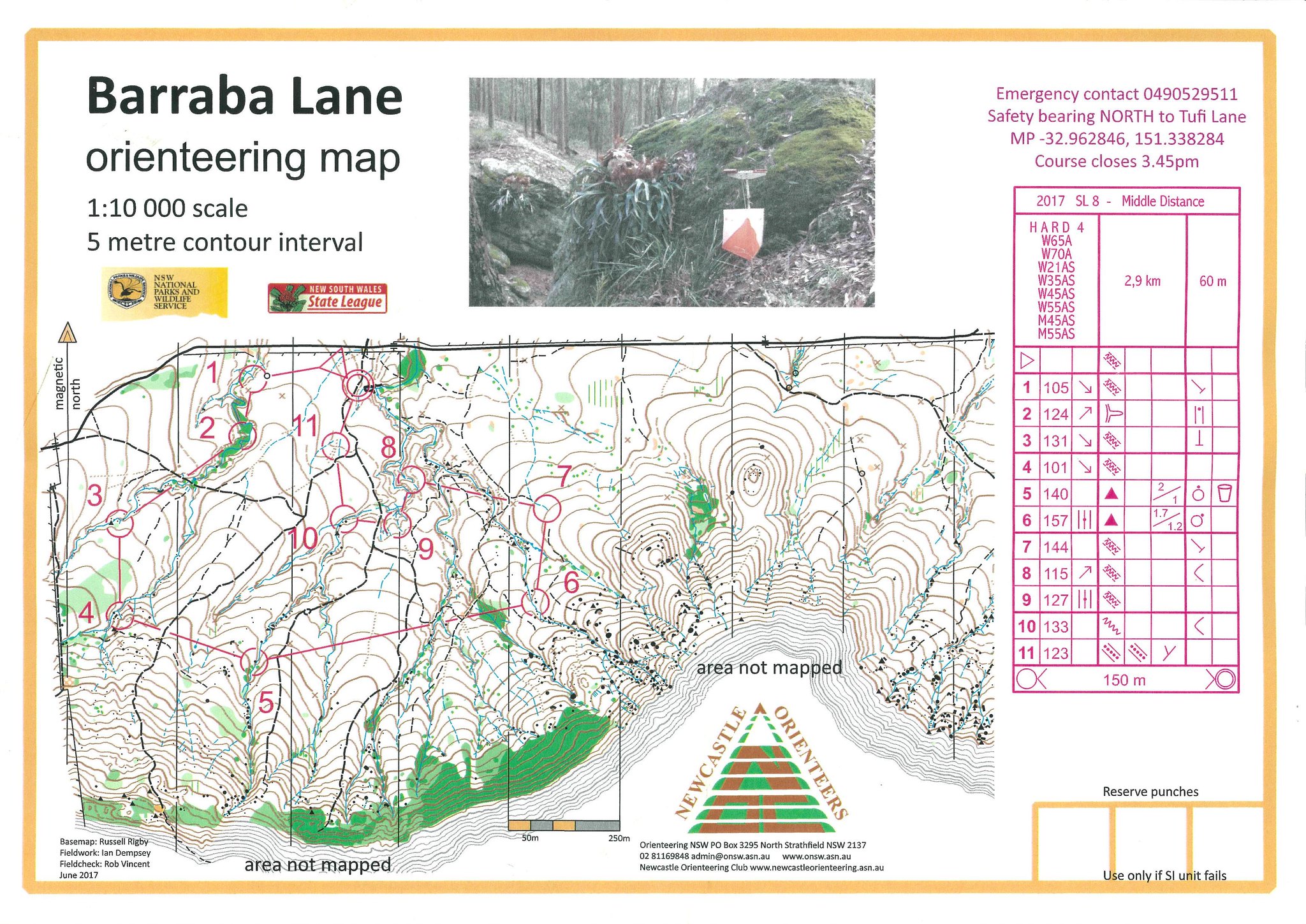
"Barraba Lane", Watagans National Park, Quorrobolong. Hard 4 / M55AS: 2.9km, +60m, 11c. 15th/35 in H4; 9th/12 in M55AS (14:41 behind Dale). Accumulated mistakes on just about on every control. Not really hampered by illness. #1: Ran parallel to fence but failed to see control at top of gully (lost 2' running down/across/up). #2: Difficult to see which side of creek control was placed in blurry blue/green detail, guessed wrong side (-2'). #3: Minor track to 50m of control above watercourse. #4: Straight to watercourse then up. #5: Minor track to 100m of control. #6: Fast tracks to opposite side of watercourse from boulder but ran 50m too far (-1'). #7: Bad bearing and missed start of shallow gully (-1'). #8: Tracks to spur but looked for control on wrong side (-3'). #9: Followed ridge to gully. #10: Compass from track junction. #11: Distracted by wrong control (-30"). Best legs: #3/#F (1st/35). Best pos: 11th/35 (#5-6). 15°C. TE 3.7.
Wednesday Jul 12, 2017 #
7 AM
Walk (commuting) 24:59 [1] 1.7 km (14:43 / km) +58m 12:34 / km
slept:6.3 weight:65kg (sick)
Home>Berowra Station. 9°C.
Tuesday Jul 11, 2017 #
1 PM
Bike (path) 45:38 17.24 km (22.7 kph) +116m
ahr:135 max:158 rhr:79 slept:5.55 weight:65kg shoes: Giant Roam XR1 (white)
Parramatta-Newington loop (ACW). Think I'm coming down with a cold. Throat feels a bit sore. Adam has been sick since returning from the Uni Games hockey tournament last week (losing 3rd/4th playoff on penalty strokes). 16°C. TE 3.0.
Monday Jul 10, 2017 #
1 PM
Bike long (path/road) 1:16:07 28.48 km (22.4 kph) +136m
ahr:135 max:150 rhr:92 slept:4.8 weight:65kg shoes: Giant Roam XR1 (white)
Parramatta-Wetherill Park loop (ACW). Did a short stretch of the T-Way from Wetherill Park (Prospect Hwy) towards Woodpark. Both the Sydneycycleways map and Google said it was a legitimate bike route. However when I got to Gipps Road I noticed some 'No Bikes' signs on the entries to the next section and the return for the bit I had just done. Bailed out at this point and went back to the regular bike path to Yennora. Need to clarify with someone official. 16°C. TE 3.0.
Sunday Jul 9, 2017 #
11 AM
Orienteering race (Highlands Forest Series) 55:40 **** 5.21 km (10:41 / km) +174m 9:09 / km
ahr:149 max:179 spiked:6/10c rhr:76 slept:6.45 weight:65kg shoes: Nike Air Pegasus 30 (blue)
"Beyond Rocklea", Belanglo State Forest. Short Hard: 3.6km, 9c. 5th/15 (6:55 behind Garry Stewart). A good mix of fast tracks and and tricky bush nav. #1: tracks to bend, compass to gully, a bit left (lost 30"). #2: tracks to junction, compass to boulder, way left, relocated from termite mound (-2:30); boulder didn't seem to be mapped in the right place. #3: drifted R off compass line into thick scrub, didn't go far enough to cliff line (-5'). #4: straight to gully and to top of ridge. #5: tracks. #6: tracks to TM, compass to double TM. #7: run to top of gully, compass to cliff but drifted too far left and low to wrong cliff line (-8'). #8: run to track, then compass from TM to gully. #9: tracks. #F: track. 9°C. TE 3.2.
