Discussion: Massanutten?
in: PG; PG > 2017-12-09
Dec 9, 2017 11:57 PM
#
Well, even if it wasn't spelled that way, that's the way I read it. At first I thought, well he's really pulling Phil's leg, but, no, just wishful thinking instead.
Dec 10, 2017 1:08 AM
#
false summit
Maybe. It's easy to be fooled. But I stood on top of that knoll and it certainly seemed to me to be the high point.
I guess now I have to go back with my crampons. But there are so many other peaks to climb, just in Hampshire County. Some of the next ones I'm thinking of doing will be a bit more challenging for you to match on your bike :-)
But good for you to get up the leaf covered steeper sections of the Mt Warner trail. (Even though it is about the least rocky or rooty trail in all of Western Mass.)
Dec 10, 2017 3:21 AM
#
I'm familiar with Massanutten. It's the ridge adjacent to James Madison University, where Stephen Koehler is attending college.
Dec 10, 2017 1:55 PM
#
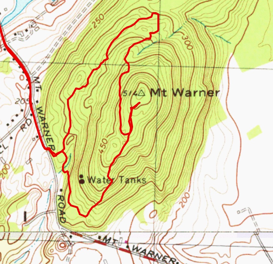
PG:
In case there was any doubt... (the red line stops at Phil's dot knoll) --
Dec 10, 2017 7:47 PM
#
Peter, surely you know how unreliable those old USGS maps are. It doesn't show the dot knoll or the surrounding rise in the terrain. You need to be sure to put your track on the most recent map.
Dec 10, 2017 8:18 PM
#
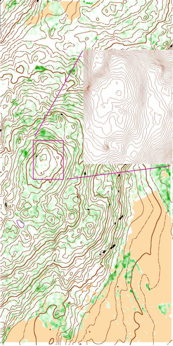
PG:
Nice, you got it up to 515', well done!
But I think I'll raise you to 517. :-)

But I think I'll raise you to 517. :-)
Dec 17, 2017 9:40 PM
#
PG:
Very nice! Philosopher's Peak is certainly distinct, just not quite high enough.
I'm guessing the contour interval for the main map is 5 meters, but for the inset is 0.5 meters?
I'm guessing the contour interval for the main map is 5 meters, but for the inset is 0.5 meters?
Dec 18, 2017 7:10 AM
#
gps track overlay
https://map.routegadget.net/?apsessions=5780487&ma...
https://map.routegadget.net/?apsessions=5780487&ma...
This discussion thread is closed.