Discussion: Map junkies: 1940s aerials explain 2017 features
in: Orienteering; General
Nov 28, 2017 2:18 PM
#
We had an event at a new-to-us park. Many courses crisscrossed long, low rock piles in white woods. One of our savvy members found the 1940s aerials and checked them, and sure enough the rock lines were field boundaries 80 years ago.
1940 (with the control locations):

which now looks like
2015:

Aerials, if you are curious, here, use the "More" in the upper rightish area to check them out. If you toggle through the years, you can see the woods take over. (Crooked Lake northeast of 75 & 15)
1940 (with the control locations):
which now looks like
2015:
Aerials, if you are curious, here, use the "More" in the upper rightish area to check them out. If you toggle through the years, you can see the woods take over. (Crooked Lake northeast of 75 & 15)
Nov 28, 2017 5:02 PM
#
Pennsylvania has full sets of state aerial photos online from three eras (1937-42, 1957-62, 1967-72) which I often reference. Sometimes I just like to see what my favorite places looked like long ago, but if I find ruins in the woods or something I do often like to check and see what was there.
Nov 30, 2017 8:59 AM
#
Think of the process to make those stone walls. The walls are not there just for boundary or decoration purposes. The pioneers wanting to grow crops in those fields had to get ploughs through the ground and to get the ploughs through the ground they had to move the rocks and boulder out of the way. Often they hitched up a wide slightly curved sheet of metal to their horse or cattle, rolled the rocks on to the metal and hauled them to the sideline. Apparently the device was called a stone boat.
In some areas each year the frost action would bring a new crop of stones to the surface. (See a Swedish movie from the 1970s called 'The Emigrants')
I see those fence lines in places like the Gatineau Park and Ward Pound Ridge and marvel at the effort that went on to cultivating those lands only to see the forests reclaim what was theirs. It is the Mayan Peninsula in miniature!
Nov 30, 2017 12:32 PM
#
In this case, the park did an amazing job replanting so we got basically white woods on those slopes. Usually whatever was a field turns into impassable brambles.
Nov 30, 2017 3:37 PM
#
Back in the day when I looked at USGS for contour data, I noticed the the older USGS maps had better contour detail. And, the reason for that was that there were much less woods on the old aerial photos that they worked from. Of course, other areas may be different but here in Vermont, the land was mostly cleared around the Civil War time (1860's) and has been reforesting itself ever since.
Nov 30, 2017 6:47 PM
#
Not that there was much photogrammetry going on before cameras and airplanes were invented, of course...
Nov 30, 2017 11:59 PM
#
Forest cover might explain some situations, but I remember seeing some older USGS's (New England?) mentioning survey by plane table method.
These seemed to have surprisingly better (more detailed) contours than the "newer" photgrammetry-based USGS's.
For more info, see
https://en.wikipedia.org/wiki/Plane_table
These seemed to have surprisingly better (more detailed) contours than the "newer" photgrammetry-based USGS's.
For more info, see
https://en.wikipedia.org/wiki/Plane_table
Dec 1, 2017 12:51 AM
#
PG:
Here's a bit about a local topo (western MA), older version compared to the more recent digital one. Note that the reason the older version is black and white is I was just carrying a copy to save wear and tear on the original.
Also here is what's printed lower left corner of the older version. Survey by plane table method at a time when the farms in the hills around here had almost all grown up to be forests --
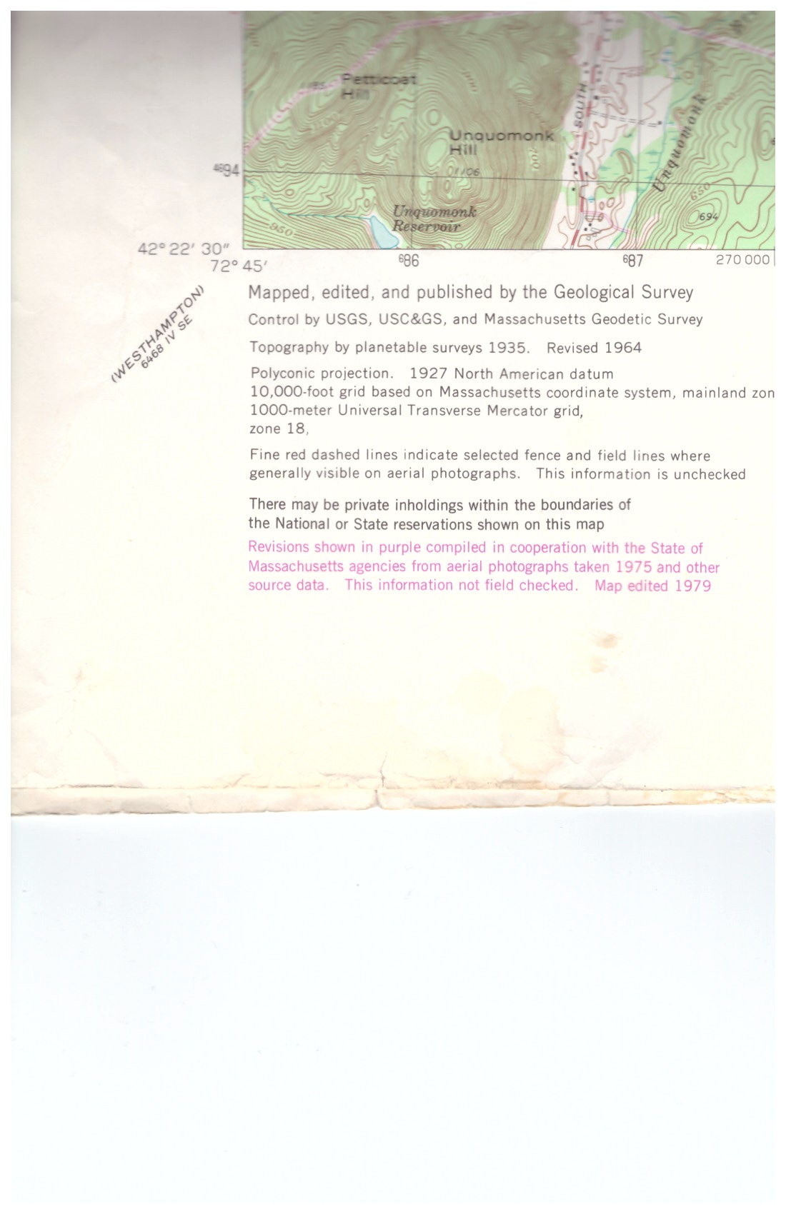
Also here is what's printed lower left corner of the older version. Survey by plane table method at a time when the farms in the hills around here had almost all grown up to be forests --
Dec 1, 2017 4:20 AM
#
rm:
I actually found that a USGS map in Weston, Massachusetts got way better with newer technology. I had mapped a small area in the northwest corner of the town. The only things accurate in the USGS basemap in that forest were trail junctions. (The trails between were way off, and all the contours were highly fictitious.) Almost white paper mapping, making for very time consuming field checking. Forward several years, and a new USGS came out, showing all the contours that I had so laboriously developed from scrtach on the O map. Since I highly doubt that USGS knew about my O map, much less used it, the new tech clearly improved substantially.
Dec 1, 2017 8:10 AM
#
@JimBaker: There is absolutely no doubt that modern LiDAR scanning has allowed us at least an order of magnitude improvement in useful base map detail, but I still suspect that if you take the LAZ files for that Weston area and try a number of iterations of LAStools' lasground_new program to detect more ground points, you will be able to come up with even more detail in the most densely forested ravines.
Dec 1, 2017 5:02 PM
#
rm:
@Terje, the improved Weston USGS (government topo) predated LIDAR. It was simply improved automated stereoscopy, from what I could figure out from the info I found. The LIDAR basemap that I'm now using (out here in Colorado) is truly amazing...essentially perfect 5m contours and 2.5m form lines. It's merely a matter of removing unneeded bits of form line, and one or two miniscule tweaks to the shape of a contour or form line.
This discussion thread is closed.