Discussion: ISOM 1:15 vs non-ISOM maps
in: Orienteering; General
Apr 7, 2017 8:18 AM
#
There are posts in other threads and I will try to repost some of them here. For me it would be good to have a separete thread to follow only this issue - pros and cons. From the begiging of the ISOM 201X this was one of the most discussed topic.
What we have now is written in ISOM 2017.
"The base scale for an orienteering map is 1:15 000. Generalisation shall follow the requirements for the scale 1:15 000.The IOF competition rules regulate the use of map enlargements for IOF events. When a map is enlarged, all lines, symbols and screens shall be enlarged proportionally (for the map scale 1:10 000 this means to 150%). This also applies to the overprint symbols."
I was expecting this but I'm also dissapointed because they didn't leave any room for detail terrains and we are again on point 0.
Apr 7, 2017 8:30 AM
#
1. Request
IOF or MC please prepare images of enlarged 1:10 maps from old official IOF races and add 1:15 base map with the comment. Maybe also federations can produce such list for their national races.
2. Request
Can someone who is in camp 1:15 post a image of 1:10 and 1:15 of the same detailed terrain. I can't because in Slovenia we have very few terrains where 1:15 maps exist.
3. Request
Can someone who is in camp 1:10 post a image of 1:10 and explain what is the reason to not use genaralisation requirements for scale 1:15.
Apr 7, 2017 10:49 AM
#
Do you mean 1:10 and 1:15 via enlargement or by separate mapping at different scales? I doubt there are many maps mapped at the two different scales. My observation is that in detailed terrain an experienced mapper maps to the scale they can get away with. It might be advertised as 15k but the detail will be such that an enlargement at 1:10 may still be hard to read.
An example that you might be seeking would be the French WOC map that had a somewhat controversial remap.
What I would find enlightening is a logical process that can be used to explore what the best scale is for a terrain. Its a compromise between a number of constraints-
* What the competitor sees in the terrain that they expect to see on a map
* The speed of the terrain and the size of map in the orienteers hand
* The limits of visual acuity.
Apr 7, 2017 10:56 AM
#
Your question assumes that there even *is* a best scale for a terrain. I think plenty of areas can be used for a variety of different purposes at a variety of different scales.
Apr 7, 2017 11:08 AM
#
@Do you mean -> Separate mapping at different scales 1:10 and 1:15 or additional objects on 1:10 respecting minimum spacings between symbols.
@that there even *is* a best scale for a terrain -> I would say... more appropriate. We are talking about terrains, scale and requirements for detailed terrains where the final map can be used also for IOF orienteering race.
@that there even *is* a best scale for a terrain -> I would say... more appropriate. We are talking about terrains, scale and requirements for detailed terrains where the final map can be used also for IOF orienteering race.
Apr 7, 2017 11:23 AM
#
@TheInvisibleLog:
Following the rules there should be also official 1:15 map for all IOF middle distance races (WOC, WC, WG, WRE,...) at 1:10. It is just an enlargement out of 1:15. Right?
Following the rules there should be also official 1:15 map for all IOF middle distance races (WOC, WC, WG, WRE,...) at 1:10. It is just an enlargement out of 1:15. Right?
Apr 7, 2017 12:11 PM
#
How do you define if a map is mapped at 1:15,000? I know of maps "mapped" at that scale that are never actually printed at that scale, but at 10 and 7.5. It might have been mapped at 1:15 but its not useable at 1:15. It comes back to the compromises I mentioned earlier. I don't accept that this is just a case of a lack of generalisation. It only happens on certain terrains.
Apr 7, 2017 12:22 PM
#
I assume. The best solution would be a rule that at each IOF event where 1:10 map is used the organizer should show/print also 1:15 map after the race.
Apr 7, 2017 12:53 PM
#
I also don't understand the logic:
"It might have been mapped at 1:15 but its not useable at 1:15."
For me this is waste of time and money when it comes to mapping of detail terrains. Do you really have such an example?
"It might have been mapped at 1:15 but its not useable at 1:15."
For me this is waste of time and money when it comes to mapping of detail terrains. Do you really have such an example?
Apr 7, 2017 1:37 PM
#
ISSOM and ISOM maps comparison may illustrate something. At last how details seem to end up small and hard to read no matter what the scale is.

Apr 7, 2017 3:23 PM
#
@Jagge
Are you saying that dimensions for same point symbols in ISSOM 1:5000 are relatively smaller than what is the norm in ISOM 1:15000?
Are you saying that dimensions for same point symbols in ISSOM 1:5000 are relatively smaller than what is the norm in ISOM 1:15000?
Apr 7, 2017 3:50 PM
#
rm:
I don't have the Flock Hill map handy, but it is an example of an area of terrain that cannot usefully be mapped at 1:15,000 except as a big black blob obstacle (but can be mapped at larger scales, and enjoyably orienteered on). (The surrounding terrain is much less detailed, and can be mapped at 1:15,000 I recall.) Can someone else post this map possibly? It'd illustrate a lot. It was a well received if novel area. Then the 1:15-only folks can explain why this terrain (and others like it) should never be mapped at 1:5,000 and never used for orienteering because it's too detailed for 1:15,000.
Apr 8, 2017 3:32 AM
#
rm:
Thanks for posting Flock Hill, to clarify the discussion. It had been since 2000 that I'd seen it.
Apr 8, 2017 8:14 AM
#
A few clips about scale from ISOM2017 - The beginnig thread
@TheInvisibleLog:
Scale. Its an issue that won't go away. Our event advisers are put in a very difficult situation by the popularity and value of a number of highly detailed maps. The detail isn't a result of the much touted "under-generalisation". Its the nature of the terrain.
@graeme:
"The base scale for an orienteering map is 1:15000." So it has been considered and addressed. Just not in the way we would have liked.
@JimBaker:
The IOF's map committee took it as part of its charter to decide what is and isn't orienteering terrain, and what is and isn't orienteering. Flock Hill as a whole could be mapped at 1:15,000, but the interesting limestone detail would just become one big black blob I think
@Jagge:
It might be much more fruitful to agree 1:15 000 and generalization is possible and fine, but also claiming there is new parallel world out there there for orienteering if we map same areas _also_ to a larger scale with an entirely different generalization level. And as a side effect it would also make it possible to map and use also those very rare areas that are genuinely not usable at 1:15 000 (and not only considered by some orienteers to be less fun if generalized all the way to 1:15000 scale).
@Jagge:
To me Flock Hill is a good example of area that could benefit from getting mapped in two scales with two entirely different generalization level.
Apr 8, 2017 8:28 AM
#
The last thought from Jagge is not recognized by MC/IOF. They simply ignored all the comments and feedbacks that they have got.
Mapping terrain at 1:15 is the only valid approach to use terrain for official IOF events. IOF has a mission to preserve 1:15 scale as the only valid base scale for forest orienteering. Period.
It is funny how old folks think they can instrument the future which not belong to them anymore.
Mapping terrain at 1:15 is the only valid approach to use terrain for official IOF events. IOF has a mission to preserve 1:15 scale as the only valid base scale for forest orienteering. Period.
It is funny how old folks think they can instrument the future which not belong to them anymore.
Apr 8, 2017 8:58 AM
#
rm:
What's odd is why they feel that this is necessary. Maps like Flock Hill have been around for decades; plentiful examples exist of terrain that benefits from other scales. Sprint is of course one example of this. There appears to be some unusual logic that if maps are done at 1:15,000, then the level of generalization will be appropriate (while simultaneously bemoaning all the 1:15,000 maps that are not).
Apr 8, 2017 1:00 PM
#
"We" don't need to follow "they". A very small proportion of events are IOF ones.
We need a coherent philosophy though. It could be something like this. I'll use letters to describe some different types of orienteering, as I think distance is a red herring.
For Type A orienteering in suitable natural terrain, we'll map at 1:15,000. Yes that will mean not having any controls in the rocks at Flock Hill. Bear with me, there is something coming for you. This scale and symbol sizes apply to those in the prime of life. The map is served up at larger scales with proportional enlargement for kids and 45yrs+ (learning and eyesight reasons).
For Type B orienteering in natural terrain we'll use the same symbol sizes at (provisionally) 1:10,000 This may suit many of the detailed terrains that we enjoy. Yes the mapping will be different. We map for A or we map for B orienteering. Possibly B courses might be shorter than A courses, but not necessarily. The map is served up at larger scales with proportional enlargement for kids and 45yrs+
There may be natural terrains in which we can do "maze-type orienteering", lets call this Type C. We'll use the same symbol sizes at (provisionally) 1:5000. The rocky bit of Flock Hill is an example - when I did some fieldwork there rocks under shoulder height were omitted. It has been generalised a lot, and maybe there's some fun in showing more detail. Maps are served up at larger scales with proportional enlargement for kids and 45yrs+
I would think that imaginative planners might offer composite courses especially where there are pockets of detailed terrain. You might A-navigate to an area of detail, and have a map change for a section of B or C type orienteering.
Now for urban orienteering: D, E and F type orienteering similar to the above. (ISSOM could be better focussing on the urban terrain rather than the distance. But maybe that will come when the "sprint" specification comes up for review.)
I'm thinking of Jim's reference to the Park World Tour. It didn't start as an IOF initiative. I expect their mapping will have had a consistency, but I bet it wasn't ISOM.
Apr 8, 2017 3:39 PM
#
Agree. To be more visible and consistent about what is our goal maybe "we" can produce a logo. For example "ISOM 10" or "ISOM 10 is fun" so any organizer could support the iniciative with a logo on a competition map. Any other idea?
Apr 8, 2017 6:39 PM
#
The question is how do you stop mappers/clubs mapping also normal terrains (only) at 1:10 000,1:7500 or 1:5000 using overmapping style - plenty of overly small details mapped or not using generalization methods (like preferring single boulders over boulder field, mapping all over 1m cliffs and 1m boulders or even smaller, instead of setting the limit higher like 1.7m, mapping yellow/green in detailed way instead of doing generalization) and claiming terrain is so detailed it needs to be mapped at this scale. That makes mapped areas smaller, more expensive per km2 and easily results as equally poorly legible map as today's 1:15000 maps. And also makes orienteering less technical and less challenging, because character of each feature is captured instead mapping features just as generic members of the class. And how do you stop athletes from expecting all terrains are mapped like that and blaming map if something is missing from fine but more generalized maps? Every terrain at least here in scandinavia has plenty of unmapped details that could be taken into maps if wanted, like that 1:5000 forest sprint map I posted could easily be filled in illegible way with form lines, small cliffs and boudlers that are there but are not needed for navigation really. Like Zerbembasqwibo wrote in an other ISOM thread these terrains are almost neverending complicated and full of details down to quantum or even smaller.
I believe these are the questions IOF MC haven't yet found answers and that's the root reason sticking to 1:15 000 base scale rule and not opening the worm can of allowing larger scale maps. That 1:15 000 base is simply tool for setting generalization at some level and limiting overmapping to a certain level. Figure out answer to these questions, then you have better chances to get some traction with these initiatives.
I believe these are the questions IOF MC haven't yet found answers and that's the root reason sticking to 1:15 000 base scale rule and not opening the worm can of allowing larger scale maps. That 1:15 000 base is simply tool for setting generalization at some level and limiting overmapping to a certain level. Figure out answer to these questions, then you have better chances to get some traction with these initiatives.
Apr 8, 2017 8:49 PM
#
pi:
Exactly, I always thought the main reason for MC's stubborn stance was to try to resist unnecessary overmapping of "regular" terrain... which is a legitimate concern.
I have seen, and still continue to see, plenty of maps with blatant overmapping, shrinking of symbol sizes, formlines between every contour etc etc. These difficult to read maps lead to a desire to move to a larger scale, which then "bad" mappers promptly fill with even more details. And on it goes.
For this reason the orienteering community needs to maintain the skill to generalize at an appropriate level also in the future.
Hower, to map unusually detailed terrain at a higher scale should absolutely not be disallowed by a mapping standard. It should state minimum symbol sizes and gaps, at whatever scale, so that we can read the maps.
Apr 9, 2017 12:13 AM
#
Agree. Many of our club's gully spur areas could easily be mapped at 1:20k. In fact, printing 15k at 20k would be fine for all except those with older eye sight (such as myself). With very few point features and the detail being only in the broad contours, it would take exceptional incompetence to manage to under generalise these areas. There are not many terrains that benefit from mapping at 1:10 rather than 15k. But these are the terrains that tend to get used for the more important events and thus have IOF advisers.
But, I have mapped a number of small detailed gold mining areas to ISSOM specs and these are quite popular for bush sprint events. As soon as I say ISSOM, no-one thinks about lack of generalisation. If I printed them at 1:10k the issue of under generalisation would be raised. Which tells me the real issue is mapping legibly. It would be more constructive to concentrate on legibility with scale as a secondary issue.
But, I have mapped a number of small detailed gold mining areas to ISSOM specs and these are quite popular for bush sprint events. As soon as I say ISSOM, no-one thinks about lack of generalisation. If I printed them at 1:10k the issue of under generalisation would be raised. Which tells me the real issue is mapping legibly. It would be more constructive to concentrate on legibility with scale as a secondary issue.
Apr 9, 2017 3:37 AM
#
rm:
to map unusually detailed terrain at a higher scale should absolutely not be disallowed by a mapping standard. It should state minimum symbol sizes and gaps, at whatever scale, so that we can read the maps.
Which tells me the real issue is mapping legibly. It would be more constructive to concentrate on legibility with scale as a secondary issue.
This and this, though I'll argue with the last six words, that I don't see how it's even a secondary issue, or an issue at all.
The arguments for conflating choice of scale and choice of generalization tend actually to argue for the opposite. By specifying (in ISOM 2017) generalization appropriate to 1:15,000, the MC effectively admits that there's no reason to choose a specific scale, since appropriate generalization can be achieved for a given scale. If there's a notion of appropriate generalization for one particular scale, then there's appropriate generalization for any other scale. If one lists maps that have under-generalization for 1:15,000, and then for 1:10,000, and then for 1:7500, and then one lists maps that are properly generalized for 1:15,000, and others for 1:10,000, etc., then one's just emphasizing that one can have proper generalization, or not, for any scale, and therefore that the issue of generalization is utterly independent of scale (orthogonal concerns). In fact, by incorrectly tying the issue to scale, one's taking the focus off the real issue, appropriate generalization for legibility. The logic appears to be that some maps have characteristic a (scale) and characteristic b (under-generalization). The latter characteristic is undesirable, so therefore the former is too. (But then, listing maps that have both undesirable under-generalization and the supposedly "desirable" scale, and reaching the same conclusion. It's hard to follow the logic and not have it dissolve into dust as one thinks about it.) Let's have orienteering at various scales and various levels of detail appropriate to the scale as we have successfully for decades, really far beyond even the 1:4000/1:5000 scales for ISSOM and the scale of 1:15,000. If there are issues with generalization and legibility, let's deal with that head-on, and not rather uselessly drag in other issues (scale) that only superficially have any relation. (And not have the MC unilaterally dictate something unrelated to the issue at hand against the wishes of the IOF Council and the various federations.)
In terms of Jagge's concern about mappers and clubs choosing to map an area at a larger scale in order to include more detail (but using appropriate generalization for legibility at that scale), I'm not sure why I would want to put myself between the mapper, the club and any willing event participants and holler "stop!". If an area can be usefully mapped with the generalization needed for 1:15,000, but also mapped with more detail at a suitable generalization for a larger scale, why doesn't that just offer more kinds of orienteering on the same terrain? As we age, some of us get slower. But, if our minds are intact, we may want to encounter the same number of features per minute as we did at a younger, faster age. (Not that lots of features is the only way to have interesting orienteering, but it's certainly one kind of interesting terrain.) I don't understand the value in objecting to this, and saying that one should map to a particular scale if one can. For a specific WOC/IOF discipline, sure. But for orienteering as a whole, variety in level of detail seems fine, with a map that's legible for that choice of detail. I'll go to the events that interest me, as others will. If a particular kind of map attracts no participants, the "problem" will take care of itself. If it attracts participants, then OK, it's serving somebody, and there's orienteering happening. My 2c.
Apr 9, 2017 4:01 AM
#
I think scale remains an issue, though secondary, because of the planned duration of the event and the need for a manageable size of map.
To me it seems some are advocating for a mapping standard suitable for long style events. If that was taken as an overt position, I would be quite accepting. The more we can do to differentiate long and middle styles the more interesting the sport would be to me. I hope the rules committee takes this direction- differentiating between long and middle rules with regard to scale. Something like- a long event shall be on a 1:15k map, mapped at that scale. A middle may be on terrain mapped at 10k or 15k, as long as the legibility is maintained. I am sure it could be expressed much better than that.
To me it seems some are advocating for a mapping standard suitable for long style events. If that was taken as an overt position, I would be quite accepting. The more we can do to differentiate long and middle styles the more interesting the sport would be to me. I hope the rules committee takes this direction- differentiating between long and middle rules with regard to scale. Something like- a long event shall be on a 1:15k map, mapped at that scale. A middle may be on terrain mapped at 10k or 15k, as long as the legibility is maintained. I am sure it could be expressed much better than that.
Apr 9, 2017 4:37 AM
#
rm:
Ok, I agree with that heartily, Log. Scale definitely has implications, and a scale (and matching generalization) definitely can be optimal for a given discipline. Which, of course, is why it's been suggested that the choice of scale be in the rules for a discipline, rather than the map spec, and it sounds like so many of us hope that this eventually happens as the IOF Council seems to have directed. ( I had thought you were saying that scale was a secondary factor in terms of being able to generalize appropriately, as in some scales being more suited to proper generalization than others, rather than it being a matter of matching generalization to scale, and choosing that pair optimally for the terrain and event format.)
Apr 9, 2017 6:45 AM
#
Number of features per minute? I find that quite irrelevant. See, athletes does not read everything, because it makes them too slow. We pick easily identifiable, distinct feature further away and aim for it without map contact to lesser details in between. We look head and spot the feature and the challenge is not getting distracted with those mapped or not mapped (depending on generalization level) features and not identifying those as the target feature we are aiming for. Now if map is not overmapped athlete can't use this or that lesser feature or character of a feature to make sure or relocate, athlete just must trust himself and be able to identify the feature and have self confidence to carry on. With overmapped maps athlete when unsure or after being unfocused can simply use additional features to make sure it is the right feature and carry on. With generalized map this is not possible because, the area around one can see is has too few details on map to be used to relocate just like that - even if both maps are generalized to it's scale this visible area around person in terrain remains the same. This is why orinteering is more interesting and challenging when map is generalized enough, it is more about skills, self confidence, staying focused and understanding map. With overly detailed map it is less challenging and loosing focus isn't that big deal.
1:15 000 scale generalization is proven to be pretty good to keep mappers from capturing character of features and instead mapping features just as generic representatives of it class (for example mapping a knoll just as a knoll, not as a banana or apple shaped knoll) making it essential for athlete to already know this is the knoll when he arrives instead of of being unsure and identifying it by using the character captured by mapper.
So, if all normal areas (huge amount of details but still possible to generalize to 1:15 000) gets mapped only with over mapping style it is big shame because oreinteering is becomes less challening and less fun, at least for those advanced elite ones have skills. For a beginner overmapped ones may feel interesting because of that number-of-featuers-per-minute for they are still lacking some of the basic skills needed in elite high speed orienteering.
The big fun and challenge is having huge amount of not mapped features around and being able at high speed to ignore most and identify the correct mapped ones, use compass when needed and having the self confidence to carry on even when everything does not look exactly as expected (for generalization). It sure is shame if this mostly disappears form orienteering and gets replaced by straight forward map detail reading. Especially as we age and we get slower we get plenty of time to read the character of those distinct features we aim for making it pretty uninteresting physical running race. With generalized maps the navigational challenge pretty much remains the same as we get old.
Apr 9, 2017 8:46 AM
#
I am sympathetic to the "number of features per minute" philosophy. Jagge, please understand that older (slower) orienteers do go past many unmapped features in between the mapped ones on a more detailed map, and need to display the discrimination and confidence that you speak of. But I haven't suggested providing this, we cannot afford to produce a lot of different maps of the same terrain.
I am thinking that the terrain characteristics usually lead to one scale; and the scale leads to the type of orienteering. For example where people are enjoying detailed terrains this might be 1:10,000, which leads to orienteering type B. The kids/oldies would get the same mapping at 1:6666 or so.
But I understand your concern that this could encourage a long-term shift towards larger and larger scales, and more and more detail, and a shift in the type of navigation. Well, this has been happening for 100 years. Is there any demand to return to 1:50,000 mapping? I meet this scale in rogaining, and I think that the control sites that may be used are limited to very bold features, and one needs to rely on compass and distance estimation rather than feature recognition.
While that doesn't find favour among the orienteering community, there are many rogaines, right up to world championships; and people who enjoy this style of navigation. Lets just call it Type X orienteering. And in the other direction there's OrientShow with 1:1000 (?) mapping. While there is good practice around legibility, I think that we should "let the market decide" which types of orienteering survive. And that means being open to variations.
(My thoughts are still evolving, thank you for encouraging this. I see there's a new message while I was writing this. I will try and understand all points of view and might even change my own:-))
Apr 9, 2017 12:27 PM
#
I find he "number of features per minute" argument initially compelling, but ultimately invalid because the "number of features within sight distance" doesn't change, as one gets older and slower.
Navigating by the features at your feet, rather than the features within sight distance, is simply stupid or at least non-competitive orienteering, and growing old is no excuse for that technique, nor a reason to promote that style of mapping. Enlarged map scales and eye equipment are reasonable remedies for aging. Putting more crap on the map is not.
Putting more details on the map is completely valid for physically non-competitive forms of orienteering (Trail O), but not for physically competitive orienteering, which is what ISOM and ISSOM are responsible for.
If it needs restating, the larger scales for Sprint O maps are justified by the density of large objects in the selected terrain, in combination with critically small passageways, not as a means to include more or smaller objects on the map.
Apr 9, 2017 11:06 PM
#
"larger scales for sprint maps are justified by the density of large objects in the selected terrain". So you are arguing that map scale can be flexible in sprint (1:5 or 1:4) because of the variation in terrain, but not in other forms of orienteering. Is there an underling assumption of international terrain homogeneity?
I don't think anyone advocating scale neutral mapping rules is doing so to achieve "more crap on the map". Its instructive to consider the fact that those countries arguing for scale neutrality were the countries with gold mining or limestone terrains. Glacial terrain countries seem to be happy with a fixed mapping scale. Herein lies the heart of the Australian submission- an international mapping standard needs to have international utility. Maybe there is something going on here other than mapper incompetence. As I said earlier, I think the nature of the terrain one maps tends to align with positions taken on this issue. I am happy to accept the majority opinion of mappers of glacial terrain for glacial terrain. I have no experience (or idea of) mapping such terrain. We don't have any down here.
I don't think anyone advocating scale neutral mapping rules is doing so to achieve "more crap on the map". Its instructive to consider the fact that those countries arguing for scale neutrality were the countries with gold mining or limestone terrains. Glacial terrain countries seem to be happy with a fixed mapping scale. Herein lies the heart of the Australian submission- an international mapping standard needs to have international utility. Maybe there is something going on here other than mapper incompetence. As I said earlier, I think the nature of the terrain one maps tends to align with positions taken on this issue. I am happy to accept the majority opinion of mappers of glacial terrain for glacial terrain. I have no experience (or idea of) mapping such terrain. We don't have any down here.
Apr 9, 2017 11:08 PM
#
rm:
What if forest terrain, like Flock Hill, had a high density of large objects with critically small passageways?
Apr 10, 2017 2:51 AM
#
"So you are arguing that map scale can be flexible in sprint (1:5 or 1:4) because of the variation in terrain, but not in other forms of orienteering."
Hardly, but the rationale for an intermediate base scale(s) must be guided by the same principle, the density of undeniably significant objects, and passageways. Prominent objects in the terrain must remain prominent on the map, and not be lost among insignificant detail.
"I don't think anyone advocating scale neutral mapping rules is doing so to achieve "more crap on the map"."
WOW. I think we have a huge reality gap here. Granted, no advocate would use this admittedly flippant phrase, but how many more overmapped examples are needed to prove the point?
I have a close friend who is one of the worst US offenders!
Yes, the mathematical gap between 1:15 and 1:5 seems big, but there just aren't many examples within the gap.
Flock Hill seems like a reasonable example, but that is only some pockets of detail, not a complete terrain. Some of the southern Euro (karst?) terrain, might qualify, as well as some special vegetation, manmade and sand dune terrains. However, most manmade and sand dune terrains have already been shown to be mappable by the 1:15 standard, or at least the common 1:10 strict enlargement of that standard.
I think the record clearly shows I am very willing to criticize MC, and map < 1.0m boulders in some circumstances ;-) , but I am very sympathetic to MC on this scale issue. True, I wish we would hear something besides silence from MC on this subject and MC"s stonewalling on the ISOM phrase about non-15k terrain being unsuitable, is completely indefensible.
Still, I'm willing to cut MC some slack here, because I think there is overwhelming evidence that overmapping is a much greater problem than addressing the small group of special terrains which truly justify scale revision, an issue which I think is extremely difficult issue to address, much less put into words and numbers.
Apr 10, 2017 4:37 AM
#
rm:
But has specifying 1:15,000 for decades led to ideal generalization? Really not. Let's address the issue, rather than a surrogate. I know that in the past I've mapped too much detail, as have others. I'm trying on my current map to have greater generalization, and hit that sweet spot. In America, few mappers have hit that sweet spot, notably Peter Gagarin with maps like Mount Tom, Quabbin Hill, and I believe Northfield Mount Herman. If clubs that hire mappers, and participants, value the simple clarity of maps like Mount Tom, then that's what we'll eventually get.
Apr 10, 2017 7:41 AM
#
Perfectly readable 1:15 000 map in a terrain type where everybody (including the mappers) said it was impossible to produce such a map:
http://martijan.cz/maps/show_map.php?user=martijan...
The old 1:10 000 version of the map:
http://www.gustavbergman.se/doma/show_map.php?user...
http://martijan.cz/maps/show_map.php?user=martijan...
The old 1:10 000 version of the map:
http://www.gustavbergman.se/doma/show_map.php?user...
Apr 10, 2017 8:01 AM
#
ISOM 2017 is very clear about Generalisation and legibility, Minimum dimensions and Minimum gaps. O.K., this is great, nobody argue about that. For me the issue is the level of generalization because ISOM tells only what supposed to be good and what is not good for complex terrain. ISOM doesn't tell nothing when overgeneralization can influence the fairness issue. In previous ISOM 2000 this issue was solved simply by saying that terrains which can not be mapped at 1:15 are not appropriate orienteering terrains. They were wrong. They neglected the most important part about orienteering sport and why people love orienteering. 1:10 maps are here mostly because of fairness issue and not because people want more details on the map. It is the same logic as in the past. We want fair orienteering races and not a bingo races on 1:15. The generalization vs fairness issue is important part and it is missing in ISOM.
Apr 10, 2017 8:02 AM
#
And then there are other ISOM points which also need answers:
--> 2.9.1 Map enlargements
The IOF competition rules regulate the use of map enlargements for IOF events. When a map is enlarged, all lines, symbols and screens shall be enlarged proportionally (for the map scale 1:10 000 this means to 150%). This also applies to the overprint symbols....Maps larger than A3 should be avoided.
--> 2.11.1 On the ground (real world) minimum dimensions
Minimum dimensions do not mean that all features larger than that need to be represented on the map. For complex terrain, it will often be necessary to operate with larger minimum dimensions to achieve a legible map.
--> 2.11.3 Graphical minimum dimensions
The graphical minimum dimensions apply to the base scale of 1:15 000. This means that for enlarged maps, thegraphical minimum dimensions will be proportionally larger (1.5 times larger for the 1:10 000 map scale). For instance for a cliff (symbol 202), the minimum length on the map is 0.6 mm. This means that for the map scale 1:10 000, the minimum length on the map for a cliff is 0.9 mm.
Sometimes I feel that MC is not able to connect points in the space. They are making sentences without checking if equation is valid in all forms. If mapper respect 1:15 rules, minimum dimension and gaps, map not larger than A3.... then there is no real difference between 1:15 and 1:10 for competitor except there are more features on the map or more point features instead of area symbols. Perfect for Middle distance and course setting! Also 1:10 map larger then A3 is very rare.
...but ISOM tells us that these symbol dimensions can be used for 1:15 only. You just can't use the same symbol dimensions for 1:10. NO EXPLANATION WHY!
Where is the logic?
I'll say that: ISOM is not international specification for orienteering maps because somebody or whole MC still want to control the sport development throught the map standard. Map standard should be a map standard and nothing more. "We" hoped for more but get nothing from this ISOM revision. If there is a big interest to restrict IOF events only to 1:15 maps and map enlargements (1:10) then this should be accepted by IOF council. This should never be a solely MC task and responsibility. This issue should be re-written in competition rules.
Apr 10, 2017 8:15 AM
#
Eric and Jim you both have valid points of view. I too can see what I consider ridiculous detail all over the place. But I think there's a continuum of feature density on the land. And a search, and triumphant advertising, for detailed terrain. This may be regarded as a "fashion", but I don't think it is transient.
The orienteers around here wouldn't be interested in Flock Hill were it not for the two rock mazes, without them its like an upturned pudding-basin. It doesn't even have trees. Central Europeans are searching out their karst. Australians are searching out their granite. New Zealanders (with less rock) are searching out their sand dunes.
I don't know if this analogy will work all round the world, but around here High St shopping is on the wane. Retail is going to malls and big-box retail centres. Many people (including me) are sad about the loss of vibrant shopping streets. But do you stop it? Of course not, the majority are voting with their feet. And the malls are themselves being threatened by online shopping.
Apr 10, 2017 8:29 AM
#
"bingo races on 1:15. The generalization vs fairness issue".
Sorry, but that's just nonsense. Of course it is bingo if you hide flags in a generalized area. It is not if flag is visible enough and location is correct. Or are you saying rogaining on 1:50 000 maps is all about pure luck?
You are giving impression most Slovenian terrains are not suitable to be mapped at 1:15 000. How about posting map examples here. One extreme, one average and one less detailed. So we could take a look, how much more difficult those look compared to for example the example Eriol posted above.
Apr 10, 2017 8:50 AM
#
"Sorry, but that's just nonsense. Of course it is bingo if you hide flags in a generalized area."
I'm not saying that. If the mapper need to generalize too much then course setter need to make compromises with the courses. Puting a flag on a boulder it is not possible because you have boulder field instead of a boulder. Yes, also at 1:25 map is somethimes a bingo race at our rogaining races. You have only 1 sinkhole instead of 5-6 sinkholes which are in reality. But in rogaining this is prefered option and everybody like it this way. But at orienteering race this is not acceptable if you want to have a fair race.
Of course we also have continental terrains but most of the people and organizers prefer detailed, complex terrain which are more fun to run. I'm not saying that all terrains can't be mapped at 1:15. I'm saying that ISOM is not helping us when it comes to complex terrain. I will collect map samples and post it here.
Apr 10, 2017 9:04 AM
#
"You have only 1 sinkhole instead of 5-6 sinkholes which are in reality."
That's not bingo if flag is not hidden at the bottom of that hole ~ meaning athlete can see the flag when he comes to the correct location using compass or what ever. If some athlete gets distracted for unmapped sinkholes that's just great at how it should be - they are lacking orienteering skills needed there and get penalty and those with the skills wins.
As I can see it's not much any different form the typical case of having ten 1.4m boulders and only one boulder mapped (the one mapper thought is slightly higher and about 1.5m) being mapped and flag placed by that boulder. Often happens with cliffs too. Entirely fair as long as you don't hide the flag and by that force athletes to check the bottom of every unmapped sinkhole/boulder/cliff they run by.
Apr 10, 2017 9:24 AM
#
Maps from Slovenia.
+ Link to federation website. It is not a complete list, samples.
http://www.orientacijska-zveza.si/karte/evidenca.h...
Here are few examples. Printed at 1:7500
EXTREME A
http://karte.rutka.net/show_map.php?user=bubi&map=...
EXTREME B
http://karte.rutka.net/show_map.php?user=bubi&map=...
EXTREME C
http://www.oocup.com/wp-content/uploads/2016/07/S5...
EXTREME D
http://karte.rutka.net/show_map.php?user=bubi&map=...
EXTREME E
http://karte.rutka.net/show_map.php?user=bubi&map=...
LESS DATAILED A
http://karte.rutka.net/show_map.php?user=bubi&map=...
LESS DATAILED B
http://karte.rutka.net/show_map.php?user=bubi&map=...
Apr 10, 2017 9:29 AM
#
One way to identify maps with overmapping and generalization possibilities is looking for features mapped multiple times. For example imagine hill side with a bump with a steep edge with no trees just bare rock visible on it and some 1m boulders next to it, boulders being less distinct that the bump.
It possibly can be mapped as a dot knoll. Or as a spur (bending existing contour line a little). Or as a small cliff. Maybe as a patch of bare rock or yellow.
Then we are moving from minimalism to overmapping side. Double mapping. Spur with a cliff. Dot knoll with bare rock. Adding form line instead of bending the existing one. cliff with yellow. And so on. Just individual character of the feature gets added with that additional ink.
the comes ripple mapping. Spur with cliff and some yellow. Spur with cliff and dot knoll.
Mapping the feature 4 times or more. Spur with a cliff and dot knoll on bare rock and a boulder field symbol.
Then you begin to see character of features characters being captured. Cliff is having a shape instead of being just straight line. dot knoll becomes form line knoll wit shape. yellow/bare rock is not just a round blob but has shape too. Boulders are mapped individually. Often such maps need to be printed out at 1:7500 scale to make them legible.
And all we have is just a bump by a hill.
Apr 10, 2017 9:54 AM
#
Jagge, you are too extreme with your generalization views. For my taste this generalization approach is not fair because it is hidding too many important features. Relocation is not very easy if you run in complex terrain. With only 1 boulder on the map (out of 10) is just unfair to me. You are talking about long events and 1:15 and I am talking about 1:10 and middle distances mostly. IOF is very clear what is prefered orientering technique for long and middle. So maps should follow this way. It is simply not right to force too much of compass technique (only) on middle distance competition. Yes, it is easier to prove this with less details on the map. The courses on complex terrain are best when the map is not too much generalized. What people really want and what elite can handle is cleary shown if you look Map/course of the year competition. And Yes, there are also unmapped features on our maps. You need to come to Slovenia and map one of the complex area.
Apr 10, 2017 10:23 AM
#
@gruver.
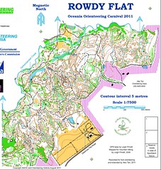
Yes, the detailed terrain gets publicised because it attracts entrants. But I don't think the granite over here is what we are talking about with regard to this issue. In fact, I think it can be limited to perhaps four maps, three of which are mining terrain. I have posted the story of one of these areas before in another discussion. A precis.
1. Mapped by a local at 1:5,000.
2. Suggested for Oceania Champs in 2011.
3. Due to complexity a test section was mapped at 1:15k and printed at 1:10k for a test. Mapper chosen was Australia's most experienced. Testers loved the terrain and gave go ahead. I think infatuation may have overcome sense given the rules.
4. IOF adviser and setter disagreed about scale to print the map. As far as I know the disagreement was not resolved and the setter went for 1:7.5k for most classes. This was certainly in contravention of the rules. The choices were to have a legible map or a rule compliant map.
No-one has ever suggested the mapping under-generalised within my hearing. If you have hired the most experienced mapper (experience back to WOC 1985) who was also an accredited IOF event adviser, then you can expect that the issue of generalisation will be in hand. I would go further snad say that the mapping was quite an achievement given the base map material (10 metre contours).
I think this is one of those rare areas that fitted the previous ISOM description of being "unsuitable for international orienteering" (given the state of the rules) in that it could not be mapped legibly at 1:15k in a manner that preserved the features of the terrain any orienteer would expect to see on the map. At least the previous rules recognised a few terrains have this characteristic, but dismissed them as "unsuitable". As this situation only refers to a handful of terrains it would hardly matter, except that we keep returning to these terrains for big events.
I realise none of this is going to change minds. I just find the situation interesting and in need of an impartial logical analysis of the issues. I suspect that both sides of the discussion will have valid concerns. Which implies a compromise is required that meets the concerns of both sides.
Apr 10, 2017 10:55 AM
#
Copying from ISOM2017 - The Beginning
@Terje Mathisen
To me there are two remaining key issues:
a) Scaling 1:15K maps to 1:10K by default, in order to make the maps readable at full competition speed even when printed on a CMYK Laser. I.e. this is in order to make all lines and symbols so much larger that currently available, reasonably affordable laser printers can faithfully reproduce sharp lines of the required thickness and Pantone color value. Since all relative dimensions stay exactly the same, this has (at least in theory!) nothing to do with mapping extremely complex terrain, like limestone/karst rock pillars.
b) Allowing scale changes _without_ symbol scaling in order to have room on the map for arbitrarily complex, critical features.
The second one is the real cliff in front of us, it corresponds very closely to what happened when we went from 1:25K to 1:20K and then to 1:15K, i.e. we kept more or less the same symbols, but increased the scale so that there was room for more of them.
When we are allowed to create (say) a 1:12500 map with 1:15K symbol sizes, and use that for WRE/championship races, then we will in fact be able to map more complicated terrain than today, while still allowing racers to read it at speed.
BTW, I have checked some old 1:20K maps, and some/many of them seems to have used 0.10 mm contour lines instead of the ISOM 2000 0.14 mm standard. This explains why those maps seem a lot whiter than new maps of the same area.
Apr 10, 2017 11:00 AM
#
MC should produce a discussion paper on this issue. I hope we don't ask too much.
Apr 10, 2017 11:54 AM
#
Generalization is difficult or impossible if size of those features has same size so we need to take them all or none. And also there isn't much other features making area useless if most of those are dropped. Or if those features to be generalized are impassable, unmapped impassable features or unmapped passages.
To me TheInvisibleLog:s example looks quite difficult to generalize. Man made terrains like that easily are. If you start leaving out some and keeping some it may not end well because there is not much anything else, no any bigger land form one could navigate with instead. I'd say that may well be one of those rare ares deserve exception (and other similar mining areas too).
Even if Eriol's exampel was managed to get mapped at 1:15 000 I still would like to say it is one of those rare areas too. There would be enough bigger land forms and bigger black objects to navigate with but the need for generalizing impassable features and passable gaps in makes some parts of that map easily unfair and unusable, the same way as the Flock Hill map (the Flock Hill could also be generalized about the this map was mapped). But the me none of the Slovenian maps are really like that, no. There is plenty of land forms of varying size, so it is possible to leave out smaller ones without making the area unusable. Heck, you could map that at 1:20 size and 10m contour interval and it make it would still be usable. It would actually be great fun to race there with maps generalized properly to 15 scale. That would reveal who knows how to navigate and who does not. And provide epic mistakes for relocation becoming more difficult.
But kofols don't take me wrong. As I wrote earlier here, I am not all against mapping these terrains with 10 scale. All I am trying to say it may not be fruitful to claim larger scales are absolutely needed for Slovenian maps and that none of those areas can't be mapped at1:15 scale. Just because anyone can see immediately it is not true. You must change your arguments. You need the larger scale because you get so much more out of your limited terrain assets when you do so. Everyone would agree with that argument right away. I'd say that's the argument this issue of going to larger scales will have to be based on. But how do we keep generalized maps for long still being produced and stop larger scales from being used for overmapping. And avoid orienteering becoming from becoming laughable game of running tiny loops around small area with map full of obsolete features no-one really needs for navigation Instead of a serious race with long legs over the hills.
Apr 10, 2017 12:07 PM
#
Here is one example of an area with increased value if mapped using larger scale.
http://sun-o.com/doma/show_map.php?user=sun-o.com&...
Perfectly possible to map and generalize to 1:15 scale but it would make it rather boring, boring to the point it might not be point mapping it at all. And we get much more out of the terrain if mapped to larger scale. Is it all wrong to take orienteering to areas like this? I'd say it is not wrong at all.
Apr 10, 2017 1:11 PM
#
@Eriol Its a nice example of how to make a legible map at 1:15,000.
BUT...
it has been done by, e.g. mapping 9m cliffs using the passible cliff symbol. So it's no more an ISOM-compliant map than the 1:10,000 version.
The argument about 1:10 vs 1:15 is the wrong one to be having. We should be starting from the questions "How big is a piece of paper" and "What can I see", the second question pertaining to the map and the ground. Then:
What can I bring into focus? -> symbol size and gaps, bigger for oldies.
What can't I see behind/get past? -> what needs to be on the map (person-sized features).
Size of area divided by A3 paper size -> scale of map.
and then if the map looks a bit blank, add small features down to 1m to give the planner something to work with.
Presumably there's a reason why the WOC relay and middle are on 1:10,000 blown-up maps. Does anyone know what it is?
Apr 10, 2017 4:15 PM
#
@graeme: I have shown examples of Scale = paper size previously, the last time I used it myself was for the Rauland long distance mountain race last year, where we settled on 1:20K in order to fit the planned courses within A3 size.
https://tmsw.no/qr/show_map.php?user=terjem&ma...
(The senior men had a much longer course!)
https://tmsw.no/qr/show_map.php?user=terjem&ma...
(The senior men had a much longer course!)
Apr 10, 2017 4:54 PM
#
rm:
a search, and triumphant advertising, for detailed terrain. This may be regarded as a "fashion", but I don't think it is transient.
[...] Central Europeans are searching out their karst. Australians are searching out their granite. New Zealanders (with less rock) are searching out their sand dunes.
Yes, I think that the increasingly detailed terrain and maps are a result of market forces and deliberate choices. And in the past I, and many others, were part of that, though I'm trying to back away from that. And it's OK, to me, to the degree that people want it; let them eat cake.
If there's a desire for the terrain, maps and navigation of old (like Mount Tom in western Massachusetts in northeastern America), then I'd suggest creating branded races that focus on this. If there are orienteers interested in it, then it will grow. Decades ago, Peter Gagarin started the Billygoat in order to have a race the length of WOC Men's Long (then Classic), because there were few such races in the American northeast at the time. It started with small numbers, and over the decades gathered a large following. Similarly, he and Fred Pilon created a trail running race, Seven Sisters, initially partly as an exercise for the national orienteering team which was training in the area, with the few runners in attendance chortling about the instruction to be careful if one didn't regularly train on slippery wet rock. Now it appears to be a major annual trail running race. This approach...create a small race with the desired characteristics, brand it so that those interested can find it in the future, and let it grow over time...is more effective (much more so, I think) than rules like ISOM's saying "all maps and races must be so". If there's an interest in what you're advocating, and you or someone offers it, then it'll grow organically, and what you're advocating will become (or remain) reality. Put in rules that just annoy and divide people, and I don't think you'll necessarily get that result. (The same, really, with map printing...if you feel that spot color produces the best results (and there's a strong argument for that), then working to make it more available will have more benefit than just making a rule about it, as we've seen.)
Apr 10, 2017 5:19 PM
#
The map is supposed to get good orienteers from A to B as quickly as possible. Sometimes that needs more detail, sometimes less.
Generalisation leads to higher speed in most terrain. It makes the map easier to read and highlights the bigger features.
Counterexamples to this include the largely open, south of France terrain with lots of passages between spiky, impenetrable vegetation, where micro-route choices halfway along a long leg become important. Without this detail (mappable at 1:5 or 1:7,5), finding good routes is a matter of luck.
Apr 10, 2017 6:18 PM
#
The map is supposed to get good orienteers from A to B as quickly as possible.
Some people believe the map is meant to create as many "A"s and "B"s as possible...
Having not been to the terrain, I'm intrigued by the Santa Pola map that Jagge posted. What is the advantage of the detailed mapping of the light green? Is it best to read all the details, or is it more a clever way to show a continuous range of bushy thickness?
Apr 10, 2017 9:39 PM
#
I've trained and raced on Santa Pola. The map is excellent. All the different shapes of bushes and clearings are discernible. If you concentrate, and have good vision, then it is possible to make things out at race pace. If you lose concentration, you're screwed.
I encourage mapping like this. I've been on similar maps in France, but where the rock detail was very non-ISOM, but also very well mapped.
I encourage mapping like this. I've been on similar maps in France, but where the rock detail was very non-ISOM, but also very well mapped.
Apr 10, 2017 11:11 PM
#
@Jagge: But how do we keep generalized maps for long still being produced and stop larger scales from being used for overmapping. And avoid orienteering becoming from becoming laughable game of running tiny loops around small area with map full of obsolete features no-one really needs for navigation Instead of a serious race with long legs over the hills.
I think Jim has nailed it. The popularity of various forms of orienteering will decide.
I read some history of orienteering mapping. There was a time when today's long distance, and 1:15K degree of generalisation, would have been regarded as "tiny loops... with map full of obsolete features".
All sport is a laughable game.
Apr 10, 2017 11:40 PM
#
Rogainers still think that way.
re: "But how do we keep generalized maps for long still being produced and stop larger scales from being used for overmapping."
I think there is ample room for compromise. Rules for long scale as at the moment. Rules for middle alllow a little flexibility if it can be argued the terrain is exceptional. My objection to the current situation remains - trying to exclude areas such as Rowdy Flat to maintain mapping standards on other terrains seems a very parochial approach. It suits countries with mostly glacial terrain so they don't experience any of the disbenefits of this approach.
Apr 10, 2017 11:50 PM
#
Well I bet that Rod, Gail and Neil are turning in their "graves" at special-purpose rogaine mapping, heh heh.
Apr 10, 2017 11:59 PM
#
I did one of those. Stitched together 5 O maps and presented at 1:20k scale (with inserts at 1:10 for mining ). Set the controls according to orienteering culture- find the feature and you will see the control. The reaction was interesting.
Orienteers loved ir.
Rogainers thought it was too easy because all the tracks were mapped.
Adventure racer thought it was unfair because you should see the control the moment you enter the circle.
Orienteers loved ir.
Rogainers thought it was too easy because all the tracks were mapped.
Adventure racer thought it was unfair because you should see the control the moment you enter the circle.
Apr 11, 2017 12:34 AM
#
Each to their own.
I think the contribution we can make is NOT to tell people what they will like. It is to define the types of navigation which make up our games. In the past orienteering has done this by race distance. I suggest that we do it by map scale, which is connected to feature density by the characteristics of the paper map and the human eye. And from feature density comes selection of areas and navigation type.
Those people who like a race over the hills will go there. Those people who like tiny loops round a small area, will choose that. We shouldn't call one more "serious" than the other.
Does this make sense? I'm evolving my thoughts as we go along.
Apr 11, 2017 1:34 AM
#
@Log - I did something similar, set a rogaine on an orienteering area (Lover's Ridge, if you were over here for the 2014 Nationals). Map was rogaine-spec, but the controls required more fine navigation than usual. Orienteers thought it was nice to have a stroll around an area they're normally racing around. Rogainers thought it was a horrible bit of orienteering creeping into their beloved bushwalk. :)
Apr 11, 2017 5:36 AM
#
"And we get much more out of the terrain if mapped to larger scale. Is it all wrong to take orienteering to areas like this? I'd say it is not wrong at all."
I got a feelling that most of the maps are non ISOM maps today. Is this a fault by IOF, federations, clubs or new terrains? We as a community don't even measure this on IOF level. I would be interesting to know more about how top O-countries organize their monitoring processes. A few questions...
1. How national events/maps are confirmed?
2. Is it neccesary to use ISOM compliant map for national event?
3. What type of base scales are allowed?
4. Reports / event / map
5. Exceptions in mapping rules ...
Apr 11, 2017 8:28 AM
#
@kofols
In the UK...
1. We have a mapping committee who look at maps for big events
2. ISOM compliance is not required, the organisers have to make a case to the MC for why they want a deviation.
3. Dont understand the question
4. No report. Nobody ever tries to learn from experience
5. Exceptions to rules as per 2.
Generally it works OK.
We had a few cases where areas were mapped to be legible at 1:10 not 1:15, then the next event we got a shrunken version at 1:15 which was what eventually forced me onto old-man classes. This year's British Champs may be an example - it was mapped at 1:10 for a WC classic race because it was "too detailed for 1:15" and I doubt if it has been generalised since.
http://www.mdoc.routegadget.co.uk/rg2/?act=map&id=...
Apr 11, 2017 9:07 AM
#
Thanks, yes the 3. question is really strange. I wanted to ask: What scale is allowed as a base map at national events, but you already gave me an answer. The interesting part for me is the fact that all (presumnbly MC, organizer and mapper) had a meeting to decide that the area is not legible at 1:15. This is what I miss at the IOF MC decisions. A report for all map deviations so we could learn and get better ISOM rules at the end.
Apr 11, 2017 11:13 AM
#
@kofols. I completely agree.
We got an exception for the Scottish Champs this year (sanddune area) to map using ISOM-sized symbols at 1:12500 and print at 1:10,000 (1:7500 for oldies).
The map will be legible if rather large, but it all seems a bit arbitrary. 1:12500 print would also be legible and more portable. We could have used 1:8333 so that the symbols on the oldie maps are the size they should be in ISOM201X. Or we could have mapped with ISOM symbols at 1:10,000 and given the oldies the correct symbol size at 1:6666, or undersized symbols at 1:7500.
I could go on, but the point is that by not including sensible scaling rules in ISOM201X, the IOF have created a dogs-breakfast of uncertainty.
Apr 11, 2017 11:48 PM
#
Orienteers loved it.
Rogainers thought it was too easy because all the tracks were mapped.
Adventure racer thought it was unfair because you should see the control the moment you enter the circle.
An orienteer, a rogainer and an adventure racer were meeting at a bar using an orienteering, rogaining and AR map respectively to find it. The orienteer was there on time. The rogainer had troubles because he thought the circle was centred on 'the spur' next to the black square on the map. The adventure racer was 12hrs late because the 1:100,000 map failed to show the detail.
Apr 12, 2017 1:11 AM
#
You were at the event? There were two pubs (bars) marked with a specialised refreshment symbol- a stylised frothing mug. I was unaware of anyone having difficulty finding them though, even the AR racer.
Apr 12, 2017 4:13 AM
#
So should the thread title be 1:15 vs 1:12.5 vs 1:10?
Oh dear lord, it's a mapping spec with 27.5" wheels.
Apr 12, 2017 6:28 AM
#
I haven't used the phrase, but I think there is a continuum of technically "non-ISOM". At one extreme is the modification of a single symbol size, or a colour that isn't quite right. The colour issue is in part print technology dependent. When kofols says many maps are "non-ISOM", I assume this is what he means. The more extreme form would be mapping to a scale such as 1:10k.
Apr 12, 2017 7:05 AM
#
ISOM has guidelines how to implement it to larger scales like 1:5000. So I'd say these 1:7500 maps are not non-ISOM maps.
For me the line lies in between auto generated Karttapullautin maps and manually improved versions of those. Former aren't ISOM maps, latter can usually be seen more or less as an attempt to make ISOM map.
"Non ISOM" may be used for "non IOF event compliant", meaning you need to ask permission for deviations to use it at IOF event. But even if you need to do it or will not get it your map usually still is ISOM map.
Apr 12, 2017 7:50 AM
#
With "non ISOM" I meant ISOM compliance which automatically mean that terrain mapped at 1:10 is not suitable for IOF event. Asking for map deviation and exception for WRE is possible but as we've seen in many cases most of them were rejected. In the past when there was a big interest to spread WREs MC also approved such cases. The problem went down also to national team because they were training on "non ISOM" maps and when they went to EYOC, JWOC most of them were not familliar with only valid generalization approach - a real ISOM. This is one side of the effect. And there were also non ISOM maps at the IOF events.
So should the thread title be "non ISOM map"?
So should the thread title be "non ISOM map"?
Apr 12, 2017 8:26 AM
#
As you said
@to map unusually detailed terrain at a higher scale should absolutely not be disallowed by a mapping standard.
+
@graeme
to map using ISOM-sized symbols at 1:12500
or at 1:10. It is a bad feeling when you know that the only chance to organize an event on a superb complex terrain is to produce a non ISOM map. But we don't want to break the ISOM rules. Why 1:15 base map only if we can respect all other ISOM rules? Not just enlargement of 1:15. Small problem if you ask me. MC is acting too much like a "mother". No need. Whoever is interesting to organize a long race on a legible 1:15 map will just do it. But you know.... on complex terrain this would be nearly impossible, so organizer must find other suitable terrain with less features. And over the years I got the feeling that with ISOM responsible people want to control possible venues of IOF events. At least to some degree. I believe that Slovenia and other similar countries are able to host an IOF event if there would be a possibiliy to use our best terrains at the appropriate scale that we believe it is necessary to have a fair race.
Non ISOM map = Big summer events only!
Apr 12, 2017 9:27 AM
#
By non-ISOM map, I mean that the mapper deliberately doesn't follow the ISOM specifications for symbol and gap size to make it legible at 1:15000. I think that's an unambiguous definition.
I don't include anything to do with errors, poor cartography, scale or printing.
Extreme examples might be...
ISOM-map - Offset printed at 1:4775 with symbols scaled by pi
non ISOM map - Laser printed at 1:15000 with symbols scaled by 90%
I never say "mapped at 1:10000". AFAIK, most mapping is done at 1:7500.
Apr 12, 2017 10:09 AM
#
pi:
See, here is where our opinions differ (as been discussed in circles on many many AP-threads).
I think the absolutely most important point is that we need maps that we can read (do we agree on that?). Therefore I think we should be allowed to only change the scale to adjust to various terrain types, not the size of the symbols and gaps on the printed paper.
In my opinion the ISOM-1:15 symbols and gaps are already too small. It's possible to make a completely compliant ISOM map that is still very hard to read at 1:15. I think the 50% enlargement is closer to where we need to be, i.e. ISOM-1:10 sizes, but perhaps there is some compromise in between.
So, I'm completely against making a 1:10 map with 1:15 size symbols. To me this is just moving unreadable maps one step down the ladder. Next you will ask for 1:15 size symbols on 1:7500 because it's "impossible to generalize at 1:10".
But I'm fully supporting making 1:7500 map with 1:10 symbols for example. Or perhaps 1:10 maps with 1:12500 symbols if that's the compromise.
Apr 12, 2017 11:01 AM
#
@pi
...we need maps that we can read..."
Agree.
"...not the size of the symbols and gaps on the printed paper."
I'm saying that if you use same size of the symbols and gaps at 1:15 and 1:10 you get the same effect on readability and legibilty of the map. What is the difference for the competitor if this approach would be valid? The point is that generalization on complex terrain is much harder to make a legible/fair map. The logic is simple and everyone can uderstand that more complex terrain need larger scale. That is why ISSOM was invented. To have a legible/fair map.
"In my opinion the ISOM-1:15 symbols and gaps are already too small."
Anyone has an opinion but the fact is that MC and IOF think that the symbol sizes are large enough and appropriate otherwise they would change the sizes. Are we agree about that?
"So, I'm completely against making a 1:10 map with 1:15 size symbols."
This statement is also what MC is saying. This debate tells me that symbol sizes are the most important asppect of the ISOM and scale issue comes after that. Using symbol sizes and gaps which are readable at different scales should be tested and clearly wirtten in ISOM. If minimum symbol sizes on paper are appropriate for one scale then they should be appropriate for all scales.
We just need to ackonwledge that terrains differ more than in the past and we need more flexible ISOM. Generalization should not be fixed to the scale but on complexity of the terrain.
Apr 12, 2017 11:20 AM
#
"...we need maps that we can read..."
@pi. What exactly to you mean by "we"?
There's a massive difference between an M21 standing still with a magnifier in good light, and an M65 running through a dark forest.
It would be also nice for maps to be accurate. So e.g. two trees (0.9mm) at minimum separation (0.15mm) must already be mapped 16 metres apart. Expanded by 50% and that would be 24 metres. Is that an acceptable level of distortion?
Apr 12, 2017 11:26 AM
#
rm:
Heck, there's a difference between an M21 running through dark forest and this M50 standing in daylight with a magnifier.
I keep saying, display maps on a mobile device and you can get any scale you want, any color scheme you want.
I keep saying, display maps on a mobile device and you can get any scale you want, any color scheme you want.
Apr 12, 2017 12:03 PM
#
"let the market decide which types of orienteering survive".
I'd think the market is on average middle aged orienteers, with best vision gone, some overweight and mediocre orienteering skills. A lot like me actually. We may prefer small areas mapped at 1:5000 and blown up for obvious reasons. And not mapping physically tough terrains because because slow walk there is boring. And no use mapping steep areas for poor fitness and bad knees. Is our point of view a valid reason for killing something elites may prefer - young elite orienteers racing in IOF events like world champs may see these things a bit differently. We old farts easily outnumber them.
I'd think the market is on average middle aged orienteers, with best vision gone, some overweight and mediocre orienteering skills. A lot like me actually. We may prefer small areas mapped at 1:5000 and blown up for obvious reasons. And not mapping physically tough terrains because because slow walk there is boring. And no use mapping steep areas for poor fitness and bad knees. Is our point of view a valid reason for killing something elites may prefer - young elite orienteers racing in IOF events like world champs may see these things a bit differently. We old farts easily outnumber them.
Apr 12, 2017 12:10 PM
#
pi:
@kofols
I don't think it helps if we agree on what we think the MC is thinking... but, yes, I agree with you that ISOM needs to be more flexible.
@graeme
By "we" I mean "everyone", MW10 to MW90. ISOM sets the sizes/gaps for those with good vision, then we obviously print enlargements from there for Masters.
Yes, I think such distortion is acceptable. If the human can actually read it as two separate dots they will conclude it symbolically means a "pair" of trees, whereas if they can't even see that it's separate dots... But somewhere is a limit of course. Typically you don't map individual trees at 1:15, but with boulders you have this situation often.
Apr 12, 2017 12:24 PM
#
"The map is supposed to get good orienteers from A to B as quickly as possible. Sometimes that needs more detail, sometimes less."
Right. But international orienteering is racing with standard maps, just like in athletics they use standard discus. Sure it is possible to make a disc that flies further than the standard one. So even if a local mapper is able to make faster map than the kind of map ISOM allows they should not do it. Faster map isn't necessarily better map, for giving advantage to local orienteers used to race with such maps.
Right. But international orienteering is racing with standard maps, just like in athletics they use standard discus. Sure it is possible to make a disc that flies further than the standard one. So even if a local mapper is able to make faster map than the kind of map ISOM allows they should not do it. Faster map isn't necessarily better map, for giving advantage to local orienteers used to race with such maps.
Apr 12, 2017 12:27 PM
#
rm:
the market is on average middle aged orienteers, with best vision gone, some overweight and mediocre orienteering skills. [...] Is our point of view a valid reason for killing something elites may prefer [...] We old farts easily outnumber them
The young elite have long been partly dependent on the middle age weekend warriors, for paying for the maps, supporting the teams, making the numbers that interest sponsors, staffing the start, finish, results, and so forth. Then again, the Park World Tour proved that the elite can organize something themselves, including getting media and sponsors (but I wonder if as many sponsors would have been available without the large pool of middle age orienteers elsewhere and the children they drag along). It's an interesting problem. But I don't think that it need be as dichotomous. Even though the middle age often like the large scale puzzler maps and events, they also support Long events like the Billygoat and Highlander in northeastern America. They even attend Team Trials (running after the elite) and try to run the elite courses (see relevant recent thread). They attend Sprints. And in America they fund the junior and senior teams. I think that letting the "market" decide needn't be awful for elite orienteers. If only elite-standard orienteering were on offer, there would be less orienteering, and probably a bit less, rather than more, elite orienteering.
The young elite have long been partly dependent on the middle age weekend warriors, for paying for the maps, supporting the teams, making the numbers that interest sponsors, staffing the start, finish, results, and so forth. Then again, the Park World Tour proved that the elite can organize something themselves, including getting media and sponsors (but I wonder if as many sponsors would have been available without the large pool of middle age orienteers elsewhere and the children they drag along). It's an interesting problem. But I don't think that it need be as dichotomous. Even though the middle age often like the large scale puzzler maps and events, they also support Long events like the Billygoat and Highlander in northeastern America. They even attend Team Trials (running after the elite) and try to run the elite courses (see relevant recent thread). They attend Sprints. And in America they fund the junior and senior teams. I think that letting the "market" decide needn't be awful for elite orienteers. If only elite-standard orienteering were on offer, there would be less orienteering, and probably a bit less, rather than more, elite orienteering.
Apr 12, 2017 1:06 PM
#
http://www.domarstigen.se/doma/show_map.php?user=p...
1:5000 map with so small cliffs it is hard to read event at that scale.
Do you think this area is too detailed it to be generalized to 1:15 000 scale? Slopes with plenty of cliffs would end up one big all black cliff. And 70% of cliffs and boulders would have to be erased. Is that a valid reason for not generalizing it. Is this terrain too detailed to be used for IOF events? Note, pretty much all terrains are like this around here.
Apr 12, 2017 1:09 PM
#
coti:
Like I say before, the biggest problem is not ISOM but WHO interpret ISOM. Intolerance is also dangerous like anarchism.
About scale; I made quite a lot of maps and in the overwhelming majority of cases, clients ask me ISOM map but a 1:10 000. Each time when I say ISOM is for 15 000, the answer is yes, we know but we want 10 000. And I believe I'm not the only one mapper in this situation. Even if 10 000 is only an enlargement of 150% to 15 000, it remains the favorite for the vast majority.
So maybe is the case to say stop of this hypocrisy.
Apr 12, 2017 1:37 PM
#
pi:
So when the client asks for 1:10 map, what size of symbols/gaps do you map with?
Apr 12, 2017 1:47 PM
#
As far as I understand council expected
- concept of impassable features being forbidden to cross be removed
- texts regarding map scale which do not affect the technical specification
and generalization requirements, be removed from the specification and instead dealt with in the IOF rules.
What this means? I'd say it means use of enlargements to 1:10 scale in long races will be up to other commissions to decide than MC. And why this change? Maybe because there hasn't been any understanding for using 1:10 enlargements for long. And the change will be that being possible in future, maps being mapped as always at 1:15 scale but allowing use as 1:10 enlargements for long and not only for middle and relay, if terrain is like that. I am pretty happy with it if it goes like that, it should have happened before and is common practice in non IOF events. When symbols sizes and gaps are correct there will be no room for extra features, maps just get more legible and less grey hair for mapper for not having to go extremes to make maps legible. (if mappers dont start shrinking symbols and filling maps with multiple form lines and stony ground and other unnecessary feature debris).
So better not start whining too much yet.
Apr 12, 2017 2:02 PM
#
coti:
@ pi :
150 % to 15 000, of course, what kind of question is that?
I have only one exception, in south of France when I used the size of 15 000, for 5000 but that was an exceptional request for an exceptional terrain.
But you can watch many others cases also to find some good solution. I have the opportunity to check the file of middle map of WOC 2003 in Switzerland. Well, all the symbols were increased only whit 125% and some ones less !!!!
And you, you made more maps for your clients to 10 000 or to 15 000?
Apr 12, 2017 2:20 PM
#
coti:
@Jagge
I agree with your analysis. More, we have now a new MC. Lets hope is they have fewer preconceived ideas and more open minds. Let's hope that MC will regain its dynamism of 80-90 years.
I agree with your analysis. More, we have now a new MC. Lets hope is they have fewer preconceived ideas and more open minds. Let's hope that MC will regain its dynamism of 80-90 years.
Apr 12, 2017 2:40 PM
#
Coti are y talking about WOC 2003 middle final map?
http://tullingesk.se/kartarkiv/show_map.php?user=h...
In bulletin 4 https://www.o-l.ch/olwm2003/static/files/Bulletin4... there is no info. about this deviation from ISOM. I suppose that they didn't have a problem to define appropriate symbol sizes. I'm not a fan of this IOF practise.
http://tullingesk.se/kartarkiv/show_map.php?user=h...
In bulletin 4 https://www.o-l.ch/olwm2003/static/files/Bulletin4... there is no info. about this deviation from ISOM. I suppose that they didn't have a problem to define appropriate symbol sizes. I'm not a fan of this IOF practise.
Apr 12, 2017 3:03 PM
#
coti:
Yes, this is one. I was not shocked about that, I could understand this kind of solutions in a very complex terrain. But It's not really the case, it's a technical terrain, dots.
But like we know, some ones are looking more carefully and more controlled that others.. WOC 2011 versus WOC 2016 by example...
But like we know, some ones are looking more carefully and more controlled that others.. WOC 2011 versus WOC 2016 by example...
Apr 12, 2017 5:20 PM
#
pi:
@ coti
I only asked because there are many maps made by professional mappers with too small symbol sizes. You just found one yourself for WOC 2003 ;)
So your clients ask for 1:10 maps, but then you make "normal" fully ISOM-compliant maps which they can print at 1:15 if they wish/need for Long? Your clients should be happy and have no problems dealing with the IOF then ;)
Myself I only worked as a professional mapper in Canada and I don't recall much discussions about "making a map for 1:10". In some cases it was known before hand that the map was needed for Long WRE.
Apr 12, 2017 6:09 PM
#
bmay:
I started writing some thoughts last night, trashed them, and am coming back now ... pi said something that really sums it up for me ... "we need maps that we can read".
For me (an M45 who still likes to dabble in M21 competition in North America), the basic challenge is ISOM printed at 1:15000. Whether it's failing eyesight, detail mapped to the limit of ISOM minimum feature separation, sub-standard-non-offset printing, I don't know. But, at the end of the day, I really don't look forward to those occasional times I'm handed a 1:15 map at the start line. It's a shame because when I'm actually in shape, I really like the challenge of long-distance orienteering.
I've pondered a variety of solutions ...
1) Use a magnifier. Probably the most sensible solution as it's the one thing I can control. Will do.
2) Long-distance maps printed at 1:10. Many events do this, but not the most prestigious ones, which are typically WRE. Has the possibility of unwieldy paper size. Some orienteers say it's hard to plan really long legs on a 1:10 map as the legs get so long (on paper). All things concerned, I would say this might be my preference, but it doesn't seem like something the MC and RC seem to want to engage in.
3) Increase the size of ISOM symbols so they are more readable when printed at 1:15 scale. For example, if ISOM was scaled up by 25%, I could probably read the symbols quite nicely. But, this would require more generalization in order to fit the symbols on the page at 1:15. Further, when printed at 1:10, the symbol sizes would become unnecessarily large. And, the loss of detail would be a downer for Middle distance, where it's nice to have really detailed maps. So, this doesn't seem like a good solution.
4) Keep ISOM the way it is, but allow long-distance to be printed at 1:12,500 or 1:12,000. Graeme's comments above got me thinking about this potentially happy medium. Symbols 20 to 25% larger than ISOM should be readable for slightly older than elite folks, and allow elites to read the map even if the printing is a little sub-offset-standard. But, at 1:12,x00, paper sizes wouldn't get so large.
To me, a logical step is for the Rules Commission to relax the scale requirements for Long Distance. Perhaps, a solution would be to allow organizers to pick between 1:10,000, 1:12,x00 and 1:15,000 based on the terrain, course lengths, paper sizes available, printing technology etc.
Apr 12, 2017 8:36 PM
#
rm:
If the reason for a larger size is CMYK inkjet or laser printing (which is probably only one of the reasons as bmay writes), then I wonder whether anyone has investigated spot color inkjet printing? It's niche, but appears to exist due to others' need, so I wonder whether it was investigated and discarded, or no one ventured down that path?
Apr 12, 2017 8:56 PM
#
pi, part of the NA problem is that 1:10 laser is often no better than 1:15 offset, so 1:15 laser is immeasurably worse.
jagge, your 1:5 example is sort of what I mean. One could get to the centre of each circle on a 1:10 version of that map without any real trouble. In S. of France terrain, for example, the 1:10 version would not get you fast to the centre of the circle.
Most of the time people aren't making better discuses.
Apr 12, 2017 9:36 PM
#
jagge, your post is still very actual. I just need to read it once more.
https://www.facebook.com/permalink.php?story_fbid=...
https://www.facebook.com/permalink.php?story_fbid=...
Apr 13, 2017 2:28 PM
#
@ndobbs: You are totally right, many (most?) color laser printouts of 1:10K maps are no more readable than a proper 1:15K offset map unless they have been carefully optimized/calibrated. (I know that I personally had to spend about 2 months before my color calibration values were good enough.)
Here in Norway we have certified a small group of map printers, pretty much all of them for 1:10K or larger, but I have hope that new A3 lasers like the Epson D9300N with a hw resolution of 4800 DPI should be capable of 1:15K printing at a quality level where nobody even notice any difference.
Here in Norway we have certified a small group of map printers, pretty much all of them for 1:10K or larger, but I have hope that new A3 lasers like the Epson D9300N with a hw resolution of 4800 DPI should be capable of 1:15K printing at a quality level where nobody even notice any difference.
Apr 13, 2017 4:54 PM
#
rm:
I wonder if the additional colors beyond CMYK available on, say, Epson's Ultrachrome HDX (which is inkjet not laser though) would allow easier representation of brown and thus less graininess and thus better thin brown lines. And if we could get inks or toners mixed exactly to the ISOM Pantone colors, that would be even better. A lot of the benefit of high resolution is lost when the printer needs to make speckle patterns in order to match a color, especially for thin lines and fine features.
Apr 14, 2017 6:14 PM
#
"You just found one yourself for WOC 2003 ;) "
found... Orienteering is a funny sport. We like it, we want to develop it, we want to promote it and we like to share our ideas but when it comes to learning the map standard, examples and previous practices "we" just can't share it. Are we interested to change this culture? Is it really no interest among mappers to make a map analysis of WC/WOC maps for period from 2000-2017?
found... Orienteering is a funny sport. We like it, we want to develop it, we want to promote it and we like to share our ideas but when it comes to learning the map standard, examples and previous practices "we" just can't share it. Are we interested to change this culture? Is it really no interest among mappers to make a map analysis of WC/WOC maps for period from 2000-2017?
Apr 14, 2017 8:52 PM
#
coti:
@ ndobbs: "part of the NA problem is that 1:10 laser is often no better than 1:15 offset, so 1:15 laser is immeasurably worse."
Well said and objective! But this problem is everywhere, not only in NA! Most recently, WOC 2016, Sweden.. Even worse: We prints worse than 90 years but have more complex maps...
So @ pi therefore, you must admit that a bad print at 150% or 125% (what I just found myself one for WOC 2003 ;) ) is more visible than a bad print at 100%.
pi, You're a very lucky guy if all your maps were used only 15 000. I am not so lucky. From everything we've done very few and especially for world championships and world cup they were used at this scale. For an another World Cup, it was 10 000.
In my case, the same, it was known that it is a World championship or world cup ;)
Bad decision, bad terrain, bad mapmaker, who know?!?
In another case, even if my clients often demanded exemption from 15 000 to 10 000 was not accepted because IOF said the maps are legible. Good decision, wrong decision, or political decision? Who knows? Personally I think it was wrong.
Apr 14, 2017 8:53 PM
#
Mappers are artists. Artists don't want to analyse their art. They do it for themselves, not for the audience.
True or not?
True or not?
Apr 14, 2017 10:39 PM
#
rm:
If I wanted to do art in the landscape, I'd take my acrylic paints, brushes and canvas to the terrain. Plenty of pretty things to paint.
Orienteering mapping is about the audience, theoretically competitive orienteers, but in reality mostly recreational ones. In either case, they have specific needs which I try to make the map accommodate. And one is trying to render the terrain according to the specification, for which the interpretation isn't unlimited. No Picasso please. Having said that, if orienteers gripe at the finish line, in some cases I may take that in as they made an error and can't admit it, and in other cases I'll take it as feedback. Comments received go through a reality check filter.
I think that the "mapper as artist" meme is way overrated. Closer to the spec please.
Apr 18, 2017 12:55 AM
#
Oceania Champs (just concluded) and World Masters (next week) are using some quite detailed terrain. You can see maps on rg.orienteering.org.nz. They have IOF SEAs (controllers) so presumably everything is kosher. An aspect that is often confused with the underlying issues is enlargement for kids/old eyes - particularly the case in the masters. But anyway, some examples of campus, sand-dune and karst terrain.
Apr 18, 2017 4:56 AM
#
RE: "No Picasso Please"
Although I doubt that Picasso would care to conform to standards, I suspect he would have been quite diligent in his efforts to generalize.
Take, for example, his lithographs on the bull... http://blog.evanweinberg.org/wp-content/uploads/20...
Although I doubt that Picasso would care to conform to standards, I suspect he would have been quite diligent in his efforts to generalize.
Take, for example, his lithographs on the bull... http://blog.evanweinberg.org/wp-content/uploads/20...
May 9, 2017 11:51 AM
#
Gruver. Those maps were ISOM 2000. I doubt the kaarst map can be converted without radical simplification. I have just undertaken my first conversion of a modest complexity mining map.
May 9, 2017 6:09 PM
#
@TheInvisibleLog: I suggest you make an experiment on that map!
Use the 1:15K symbol sizes for a map in scale 1:10K (maybe 1:12x as a compromise?) and see how it turns out. We really do need some real life samples of terrain which is (a) interesting for both elite and regular (veteran?) runners and (b) cannot really be generalized to ISOM 2017 correct/readable symbol separation.
Use the 1:15K symbol sizes for a map in scale 1:10K (maybe 1:12x as a compromise?) and see how it turns out. We really do need some real life samples of terrain which is (a) interesting for both elite and regular (veteran?) runners and (b) cannot really be generalized to ISOM 2017 correct/readable symbol separation.
May 9, 2017 11:47 PM
#
That is the plan. I think the new spec will encourage the overt shift to mapping at 1:10k. Of course that is in direct contravention of the standard. Its a decision that the terrain will never be used for an IOF event as the current rules stand. conversion. Or we could just amend symbol sizes as we were forced to in the old spec. I think changing scale is the better option.
May 10, 2017 12:35 PM
#
Ground is very broken if there is pit, right? 3 very broken ground dots (minimum allowed) takes a lot less space than the V symbol.
May 10, 2017 12:36 PM
#
British champs this weekend used 1:15 for elite, 1:10 for non-elites, 1:7500 for 45+s.
http://www.boc.routegadget.co.uk/rg2/#24
It's a very detailed area, everyone liked it. The smallest mapped features* (eg #4 on course 1) are ~1.5m, big enough to be difficult to get over and impossible to see over.
The 1:7500 maps only covered an A3 sized part of the area.
* apart from the black o "Charcoal Burning Circles", which aren't anything at all.
May 10, 2017 1:53 PM
#
Looks an interesting area. Its always hard to tell from a source such as RG with all the magnification options, but I wouldn't be surprised if control 4 doesn't meet the minimum spec for a knoll. Minimum width .6 mm.
May 10, 2017 4:37 PM
#
I don't know anyone who successfully read #4 as a long thin formline knoll at the time. I saw it (on 1:7500) as a pair of dot knolls. The 1:15 brigade got to the right place and rootled around until they found a flag.
May 11, 2017 12:26 AM
#
Pre-conceptions might have added to legibility problems. Is it usual in this terrain to have a long thin formline hill in the bottom of a long thin re-entrant? Or do I have pre-conceptions about pre-conceptions?
May 11, 2017 1:04 PM
#
I read it as a depression, maybe spent to much time in NZ lately ;)
May 12, 2017 12:55 PM
#
paul:
copied and pasted directly from the new ISOM 2017 specifications...
"Note: dimensions are
specified in mm at
the scale of 1:15 000.
All drawings are at
1:7 500 for clarity only."
Oh the irony.
"Note: dimensions are
specified in mm at
the scale of 1:15 000.
All drawings are at
1:7 500 for clarity only."
Oh the irony.
May 12, 2017 4:39 PM
#
rm:
It is unintentionally hilarious. Maybe someone will opine that the ISOM booklet isn't suitable for orienteering if it can't be legible at 1:15,000. Or perhaps they assume that most mappers are in the 50+ categories needing substantial enlargements (possibly true?).
May 12, 2017 11:30 PM
#
After my giggle, I will be fair. Given the spec is based on paper and pencil fieldwork at 1:7,500, this is probably the scale to demonstrate minimum distances etc. In which case the text would be less humorous if it read as follows:
"Note: dimensions are
specified in mm at
the scale of 1:15 000.
All drawings are at
1:7 500 to represent specifications in 1:7,500 paper and pencil fieldwork."
Which I admit would be humorous for other reasons.
"Note: dimensions are
specified in mm at
the scale of 1:15 000.
All drawings are at
1:7 500 to represent specifications in 1:7,500 paper and pencil fieldwork."
Which I admit would be humorous for other reasons.
May 12, 2017 11:48 PM
#
Jim: perhaps they assume that most mappers are in the 50+ categories
Nope. The recent world masters asked IOF for 1:7500 for 50+ in complex sand-dune terrain. They were (grudgingly one might postulate) allowed 1:7500 over 60.
Nope. The recent world masters asked IOF for 1:7500 for 50+ in complex sand-dune terrain. They were (grudgingly one might postulate) allowed 1:7500 over 60.
May 13, 2017 12:48 AM
#
walk:
If the map is at 1:7500 scale, does that mean it was produced at 1:3750 paper and pencil fieldwork?
May 13, 2017 1:09 AM
#
Print scale or mapped scale? Given the trend towards non-film field work, I think the only way to define map scale is as the scale at which the required symbol dimensions match the printed symbol dimensions.
May 13, 2017 3:05 PM
#
rm:
If mobile devices are ever used for displaying the map while orienteering, then scale will indeed become a very different concept, though degree of generalization will still apply, just possibly be harder to describe.
May 21, 2017 3:29 PM
#
Here is interesting map comparison. Map of Finnish middle champs 2017 and Finnish classic champs 1997. Twenty years between these maps.
http://routegadget.net/misc/ponsa_comparison.jpg
http://routegadget.net/misc/ponsa_comparison.jpg
May 21, 2017 3:49 PM
#
rm:
The newer one is much more readable. But at a glance, I'm thinking that it's not using the new symbology?
May 21, 2017 4:55 PM
#
of course not, it must have been mapped well before new ISOM being released.
This just illustrates how wrong would have been arguing larger scales would have been needed, based on old map being so detailed or terrain just being very detailed. Generalizing did the trick, no need for larger scales. And the challenge for athletes is coping with the generalization, not having good enough vision to see the map.
This just illustrates how wrong would have been arguing larger scales would have been needed, based on old map being so detailed or terrain just being very detailed. Generalizing did the trick, no need for larger scales. And the challenge for athletes is coping with the generalization, not having good enough vision to see the map.
May 22, 2017 11:35 AM
#
Jagge this map comparision not look to me as a very detail terrain. Maybe by the Finnish standard. More or less in general the new map looks better because the contours are better generalized. Probably small hills/knolls went out. What is more interesting to me is what happened with the black. It looks that on the new map some boulders are missing. This tells me that probably on old one map there was mapped also very small stones on it. OK this is good, but this not support your argument. When it is a debate about large scales you need to compare old/new map from a very detailed terrain. As Central EU folks always think and say: 1:15 is suitable for Scandinavian type of terrains and generalization. Yes, you probably don't need large scales at all.
May 22, 2017 12:00 PM
#
kofols, you are correct. The old map had under 1.6m cliffs and boulders mapped, new one has about 1.6 m or higher cliffs only. I have been told some athletes were confused and made parallel mistakes with ~1.6 m difficult to pass unmapped cliffs, best athletes coped with it just fine. Must have been great fun!
May 22, 2017 8:59 PM
#
An interesting experiment. Map a selection of complex terrains at 1:15 and 1:10. Run double middle style races on each with a random allocation of first and second scale. Then ask orienteers which they would prefer to run on.
May 22, 2017 11:25 PM
#
And they all have to wear blindfolds. This is known as a double-blind study.
May 22, 2017 11:52 PM
#
No, its double blind because you do the evaluation session in a room with two windows but exclude natural light. But I would like to see the experiment done.
May 23, 2017 12:20 AM
#
Jagge, a very worthwhile comparison.
I think the newer version demonstrates some important points, but I am skeptical about some issues as well.
To me, the most obvious problem with the older version is the bare rock symbol, which obscures the more important contour information.
Even offsite, it is very easy to believe this feature is overmapped, because this has been a chronic Finnish obsession for generations. (Sorry Jagge, and others?)
A close inspection of the detailed old map reveals many small patches of bare rock on top of small knolls and even dot knolls. I think others on AP have pointed out the insanity of mapping these already small features with two or three symbols, and bare rock is the most useless. First priority goes to topo/ brown features. Vertical rocks (cliffs, boulders) have second priority, but only if absolutely essential. Horizontal bare rock has no significance in small pieces. Almost all "up" features in this terrain have some rock showing, but the "up" brown aspect is more important.
As important as the surveying, is simply the bare rock printing, which is unfortunately dark on the older map. For this terrain type, I think the new 25% spec is a step in the right direction, and arguably optimal. However, in other terrain types, I think 25% is a step in the wrong direction. I think requiring a single spec, rather than a range, is extremely misguided, if only for the very real issue of printer variation, and this symbol is one of the most inconsistent, and difficult to get right.
On the new map, the lighter bare rock symbol, also allows a slightly lighter brown for contours which provides better contrast for the black rock features. A nod to Norway's printer/ draftsman Jorg Luchsinger for advocating this, since forever.
A cliff minimum of 1.6m sounds very appropriate in this terrain, so I can believe that helps to clean up the map. However, I think boulders can be useful at a smaller size, say 1.0m -1.2m in this context.
Based on my observations, overmapping is not a Finnish tradition, but I can agree this specific map has telltale signs of overmapping. Still I remain skeptical about the improved readability of the new map. Sure, a simplified map is easier to read at home, but readability is meaningless if the map does not provide utility in the terrain. Does the simplified version accurately depict the terrain? This can only be answered on site. Based on the comment "some athletes were confused", it sounds like there was at least a difference of opinion. The map must work for both winners and non winners.
The difference in mapping knolls is very obvious, but also the most difficult to evaluate off site. On site reports would be very valuable. In general. I think all "up" features should be emphasized, but this is highly relative to the surroundings, and in rumpled Nordic terrain some humps need to be ignored.
The detailed map has many full contour knolls that appear to be drawn even smaller than the dot knoll symbol, and they certainly have less visual impact, which would seem to be difficult to rationalize given accepted knoll definitions. Laughably, some of these seem to have bare rock as well.
Another reason I'm skeptical of the newer simplified map is that it appears to be more crudely drawn. This is most evident in the contours, but also in other curvilinear shapes.
If the earlier map was available as a base map, why was it not used? Even if simplification was the respectable goal, why start over? There are plenty of shapes that appear to be lost, and the disparity in contour levels seems to indicate that a different base map was used.
Are the intricate contour shapes exaggerated? if so, I agree they don't help, but if they are truly accurate to the ground, they strike me as significant, and worth showing. The shapes look plausible to my eye's experience.
The number of form lines has been reduced, slightly, but the new ones provide arguably less information. The form lines on the old map look very carefully drawn, and for the most part show significant shapes.
I can agree the older detailed map deserved criticism, but I suspect it needed editing rather than a generalized redrawing.
May 23, 2017 4:22 AM
#
Eric, I don't know about Finland (maybe trees grow out of the rock there?), but in Australia if we didn't show bare rock in grey it would have to be shown by yellow, because it is mostly 'open land' but with a rock surface rather than a dirt or grass one. To my eyes, brown features show up better on a grey background than a yellow one.
May 23, 2017 4:55 AM
#
Eric, I was going to write a post about the obvious differences between those two maps (which we've also discussed in the Norwegian mapping council), but you beat me to it and said it much better as well. :-)
The new map is obviously much easier to read, but that really doesn't matter if it doesn't also provide at least approximately the same ability to show the terrain as it will be experienced by a racing orienteer.
I think I'll do an experiment and grab the relevant LAZ files of the area and generate 0.5 or 1 m raw (unfiltered) contours just to see what the real structure of the terrain looks like!
May 23, 2017 5:41 AM
#
Eric, that map comparison can be used also to get some idea how overused bare rock has been around here. It is questionable bare rock use even in new map at proper level, but maybe it is fine compromise between proper level and expectations of old.
None of those images are scans of actual maps (just jpegs taken fro the web) and colors does not reflect the actual printed maps. Both maps were sport color offset printed and with no color problems you illustrated. And as simmo wrote, in general bare rock does not obscure contours the way yellow does (not even when CMYK printed, because grey is produced with K and contours with CMY so they doesn't interact much ), at least not if shade of grey is somewhat correct.
I guess you are right with the boulder size, I cant recall this being exceptionally bouldery area, so old map must have had close to 1m boulders and the new one something like 1.2m.
Old maps was photogrammetry based and there is always some exaggeration made when such base maps were made. And to get room for all details it must have been skewed little more, and no gps used. New map was note made to get maximum amount of details in and open lidar is available and mapper does always all the mapping with tablet PC, so no any reason really to take old exaggerations in. So skewed parts of old are crudely drawn more correctly. In addition, the old map is fine for what it is and does not disappear, club can still use it, for most parts it's not outdated to the level being unusable. Why would they hire one of the best mappers out there to re-make to get the same old? Any club mapper could have done that and still can do if needed. Now they have two usable maps over their best area, maps so different the terrain is like new and different features are used for controls and for navigation. They kind of they kind of have doubled the terrain. Not bad IMHO. And it was national champs, so like this none of those local runners who used to train there a lot got a lot less advantage for map being entirely new.
What it comes to some athletes being confused, of course some expected and hoped it would be like the old map and ma have prepared for that with magnifiers and never really checked who will make the race map and never figured it all out.
I believe there is plenty clubs and maps out there like this that could benefit from similar re-make of best areas.
Based on how much new map has been praised by runners and janne's maps in general lately of challenging terrains makes me I think it is unreasonable to say there is something that much wrong here.
May 23, 2017 6:08 AM
#
Snippet of Surebridge thrown in for comparison.

Is a map over generalized and undermapped if it has tiny bit less details than Surebridge?
Is a map over generalized and undermapped if it has tiny bit less details than Surebridge?
May 23, 2017 6:31 AM
#
Simmo (and all) what would be lost if bare rock was shown as open land?
May 23, 2017 6:45 AM
#
You would not be able to easily identify fast grass free (and often debris free) bare rock patches on rough open. Makes huge difference and is essential to spot for example when running over clearings with green stripes with some bare rock patches here and there. And legibility of contours would be worse if yellow is used.
May 23, 2017 7:46 AM
#
Terje, here is full map overlayed on mapant map. Use slider at top right to swap between maps.
http://map.routegadget.net/?basemap=0&mapurl=http%...&
http://map.routegadget.net/?basemap=0&mapurl=http%...&
May 23, 2017 8:04 AM
#
> They kind of they kind of have doubled the terrain. Not bad IMHO.
Something I can really agree with. I have assumed that the prohibition of 1:10k mapping for middle was to prevent the expensive outcome of multiple map versions. But from your point of view, its an advantage. I am mapping an area of gold mining terrain at the moment with one part f it suitable for mapping at 1:15, 1:10 and 1:5k. Its a tempting idea. I can run a three race event on the same area with each version of the map. The 1:10k version is underway (proudly non-compliant etc) and the most obvious difference with 15k is that I don't have to reduce the size of the pit symbol, which I suspect is different to many Australian mining terrain maps.
Something I can really agree with. I have assumed that the prohibition of 1:10k mapping for middle was to prevent the expensive outcome of multiple map versions. But from your point of view, its an advantage. I am mapping an area of gold mining terrain at the moment with one part f it suitable for mapping at 1:15, 1:10 and 1:5k. Its a tempting idea. I can run a three race event on the same area with each version of the map. The 1:10k version is underway (proudly non-compliant etc) and the most obvious difference with 15k is that I don't have to reduce the size of the pit symbol, which I suspect is different to many Australian mining terrain maps.
May 23, 2017 9:52 AM
#
As promised I downloaded the 4 surrounding LAZ blocks and generated contours and vegetation plots:
https://tmsw.no/o/sm_middle_ground.gif
I also did a check of the surprisingly small LiDAR data and discovered that it had been flown with a resolution of just 0.5 pulses/square meter, this is near the minimum required for orienteering purposes, and too coarse for my cliff detection, i.e. I've failed to sense many of the smaller cliffs on the 2017 map.
I was more disappointed by the bare rock though: On most terrains bare rock can only occur where you have close to zero tree cover, but here there are a lot of small and medium bare rock patches which do not show up as yellow/open on my map. I assume this is due to fir trees growing up from cracks in the rock?
May 23, 2017 11:36 AM
#
Always fun to see output from Terje's pipeline!
Here is Terje's basemap on race map:
http://map.routegadget.net/?zoom=16&mapurl=https%3...
And on MapAnt map:
http://map.routegadget.net/?basemap=0&zoom=9&mapur...
Terje, you might get better result by using the original ground classification. Usually classification is so well done in Finnish datasets it is quite difficult to improve it with lastools, usually it just becomes worse. So you might bet better cliff detection and some of those false ground knolls should disappear. What it comes to bare rock detection, well, KP did not detect some but not that well either, I believe bare rock is the type of "somewhat greyish surface under trees" kind of Finnish style bare rock, so maybe it should not be detected as yellow really and your algorithm works just fine :)
May 23, 2017 12:03 PM
#
Is a map over generalized and undermapped if it has tiny bit less details than Surebridge?
The Surebridge map is more detailed than it should be. There's lots of praise for it, but when I was working the WOC courses in 1993, it was frustrating because there was too much on the map, making it difficult to read. This includes things like tiny patches of bare rock (which I found out about in an intimate way when part of the data file was lost and I redrafted it from a printed copy). So a map that shows less detail than Surebridge could very well be perfect.
The Surebridge map is more detailed than it should be. There's lots of praise for it, but when I was working the WOC courses in 1993, it was frustrating because there was too much on the map, making it difficult to read. This includes things like tiny patches of bare rock (which I found out about in an intimate way when part of the data file was lost and I redrafted it from a printed copy). So a map that shows less detail than Surebridge could very well be perfect.
May 24, 2017 6:46 AM
#
@Jagge: I did both, i.e. generated a map based on the original ground points first, and then (partly due to not finding as many cliffs as I was expecting) I redid it with an additional lasground_new stage with maximum resolution.
With a few exceptions, the contours were almost identical, so I just posted the last version, but a couple of those differences were problematical, like a small contour patch that almost doubled back on itself.
BTW, when I use lasground_new these days, I do so after first locating and classifying all buildings (as class 6) and then I ignore noise/buildings/water etc in lasground_new. I also tell it to only add ground points, and leave all other points unmodified.
May 28, 2017 1:24 PM
#
Finally found time to respond to the "yellow" issue.
I have almost never found yellow to be problematic for readability, but I accept the comments as honest feedback.
I'll suggest both colors (gray and yellow) share common ground with the principle of keeping them both subdued, especially when used over significant contours. This means severely limiting the application of 100% yellow, using the 75% option for any sizable area.
In natural settings, I think the rough open symbol can be used almost exclusively, and save the 100% symbol for cultivated, cut grass.
My eyes were opened to this principle on the Aussie WOC '85 maps where I was struck by rough open being used exclusively for extra clean/ runnable treeless areas that would otherwise qualify as 401 Open.
Sparse forests can also be left white, except for very large areas, rather than using Rough Open 403/404, as long as the ground vegetation is still the same as the treed areas. This principle was also evident in WOC 85, as well as sparse north Nordic birch forests.
Historically Norway and Sweden have been completely blind to all yellow (or bare rock) in natural settings, although more recent mapping seems to adapt to international norms.
Jagge, thanks for throwing in the back-yard-familiar Surebridge. :-) Compared to JJ, I have slightly more positive comments, but he's given more blood on that map. I certainly agree this map is right on the edge. This terrain, and the adjacent Sebago terrain are indeed more detailed than the other neighbor terrains within the same Harriman Park. It's not just the mapping.
For me this map was always difficult to read at home, but once in the terrain, everything became clear.
Re bare rock, Surebridge is a prime example of the importance of controlling the strength of the symbol, both in the spec as well the printing. The initial WOC 93 version got the bare rock just fine, for my eye, but on a subsequent printing (same spec, right JJ?) the bare rock came out much darker, making numerous sections unreadable.
Coincidentally, the current Finnish W Cup maps seem to have a very light bare rock, which is fine by me, as much as you can trust online images.
http://www.tulospalvelu.fi/gps/2017wcmiddleW/
In this case I'm guessing that color blind people have great difficulty distinguishing between light green and bare rock.
May 28, 2017 3:18 PM
#
I just came home from W Cup spectator race. I scanned my race map and two other maps with full resolution on my cheap scanner 1200 dpi with no any post processing
http://routegadget.net/misc/1200dpi.png
Top left is W cup map. It is sport offset printed. Bottom left is Halikko relay map cmyk printed. And right one is cmyk printed eGames 2016 map.
Espoon Suunta (Matti Toivanen I think) has been tuning cmyk colour values for years to get as sharp and crisp maps as possible, especially contours. Instead of trying to get the tone as close as possible to the tone of ISOM the goal has been producing best/sharp possible edge to the colours (brown). For brown this means having a lot of magenta (close to 100%) to avoid those light yellow blobs in contours you seen in Halikko map, those blobs make contours look less sharp and make them vulnerable to readability issues on yellow background. And there is no only light blobs, there is darker dots as well in contour brown (C or K on M), that dotty appearance of contours makes bad for edge's sharpness.
The interference of yellow and brown is result of contours having those yellow blobs to make it light enough and yellow having brown blobs to make it look dark enough and because those moth are made of same components (Y and M) the dot screen matches making edges not look sharp. Gray on the other hand is made with K and it does not disturb that much because dot screen has different angle.
But it mostly is all about darkness, if either colour (yellow / gray) is too dark it becomes hard to read.
All of those maps are printed in same factory Grano).
(That dark yellow (orange) line in egames map is string for sub 8 old kids.)
May 28, 2017 4:19 PM
#
On yellow, some Scots pine forest is very open and could be mapped with yellow blotches. Where the trees are further apart, the heather is deeper, so the runnablity is unaffected. At WOC2015, the original map was pure white, the second version tried to show clearings, which weren't useful for detailed navigation. But what it did show in a mixed plantation was where it was open pine forest (runnable) vs beech (very fast) - information useful for route choices.
So I feel using the pale yellow (or grey) symbol is fine if there's good enough contrast with more important details.
And what about this? Legs 5-10 I had no idea what the map meant, and the terrain looked to me like a sea of rock, but the locals picked the yellow/white/grey.green distinction and used it just fine.
http://www.liganorteorientacion.org/doma/show_map....
May 29, 2017 2:09 PM
#
@graeme: Ouch!
Except for a couple of races on the really infamous French terrains I don't think I have ever seen a competent orienteer make that many mistakes on a single race.
(This wasn't _your_ map though, right?)
Except for a couple of races on the really infamous French terrains I don't think I have ever seen a competent orienteer make that many mistakes on a single race.
(This wasn't _your_ map though, right?)
This discussion thread is closed.